
Photo Credits (5)
Difficulty
Easy
Trail Length
1.3 km
Trail Type
Out And Back
Elevation Gain
33 m
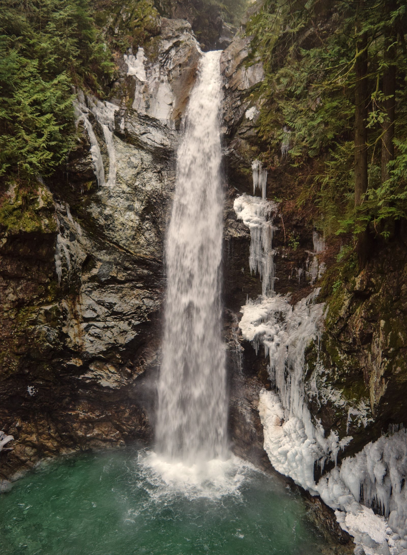
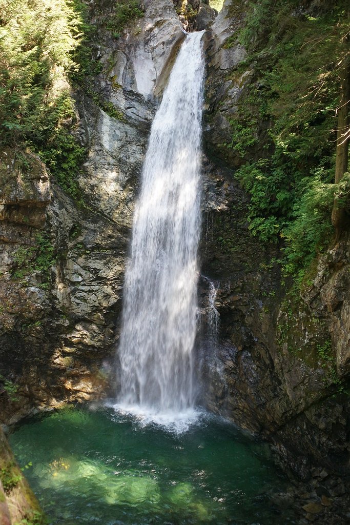
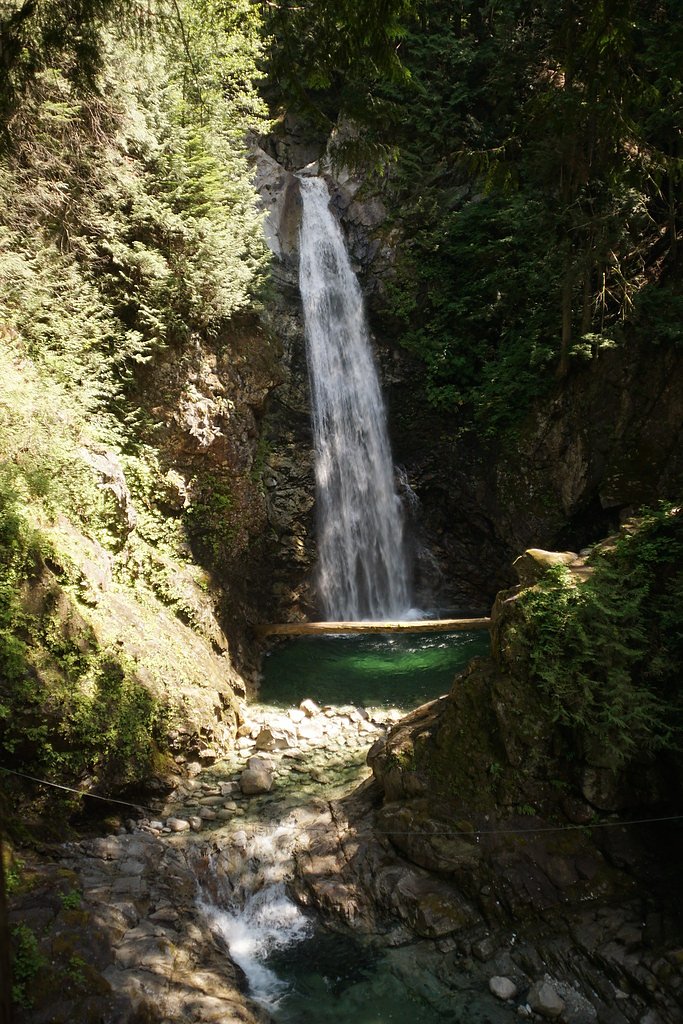
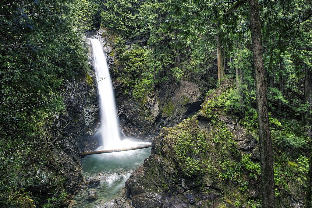
About Cascade Falls
Cascade Falls is a forested, multi-tiered cascade located near Abbotsford, British Columbia (approx. coordinates 49.2748, -122.213). The feature sits in a rural/wooded landscape north of the Sumas/Abbotsford valley and is most noticeable when snowmelt and seasonal rains increase streamflow in spring. Public information about formal trail development and facilities at this exact coordinate is limited; visitors should expect a natural site with informal access in places and variable water flow depending on season.
The Setting
Cascade Falls sits at 201 metres in the foothills of British Columbia. The falls drop 30 metres.
Why This Waterfall Exists
Cascade Falls flows over hard intrusive rock laid down about 145-162 million years ago. These resistant rocks form a durable ledge that water cannot easily wear away, creating a 98-foot drop where softer material downstream has already eroded.
Nearby Falls Worth Visiting
Cascade Falls Natural Waterslide (30 m) lies 0.8 kilometres to the east. Also nearby: McDonald Falls (25 m, 2.9 km) and Terepocki Twin Falls (13 m, 11.9 km).
Trail & Hike Details
The Approach
The easy 1.3-km out-and-back trail gains 33 metres of elevation on the way to the falls.
Trail Description
There is limited authoritative information about an established, maintained trail to the falls at these coordinates. Where trails exist they are likely short but may be informal, steep in sections, and run through forested terrain. Expect natural surface trails, roots, rocks and potentially muddy conditions after rain. If you cannot find an obvious maintained trailhead, exercise caution when bushwhacking; navigation skills and a map/GPS are recommended.
What to Expect
The falls cascade 30 metres over hard intrusive rock.
Accessibility
The trail is short and relatively flat, but the surface may be uneven. Contact the managing agency for accessibility details.
Frequently Asked Questions
🐶 Are Dogs Allowed at Cascade Falls?
❌ Dogs are not allowed
Are There Any Fees or Permits Required?
🆖 No fees required
🏊 Is There Swimming at Cascade Falls?
❌ Swimming is not allowed
When to Visit
Spring, best for higher flow and fuller cascades. Late spring/early summer balances flow and easier trail conditions. Summer offers drier ground and easier access but reduced flow. Avoid times of heavy rain for safety due to slippery terrain and stronger currents. Winter can be icy and hazardous and may make access difficult.
Seasonal Access
The best time to visit is Spring, Summer, and Fall. Winter access may be limited. Check with the managing park or local authority for current conditions.
Safety Information
Exercise caution around wet rock, steep banks and fast-moving water. Slippery surfaces and unstable banks are common hazards. Watch for sudden increases in flow after heavy rain or upstream activity. Carry navigation tools and tell someone your plans if the area is remote. Use caution with children near the water. If unsure about conditions, do not attempt to approach the edge of the falls.
7-Day Flow Outlook
Based on the WSC gauge FRASER RIVER AT MISSION (18 km away).
Best time of year: this gauge typically runs highest from early May to early August, peaking in June.
How we calculate this
This is a transparent outlook, not a precise forecast. We take the waterfall's current flow strength (how it ranks against its historical normal for today, from the nearest WSC stream gauge), carry that ranking forward along the gauge's seasonal curve, and nudge it for forecast rain. Confidence is highest for the next day or two and falls further out. Always check official conditions and your own judgment before visiting — high flows can be dangerous.
Know when to go.
Get a free email alert when waterfalls near Abbotsford hit peak flow. We only send when conditions are worth the trip — no weekly newsletters, no spam.
Weather Forecast
Location & Access
Getting There
The falls are located near Abbotsford, Sumas and Chilliwack (roughly 15–17 miles from each town by road). Use the coordinates 49.2748, -122.213 in a reliable GPS or mapping app to pinpoint the site. Local access is likely via secondary roads or forest/utility roads; official trailhead signage and maintained parking may be limited or absent. Confirm recent trip reports or contact local municipal/park authorities before visiting.
Get Directions on Google MapsParking
Parking details are not well documented for this specific location. Expect limited or informal roadside parking in nearby pullouts. Do not block driveways or gates. If a designated lot exists it may be small, arrive early on busy days.
Elevation
201 metres above sea level
Coordinates
49.274836° N, -122.212980° W
Visitor Tips & Gear
• Check recent trip reports or local park/municipal pages for up-to-date access information before you go. • Wear sturdy, grippy footwear and bring layers; ground can be muddy or icy depending on season. • Stay back from the edge of the falls and avoid climbing on wet rocks. • Pack out what you bring in and follow Leave No Trace principles. • Be prepared for limited signage and bring a map or GPS coordinates (49.2748, -122.213). • If wildlife (e.g., black bears) are known in the region, carry bear-aware gear and know how to use it.
As an Amazon Associate, we earn from qualifying purchases.
For this easy 1.3 km trail, lightweight trail shoes and a water bottle are usually sufficient. Sun exposure on the trail makes good sun protection a must in summer.

Polarized Sunglasses (Knockaround)
Cuts glare off the water so you actually see the falls — and your photos turn out better too.

Columbia Watertight II Rain Jacket
Packs into its own pocket, seam-sealed, and keeps you dry from spray and surprise rain.

Earth Pak Waterproof Dry Bag
Keeps your phone and gear dry when waterfall mist soaks everything else.

Waterproof Phone Pouch (AiRunTech)
Cheap insurance — take photos right next to the falls without killing your phone.

JOBY GorillaPod Starter Kit
Wraps around railings and rocks for long-exposure waterfall shots — no flat surface needed.

Osprey Daylite Daypack
Light, organized, and just the right size for a day hike — fits water, snacks, and layers.
Where to Stay
Browse vacation cabins and private rentals nearby
Unique outdoor stays — tents, yurts, and treehouses
Rent a campervan or RV for your waterfall road trip
Some links are affiliate links. We may earn a commission at no extra cost to you.
Nearby Campground
Stave Island Dispersed Site
7.9 km away
Nearby Hot Springs
Hot springs near Abbotsford, British Columbia
Dorr Fumarole Field
Dorr Fumarole Field reaches 194 degrees at 8,168 feet elevation on Mount Baker's active volcanic slopes, producing superheated ...

Sherman Crater Fumaroles
Sherman Crater Fumaroles register 266 degrees Fahrenheit at 9,463 feet elevation within the active volcanic crater atop Mount B...
Baker Hot Spring
Baker Hot Spring emerges at 108 degrees Fahrenheit on US Forest Service land in Mt. Baker National Forest, flowing 59.5 degrees...
Looking for a soak after your hike? Explore more hot springs near Abbotsford, British Columbia on SoakingSprings.
Explore British Columbia springsAdditional Information
Nearby Attractions
The site is roughly equidistant to Abbotsford, Sumas and Chilliwack, each town offers additional parks, trails and services. Check local tourism sites for regional parks, day hikes, and viewpoints in the Fraser Valley area.
Wildlife
Typical Fraser Valley wildlife may be present: deer, small mammals, many bird species, and occasional large mammals such as black bears or cougars. Also be aware of ticks in warmer months. Observe wildlife from a distance.
Cities near Cascade Falls
Nearby Waterfalls
Other waterfalls named Cascade Falls
24 other waterfalls share this name across Canada.
Writing about Cascade Falls? Embed this waterfall on your site for free.