
Photo Credits (5)
Difficulty
Easy
Trail Length
1.2 miles
Trail Type
Out And Back
Elevation Gain
200 ft
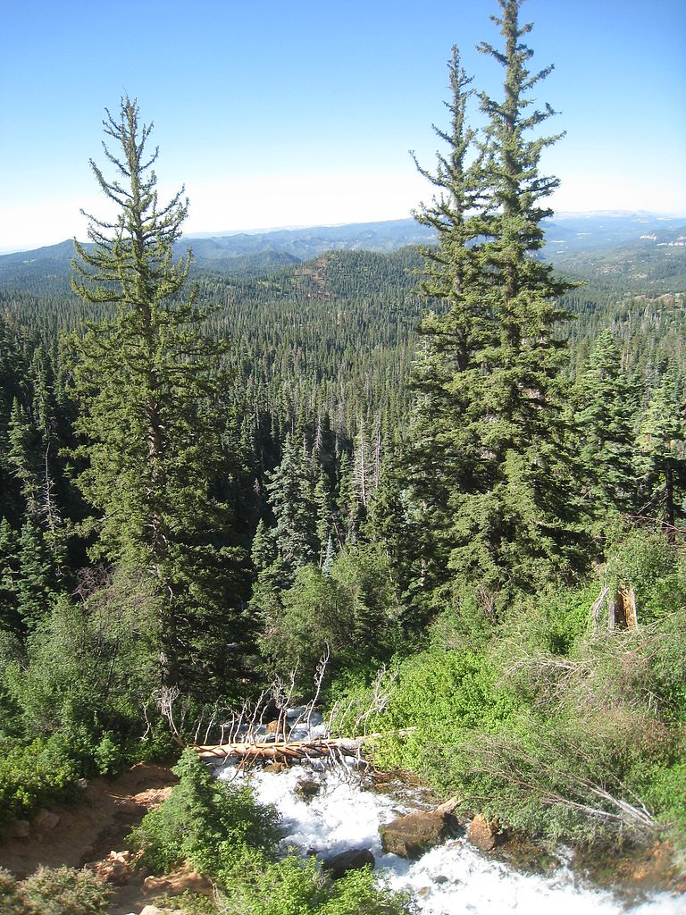
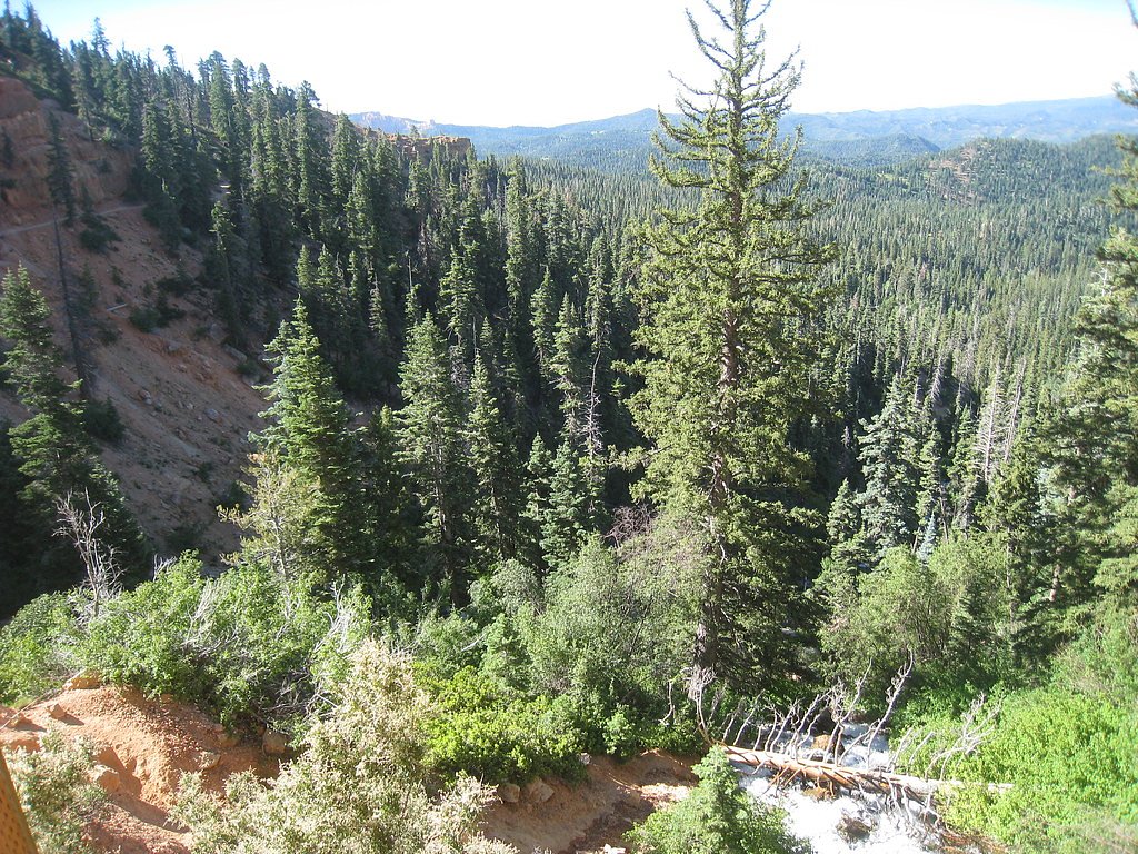
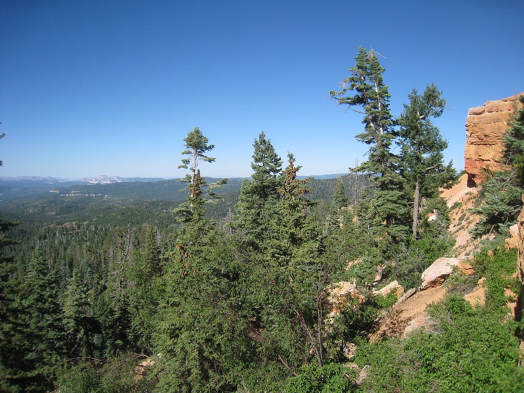
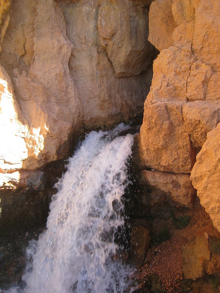
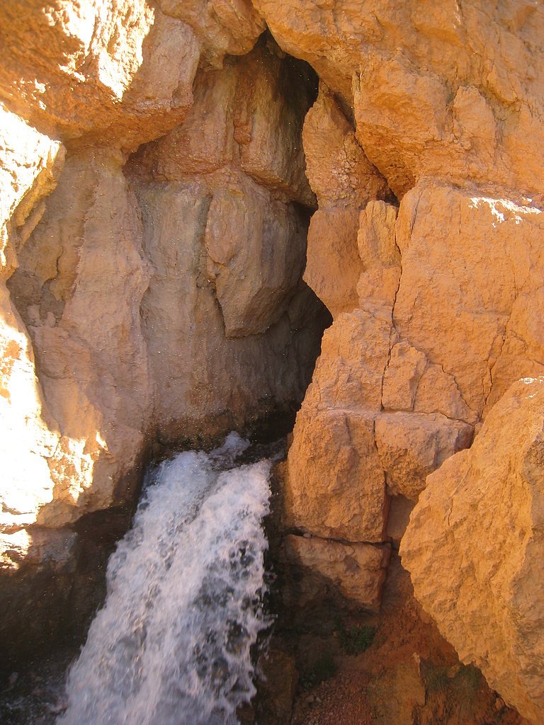
About Cascade Falls
Cascade Falls is a picturesque waterfall in southern Utah near Navajo Lake, where water emerges through a rock face to create a narrow, scenic cascade framed by forested slopes and sandstone cliffs. The setting feels tucked away but is managed by the U.S. Forest Service within Dixie National Forest, giving the area a protected, backcountry character that’s great for a half-day outing. Access to the falls is via the USFS CASCADE FALLS TRAIL (Trail #32055). The hike is short and user-friendly—about 1.2 miles round-trip with roughly 200 feet of elevation gain—making it an appealing choice for families and casual hikers. If you want to linger overnight, Spruces Campground (Dixie NF) sits about 2.37 km from the trailhead and provides a convenient nearby camping option.
The Setting
Cascade Falls sits at 8,750 feet within Dixie National Forest, fed by the East Fork Virgin River, in the high alpine of Utah.
Trail & Hike Details
The Approach
The easy hike follows Cascade Falls Trail (#32055), a 1.2-mile out-and-back trail over natural surface. Expect 200 feet of elevation gain. The trail is highly developed (Class 4).
USFS Trail
CASCADE FALLS TRAIL #32055
Trail Class
Highly Developed
Surface
USFS Segment
0.55 miTrail Description
USFS CASCADE FALLS TRAIL (Trail #32055) — out-and-back, approximately 1.2 miles round-trip (GIS records show ~0.55 miles one-way). Elevation gain is about 200 feet and the route is rated easy. The trail is Class 4 on USFS records and follows native material tread (dirt/rock), with well-worn footpath sections and some rocky stretches underfoot. This short route is suitable for most hikers looking for a quick, scenic destination; note that surfaces can be uneven, so solid footwear is recommended.
What to Expect
Dogs are welcome.
Accessibility
The trail is not wheelchair accessible. Uneven terrain and elevation changes require steady footing.
Frequently Asked Questions
🐶 Are Dogs Allowed at Cascade Falls?
✅ Dogs are allowed
Are There Any Fees or Permits Required?
🆖 No fees required
🏊 Is There Swimming at Cascade Falls?
❌ Swimming is not allowed
When to Visit
The best time to visit is late spring through early fall when the trail is clear of snow and the waterfall flow is at its peak.
Seasonal Access
The best time to visit is Spring, Summer, and Fall. Access roads and trails may close during winter due to snow. Watch for flash flood warnings during monsoon season (July through September). Check with Dixie National Forest for seasonal road closures.
Safety Information
Be cautious on rocky sections of the trail to avoid slipping. Watch for changing weather conditions, as storms can develop quickly in the area. In winter, snow and ice may make the trail hazardous.
Current Water Conditions
5 ft³/s
Current discharge — how much water is flowing
Lower than usual for this time of year
Based on 59 years of record
9.99 ft
Water depth at gauge
7-Day Discharge Trend
What does this mean for your visit?
Flow is lower than usual for this time of year.
About This Gauge
This gauge is on a nearby waterway and may not reflect exact conditions at the falls.
7-Day Flow Outlook
Based on the USGS gauge EAST FORK VIRGIN RIVER NEAR GLENDALE, UT (23 km away).
Today
Low
5 cfs
6/10Tomorrow
Low
5 cfs
6/10Fri
Low
4 cfs
6/10Sat
Low
4 cfs
6/10Sun
Low
5 cfs
6/10Mon
Low
5 cfs
6/10Tue
Low
4 cfs
6/10Best window: Today — low flow, sunny (trip score 6/10).
Best time of year: this gauge typically runs highest from late January to mid April, peaking in March.
How we calculate this
This is a transparent outlook, not a precise forecast. We take the waterfall's current flow strength (how it ranks against its historical normal for today, from the nearest USGS stream gauge), carry that ranking forward along the gauge's seasonal curve, and nudge it for forecast rain. Confidence is highest for the next day or two and falls further out. Always check official conditions and your own judgment before visiting — high flows can be dangerous.
Know when to go.
Get a free email alert when waterfalls near Brian Head hit peak flow. We only send when conditions are worth the trip — no weekly newsletters, no spam.
Weather Forecast
Location & Access
Getting There
Cascade Falls is located in the Dixie National Forest near Navajo Lake. From Cedar City, take Highway 14 east for about 25 miles, then turn onto Navajo Lake Road (Forest Road 053). Follow signs to the Cascade Falls trailhead.
Get Directions on Google MapsParking
There is a designated parking area at the Cascade Falls trailhead, which is typically sufficient for visitors.
Elevation
8,750 feet above sea level
Coordinates
37.502088° N, -112.757010° W
Land Management
Managed by USFS
Visitor Tips & Gear
Wear sturdy shoes as the trail can be rocky in some areas. Bring water, especially during the summer months, as the trail is exposed to sunlight. Check weather conditions before visiting, as the trail may be slippery after rain or snow.
This trail sits at 8,750 ft — the air is noticeably thinner
High AltitudeSome visitors experience headaches, fatigue, or shortness of breath at this elevation. Take it slow, stay hydrated, and consider supplemental oxygen if you're coming from a lower altitude.
As an Amazon Associate, we earn from qualifying purchases.

Coppertone Sport SPF 50 Sunscreen
UV intensity jumps ~4% per 1,000 ft — at this elevation you can burn in half the time.

Sun Bum SPF 30 Lip Balm (3-Pack)
Lips have almost no natural UV protection and burn fast in thin, dry mountain air.

Liquid I.V. Electrolyte Packets
You lose moisture ~2x faster at elevation — electrolytes help you absorb water efficiently.

ROCKNIGHT Polarized UV400 Sunglasses
High-altitude glare off rock and water is intense — UV400 lenses block 99%+ of UVA/UVB.

Boost Oxygen 10L Canister (2-Pack)
Portable supplemental oxygen for quick relief from headaches and shortness of breath.

Altitude Rx OxyBoost Complex
Antioxidant formula designed to support your body's natural altitude acclimation.
As an Amazon Associate, we earn from qualifying purchases.
This easy 1.2 miles hike is straightforward — comfortable trail shoes and plenty of water should do. Sun exposure on the trail makes good sun protection a must in summer.

Polarized Sunglasses (Knockaround)
Cuts glare off the water so you actually see the falls — and your photos turn out better too.

Columbia Watertight II Rain Jacket
Packs into its own pocket, seam-sealed, and keeps you dry from spray and surprise rain.

Earth Pak Waterproof Dry Bag
Keeps your phone and gear dry when waterfall mist soaks everything else.

Waterproof Phone Pouch (AiRunTech)
Cheap insurance — take photos right next to the falls without killing your phone.

JOBY GorillaPod Starter Kit
Wraps around railings and rocks for long-exposure waterfall shots — no flat surface needed.

Osprey Daylite Daypack
Light, organized, and just the right size for a day hike — fits water, snacks, and layers.
Where to Stay

Mountain Ridge Cabins & Lodging Between Bryce and Zion National Park

The Knotty Pine

Under Canvas Zion

Spectacular Chalet overlooking the ski slopes
Browse vacation cabins and private rentals nearby
Unique outdoor stays — tents, yurts, and treehouses
Rent a campervan or RV for your waterfall road trip
Some links are affiliate links. We may earn a commission at no extra cost to you.
Nearby Campground
SPRUCES CAMPGROUND (DIXIE NF)
1.5 miles away · 29 sites
Overview Spruces Campground on the shores of Navajo Lake, provides a spectacular setting for boating, canoeing, camping, fishing, wildlife viewing, and photography. Take advantage of several outstanding hiking and biking trails or just relax and enjoy the cool, crisp mountain air. The popular Virgin Rim River Trail is located just .5 miles from the campground.Recreation Navajo Lake offers canoeing, kayaking and fishing opportunitites. Hiking and biking are popular activities as well. Close to the
Book on Recreation.govNearby Hot Springs
Hot springs near Brian Head, Utah
Red Canyon
Red Canyon Spring flows at 72°F at 5,360 feet elevation in Kane County's red rock country near Kanab, running 18.6 degrees abov...
Lefevre
Lefevre Spring discharges at 90°F from BLM land at 6,460 feet elevation near Panguitch, accessible via a 441-meter walk from th...
Tebbs
Tebbs flows at 68 degrees Fahrenheit in Garfield County at 6,460 feet elevation, emerging exactly 20 degrees above the regional...
Big Maple Spring
Big Maple Spring flows at 70°F on BLM land managed by the Cedar City Field Office in Beaver County, Utah, at 6,700 feet elevati...

Dixie (Laverkin) Hot Springs
Dixie Hot Springs flows at 108°F just 25 meters from road access in Washington County, making it one of southwestern Utah's hot...
Willow Spring
Rising at 72 degrees Fahrenheit in Beaver County's high plateau country, Willow Spring emerges 21.7 degrees above ambient at 6,...
Looking for a soak after your hike? Explore more hot springs near Brian Head, Utah on SoakingSprings.
Explore Utah springsAdditional Information
Nearby Attractions
Navajo Lake, Cedar Breaks National Monument, Zion National Park
Wildlife
Visitors may encounter deer, squirrels, birds, and other small wildlife native to the Dixie National Forest.
Cities near Cascade Falls
Other waterfalls named Cascade Falls
24 other waterfalls share this name across the U.S.
Writing about Cascade Falls? Embed this waterfall on your site for free.