Photo Credits (5)
Difficulty
Easy
Trail Length
1.4 miles
Trail Type
Out And Back
Elevation Gain
200 ft
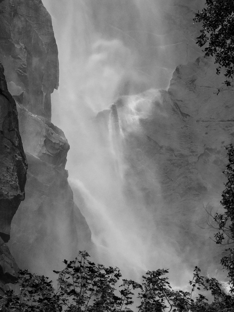
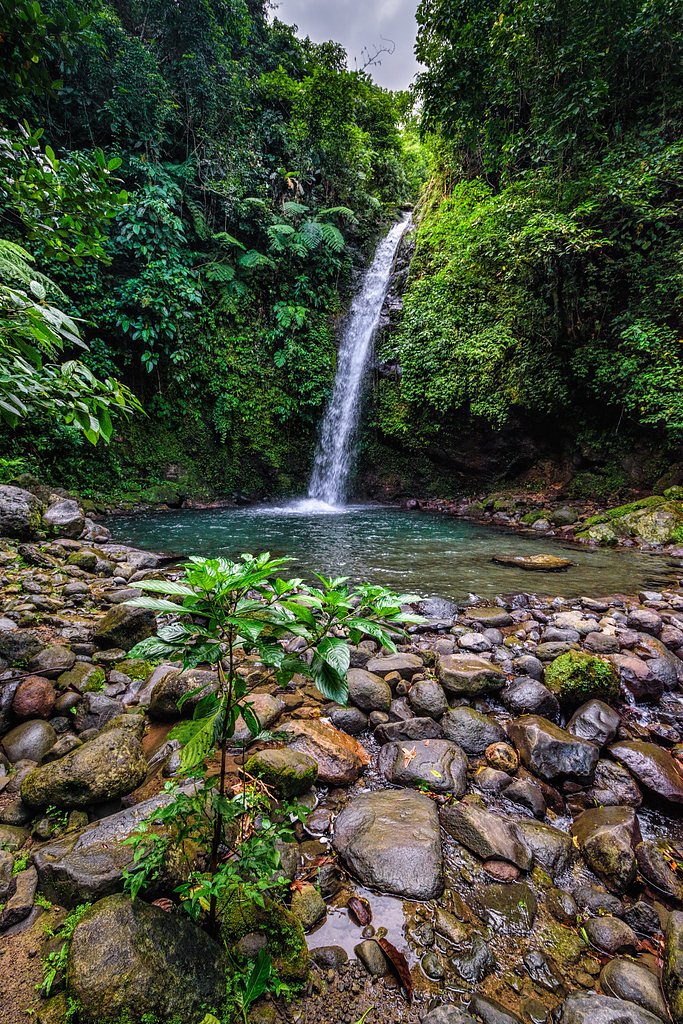
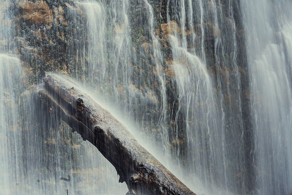
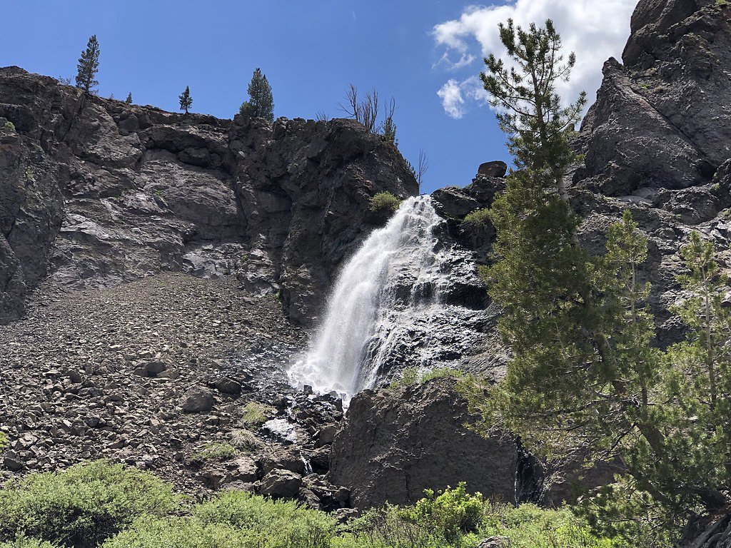
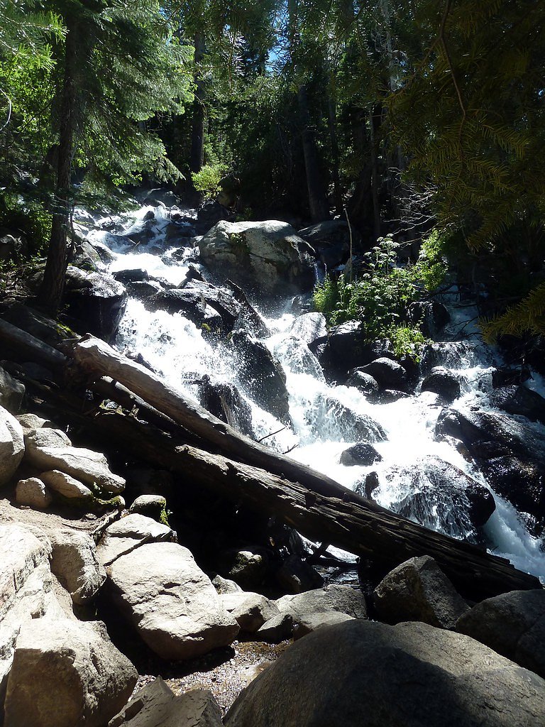
About Cascade Falls
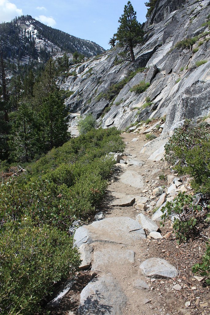
Cascade Falls is a compact, scenic cascade set on U.S. Forest Service land within the Toiyabe National Forest. It’s accessed by the well-marked Cascade Creek Trail (USFS Trail #22055), making the falls an appealing destination for hikers who want a high-reward outing without a long approach. The setting is forested and intimate, ideal for a short day trip or a photography stop. The route to the falls is short and approachable—about 1.4 miles with roughly 200 feet of elevation gain—so it’s a popular option for families and hikers looking for an easy scramble to a waterfall. Because the trail and falls are managed by the U.S. Forest Service, follow posted regulations and Leave No Trace practices to help keep the area pristine for others.
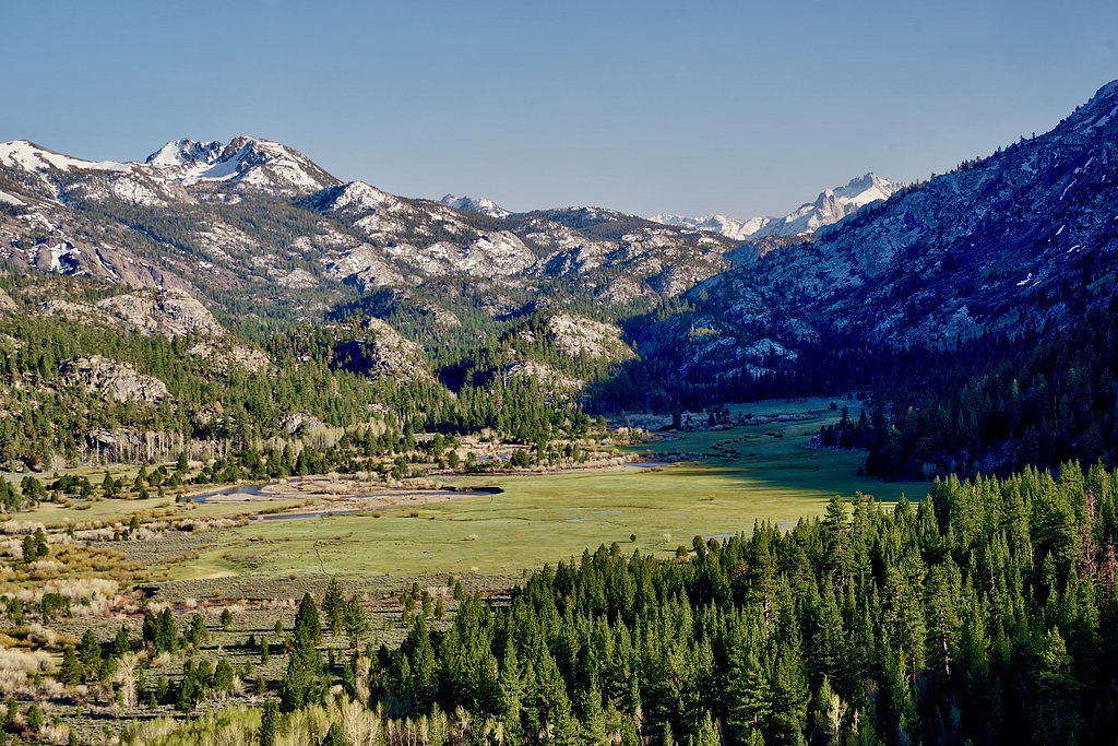
The Setting
Cascade Falls sits at 8,356 feet within Toiyabe National Forest, in the high alpine of California.
Trail & Hike Details
The Approach
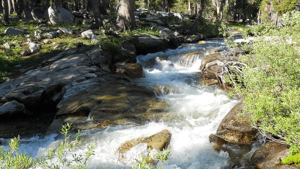
The easy hike follows Cascade Creek (#22055), a 1.4-mile out-and-back trail over natural surface. Expect 200 feet of elevation gain with grades of +12-20%. The trail is moderately developed (Class 2).
USFS Trail
CASCADE CREEK #22055
Trail Class
Moderately Developed
Surface
Avg Grade
USFS Segment
1.39 miTrail Description
Trail: CASCADE CREEK (USFS Trail #22055). Trail class: 2. Surface: native material. Typical grade: +12–20%. Length: approximately 1.4 miles (GIS 1.39 miles) round-trip, elevation gain ~200 ft. Difficulty: easy. Trail type: out-and-back. Expect a short, mostly native-tread route with some moderately steep pitches (12–20% grade) and simple scrambling in places; suitable for most hikers with basic footwear and light packs.
What to Expect
Dogs are welcome.
Accessibility
The trail is not wheelchair accessible. Uneven terrain and elevation changes require steady footing.
Frequently Asked Questions
🐶 Are Dogs Allowed at Cascade Falls?
✅ Dogs are allowed
Are There Any Fees or Permits Required?
🆖 No fees required
🏊 Is There Swimming at Cascade Falls?
❌ Swimming is not allowed
When to Visit
The best time to visit Cascade Falls is in the spring or early summer when the waterfall is at its fullest due to snowmelt. Fall offers beautiful foliage, while summer provides warm weather for hiking.
Seasonal Access
The best time to visit is Spring, Summer, and Fall. Access roads and trails may close during winter due to snow. Check with Toiyabe National Forest for seasonal road closures.
Safety Information
Exercise caution near the waterfall, as rocks can be slippery. Stay on marked trails to avoid getting lost or damaging the environment. Check weather conditions before visiting, as snow or rain can make the trail hazardous.
Current Water Conditions
83 ft³/s
Current discharge — how much water is flowing
About average for this time of year
Based on 51 years of record
2.36 ft
Water depth at gauge
7-Day Discharge Trend
What does this mean for your visit?
Flow is about average for this time of year.
About This Gauge
This gauge is on a nearby waterway and may not reflect exact conditions at the falls.
7-Day Flow Outlook
Based on the USGS gauge BUCKEYE CK NR BRIDGEPORT, CA (21 km away).
Today
Low
86 cfs
6/10Tomorrow
Low
83 cfs
6/10Thu
Low
81 cfs
6/10Fri
Low
79 cfs
6/10Sat
Low
79 cfs
6/10Sun
Low
80 cfs
6/10Mon
Low
76 cfs
6/10Best window: Today — low flow, sunny (trip score 6/10).
Best time of year: this gauge typically runs highest from late April to late July, peaking in June.
How we calculate this
This is a transparent outlook, not a precise forecast. We take the waterfall's current flow strength (how it ranks against its historical normal for today, from the nearest USGS stream gauge), carry that ranking forward along the gauge's seasonal curve, and nudge it for forecast rain. Confidence is highest for the next day or two and falls further out. Always check official conditions and your own judgment before visiting — high flows can be dangerous.
Know when to go.
Get a free email alert when waterfalls near Twin Lakes hit peak flow. We only send when conditions are worth the trip — no weekly newsletters, no spam.
Weather Forecast
Location & Access
Getting There
Cascade Falls is located in the Emerald Bay area of Lake Tahoe. The trailhead begins at the Bayview Campground, which is accessible via Highway 89. Follow signs for the campground and park in the designated area.
Get Directions on Google MapsParking
Parking is available at the Bayview Campground, but it can fill up quickly, especially during peak seasons. Arrive early to secure a spot.
Elevation
8,356 feet above sea level
Coordinates
38.203719° N, -119.558660° W
Land Management
Managed by USFS
Visitor Tips & Gear
Arrive early to secure parking, especially during weekends and holidays. Bring water and wear sturdy shoes, as the trail can be uneven in places. Be cautious near the waterfall, as rocks may be slippery.
This trail sits at 8,356 ft — the air is noticeably thinner
High AltitudeSome visitors experience headaches, fatigue, or shortness of breath at this elevation. Take it slow, stay hydrated, and consider supplemental oxygen if you're coming from a lower altitude.
As an Amazon Associate, we earn from qualifying purchases.

Coppertone Sport SPF 50 Sunscreen
UV intensity jumps ~4% per 1,000 ft — at this elevation you can burn in half the time.

Sun Bum SPF 30 Lip Balm (3-Pack)
Lips have almost no natural UV protection and burn fast in thin, dry mountain air.

Liquid I.V. Electrolyte Packets
You lose moisture ~2x faster at elevation — electrolytes help you absorb water efficiently.

ROCKNIGHT Polarized UV400 Sunglasses
High-altitude glare off rock and water is intense — UV400 lenses block 99%+ of UVA/UVB.

Boost Oxygen 10L Canister (2-Pack)
Portable supplemental oxygen for quick relief from headaches and shortness of breath.

Altitude Rx OxyBoost Complex
Antioxidant formula designed to support your body's natural altitude acclimation.
As an Amazon Associate, we earn from qualifying purchases.
This easy 1.4 miles hike is straightforward — comfortable trail shoes and plenty of water should do. Sun exposure on the trail makes good sun protection a must in summer.

Polarized Sunglasses (Knockaround)
Cuts glare off the water so you actually see the falls — and your photos turn out better too.

Columbia Watertight II Rain Jacket
Packs into its own pocket, seam-sealed, and keeps you dry from spray and surprise rain.

Earth Pak Waterproof Dry Bag
Keeps your phone and gear dry when waterfall mist soaks everything else.

Waterproof Phone Pouch (AiRunTech)
Cheap insurance — take photos right next to the falls without killing your phone.

JOBY GorillaPod Starter Kit
Wraps around railings and rocks for long-exposure waterfall shots — no flat surface needed.

Osprey Daylite Daypack
Light, organized, and just the right size for a day hike — fits water, snacks, and layers.
Where to Stay

Silver Maple Inn

The Long Barn Lodge

Mountain Getaway with Granny Unit, Dogs Ok #47

Ruby Inn Bridgeport
Browse vacation cabins and private rentals nearby
Unique outdoor stays — tents, yurts, and treehouses
Rent a campervan or RV for your waterfall road trip
Some links are affiliate links. We may earn a commission at no extra cost to you.
Nearby Campground
Obsidian Campground
8.9 miles away · 0 sites
Obsidian Campground offers opportunity to get away from crowds amidst shade of aspens and pines. Campground is close to Molybdenite Creek and Little Walker River. The river is stocked with trout. Area trailheads offer several interesting hikes. The trail from Molybdenite Creek trailhead splits, with one branch heading south into the Hoover Wilderness, and one looping north along Wheeler Creek to connect with the trail along the Little Walker River. This can be hiked as a loop from Burt Canyon tra
Book on Recreation.govNearby Hot Springs
Hot springs near Twin Lakes, California
Buckeye Hot Spring
Buckeye Hot Spring flows at 140°F from the eastern Sierra Nevada in Mono County at 6,963 feet elevation on US Forest Service la...
Fales Hot Springs
Fales Hot Springs reaches 180°F in the high Sierra Nevada, flowing 137°F hotter than the surrounding air at 7,491 feet elevatio...
The Hot Springs
The Hot Springs delivers 113°F water in Mono County near Bridgeport, a comfortable temperature in the eastern Sierra Nevada whe...

Travertine Hot Springs
Travertine Hot Springs delivers scalding 180°F water in Mono County near Bridgeport, creating one of the eastern Sierra Nevada'...
Warm Spring
Warm Spring flows at 77°F near Bridgeport in California's High Sierra, rising 33.5 degrees above the 43.5°F annual average in a...
Unnamed Spring Lyon County
This unnamed warm spring emerges in Lyon County, Nevada near Smith Valley at 5,019 feet elevation, sitting virtually roadside j...
Looking for a soak after your hike? Explore more hot springs near Twin Lakes, California on SoakingSprings.
Explore California springsAdditional Information
Nearby Attractions
Emerald Bay State Park, Vikingsholm Castle, Eagle Falls Trail
Wildlife
Visitors may encounter wildlife such as squirrels, birds, and occasionally deer. Be cautious of bears in the area and store food properly.
Cities near Cascade Falls
Nearby Waterfalls
Other waterfalls named Cascade Falls
24 other waterfalls share this name across the U.S.
Writing about Cascade Falls? Embed this waterfall on your site for free.