Photo Credits (5)
Difficulty
Moderate
Trail Length
2.4 miles
Trail Type
Out And Back
Elevation Gain
350 ft
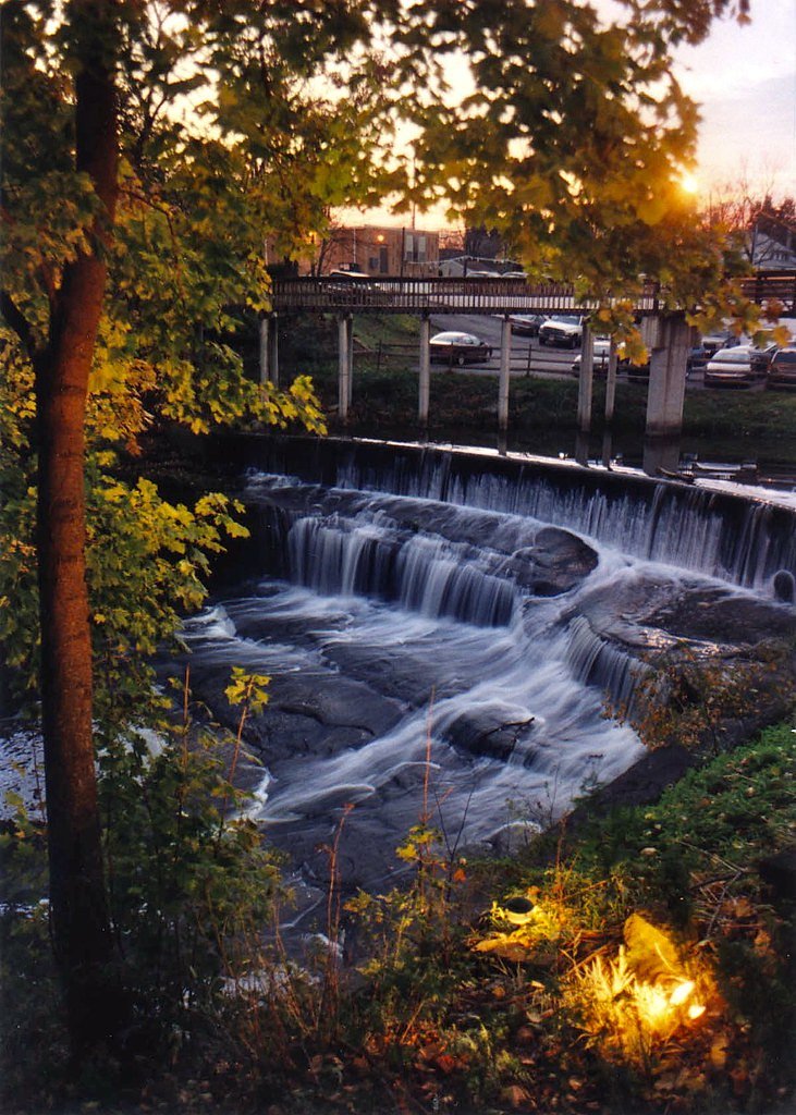
About Cascade Falls
Cascade Falls, located in Nelson-Kennedy Ledges State Park in Ohio, is a picturesque waterfall surrounded by unique rock formations and lush forest. It is a popular destination for hikers and nature enthusiasts.
The Setting
Cascade Falls sits at 974 feet within Nelson-Kennedy Ledges State Park, fed by the Eagle Creek, in the foothills of Ohio.
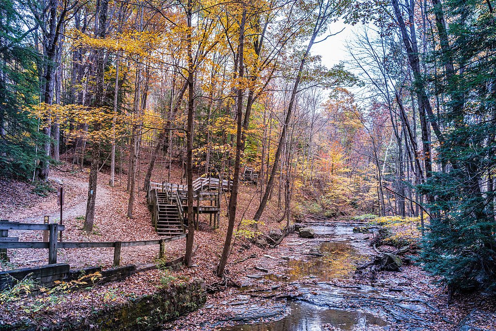
Trail & Hike Details
The Approach
The moderate 2.4-mile out-and-back trail gains 350 feet of elevation on the way to the falls.
Trail Description
The trail to Cascade Falls is short and relatively flat, making it accessible for most visitors. It winds through a forested area with unique rock formations and leads to the waterfall. The trail may have some uneven terrain and roots, so sturdy footwear is recommended.
What to Expect
Dogs are welcome.
Accessibility
The trail is not wheelchair accessible. Uneven terrain and elevation changes require steady footing.
Frequently Asked Questions
🐶 Are Dogs Allowed at Cascade Falls?
✅ Dogs are allowed
Are There Any Fees or Permits Required?
🆖 No fees required
🏊 Is There Swimming at Cascade Falls?
❌ Swimming is not allowed
When to Visit
Spring and early summer are the best times to visit, as the waterfall flow is typically stronger due to seasonal rainfall.
Seasonal Access
The best time to visit is Spring, Summer, and Fall. Winter access may be limited.
Safety Information
Exercise caution on the trail, as roots and rocks may create tripping hazards. Avoid visiting during heavy rain or icy conditions, as the trail can become slippery.
Current Water Conditions
28 ft³/s
Current discharge — how much water is flowing
About average for this time of year
Based on 97 years of record
4.00 ft
Water depth at gauge
7-Day Discharge Trend
What does this mean for your visit?
Flow is about average for this time of year.
About This Gauge
This gauge is on a nearby waterway and may not reflect exact conditions at the falls.
7-Day Flow Outlook
Based on the USGS gauge Eagle Creek at Phalanx Station OH (11 km away).
Today
Strong
32 cfs
7/10Tomorrow
Strong
29 cfs
10/10Mon
Moderate
26 cfs
9/10Tue
Moderate
28 cfs
9/10Wed
Moderate
29 cfs
9/10Thu
Moderate
26 cfs
9/10Fri
Strong
29 cfs
7/10Best window: Tomorrow — strong flow, mostly sunny (trip score 10/10).
Best time of year: this gauge typically runs highest from mid February to late April, peaking in March.
How we calculate this
This is a transparent outlook, not a precise forecast. We take the waterfall's current flow strength (how it ranks against its historical normal for today, from the nearest USGS stream gauge), carry that ranking forward along the gauge's seasonal curve, and nudge it for forecast rain. Confidence is highest for the next day or two and falls further out. Always check official conditions and your own judgment before visiting — high flows can be dangerous.
Know when to go.
Get a free email alert when waterfalls near Parkman hit peak flow. We only send when conditions are worth the trip — no weekly newsletters, no spam.
Weather Forecast
Location & Access
Getting There
Cascade Falls is located within Nelson-Kennedy Ledges State Park in Garrettsville, Ohio. The park is accessible via State Route 282, and signs within the park guide visitors to the trailheads.
Get Directions on Google MapsParking
Parking is available at the main parking lot of Nelson-Kennedy Ledges State Park, which provides access to the trails leading to Cascade Falls.
Elevation
974 feet above sea level
Coordinates
41.329778° N, -81.040928° W
Land Management
Managed by SDNR
Visitor Tips & Gear
Visit after a period of rain for the best waterfall flow. Wear sturdy shoes as the trail may be uneven in places. Arrive early to avoid crowds, especially on weekends.
As an Amazon Associate, we earn from qualifying purchases.
With 2.4 miles and 350 ft of elevation gain, sturdy boots and trekking poles will help on this moderate trail. Sun exposure on the trail makes good sun protection a must in summer.

Polarized Sunglasses (Knockaround)
Cuts glare off the water so you actually see the falls — and your photos turn out better too.

Columbia Watertight II Rain Jacket
Packs into its own pocket, seam-sealed, and keeps you dry from spray and surprise rain.

Earth Pak Waterproof Dry Bag
Keeps your phone and gear dry when waterfall mist soaks everything else.

Waterproof Phone Pouch (AiRunTech)
Cheap insurance — take photos right next to the falls without killing your phone.

Timberland Euro Sprint Mid Waterproof
Trusted waterproof boot with premium leather and grippy rubber sole — reliable on rocky, wet trails.

TrailBuddy Trekking Poles
Lightweight aluminum, cork grips, and flip-locks that actually hold — a best-seller for good reason.
Where to Stay

Holiday Inn Express Lordstown-Newton Falls/Warren by IHG

Holiday Inn Express Hotel & Suites Youngstown North-Warren/Niles by IHG

Fairfield Inn by Marriott Warren Niles

Fairfield by Marriott Youngstown/Austintown
Browse vacation cabins and private rentals nearby
Unique outdoor stays — tents, yurts, and treehouses
Rent a campervan or RV for your waterfall road trip
Some links are affiliate links. We may earn a commission at no extra cost to you.
Nearby Campground
West Branch State Park
13.8 miles away · 0 sites
This recreation area is part of Michael J Kirwan Lake
Book on Recreation.govAdditional Information
Nearby Attractions
Other attractions in Nelson-Kennedy Ledges State Park include unique rock formations and additional hiking trails. The nearby town of Garrettsville offers dining and shopping options.
Wildlife
The area is home to various bird species, squirrels, and other small woodland animals. Visitors may also see wildflowers and native plants.
Cities near Cascade Falls
Nearby Waterfalls

Other waterfalls named Cascade Falls
24 other waterfalls share this name across the U.S.
Writing about Cascade Falls? Embed this waterfall on your site for free.