
Photo Credits (5)
Difficulty
Easy
Trail Length
1.5 miles
Trail Type
Out And Back
Elevation Gain
200 ft
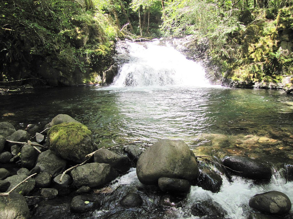
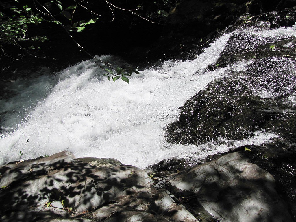
About Cascade Falls
Cascade Falls sits on Bureau of Land Management (BLM) public land in Oregon and is overseen by the Northwest Oregon Cascades Field Office. The falls are a pleasant destination for a short outing and are accessible from BLM-managed recreation areas; the site’s public-land designation (PUB) makes it a straightforward choice for day hikers looking to experience a waterfall without a long drive. The hike to the falls is an easy, out-and-back route that gains about 200 feet over its 1.5-mile length, so it’s suitable for families and casual hikers. If you want to camp nearby, Yellowbottom Recreation Site is the closest option at about 6.5 km away, making an overnight trip convenient for those who want to explore the area more slowly.
The Setting
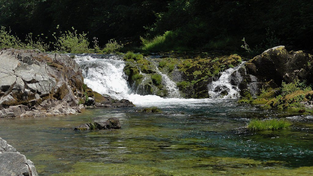
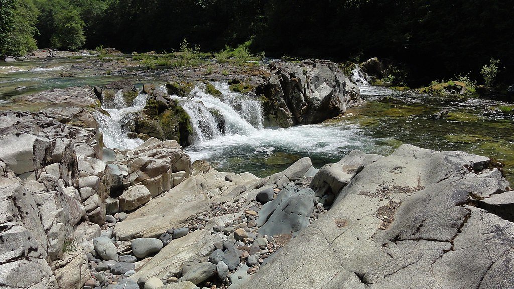
Cascade Falls sits at 1,112 feet within Nw Oregon Cascades Field Office, fed by the Quartzville Creek, in the foothills of Oregon.
Trail & Hike Details
The Approach
The easy 1.5-mile out-and-back trail gains 200 feet of elevation on the way to the falls.
Trail Description
Trail type: out-and-back. Distance: 1.5 miles. Elevation gain: ~200 ft. Difficulty: easy. Managed by: BLM, Northwest Oregon Cascades Field Office (public land designation: PUB). Official USFS trail number, surface, and class are not listed for this route in the provided data; the route’s modest elevation gain over a short distance makes for a generally gentle climb suitable for most hikers.
What to Expect
Dogs are welcome.
Accessibility
The trail is not wheelchair accessible. Uneven terrain and elevation changes require steady footing.
Frequently Asked Questions
🐶 Are Dogs Allowed at Cascade Falls?
✅ Dogs are allowed
Are There Any Fees or Permits Required?
🆖 No fees required
🏊 Is There Swimming at Cascade Falls?
❌ Swimming is not allowed
When to Visit
Spring and early summer are ideal times to visit Cascade Falls, as the water flow is typically at its peak due to snowmelt. Fall offers beautiful foliage, while summer provides warmer weather for hiking.
Seasonal Access
The best time to visit is Spring, Summer, and Fall. Winter access may be limited.
Safety Information
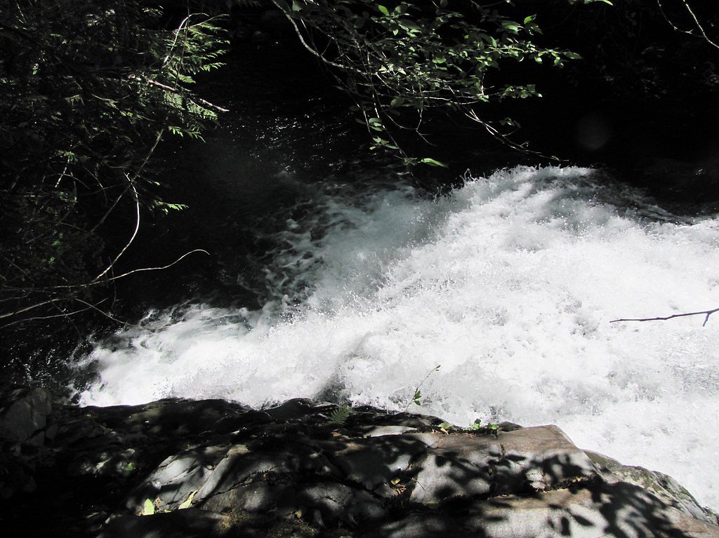
The trail may be slippery, especially after rain. Visitors should exercise caution near the waterfall and avoid climbing on wet rocks. Always stay on designated trails.
Current Water Conditions
63 ft³/s
Current discharge — how much water is flowing
Lower than usual for this time of year
Based on 61 years of record
3.33 ft
Water depth at gauge
59°F
ColdBracing — limit time in water
7-Day Discharge Trend
What does this mean for your visit?
Flow is lower than usual for this time of year. Water temperature is a bracing 59 degrees F, limit your time in the water. Expect crystal clear visibility and excellent dissolved oxygen levels.
Water Quality
Dissolved Oxygen
ExcellentSupports aquatic life
Water Clarity
Crystal clearExcellent visibility
About This Gauge
7-Day Flow Outlook
Based on the USGS gauge QUARTZVILLE CREEK NEAR CASCADIA, OR (1 km away).
Today
Roaring
72 cfs
6/10Tomorrow
Roaring
70 cfs
6/10Mon
Roaring
75 cfs
6/10Tue
Roaring
65 cfs
6/10Wed
Roaring
57 cfs
9/10Thu
Roaring
60 cfs
6/10Fri
Roaring
60 cfs
6/10Best window: Wed — roaring flow, partly sunny (trip score 9/10).
Best time of year: this gauge typically runs highest from mid March to early April, peaking in January.
How we calculate this
This is a transparent outlook, not a precise forecast. We take the waterfall's current flow strength (how it ranks against its historical normal for today, from the nearest USGS stream gauge), carry that ranking forward along the gauge's seasonal curve, and nudge it for forecast rain. Confidence is highest for the next day or two and falls further out. Always check official conditions and your own judgment before visiting — high flows can be dangerous.
Know when to go.
Get a free email alert when waterfalls near Cascadia hit peak flow. We only send when conditions are worth the trip — no weekly newsletters, no spam.
Weather Forecast
Location & Access
Getting There
Cascade Falls is located within the Umpqua National Forest in Oregon. The trailhead can typically be accessed via forest service roads, but conditions may vary seasonally. Visitors are advised to check with the U.S. Forest Service for the latest road and trail conditions.
Get Directions on Google MapsParking
Parking is available at the trailhead, but spaces may be limited during peak seasons. Visitors should arrive early to secure a spot.
Elevation
1,112 feet above sea level
Coordinates
44.545797° N, -122.428701° W
Land Management
Managed by BLM
Visitor Tips & Gear
Wear sturdy shoes as the trail may be muddy or slippery, especially after rain. Bring water and a camera to capture the scenic views. Arrive early to avoid crowds and secure parking.
As an Amazon Associate, we earn from qualifying purchases.
This easy 1.5 miles hike is straightforward — comfortable trail shoes and plenty of water should do. Sun exposure on the trail makes good sun protection a must in summer.

Polarized Sunglasses (Knockaround)
Cuts glare off the water so you actually see the falls — and your photos turn out better too.

Columbia Watertight II Rain Jacket
Packs into its own pocket, seam-sealed, and keeps you dry from spray and surprise rain.

Earth Pak Waterproof Dry Bag
Keeps your phone and gear dry when waterfall mist soaks everything else.

Waterproof Phone Pouch (AiRunTech)
Cheap insurance — take photos right next to the falls without killing your phone.

JOBY GorillaPod Starter Kit
Wraps around railings and rocks for long-exposure waterfall shots — no flat surface needed.

Osprey Daylite Daypack
Light, organized, and just the right size for a day hike — fits water, snacks, and layers.
Where to Stay

The 1908 Bungalow

Rushing River Retreat

Sweet Home Inn

Foster Lake Inn
Browse vacation cabins and private rentals nearby
Unique outdoor stays — tents, yurts, and treehouses
Rent a campervan or RV for your waterfall road trip
Some links are affiliate links. We may earn a commission at no extra cost to you.
Nearby Campground
Yellowbottom Recreation Site
4 miles away · 21 sites
Overview Yellowbottom Recreation Site is closed to camping indefinitely. Visitor safety is our top priority. The nearby Old Miner's Meadow group campsite can be reserved on recreation.gov. Other camping may be available in surrounding national forest and county areas. Yellowbottom day use area remains open for use.Recreation Yellowbottom offers a one-mile hiking trail, access to Quartzville Creek Wild and Scenic River, and a take off point to explore nearby recreation trails. Facilities This smal
Book on Recreation.govNearby Hot Springs
Hot springs near Cascadia, Oregon

Bagby Hot Springs
Bagby Hot Springs flows at 136°F deep in Mount Hood National Forest at 2,272 feet elevation, requiring a 3,720-foot hike from F...

Bigelow Hot Springs
Bigelow Hot Springs, also called Deer Creek Hot Springs, emerges at 142°F just 400 feet from Deer Creek Road in the Willamette ...

Breitenbush Hot Springs
Breitenbush Hot Springs emerges at 198°F along the Breitenbush River, ranking as one of Oregon's hottest thermal features with ...

Cougar Reservoir Hot Springs
Cougar Reservoir Hot Springs, widely known as Terwilliger Hot Springs, flows at 111 degrees Fahrenheit with roadside access req...
Foley Springs
Foley Springs emerges at 178°F in the Cascade Range of Lane County, making it one of Oregon's hottest thermal features with rec...
Belknap Springs
Belknap Springs flows at 160°F along the McKenzie River in the Cascade Range, emerging just 510 feet from North Belknap Springs...
Looking for a soak after your hike? Explore more hot springs near Cascadia, Oregon on SoakingSprings.
Explore Oregon springsAdditional Information
Nearby Attractions
Nearby attractions include Toketee Falls, Watson Falls, and the Umpqua Hot Springs, all located within the Umpqua National Forest.
Wildlife
The area is home to a variety of wildlife, including deer, birds, and small mammals. Visitors should be cautious and respectful of the natural habitat.
Cities near Cascade Falls
Nearby Waterfalls

Other waterfalls named Cascade Falls
24 other waterfalls share this name across the U.S.
Writing about Cascade Falls? Embed this waterfall on your site for free.