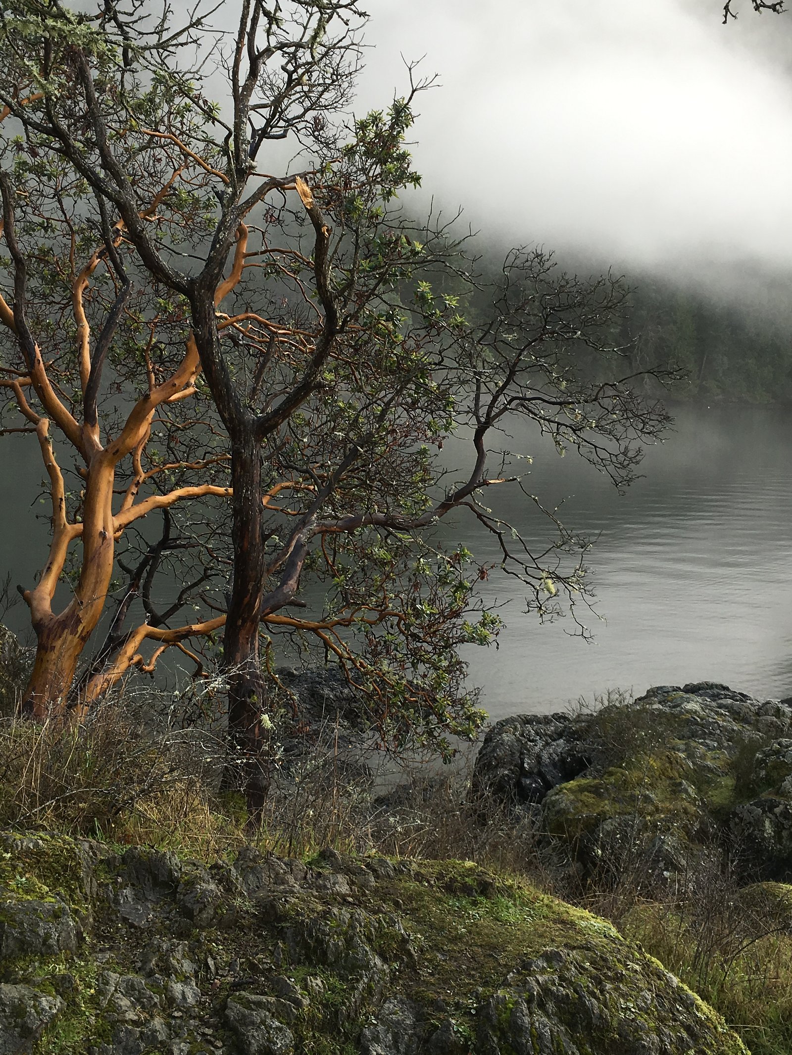
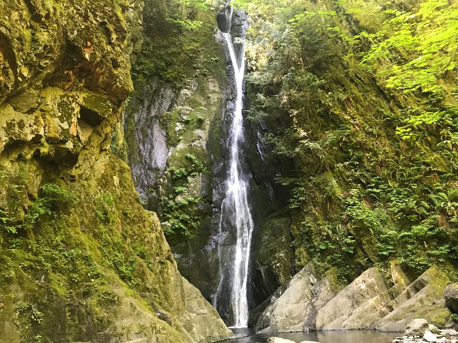
Cascade Falls
By Armen Suny · Last verified Jun 2026
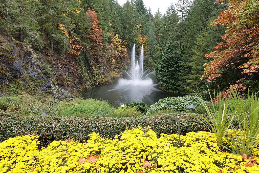
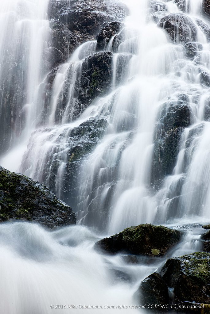
Photo Credits (5)
Difficulty
Moderate
Trail Length
3.4 km
Trail Type
Out And Back
Elevation Gain
167 m
About Cascade Falls
Cascade Falls (approx. 48.5515, -123.5024) is a small cascade-style waterfall near the Victoria / southern Vancouver Island region. There is limited authoritative, publicly available information tied to these coordinates. The waterfall appears to be modest in height and likely seasonal or variable in flow. Official measured height, formal park status, and maintained trail information could not be confidently confirmed, visitors should verify local maps, land ownership, and recent trip reports before planning a visit.
The Setting
Cascade Falls sits at 119 metres within GOWLLAND TOD PARK, in the coastal lowlands of British Columbia.
Why This Waterfall Exists
Cascade Falls flows over Westcoast Crystalline Complex, a hard intrusive rock layer deposited about 145-539 million years ago. These resistant rocks form a durable ledge that water cannot easily wear away, creating the falls where softer material downstream has already eroded.
Nearby Falls Worth Visiting
Niagara Falls (48 m) lies 8.5 kilometres to the southwest. Also nearby: Mary Vine Falls (21 m, 19.6 km) and Goldstream Falls (7 m, 11.1 km).
Trail & Hike Details
The Approach
The moderate 3.4-km out-and-back trail gains 167 metres of elevation on the way to the falls.
Trail Description
There is no verified description of a maintained or officially signed trail to this Cascade Falls location in available authoritative references. Expect unmaintained or informal footpaths, vegetation, possible short scrambles, and route-finding. Because details are unconfirmed, treat the approach as potentially rugged and on unmarked terrain.
What to Expect
A modest, forested cascade with variable flow (higher in spring and after heavy rain). The immediate area may be wooded with uneven, muddy or rocky ground. Water levels and accessibility can change seasonally. Expect limited facilities (likely no restrooms, signage, or guardrails).
Accessibility
The trail is not wheelchair accessible. Uneven terrain and elevation changes require steady footing.
Frequently Asked Questions
🐶 Are Dogs Allowed at Cascade Falls?
❌ Dogs are not allowed
Are There Any Fees or Permits Required?
🆖 No fees required
🏊 Is There Swimming at Cascade Falls?
❌ Swimming is not allowed
When to Visit
Spring (higher flows) for best water volume; late spring to early fall for easier, drier access. After heavy rains the water may be dramatic but banks and trails will be much more slippery, exercise extra caution.
Seasonal Access
The best time to visit is Spring, Summer, and Fall. Winter access may be limited. Check with the managing park or local authority for current conditions.
Safety Information
Potential hazards include slippery rocks and banks, unstable edges, variable water flow after rain, and unmaintained paths or short scrambles. Route may cross or be adjacent to private property, trespassing risks apply. Cell coverage may be intermittent. Use caution around water, supervise children closely, and avoid cliff edges. If unsure about conditions, do not attempt risky approaches.
Current Water Conditions
0.3 m³/s
Current discharge — how much water is flowing
Much lower than usual for this time of year
Based on 73 years of record
0.41 m
Water depth at gauge
7-Day Discharge Trend
What does this mean for your visit?
Flow is well below normal for this time of year, so the waterfall may be a trickle.
About This Gauge
This gauge is on a nearby waterway and may not reflect exact conditions at the falls.
7-Day Flow Outlook
Based on the WSC gauge KOKSILAH RIVER AT COWICHAN STATION (23 km away).
Today
Barely Flowing
0.3 m³/s
5/10Tomorrow
Barely Flowing
0.2 m³/s
4/10Tue
Barely Flowing
0.2 m³/s
4/10Wed
Barely Flowing
0.3 m³/s
3/10Thu
Barely Flowing
0.2 m³/s
4/10Fri
Barely Flowing
0.2 m³/s
5/10Sat
Barely Flowing
0.2 m³/s
4/10Best window: Today — barely flowing flow, sunny (trip score 5/10).
Best time of year: this gauge typically runs highest from late November to late December, peaking in December.
How we calculate this
This is a transparent outlook, not a precise forecast. We take the waterfall's current flow strength (how it ranks against its historical normal for today, from the nearest WSC stream gauge), carry that ranking forward along the gauge's seasonal curve, and nudge it for forecast rain. Confidence is highest for the next day or two and falls further out. Always check official conditions and your own judgment before visiting — high flows can be dangerous.
Know when to go.
Get a free email alert when waterfalls near Victoria hit peak flow. We only send when conditions are worth the trip — no weekly newsletters, no spam.
Weather Forecast
Location & Access
Getting There
The falls are located near the provided coordinates (48.5515, -123.5024). Nearest large population center is Victoria (approx. 11.7 miles). Depending on exact access points, reaching the site will likely require driving on local roads and then a short walk; specific public trailheads were not confirmed. Confirm access and property ownership locally before visiting.
Get Directions on Google MapsParking
No confirmed official parking lot associated with these coordinates. Parking may be limited to roadside pullouts or nearby parking areas; some access may cross private land. Do not block driveways or gates and obey posted signs.
Elevation
119 metres above sea level
Coordinates
48.551525° N, -123.502422° W
Land Management
Managed by Government of British Columbia
Visitor Tips & Gear
1) Verify current access and land ownership before visiting; some approaches may cross private property. 2) Wear sturdy, waterproof footwear, rocks and banks can be slippery. 3) Avoid getting too close to the edge or climbing on unstable rocks. 4) Pack out all trash and follow Leave No Trace. 5) Bring a map/GPS with the coordinates and a charged phone, but do not rely solely on cell coverage.
As an Amazon Associate, we earn from qualifying purchases.
With 3.4 km and 167 m of elevation gain, sturdy boots and trekking poles will help on this moderate trail. Sun exposure on the trail makes good sun protection a must in summer.

Polarized Sunglasses (Knockaround)
Cuts glare off the water so you actually see the falls — and your photos turn out better too.

Columbia Watertight II Rain Jacket
Packs into its own pocket, seam-sealed, and keeps you dry from spray and surprise rain.

Earth Pak Waterproof Dry Bag
Keeps your phone and gear dry when waterfall mist soaks everything else.

Waterproof Phone Pouch (AiRunTech)
Cheap insurance — take photos right next to the falls without killing your phone.

Timberland Euro Sprint Mid Waterproof
Trusted waterproof boot with premium leather and grippy rubber sole — reliable on rocky, wet trails.

TrailBuddy Trekking Poles
Lightweight aluminum, cork grips, and flip-locks that actually hold — a best-seller for good reason.
Where to Stay
Browse vacation cabins and private rentals nearby
Unique outdoor stays — tents, yurts, and treehouses
Rent a campervan or RV for your waterfall road trip
Some links are affiliate links. We may earn a commission at no extra cost to you.
Nearby Campground
Bamberton Provincial Park Campground
6.4 km away
Nearby Hot Springs
Hot springs near Victoria, British Columbia

Olympic Hot Springs
Olympic Hot Springs flows at 118 degrees within Olympic National Park at 2,000 feet elevation, emerging 72 degrees above ambien...

Sol Duc Hot Springs
Sol Duc Hot Springs flows at 122 degrees Fahrenheit in Olympic National Park with permanently protected Class 1 status under Na...
Looking for a soak after your hike? Explore more hot springs near Victoria, British Columbia on SoakingSprings.
Explore British Columbia springsAdditional Information
Nearby Attractions
Victoria (historic downtown, ferry connections), local Vancouver Island parks and trails. The user-supplied distances also list Roche Harbor and Friday Harbor (San Juan Islands) as nearby points of interest by water/boat travel, if traveling by ferry/boat these are regional destinations to consider.
Wildlife
Typical southern Vancouver Island fauna may be present: songbirds, bald eagles, deer, small mammals. In some areas there may be coyotes or black-tailed deer; sightings of larger predators (cougar, black bear) are possible regionally but less common in densely visited areas. Be aware of ticks in grassy/wooded areas.
Cities near Cascade Falls
Nearby Waterfalls
Other waterfalls named Cascade Falls
24 other waterfalls share this name across Canada.
Writing about Cascade Falls? Embed this waterfall on your site for free.