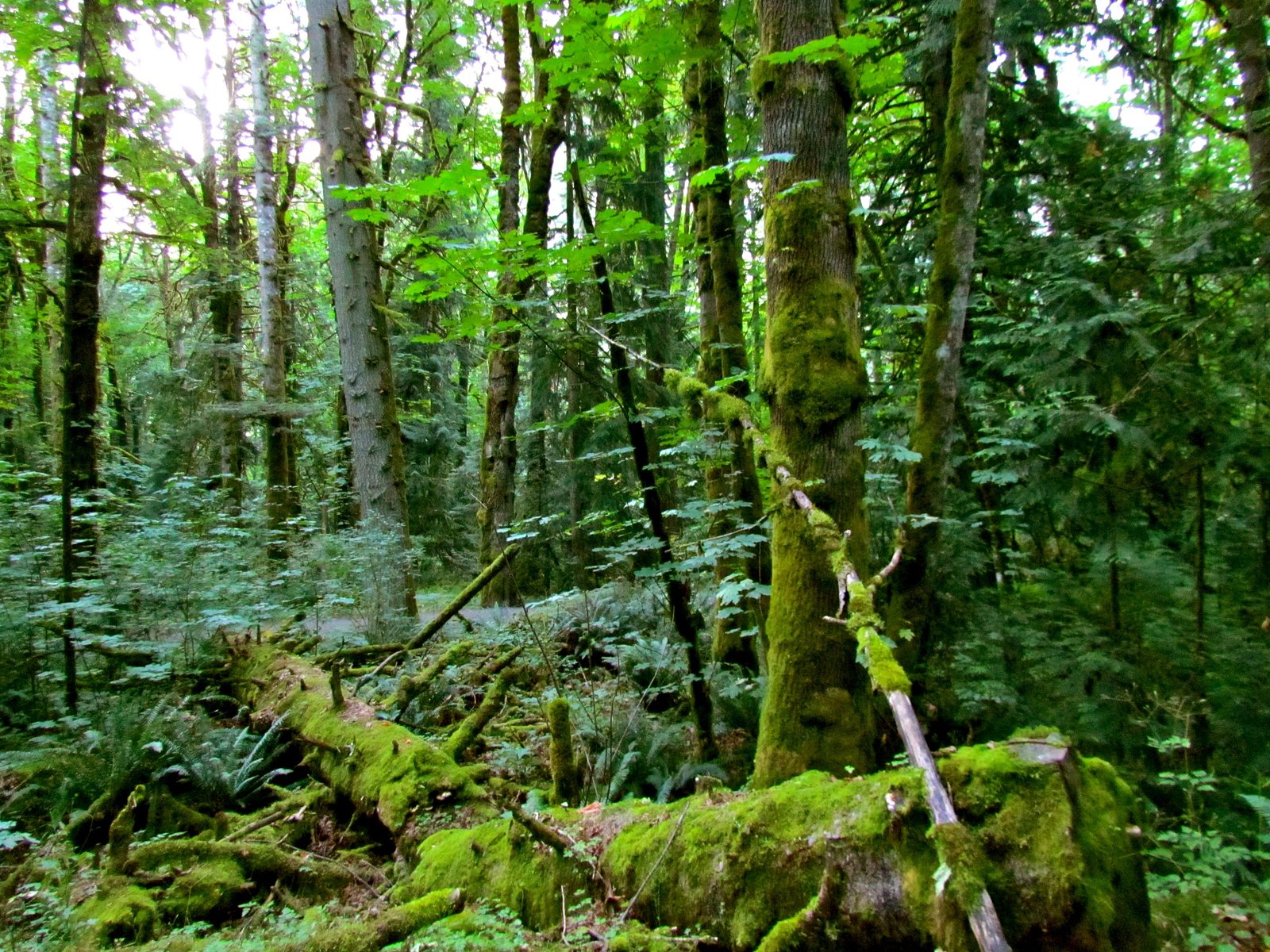
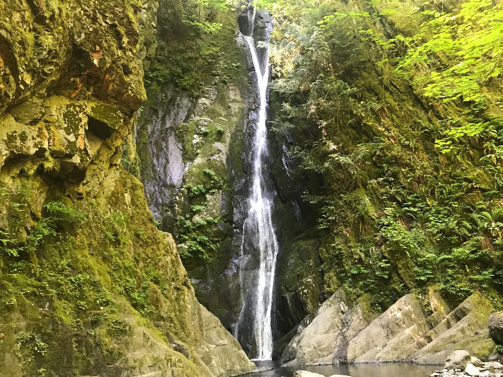
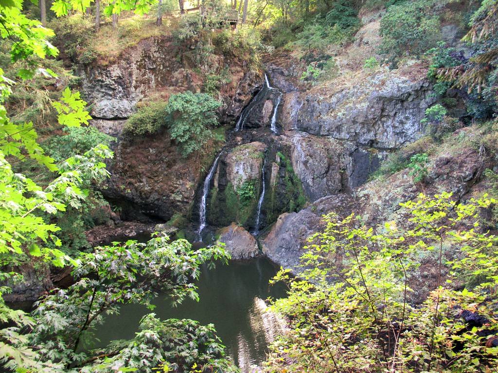
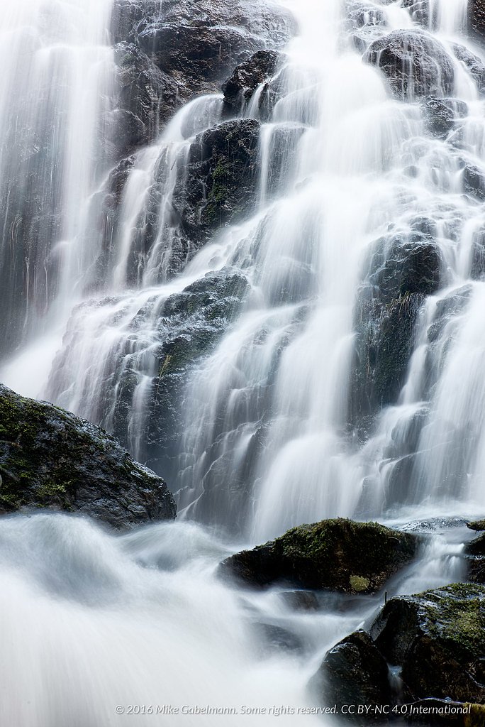
Hidden spring falls
British Columbia • Goldstream Park
By Armen Suny · Last verified Jun 2026
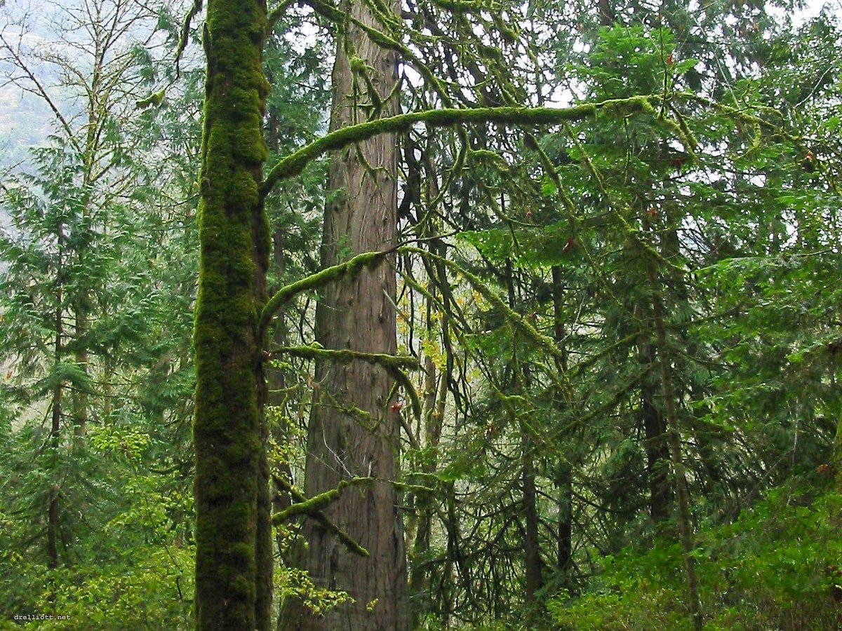
Photo Credits (5)
Difficulty
Easy
Trail Length
0.8 km
Trail Type
Out And Back
Elevation Gain
8 m
About Hidden spring falls
Hidden Spring Falls is a small, forested cascade on southern Vancouver Island, located roughly 10 miles west of downtown Victoria (coordinates: 48.4713, -123.5539). It appears to be a locally known waterfall on a tributary stream and is likely seasonal or significantly higher in flow during spring snowmelt and after heavy rain. Detailed, official descriptions are limited; visitors should consult local trail resources or recent trip reports for up-to-date conditions.
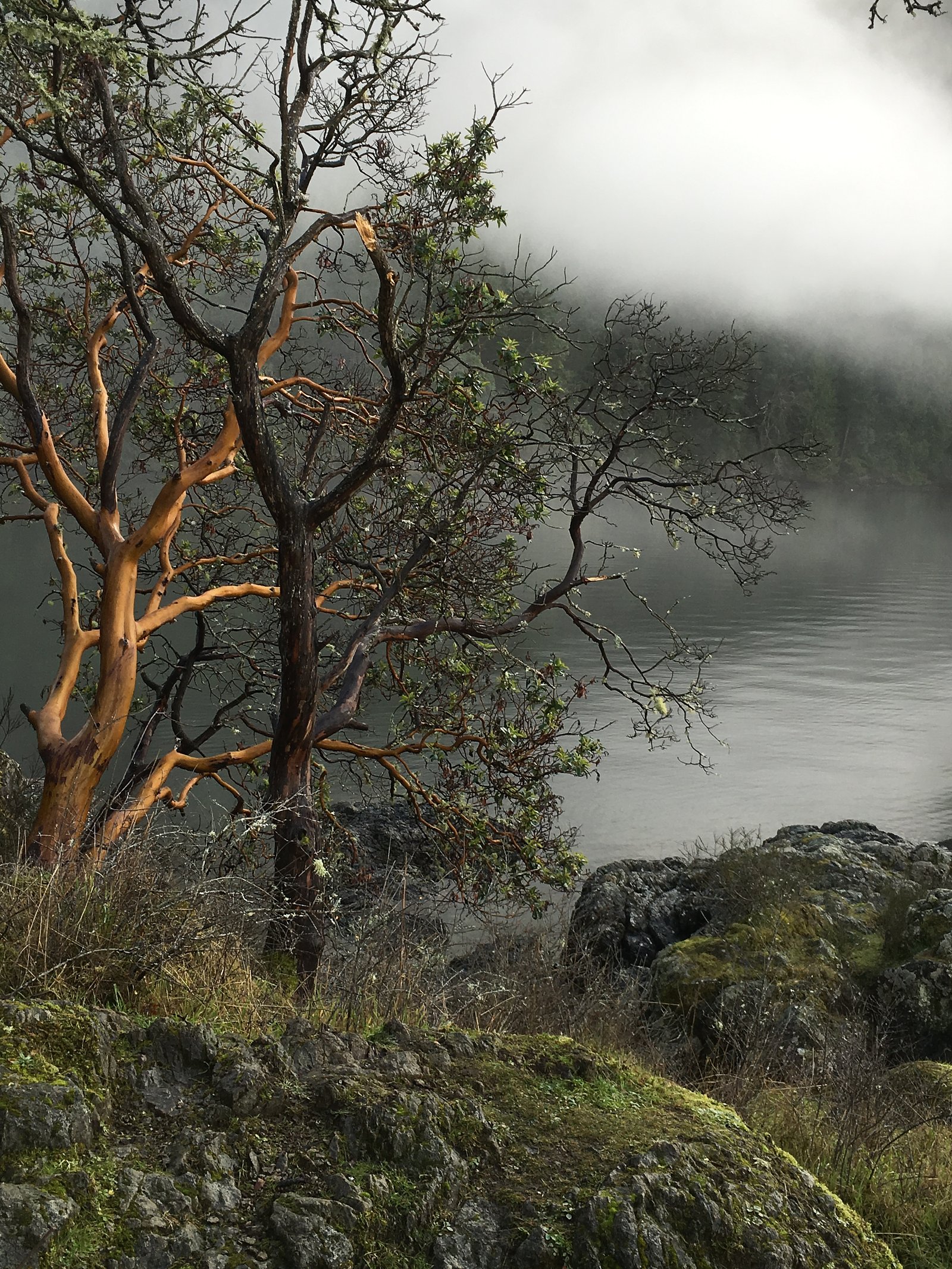
The Setting
Hidden spring falls sits at 91 metres within Goldstream Park, in the coastal lowlands of British Columbia.
Why This Waterfall Exists
Hidden spring falls flows over West Coast Complex, a hard intrusive rock layer deposited about 145-252 million years ago. These resistant rocks form a durable ledge that water cannot easily wear away, creating the falls where softer material downstream has already eroded.
Nearby Falls Worth Visiting
Niagara Falls (48 m) lies 1.3 kilometres to the north. Also nearby: Mary Vine Falls (21 m, 12.2 km) and Sitting Lady Falls (18 m, 9.5 km).
Trail & Hike Details
The Approach
The easy 0.8-km out-and-back trail gains 8 metres of elevation on the way to the falls.
Trail Description
Specific trail details are not reliably documented here. Many small island waterfalls are accessed by short forested paths that can be steep, rooty, and muddy. Expect narrow singletrack, variable footing, and limited built infrastructure (stairs, railings) unless the site is in a developed park. Confirm route, length, and difficulty with local maps and recent visitor reports before heading out.
What to Expect
A wooded setting with moss-covered rocks and a creek or tributary feeding the cascade. Flow is likely highest in spring and after heavy rain and may be low in late summer and early fall. Expect limited facilities (no toilets or potable water), potential for limited cell service, and natural, potentially slippery terrain near the falls.
Accessibility
The trail is short and relatively flat, but the surface may be uneven. Contact the managing agency for accessibility details.
Frequently Asked Questions
🐶 Are Dogs Allowed at Hidden spring falls?
❌ Dogs are not allowed
Are There Any Fees or Permits Required?
🆖 No fees required
🏊 Is There Swimming at Hidden spring falls?
❌ Swimming is not allowed
When to Visit
Spring (snowmelt and rainy season) for highest flows and most impressive appearance. Early morning or weekdays can reduce crowds. Avoid visiting after prolonged dry spells if you want a strong flow.
Seasonal Access
The best time to visit is Spring, Summer, and Fall. Winter access may be limited. Check with Goldstream Park for current conditions.
Safety Information
• Trails and rocks near waterfalls are often wet and slippery, use caution and maintain a safe distance from edges. • Water flow can rise rapidly during rain; avoid getting trapped on low banks. • There may be no signage, railings, or rescue services nearby, carry a basic first-aid kit and a way to contact help. • Check for seasonal hazards (storm damage, fallen trees, or forestry activity). • If camping or hiking in bear country, follow food storage and bear-safety guidelines.
Current Water Conditions
Based on a Water Survey of Canada gauge 30 km away
0.3 m³/s
Current discharge — how much water is flowing
Much lower than usual for this time of year
Based on 73 years of record
0.41 m
Water depth at gauge
7-Day Discharge Trend
What does this mean for your visit?
Flow is well below normal for this time of year, so the waterfall may be a trickle.
About This Gauge
This gauge is on a regional waterway. Conditions at the falls may differ, especially after local rain.
7-Day Flow Outlook
Based on the WSC gauge KOKSILAH RIVER AT COWICHAN STATION (30 km away).
Today
Barely Flowing
0.3 m³/s
5/10Tomorrow
Barely Flowing
0.2 m³/s
4/10Tue
Barely Flowing
0.2 m³/s
4/10Wed
Barely Flowing
0.3 m³/s
3/10Thu
Low
0.3 m³/s
4/10Fri
Barely Flowing
0.2 m³/s
5/10Sat
Barely Flowing
0.2 m³/s
4/10Best window: Today — barely flowing flow, sunny (trip score 5/10).
Best time of year: this gauge typically runs highest from late November to late December, peaking in December.
How we calculate this
This is a transparent outlook, not a precise forecast. We take the waterfall's current flow strength (how it ranks against its historical normal for today, from the nearest WSC stream gauge), carry that ranking forward along the gauge's seasonal curve, and nudge it for forecast rain. Confidence is highest for the next day or two and falls further out. Always check official conditions and your own judgment before visiting — high flows can be dangerous.
Know when to go.
Get a free email alert when waterfalls near Victoria hit peak flow. We only send when conditions are worth the trip — no weekly newsletters, no spam.
Weather Forecast
Location & Access
Getting There
The falls are on southern Vancouver Island near Victoria (approx. 9.9 miles). Exact public-access route is not confirmed here, many small waterfalls in this area are reached via short trails or forest/secondary roads. Before visiting, check local maps, AllTrails trip reports, or Capital Regional District/BC Parks information for the most current directions and access notes.
Get Directions on Google MapsParking
Formal parking information is not confirmed. Parking may be limited to roadside pullouts or small trailhead lots; do not block gates or private driveways. Use local trail resources to confirm parking and access.
Elevation
91 metres above sea level
Coordinates
48.471300° N, -123.553879° W
Land Management
Managed by Government of British Columbia
Visitor Tips & Gear
• Check recent trip reports (AllTrails, local hiking groups) for current access, trail conditions, and parking. • Wear good traction footwear, trails and rocks near the falls are likely slippery. • Stay back from cliff edges and unstable banks; there may be no barriers. • Pack out all trash and follow Leave No Trace principles. • Be prepared for limited or no cell reception; tell someone your plans. • Respect private property and posted signs, some access routes on southern Vancouver Island cross private land or forestry roads.
As an Amazon Associate, we earn from qualifying purchases.
For this easy 0.8 km trail, lightweight trail shoes and a water bottle are usually sufficient. Sun exposure on the trail makes good sun protection a must in summer.

Polarized Sunglasses (Knockaround)
Cuts glare off the water so you actually see the falls — and your photos turn out better too.

Columbia Watertight II Rain Jacket
Packs into its own pocket, seam-sealed, and keeps you dry from spray and surprise rain.

Earth Pak Waterproof Dry Bag
Keeps your phone and gear dry when waterfall mist soaks everything else.

Waterproof Phone Pouch (AiRunTech)
Cheap insurance — take photos right next to the falls without killing your phone.

JOBY GorillaPod Starter Kit
Wraps around railings and rocks for long-exposure waterfall shots — no flat surface needed.

Osprey Daylite Daypack
Light, organized, and just the right size for a day hike — fits water, snacks, and layers.
Where to Stay
Browse vacation cabins and private rentals nearby
Unique outdoor stays — tents, yurts, and treehouses
Rent a campervan or RV for your waterfall road trip
Some links are affiliate links. We may earn a commission at no extra cost to you.
Nearby Campground
Goldstream Group Campsite - Prospector (Upper) Site
0.7 km away
Nearby Hot Springs
Hot springs near Victoria, British Columbia

Olympic Hot Springs
Olympic Hot Springs flows at 118 degrees within Olympic National Park at 2,000 feet elevation, emerging 72 degrees above ambien...

Sol Duc Hot Springs
Sol Duc Hot Springs flows at 122 degrees Fahrenheit in Olympic National Park with permanently protected Class 1 status under Na...
Looking for a soak after your hike? Explore more hot springs near Victoria, British Columbia on SoakingSprings.
Explore British Columbia springsAdditional Information
Nearby Attractions
The falls are on southern Vancouver Island near Victoria. Other popular nearby destinations on southern Vancouver Island include regional parks, coastal viewpoints, and trails, check local visitor information for specific nearby attractions such as East Sooke Regional Park or Sooke-area sites (verify exact distances and routes).
Wildlife
Typical southern Vancouver Island wildlife may be present: black bears, cougars (rare but possible), deer, various bird species, and small mammals. Ticks can be present in brushy areas. Be aware of wildlife safety practices.
Cities near Hidden spring falls
Nearby Waterfalls
Writing about Hidden spring falls? Embed this waterfall on your site for free.