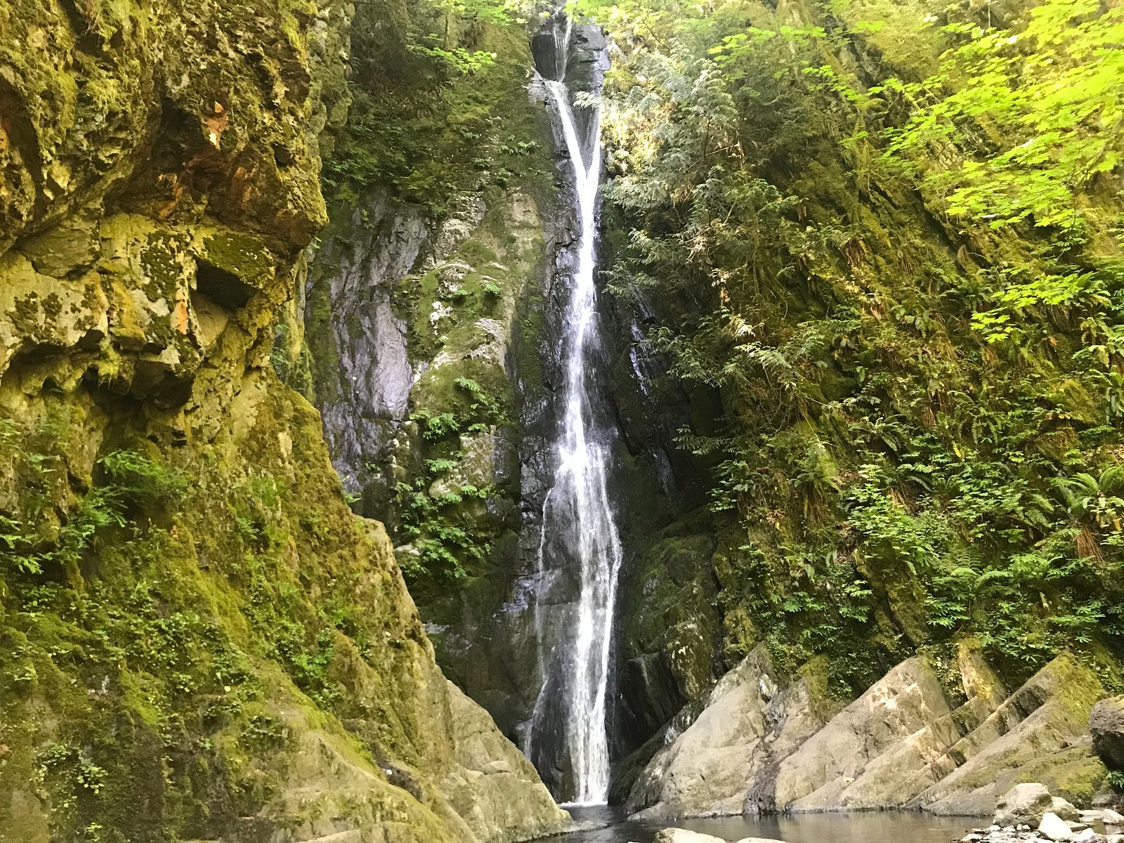
Mary Vine Falls
British Columbia • 21 m
By Armen Suny · Last verified Jun 2026
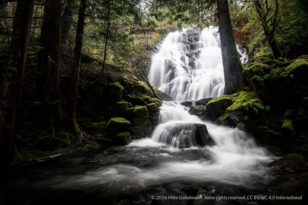
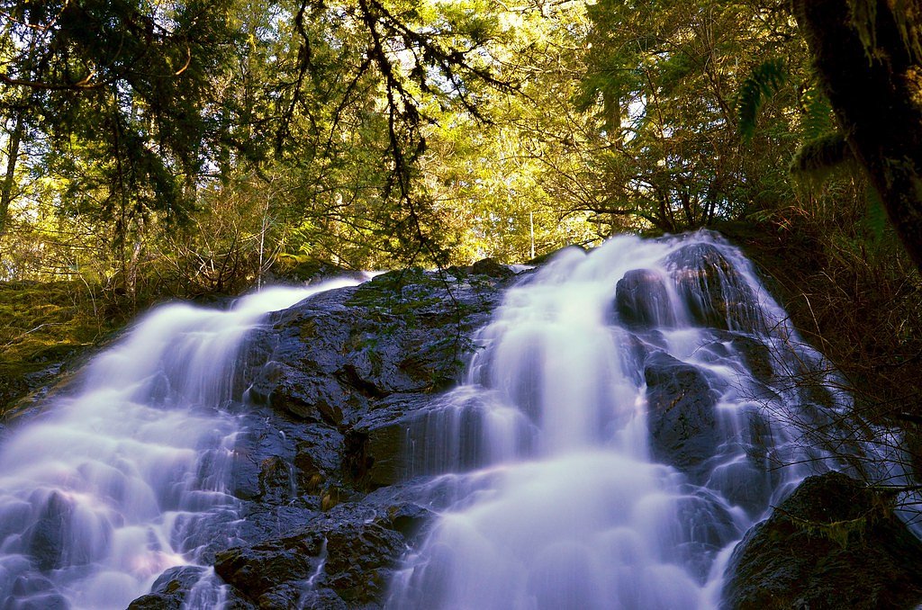
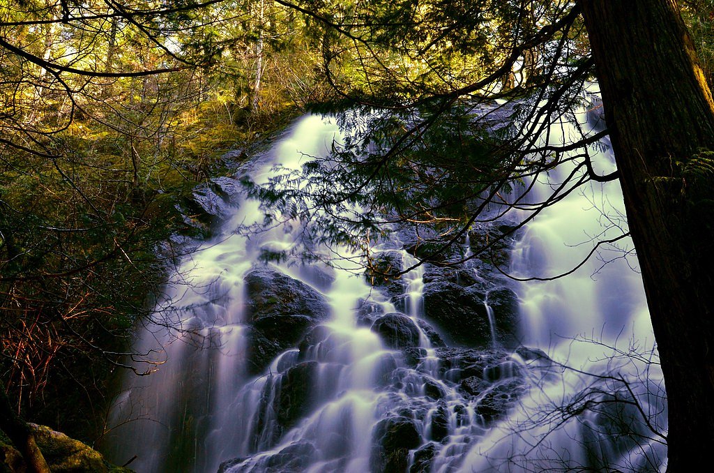
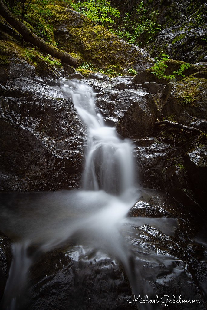
Photo Credits (5)
Difficulty
Easy
Trail Length
1.4 km
Trail Type
Out And Back
Elevation Gain
40 m
About Mary Vine Falls
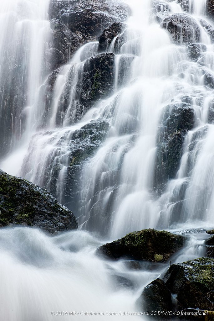
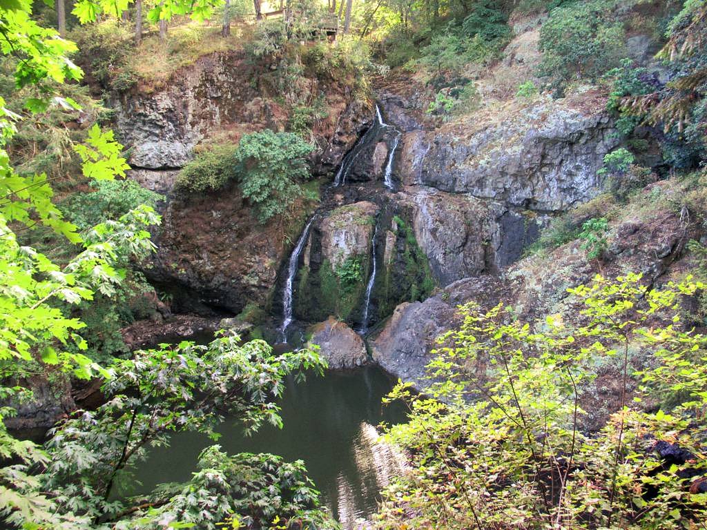
Mary Vine Falls is a small forested waterfall on southern Vancouver Island, located on or near the shoreline west of Victoria. The falls sit in a heavily treed ravine and are most often visited by locals and hikers exploring nearby regional parks. Specifics about the falls (exact height and formalized viewing infrastructure) are not well documented; descriptions below use conservative language where details are uncertain.
The Setting
Mary Vine Falls sits at 152 metres within Sea to Sea Regional Park, in the coastal lowlands of British Columbia. The falls drop 21 metres.
Why This Waterfall Exists
Mary Vine Falls flows over Metchosin Formation, a hard volcanic rock layer deposited about 34-66 million years ago. These resistant rocks form a durable ledge that water cannot easily wear away, creating a 68-foot drop where softer material downstream has already eroded.
Nearby Falls Worth Visiting
Niagara Falls (48 m) lies 12.7 kilometres to the east. Also nearby: Sitting Lady Falls (18 m, 15.8 km) and Goldstream Falls (7 m, 10.8 km).
Trail & Hike Details
The Approach
The easy 1.4-km out-and-back trail gains 40 metres of elevation on the way to the falls.
Trail Description
Trail information for Mary Vine Falls is not widely published. Access is commonly through a short forest trail that descends into a ravine; sections may be steep, narrow, and muddy or slippery after rain. There may not be a formal maintained boardwalk or viewing platform, and some approaches could involve a short scramble to reach the base or best viewpoints. Expect single-track footpaths rather than wide groomed trails.
What to Expect
The falls drop 21 metres over hard volcanic rock.
Accessibility
The trail is short and relatively flat, but the surface may be uneven. Contact the managing agency for accessibility details.
Frequently Asked Questions
🐶 Are Dogs Allowed at Mary Vine Falls?
❌ Dogs are not allowed
Are There Any Fees or Permits Required?
🆖 No fees required
🏊 Is There Swimming at Mary Vine Falls?
❌ Swimming is not allowed
When to Visit
Late fall through spring for highest water flow; summer for easier, drier trail conditions but lower flow. Early morning or weekdays reduce crowding.
Seasonal Access
The best time to visit is Spring, Summer, Fall, and Winter. Check with the managing park or local authority for current conditions.
Safety Information
• Slippery rocks and steep drop-offs present a fall hazard, stay back from edges. • Flashy flows after heavy rain can rapidly increase water volume, avoid being in or near the channel during storms. • Hypothermia risk in wet, cool weather, bring appropriate clothing. • Limited cell service in ravines; tell someone your plans and expected return time. • If bears are in the area, follow BC Parks/park authority guidance: make noise on approach, keep dogs under control, and carry bear deterrent where recommended.
Current Water Conditions
Based on a Water Survey of Canada gauge 31.6 km away
0.3 m³/s
Current discharge — how much water is flowing
Much lower than usual for this time of year
Based on 73 years of record
0.41 m
Water depth at gauge
7-Day Discharge Trend
What does this mean for your visit?
Flow is well below normal for this time of year, so the waterfall may be a trickle.
About This Gauge
This gauge is on a regional waterway. Conditions at the falls may differ, especially after local rain.
7-Day Flow Outlook
Based on the WSC gauge KOKSILAH RIVER AT COWICHAN STATION (32 km away).
Today
Barely Flowing
0.3 m³/s
4/10Tomorrow
Barely Flowing
0.2 m³/s
4/10Tue
Barely Flowing
0.2 m³/s
4/10Wed
Barely Flowing
0.2 m³/s
4/10Thu
Barely Flowing
0.3 m³/s
3/10Fri
Barely Flowing
0.2 m³/s
5/10Sat
Barely Flowing
0.2 m³/s
4/10Best window: Fri — barely flowing flow, mainly sunny (trip score 5/10).
Best time of year: this gauge typically runs highest from late November to late December, peaking in December.
How we calculate this
This is a transparent outlook, not a precise forecast. We take the waterfall's current flow strength (how it ranks against its historical normal for today, from the nearest WSC stream gauge), carry that ranking forward along the gauge's seasonal curve, and nudge it for forecast rain. Confidence is highest for the next day or two and falls further out. Always check official conditions and your own judgment before visiting — high flows can be dangerous.
Know when to go.
Get a free email alert when waterfalls near Victoria hit peak flow. We only send when conditions are worth the trip — no weekly newsletters, no spam.
Weather Forecast
Location & Access
Getting There
The falls are located roughly west of Victoria on southern Vancouver Island (coordinates 48.4464, -123.7165). Most visitors reach the area by driving from Victoria via Highway 14 (Sooke Road) toward Sooke and continuing on local roads toward the west-coast parks and forested areas. Final approach may be on unpaved roads or short forest roads; users should consult local park maps or BC Parks/Regional District resources for exact trailheads.
Get Directions on Google MapsParking
Parking is likely limited to a small pullout or informal lot near the trailhead. Expect tight spaces and possibly uneven/unmarked parking; park legally and avoid blocking private driveways or gated access roads.
Elevation
152 metres above sea level
Coordinates
48.446379° N, -123.716539° W
Land Management
Managed by Capital Region District
Visitor Tips & Gear
• Wear sturdy, grippy footwear, rocks around the falls and the trail can be slippery. • Bring rain gear and expect wet/muddy conditions outside of peak summer. • Leave no trace, pack out any trash. • Stay back from the edge of cliff faces and avoid climbing on wet rocks. • Check local park or regional district websites before visiting for any advisories or temporary closures. • If visiting from Victoria, allow extra time for narrow roads and limited parking near trailheads.
As an Amazon Associate, we earn from qualifying purchases.
For this easy 1.4 km trail, lightweight trail shoes and a water bottle are usually sufficient. Icy conditions are common in winter — traction cleats are a smart addition.

Columbia Watertight II Rain Jacket
Packs into its own pocket, seam-sealed, and keeps you dry from spray and surprise rain.

Polarized Sunglasses (Knockaround)
Cuts glare off the water so you actually see the falls — and your photos turn out better too.

Earth Pak Waterproof Dry Bag
Keeps your phone and gear dry when waterfall mist soaks everything else.

Waterproof Phone Pouch (AiRunTech)
Cheap insurance — take photos right next to the falls without killing your phone.

Kahtoola MICROspikes
Cult-favorite traction cleats that grip ice and wet rock — essential for winter waterfall hikes.

JOBY GorillaPod Starter Kit
Wraps around railings and rocks for long-exposure waterfall shots — no flat surface needed.
Where to Stay
Browse vacation cabins and private rentals nearby
Unique outdoor stays — tents, yurts, and treehouses
Rent a campervan or RV for your waterfall road trip
Some links are affiliate links. We may earn a commission at no extra cost to you.
Nearby Campground
Sooke River Campground
6.5 km away
Nearby Hot Springs
Hot springs near Victoria, British Columbia

Olympic Hot Springs
Olympic Hot Springs flows at 118 degrees within Olympic National Park at 2,000 feet elevation, emerging 72 degrees above ambien...

Sol Duc Hot Springs
Sol Duc Hot Springs flows at 122 degrees Fahrenheit in Olympic National Park with permanently protected Class 1 status under Na...
Looking for a soak after your hike? Explore more hot springs near Victoria, British Columbia on SoakingSprings.
Explore British Columbia springsAdditional Information
Nearby Attractions
Nearby attractions in the broader area include parks and sites on southern Vancouver Island such as Sooke (town), East Sooke Regional Park, Juan de Fuca Provincial Park, Sooke Potholes (a known swimming and picnic area), and the coastal viewpoints west of Victoria. Exact proximity depends on the falls' trailhead location.
Wildlife
Typical coastal Vancouver Island wildlife may be present: black-tailed deer, black bears (avoid surprising bears and store food properly), raccoons, many bird species, and small mammals. Take standard wilderness precautions for food storage and bear awareness.
Cities near Mary Vine Falls
Nearby Waterfalls
Writing about Mary Vine Falls? Embed this waterfall on your site for free.