Photo Credits (2)
Difficulty
Moderate
Trail Length
2.0 miles
Trail Type
Out And Back
Elevation Gain
300 ft
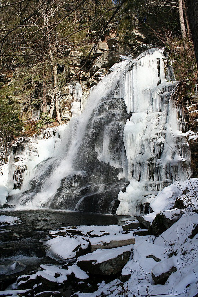
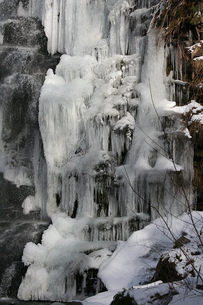
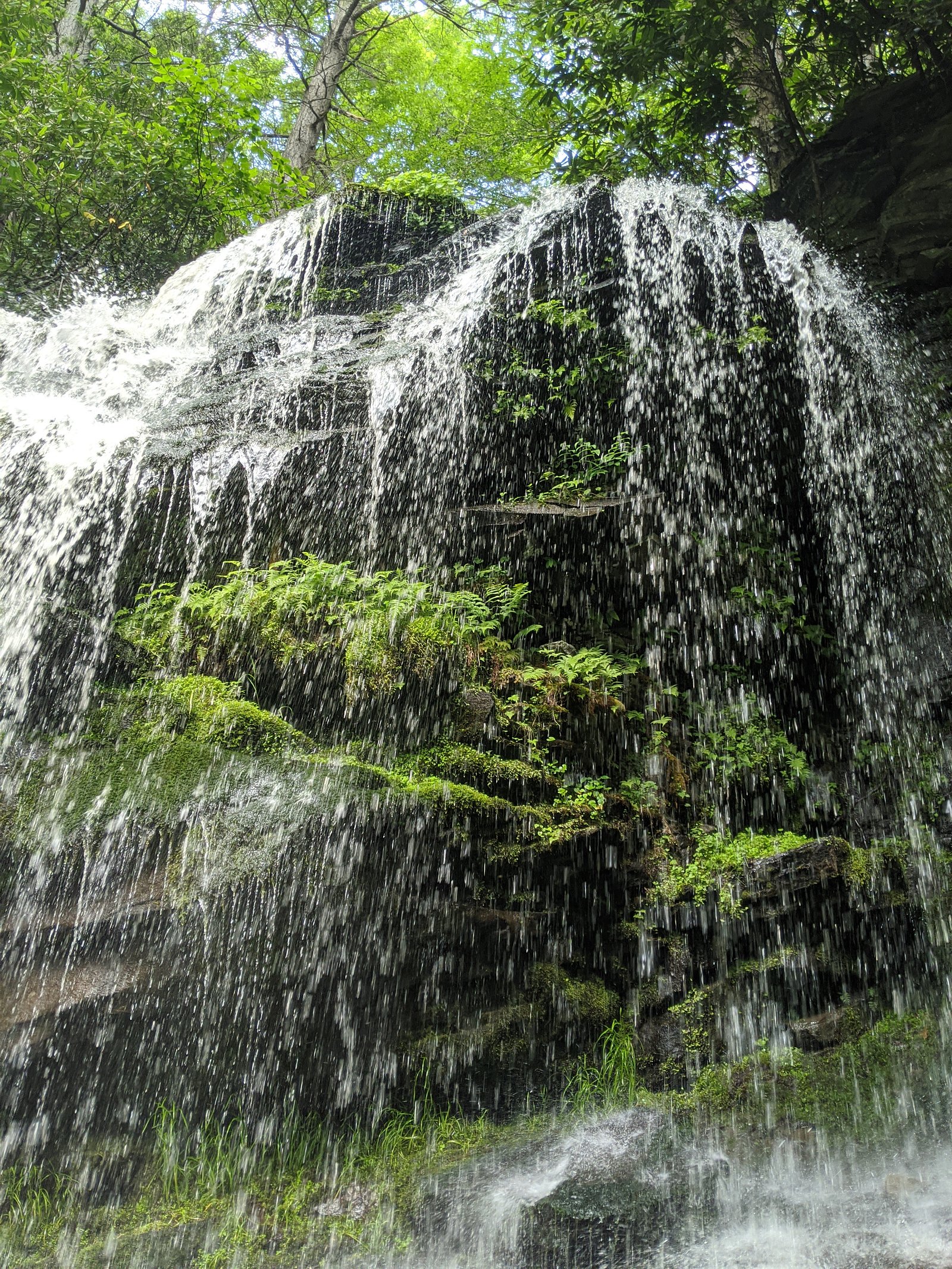
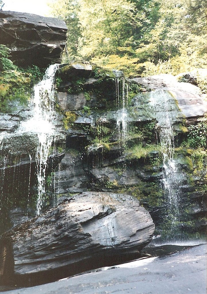
About Katrina Falls
Katrina Falls is a scenic waterfall located in the Catskills region of New York. It is known for its natural beauty and serene surroundings, making it a popular spot for hikers and nature enthusiasts. The waterfall is part of the Neversink River and offers picturesque views, especially after rainfall.
The Setting
Katrina Falls sits at 1,152 feet along the Neversink River, in the foothills of New York.
Trail & Hike Details
The Approach
The moderate 2.0-mile out-and-back trail gains 300 feet of elevation on the way to the falls.
Trail Description
The trail to Katrina Falls is a moderately challenging hike that winds through a forested area with some rocky and uneven terrain. The path is well-marked but may become muddy or slippery after rain. Hikers will encounter scenic views of the surrounding woods and the Neversink River before reaching the waterfall.
What to Expect
Dogs are welcome.
Accessibility
The trail is not wheelchair accessible. Uneven terrain and elevation changes require steady footing.
Frequently Asked Questions
🐶 Are Dogs Allowed at Katrina Falls?
✅ Dogs are allowed
Are There Any Fees or Permits Required?
🆖 No fees required
🏊 Is There Swimming at Katrina Falls?
❌ Swimming is not allowed
When to Visit
The best time to visit Katrina Falls is during spring or early summer when water flow is at its peak due to snowmelt and rainfall. Fall is also a great time to visit for the vibrant foliage.
Seasonal Access
The best time to visit is Spring, Summer, and Fall. Winter access may be limited.
Safety Information
Hikers should exercise caution on rocky or slippery sections of the trail. Carry a map or GPS device, as cell service may be limited in the area. Be aware of wildlife and avoid venturing off the marked trail.
Current Water Conditions
127 ft³/s
Current discharge — how much water is flowing
Lower than usual for this time of year
Based on 33 years of record
4.88 ft
Water depth at gauge
65°F
CoolRefreshing for swimming
7-Day Discharge Trend
What does this mean for your visit?
Flow is lower than usual for this time of year. Water temperature is a refreshing 65 degrees F, good for a quick swim.
About This Gauge
7-Day Flow Outlook
Based on the USGS gauge NEVERSINK RIVER AT BRIDGEVILLE NY (3 km away).
Today
Barely Flowing
127 cfs
5/10Tomorrow
Low
139 cfs
3/10Thu
Low
140 cfs
6/10Fri
Low
147 cfs
3/10Sat
Low
156 cfs
3/10Sun
Low
149 cfs
3/10Mon
Low
140 cfs
3/10Best window: Thu — low flow, sunny (trip score 6/10).
Best time of year: this gauge typically runs highest from early March to mid April, peaking in April.
How we calculate this
This is a transparent outlook, not a precise forecast. We take the waterfall's current flow strength (how it ranks against its historical normal for today, from the nearest USGS stream gauge), carry that ranking forward along the gauge's seasonal curve, and nudge it for forecast rain. Confidence is highest for the next day or two and falls further out. Always check official conditions and your own judgment before visiting — high flows can be dangerous.
Know when to go.
Get a free email alert when waterfalls near Bridgeville hit peak flow. We only send when conditions are worth the trip — no weekly newsletters, no spam.
Weather Forecast
Location & Access
Getting There
Katrina Falls is located near Rock Hill, New York, within the Catskills region. Access is typically via local roads, and visitors should follow signs for the Neversink River area or use GPS coordinates for precise navigation.
Get Directions on Google MapsParking
Parking is available near the trailhead, but spaces may be limited during peak seasons. Visitors are advised to arrive early to secure a spot.
Elevation
1,152 feet above sea level
Coordinates
41.607411° N, -74.618526° W
Visitor Tips & Gear
Arrive early to secure parking, especially during weekends or peak seasons. Wear sturdy hiking shoes and bring water, as the trail can be moderately challenging. Check weather conditions before visiting, as the trail may become slippery after rain.
As an Amazon Associate, we earn from qualifying purchases.
With 2.0 miles and 300 ft of elevation gain, sturdy boots and trekking poles will help on this moderate trail. Sun exposure on the trail makes good sun protection a must in summer.

Polarized Sunglasses (Knockaround)
Cuts glare off the water so you actually see the falls — and your photos turn out better too.

Columbia Watertight II Rain Jacket
Packs into its own pocket, seam-sealed, and keeps you dry from spray and surprise rain.

Earth Pak Waterproof Dry Bag
Keeps your phone and gear dry when waterfall mist soaks everything else.

Waterproof Phone Pouch (AiRunTech)
Cheap insurance — take photos right next to the falls without killing your phone.

Timberland Euro Sprint Mid Waterproof
Trusted waterproof boot with premium leather and grippy rubber sole — reliable on rocky, wet trails.

TrailBuddy Trekking Poles
Lightweight aluminum, cork grips, and flip-locks that actually hold — a best-seller for good reason.
Where to Stay

Hampton Inn Monticello, Ny

Days Inn by Wyndham Wurtsboro

Best Western Monticello

Sleep Inn & Suites Middletown - Goshen
Browse vacation cabins and private rentals nearby
Unique outdoor stays — tents, yurts, and treehouses
Rent a campervan or RV for your waterfall road trip
Some links are affiliate links. We may earn a commission at no extra cost to you.
Additional Information
Nearby Attractions
Nearby attractions include other hiking trails in the Catskills region, the Neversink River, and local small towns like Rock Hill and Monticello.
Wildlife
The area is home to various wildlife, including deer, birds, and small mammals. Visitors should be cautious of ticks and other insects.
Cities near Katrina Falls
Nearby Waterfalls
Writing about Katrina Falls? Embed this waterfall on your site for free.