
Photo Credits (5)
Difficulty
Easy
Trail Length
1.0 km
Trail Type
Loop
Elevation Gain
50 m
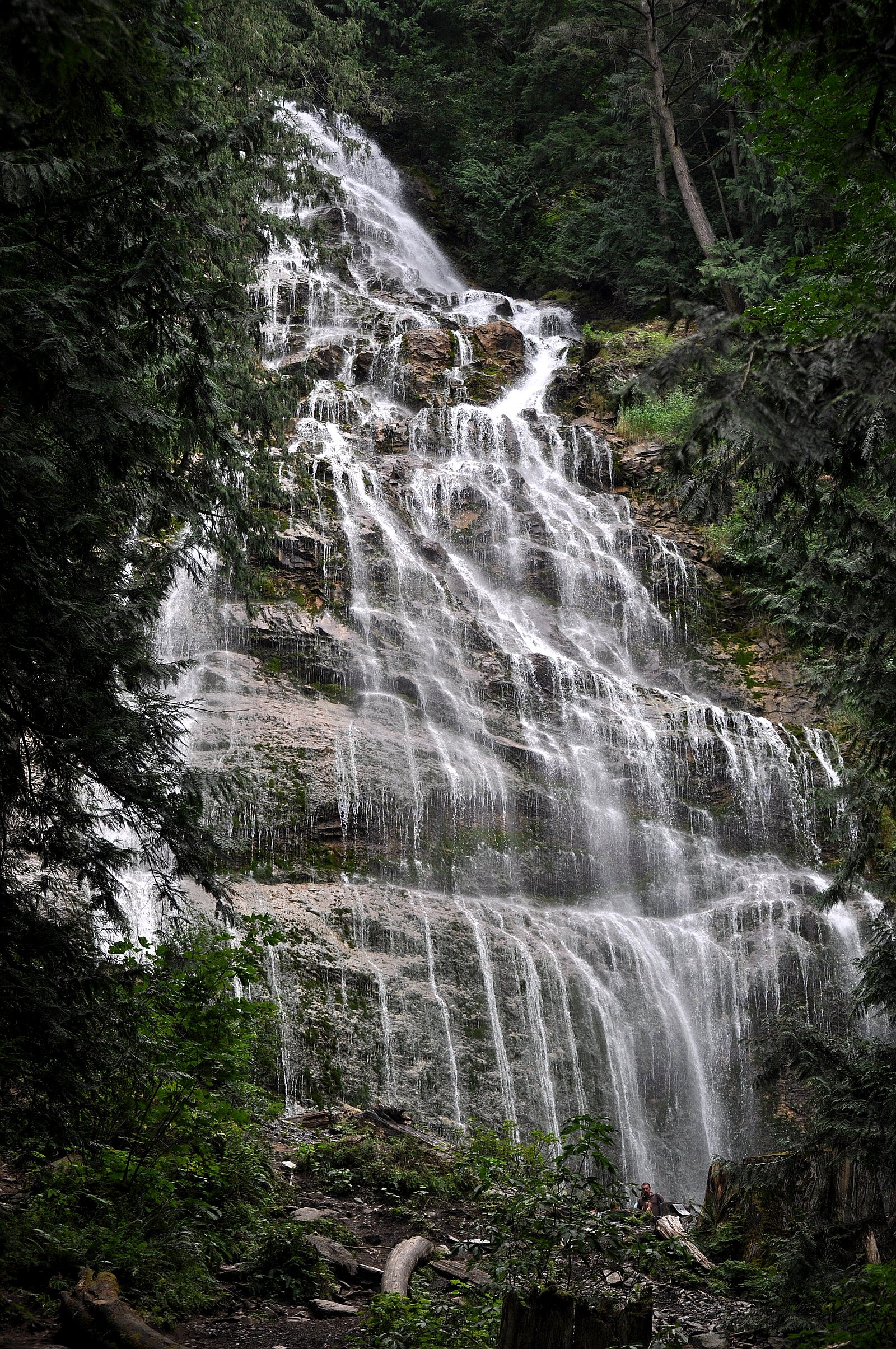
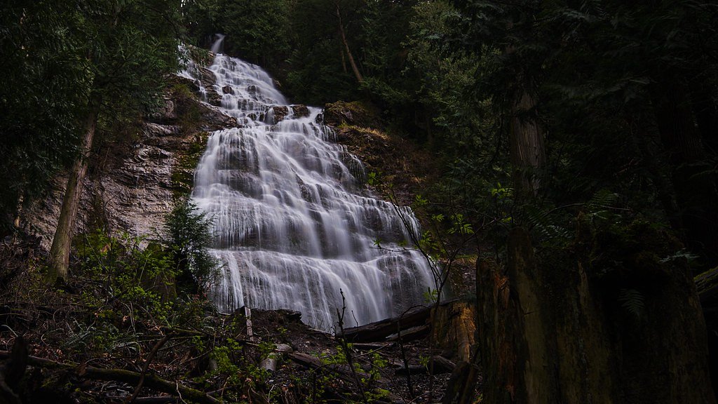
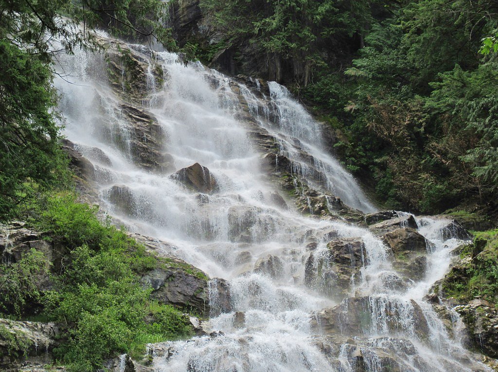
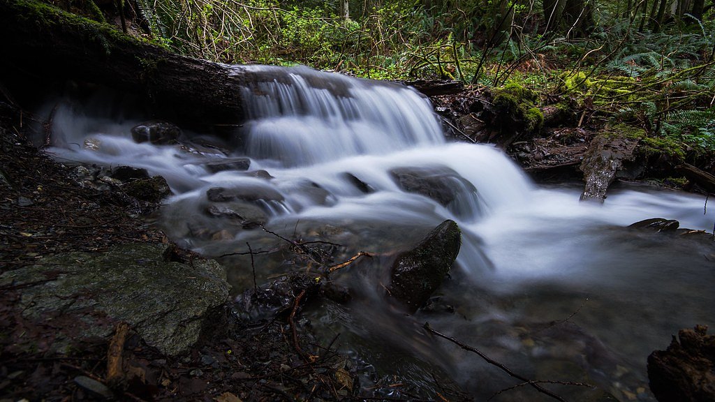
About Bridal Veil Falls
Bridal Veil Falls Provincial Park is a BC Park situated on the Trans-Canada Highway just east of Rosedale, British Columbia, Canada, within of the City of Chilliwack. The community of Bridal Falls is located adjacent to the falls and park, as well as the interchange between the Trans-Canada and BC Highway 9, offering a variety of highway-based tourism services. Access to the falls requires a short hike from the parking lot and well-groomed trails, taking most groups 15-25 minutes.
The Setting
Bridal Veil Falls sits at 301 metres within BRIDAL VEIL FALLS PARK, in the foothills of British Columbia. At 122 metres, it is among the taller waterfalls in British Columbia.
Why This Waterfall Exists
Bridal Veil Falls flows over hard volcanic rock laid down about 252-419 million years ago. These resistant rocks form a durable ledge that water cannot easily wear away, creating a 400-foot drop where softer material downstream has already eroded.
Nearby Falls Worth Visiting
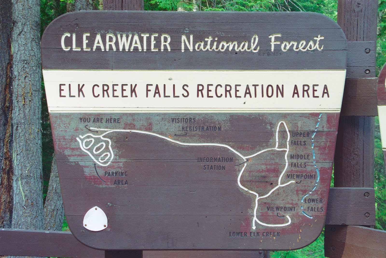
Elk Creek Falls (100 m) lies 7.1 kilometres to the southwest. Also nearby: Foley Lake Falls (20 m, 13.0 km).
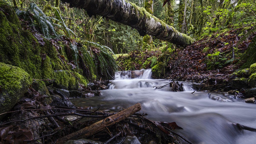
Trail & Hike Details
The Approach
The easy 1.0-km loop trail gains 50 metres of elevation on the way to the falls.
Trail Description
Trail information specific to these coordinates is limited. Expect a short forested path from a nearby parking area to a viewpoint or clearing above/along the stream. Trails to similar falls in the region are often short but can include uneven ground, roots, wet or muddy sections, and short unmaintained scrambling near the water's edge. Follow established trails and posted signs; refrain from climbing on wet rock near the falls.
What to Expect
The falls plunge a dramatic 122 metres over hard volcanic rock.
Accessibility
The trail is short and relatively flat, but the surface may be uneven. Contact the managing agency for accessibility details.
Frequently Asked Questions
🐶 Are Dogs Allowed at Bridal Veil Falls?
❌ Dogs are not allowed
Are There Any Fees or Permits Required?
🆖 No fees required
🏊 Is There Swimming at Bridal Veil Falls?
❌ Swimming is not allowed
When to Visit
Late winter through late spring for fullest flows; early summer for good access with strong flow. Late summer and fall can be drier and lower-flow but offer quieter conditions and foliage changes.
Seasonal Access
The best time to visit is Spring, Summer, and Fall. Winter access may be limited. Check with the managing park or local authority for current conditions.
Safety Information
Hazards: slippery and unstable rocks near the water, fast currents and cold water temperature, potential for falling rock or debris, steep banks and drop-offs, and seasonal high flows after heavy rain or rapid snowmelt. Weather can change quickly. Do not enter the water near the falls; footholds can be deceptive. Cell service may be unreliable, tell someone your plan and expected return time. If you encounter wildlife, remain calm and back away slowly; carry bear spray where recommended.
7-Day Flow Outlook
Based on the WSC gauge FRASER RIVER NEAR AGASSIZ (4 km away).
Best time of year: this gauge typically runs highest from early May to early August, peaking in June.
How we calculate this
This is a transparent outlook, not a precise forecast. We take the waterfall's current flow strength (how it ranks against its historical normal for today, from the nearest WSC stream gauge), carry that ranking forward along the gauge's seasonal curve, and nudge it for forecast rain. Confidence is highest for the next day or two and falls further out. Always check official conditions and your own judgment before visiting — high flows can be dangerous.
Know when to go.
Get a free email alert when waterfalls near Chilliwack hit peak flow. We only send when conditions are worth the trip — no weekly newsletters, no spam.
Weather Forecast
Location & Access
Getting There
The falls are located roughly 9–30 miles from nearby communities (Chilliwack, Glacier, Maple Falls). Access is typically by car to a small trailhead/parking area near the nearest paved road, followed by a short footpath into the forest. Visitors should follow local signage and maps; some approaches may use forest service roads or minor side roads. Verify route and road/bridge conditions before travel.
Get Directions on Google MapsParking
Limited parking at a small trailhead or roadside pullout. Parking may be tight on weekends and in high season; do not block gates or driveways. There may be no formal large paved lot.
Elevation
301 metres above sea level
Coordinates
49.180772° N, -121.739165° W
Land Management
Managed by Government of British Columbia
Visitor Tips & Gear
• Wear sturdy, grippy footwear; trail and rocks can be slippery. • Stay on designated trails and viewing areas; do not climb barriers or scramble on wet rock. • Parking may be limited, arrive early on weekends or visit weekdays. • Check local BC Parks or municipal websites and recent trip reports for current access conditions, road closures, or advisories. • Pack out all trash and follow Leave No Trace principles. • Be bear-aware in forested areas (make noise, carry bear spray where appropriate).
As an Amazon Associate, we earn from qualifying purchases.
For this easy 1.0 km trail, lightweight trail shoes and a water bottle are usually sufficient. Sun exposure on the trail makes good sun protection a must in summer.

Polarized Sunglasses (Knockaround)
Cuts glare off the water so you actually see the falls — and your photos turn out better too.

Columbia Watertight II Rain Jacket
Packs into its own pocket, seam-sealed, and keeps you dry from spray and surprise rain.

Earth Pak Waterproof Dry Bag
Keeps your phone and gear dry when waterfall mist soaks everything else.

Waterproof Phone Pouch (AiRunTech)
Cheap insurance — take photos right next to the falls without killing your phone.

JOBY GorillaPod Starter Kit
Wraps around railings and rocks for long-exposure waterfall shots — no flat surface needed.

Osprey Daylite Daypack
Light, organized, and just the right size for a day hike — fits water, snacks, and layers.
Where to Stay
Browse vacation cabins and private rentals nearby
Unique outdoor stays — tents, yurts, and treehouses
Rent a campervan or RV for your waterfall road trip
Some links are affiliate links. We may earn a commission at no extra cost to you.
Nearby Campground
Cheam Fishing Village and Campground
3.9 km away
Nearby Hot Springs
Hot springs near Chilliwack, British Columbia
Dorr Fumarole Field
Dorr Fumarole Field reaches 194 degrees at 8,168 feet elevation on Mount Baker's active volcanic slopes, producing superheated ...

Sherman Crater Fumaroles
Sherman Crater Fumaroles register 266 degrees Fahrenheit at 9,463 feet elevation within the active volcanic crater atop Mount B...
Baker Hot Spring
Baker Hot Spring emerges at 108 degrees Fahrenheit on US Forest Service land in Mt. Baker National Forest, flowing 59.5 degrees...
Looking for a soak after your hike? Explore more hot springs near Chilliwack, British Columbia on SoakingSprings.
Explore British Columbia springsAdditional Information
Nearby Attractions
Nearby communities and attractions may include Chilliwack (regional services and amenities), local provincial parks, lakes and viewpoints common to the Lower Mainland/Fraser Valley area. Check local tourism resources for up-to-date ideas and distances from the falls.
Wildlife
Typical Lower Mainland/Fraser Valley wildlife, deer, small mammals, various birds, and occasionally black bears or cougars. Also ticks in warm months. Observe wildlife from a distance and secure food.
Cities near Bridal Veil Falls
Nearby Waterfalls
Other waterfalls named Bridal Veil Falls
24 other waterfalls share this name across Canada.
Writing about Bridal Veil Falls? Embed this waterfall on your site for free.