
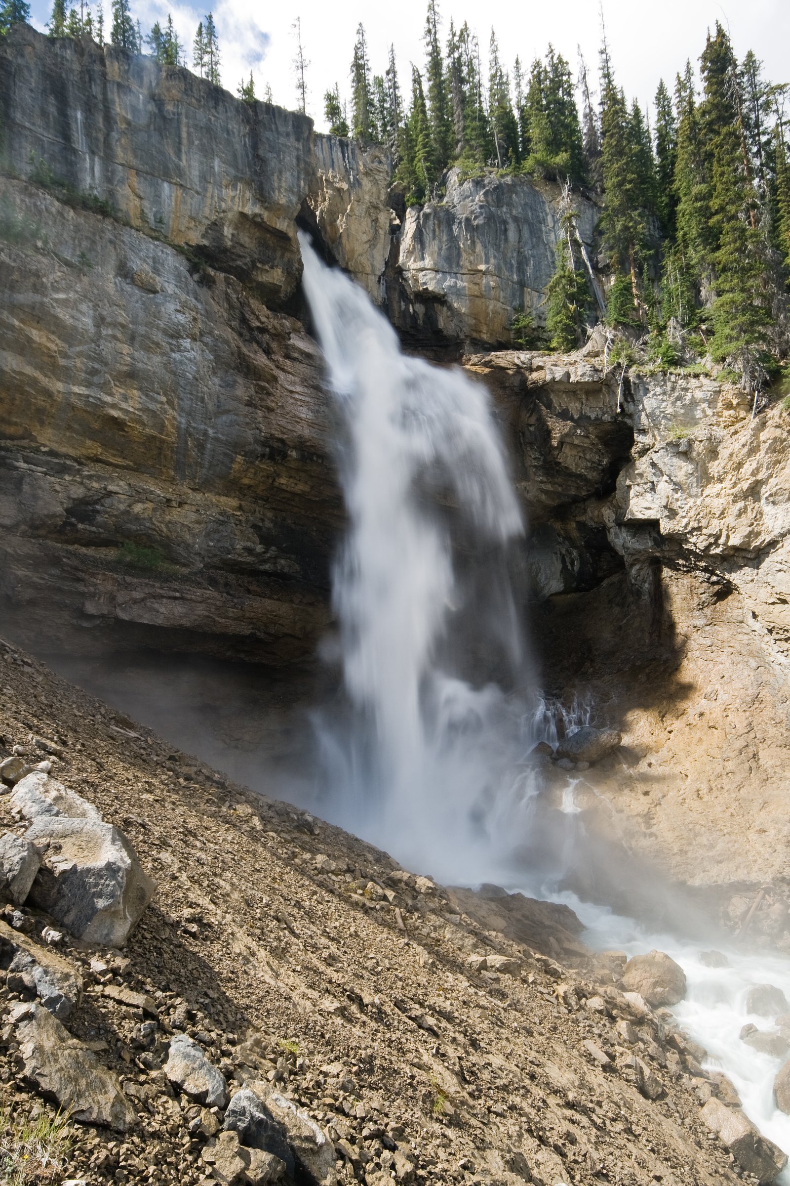
Bridal Veil Falls
Alberta • Banff National Park • 366 m
By Armen Suny · Last verified Jun 2026
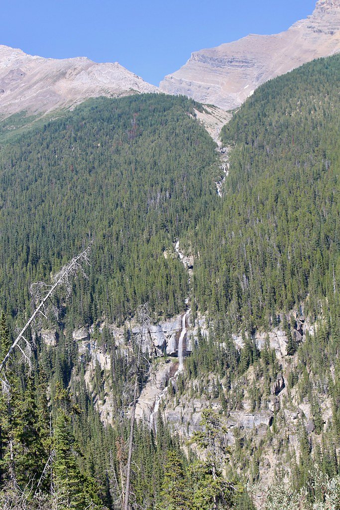
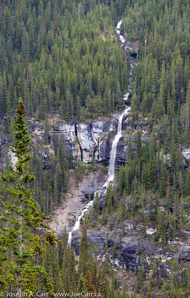
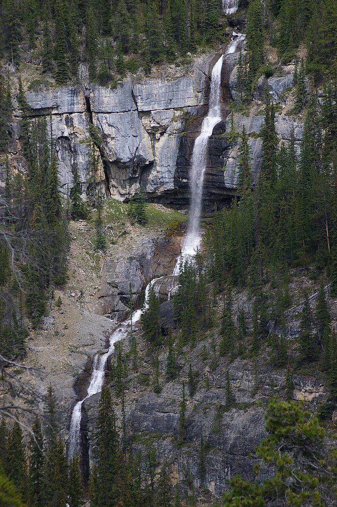
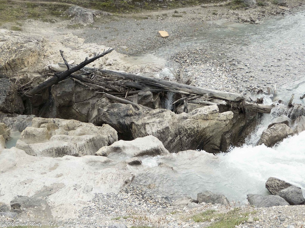
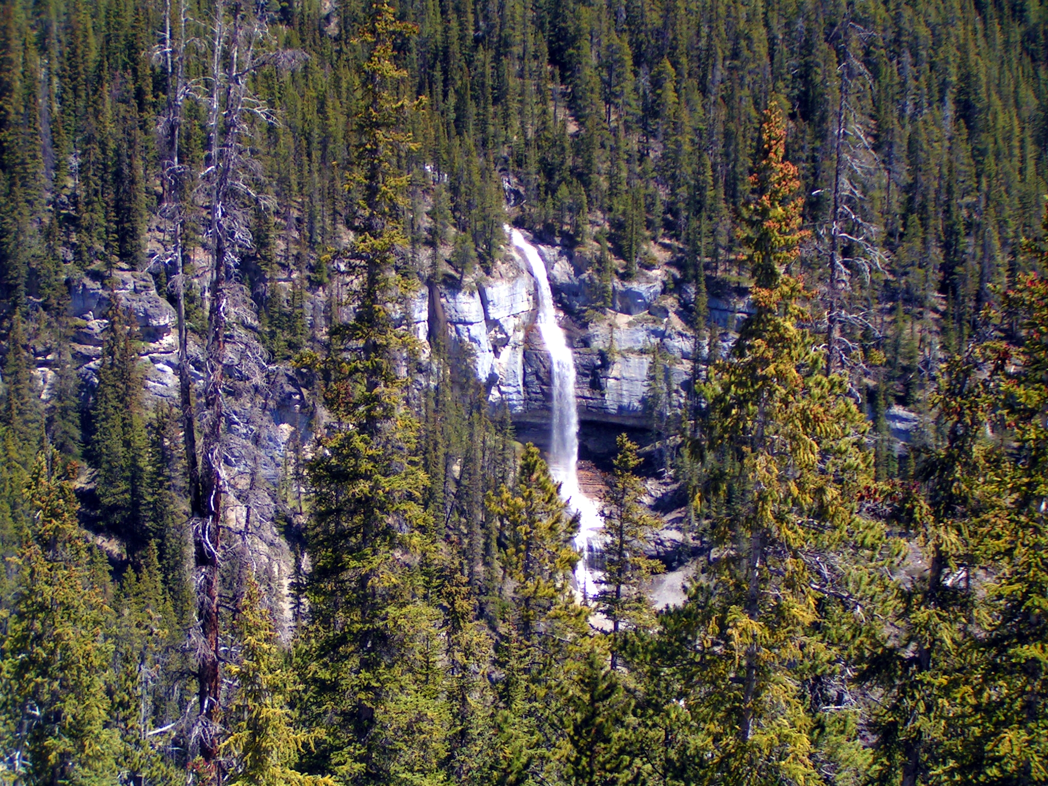
Photo Credits (5)
Difficulty
Drive Up
About Bridal Veil Falls
Bridal Veil Fall is a waterfall in Banff National Park, Alberta, Canada. It originates in the Huntington Glacier on the slopes of Cirrus Mountain. Its waters drain into Nigel Creek, then into the North Saskatchewan River at the Big Bend of the Icefields Parkway.
The Setting
Bridal Veil Falls sits at 1,723 metres within Banff National Park, in the high mountains of Alberta. At 366 metres, it is among the taller waterfalls in Alberta.
Why This Waterfall Exists
Bridal Veil Falls flows over layered sedimentary rock laid down about 323-419 million years ago. Over time, the stream has worn through these layers at different rates, creating a 1200-foot drop that forms the waterfall.
Nearby Falls Worth Visiting
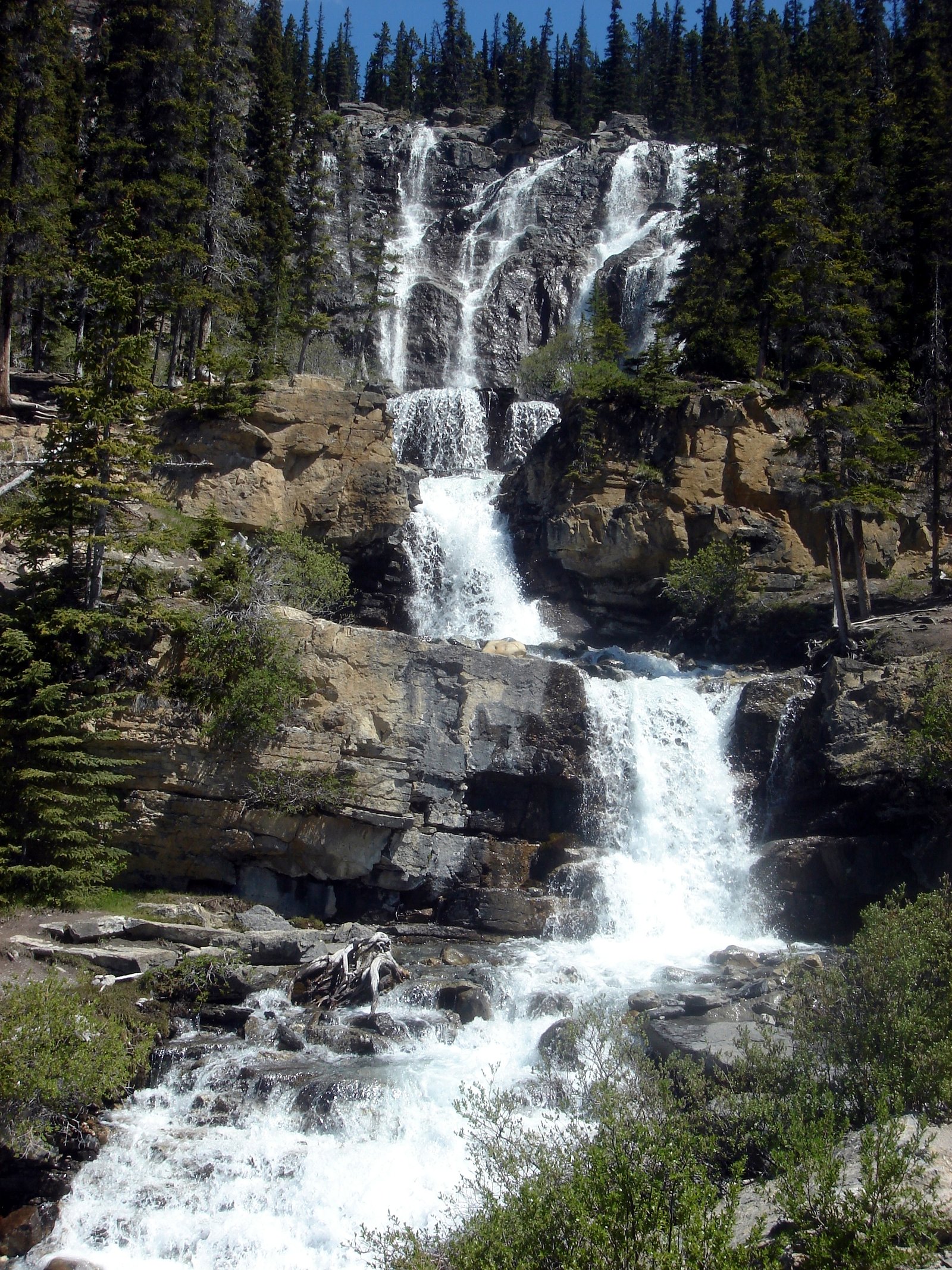
Panther Falls (66 m) lies 0.3 kilometres to the west. Also nearby: Tangle Creek (48 m, 18.5 km).
Trail & Hike Details
The Approach
No hiking required. Bridal Veil Falls is accessible by vehicle with a roadside viewing area.
Trail Description
Trail details are not well-documented for this specific coordinate and may range from a very short, level approach to a rough, unmarked path that requires careful footing. Expect an informal trail with natural surface, possible roots, rocks, and muddy sections after rain or during snowmelt. Near the falls there may be steep, slippery sections and limited guardrails or safety infrastructure.
What to Expect
The falls plunge a dramatic 366 metres over layered sedimentary rock.
Accessibility
This waterfall is viewable from a vehicle-accessible area. No hiking is required.
Frequently Asked Questions
🐶 Are Dogs Allowed at Bridal Veil Falls?
❌ Dogs are not allowed
Are There Any Fees or Permits Required?
🆖 No fees required
🏊 Is There Swimming at Bridal Veil Falls?
❌ Swimming is not allowed
When to Visit
Late spring (snowmelt) for the fullest flow; summer for the easiest access and warmer conditions; early fall for autumn color and lower flows. Winter can produce dramatic ice features but is often hazardous, only attempt in winter with proper skills and equipment.
Seasonal Access
The best time to visit is Spring, Summer, Fall, and Winter. Check with Banff National Park for current conditions.
Safety Information
Hazards include slippery rocks, steep drop-offs, fast-moving water, sudden increases in flow (especially during spring melt or heavy rain), unstable ice in winter, and limited cell coverage. Do not climb on rocks near the crest or base of the falls. Keep children and pets under close supervision. Check local conditions and advisories before visiting.
Current Water Conditions
8.4 m³/s
Current discharge — how much water is flowing
Much higher than usual for this time of year
Based on 67 years of record
1.17 m
Water depth at gauge
7-Day Discharge Trend
What does this mean for your visit?
The water is flowing much higher than usual, expect an impressive display.
About This Gauge
This gauge is on a nearby waterway and may not reflect exact conditions at the falls.
7-Day Flow Outlook
Based on the WSC gauge SUNWAPTA RIVER AT ATHABASCA GLACIER (13 km away).
Today
Roaring
9.0 m³/s
6/10Tomorrow
Roaring
8.6 m³/s
6/10Tue
Roaring
8.1 m³/s
8/10Wed
Roaring
8.8 m³/s
6/10Thu
Roaring
8.5 m³/s
8/10Fri
Roaring
8.8 m³/s
6/10Sat
Roaring
8.2 m³/s
9/10Best window: Sat — roaring flow, mainly sunny (trip score 9/10).
Best time of year: this gauge typically runs highest from early July to mid August, peaking in July.
How we calculate this
This is a transparent outlook, not a precise forecast. We take the waterfall's current flow strength (how it ranks against its historical normal for today, from the nearest WSC stream gauge), carry that ranking forward along the gauge's seasonal curve, and nudge it for forecast rain. Confidence is highest for the next day or two and falls further out. Always check official conditions and your own judgment before visiting — high flows can be dangerous.
Know when to go.
Get a free email alert when waterfalls near Jasper hit peak flow. We only send when conditions are worth the trip — no weekly newsletters, no spam.
Weather Forecast
Location & Access
Getting There
This waterfall is reached from the Yellowhead Highway / nearby regional roads (the falls are approximately 77.8 miles from Jasper as the crow flies/road distance may vary). Expect a drive through remote, mountainous terrain; plan fuel and timing accordingly. Exact turnoff and trailhead signage may be minimal, follow reliable maps or GPS coordinates (52.1814, -117.054) and check local sources for the most recent access information.
Get Directions on Google MapsParking
Parking is likely limited to a roadside pullout or small informal parking area near the trailhead. Do not block the highway; park fully off the road where allowed. There may be no formal parking lot, vault toilets, or other facilities.
Elevation
1,723 metres above sea level
Coordinates
52.181352° N, -117.053994° W
Land Management
Managed by Parks Canada Agency
Visitor Tips & Gear
• Confirm exact access and any local advisories before you go (park/forestry office or recent trip reports). • Wear sturdy footwear with good traction; traction devices may be necessary in icy conditions. • Leave no trace: pack out all garbage. • Stay behind any posted barriers and well back from edges; rocks near waterfalls are often slippery. • Bring water, layers, and navigation (map/GPS), services are limited in remote areas. • If traveling with dogs, keep them leashed and under control; verify local rules.
This trail sits at 5,653 ft above sea level
Elevated TrailUV radiation is roughly 23% stronger at this elevation than at sea level, and the dry air accelerates dehydration. Extra sun protection and fluids go a long way.
As an Amazon Associate, we earn from qualifying purchases.

Coppertone Sport SPF 50 Sunscreen
UV intensity jumps ~4% per 1,000 ft — at this elevation you can burn in half the time.

Sun Bum SPF 30 Lip Balm (3-Pack)
Lips have almost no natural UV protection and burn fast in thin, dry mountain air.

Liquid I.V. Electrolyte Packets
You lose moisture ~2x faster at elevation — electrolytes help you absorb water efficiently.

ROCKNIGHT Polarized UV400 Sunglasses
High-altitude glare off rock and water is intense — UV400 lenses block 99%+ of UVA/UVB.
Where to Stay
Browse vacation cabins and private rentals nearby
Unique outdoor stays — tents, yurts, and treehouses
Rent a campervan or RV for your waterfall road trip
Some links are affiliate links. We may earn a commission at no extra cost to you.
Nearby Campground
Wilcox Creek Campground
9.3 km away
Additional Information
Nearby Attractions
Scenic drives of the Yellowhead Highway; mountain vistas and backcountry access in the broader region. Depending on exact management boundaries, nearby attractions may include provincial parks, trailheads, and viewpoints, check local maps (provincial park or regional tourism) for confirmed nearby sites.
Wildlife
Typical mountain wildlife may include black bears, moose, deer, small mammals, and birds. Maintain distance from wildlife, store food securely, and follow local wildlife safety guidance (bear-aware practices where applicable).
Cities near Bridal Veil Falls
Nearby Waterfalls
Other waterfalls named Bridal Veil Falls
24 other waterfalls share this name across Canada.
Writing about Bridal Veil Falls? Embed this waterfall on your site for free.