Bridal Veil Falls
By Armen Suny · Last verified May 2026
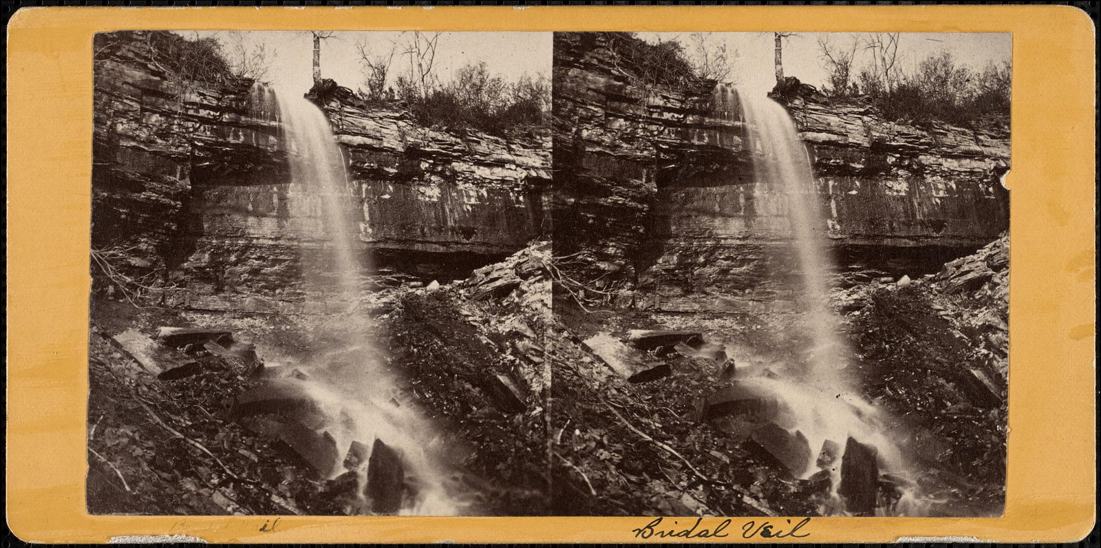
Photo Credits (5)
Difficulty
Moderate
Trail Length
2.4 miles
Trail Type
Out And Back
Elevation Gain
350 ft
About Bridal Veil Falls
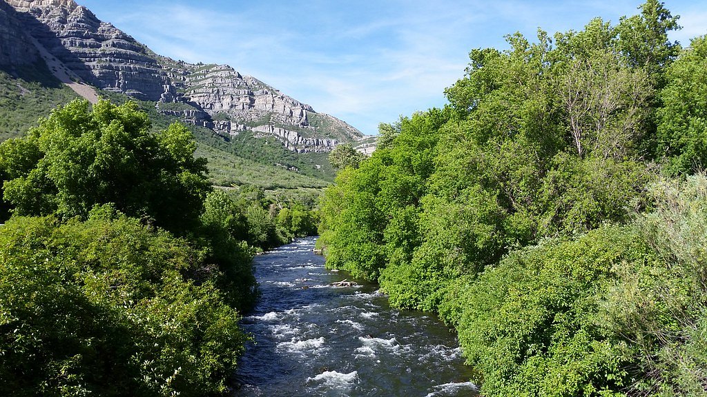
Bridal Veil Falls is a scenic waterfall set within Wyoming’s Shoshone National Forest and managed by the U.S. Forest Service. The site offers an appealing combination of forested surroundings and the steady cascade of the falls, making it a pleasant destination for day hikers and photographers looking to experience a classic mountain waterfall without committing to a multi-day trip. Access to the falls is served by a short out-and-back trail of 2.4 miles with roughly 350 feet of elevation gain; the route is generally rated moderate and rewards hikers with a close-up view of the cascade. For those planning an overnight stay, the nearest Forest Service campground is Island Lake Campground, about 19 km away.
The Setting
Bridal Veil Falls sits at 5,358 feet within Shoshone National Forest, fed by the North Fork Shoshone River, in the high mountains of Wyoming.
Trail & Hike Details
The Approach
The moderate 2.4-mile out-and-back trail gains 350 feet of elevation on the way to the falls.
Trail Description
Trail type: out-and-back. Reported length: 2.4 miles. Elevation gain: ~350 feet. Difficulty: moderate. Surface, grade, and official USFS trail class are not specified in the provided USFS data. Trail follows forested terrain in Shoshone National Forest and is managed by the U.S. Forest Service.
What to Expect
Dogs are welcome.
Accessibility
The trail is not wheelchair accessible. Uneven terrain and elevation changes require steady footing.
Frequently Asked Questions
🐶 Are Dogs Allowed at Bridal Veil Falls?
✅ Dogs are allowed
Are There Any Fees or Permits Required?
🆖 No fees required
🏊 Is There Swimming at Bridal Veil Falls?
❌ Swimming is not allowed
When to Visit
Spring and early summer are the best times to visit Bridal Veil Falls, as the water flow is typically strongest during these seasons.
Seasonal Access
The best time to visit is Spring, Summer, and Fall. Access roads and trails may close during winter due to snow. Check with Shoshone National Forest for seasonal road closures.
Safety Information
Be cautious of traffic along the highway when stopping to view the falls. Avoid climbing on rocks near the falls, as they may be slippery and dangerous.
Current Water Conditions
Based on a USGS gauge 26.1 miles away
2,650 ft³/s
Current discharge — how much water is flowing
About average for this time of year
Based on 36 years of record
5.49 ft
Water depth at gauge
7-Day Discharge Trend
What does this mean for your visit?
Flow is about average for this time of year.
About This Gauge
This gauge is on a regional waterway. Conditions at the falls may differ, especially after local rain.
7-Day Flow Outlook
Based on the USGS gauge NORTH FORK SHOSHONE RIVER AT WAPITI, WY (42 km away).
Today
Moderate
2827 cfs
6/10Tomorrow
Moderate
3129 cfs
6/10Fri
Moderate
3083 cfs
6/10Sat
Moderate
2836 cfs
6/10Sun
Moderate
2503 cfs
6/10Mon
Moderate
2658 cfs
6/10Tue
Moderate
2256 cfs
8/10Best window: Tue — moderate flow, sunny (trip score 8/10).
Best time of year: this gauge typically runs highest from late April to late July, peaking in June.
How we calculate this
This is a transparent outlook, not a precise forecast. We take the waterfall's current flow strength (how it ranks against its historical normal for today, from the nearest USGS stream gauge), carry that ranking forward along the gauge's seasonal curve, and nudge it for forecast rain. Confidence is highest for the next day or two and falls further out. Always check official conditions and your own judgment before visiting — high flows can be dangerous.
Know when to go.
Get a free email alert when waterfalls near Red Lodge hit peak flow. We only send when conditions are worth the trip — no weekly newsletters, no spam.
Weather Forecast
Location & Access
Getting There
Bridal Veil Falls is located along Spearfish Canyon Scenic Byway (US Highway 14A). The waterfall is visible from the road, making it easily accessible for visitors.
Get Directions on Google MapsParking
There is a small parking area along the highway near the falls, but it may fill up quickly during peak seasons.
Elevation
5,358 feet above sea level
Coordinates
44.844812° N, -109.341254° W
Land Management
Managed by USFS
Visitor Tips & Gear
Arrive early during peak seasons to secure parking. Bring a camera to capture the scenic views. Be cautious of traffic along the highway when stopping to view the falls.
This trail sits at 5,358 ft above sea level
Elevated TrailUV radiation is roughly 21% stronger at this elevation than at sea level, and the dry air accelerates dehydration. Extra sun protection and fluids go a long way.
As an Amazon Associate, we earn from qualifying purchases.

Coppertone Sport SPF 50 Sunscreen
UV intensity jumps ~4% per 1,000 ft — at this elevation you can burn in half the time.

Sun Bum SPF 30 Lip Balm (3-Pack)
Lips have almost no natural UV protection and burn fast in thin, dry mountain air.

Liquid I.V. Electrolyte Packets
You lose moisture ~2x faster at elevation — electrolytes help you absorb water efficiently.

ROCKNIGHT Polarized UV400 Sunglasses
High-altitude glare off rock and water is intense — UV400 lenses block 99%+ of UVA/UVB.
As an Amazon Associate, we earn from qualifying purchases.
With 2.4 miles and 350 ft of elevation gain, sturdy boots and trekking poles will help on this moderate trail. Sun exposure on the trail makes good sun protection a must in summer.

Polarized Sunglasses (Knockaround)
Cuts glare off the water so you actually see the falls — and your photos turn out better too.

Columbia Watertight II Rain Jacket
Packs into its own pocket, seam-sealed, and keeps you dry from spray and surprise rain.

Earth Pak Waterproof Dry Bag
Keeps your phone and gear dry when waterfall mist soaks everything else.

Waterproof Phone Pouch (AiRunTech)
Cheap insurance — take photos right next to the falls without killing your phone.

Timberland Euro Sprint Mid Waterproof
Trusted waterproof boot with premium leather and grippy rubber sole — reliable on rocky, wet trails.

TrailBuddy Trekking Poles
Lightweight aluminum, cork grips, and flip-locks that actually hold — a best-seller for good reason.
Where to Stay

The Cody

Hampton Inn & Suites Cody, Wy

Kings Inn Cody

Big Bear Motel
Browse vacation cabins and private rentals nearby
Unique outdoor stays — tents, yurts, and treehouses
Rent a campervan or RV for your waterfall road trip
Some links are affiliate links. We may earn a commission at no extra cost to you.
Nearby Campground
Island Lake Campground
11.8 miles away · 0 sites
This beautiful high mountain lake campground has 21 newly remodeled sites. There is always plenty to do at this campground; hiking, fishing, wildlife viewing, and beautiful wildflowers galore. 16-day stay limitWater: AvailableThis site is not accessible to persons with mobility impairments.No cell serviceNotes: Maximum spur 32 feet. Boat ramp closed until winter ice clears.Fish Your National Forests: This site can be accessed by Passenger Car; Fish available include: Trout; Types of fishing avail
Book on Recreation.govNearby Hot Springs
Hot springs near Red Lodge, Wyoming

Buffalo Bill Reservoir Springs
Buffalo Bill Reservoir Springs flows at 5,390 feet elevation along the southern margins of Buffalo Bill Reservoir, classified a...

Buffalo Bill Reservoir Springs
Buffalo Bill Reservoir Springs emerges at 5,530 feet along the shores of Buffalo Bill Reservoir in Park County, classified as w...
Buffalo Bill Reservoir Springs
Buffalo Bill Reservoir Springs emerges at 5,390 feet along the extensive shoreline of Buffalo Bill Reservoir, classified as war...

Needle Hot Springs
Needle Hot Springs discharges at 75 degrees Fahrenheit—32 degrees above ambient—along Buffalo Bill Reservoir's shoreline at 5,0...

Shoshone Hot Springs
Shoshone Hot Springs flows at 95 degrees Fahrenheit along the North Fork Highway beside Buffalo Bill Reservoir at 5,106 feet el...

De Maris Springs
De Maris Springs emerges at 97 degrees Fahrenheit along the North Fork of the Shoshone River at 4,934 feet elevation, where USG...
Looking for a soak after your hike? Explore more hot springs near Red Lodge, Wyoming on SoakingSprings.
Explore Wyoming springsAdditional Information
Nearby Attractions
Spearfish Canyon Scenic Byway, Roughlock Falls, and Devil's Bathtub hiking trail.
Wildlife
Visitors may spot deer, birds, and other wildlife in the surrounding area.
Cities near Bridal Veil Falls
Other waterfalls named Bridal Veil Falls
24 other waterfalls share this name across the U.S.
Writing about Bridal Veil Falls? Embed this waterfall on your site for free.