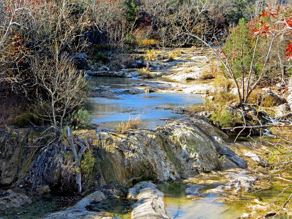
Bridal Veil Falls
By Armen Suny · Last verified May 2026
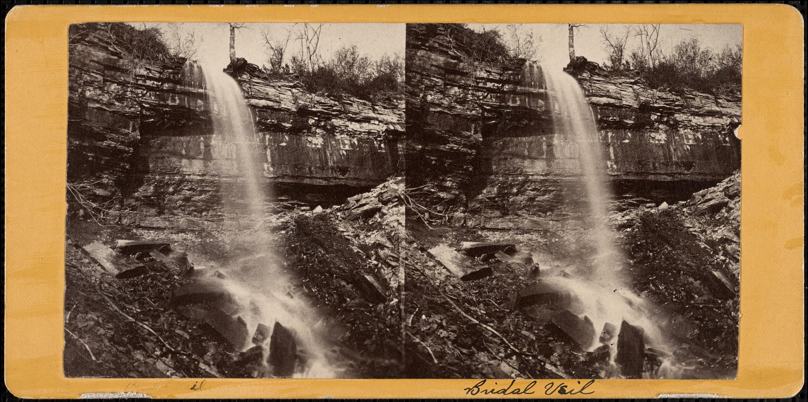
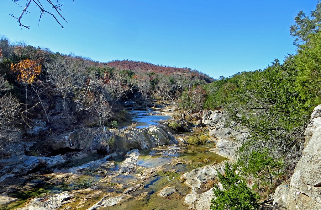

Photo Credits (5)
Difficulty
Moderate
Trail Length
2.4 miles
Trail Type
Out And Back
Elevation Gain
350 ft
About Bridal Veil Falls
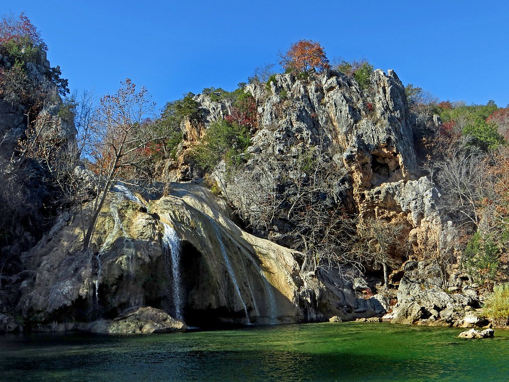
Bridal Veil Falls is a small, picturesque cascade that spills over a rocky ledge into a shady creek corridor, framed by lush green growth that’s at its most vibrant in spring and summer. The falls are intimate rather than thundering, making them an ideal destination for a quick nature break, photography, or a peaceful picnic beside Travertine Creek. The falls sit within the Chickasaw Oklahoma Tribal Statistical Area on land owned by DESG and managed as a tribal site (designation TRIBL; manager: TRIB). The setting feels tucked-away and wooded, and visitors should be mindful that the waterfall and its approaches are on tribal lands—treat the area respectfully and follow any posted access guidelines from tribal managers.
The Setting
Bridal Veil Falls sits at 1,017 feet within Chickasaw Oklahoma Tribal Statistical Area, fed by the Honey Creek, in the foothills of Oklahoma.
Nearby Falls Worth Visiting
Turner Falls, the tallest waterfall in Oklahoma at 77 feet, lies 0.1 miles to the northeast.
Trail & Hike Details
The Approach
The moderate 2.4-mile out-and-back trail gains 350 feet of elevation on the way to the falls.
Trail Description
The approach to Bridal Veil Falls is an out-and-back route of about 2.4 miles round trip with roughly 350 feet of elevation gain, typically rated moderate. The trail follows a well-maintained path along Travertine Creek, offering frequent creekside views and shaded walking; footing is generally maintained but the climb includes some steeper stretches. Expect a mostly natural trail surface suitable for typical hiking footwear; the moderate rating reflects the length and the short, steeper sections rather than technical difficulties.
What to Expect
Dogs are welcome.
Accessibility
The trail is not wheelchair accessible. Uneven terrain and elevation changes require steady footing.
Frequently Asked Questions
🐶 Are Dogs Allowed at Bridal Veil Falls?
✅ Dogs are allowed
Are There Any Fees or Permits Required?
🤑 Fee: $0.00
🏊 Is There Swimming at Bridal Veil Falls?
❌ Swimming is not allowed
When to Visit
Spring and early summer are the best times to visit, as the water flow is typically stronger and the surrounding vegetation is lush and green.
Seasonal Access
The best time to visit is Spring, Summer, and Fall. Winter access may be limited.
Safety Information
Be cautious of slippery rocks near the falls, especially after rain. Stay on designated trails to avoid damaging the environment or getting lost.
Current Water Conditions
15 ft³/s
Current discharge — how much water is flowing
Higher than usual for this time of year
Based on 21 years of record
1.40 ft
Water depth at gauge
7-Day Discharge Trend
What does this mean for your visit?
The water is flowing higher than usual for this time of year.
About This Gauge
7-Day Flow Outlook
Based on the USGS gauge Honey Creek below Turner Falls near Davis, OK (1 km away).
Today
Barely Flowing
15 cfs
5/10Tomorrow
Barely Flowing
17 cfs
5/10Sun
Low
19 cfs
3/10Mon
Low
19 cfs
3/10Tue
Barely Flowing
16 cfs
5/10Wed
Barely Flowing
15 cfs
5/10Thu
Barely Flowing
15 cfs
5/10Best window: Today — barely flowing flow, sunny (trip score 5/10).
Best time of year: this gauge typically runs highest from late April to mid June, peaking in May.
How we calculate this
This is a transparent outlook, not a precise forecast. We take the waterfall's current flow strength (how it ranks against its historical normal for today, from the nearest USGS stream gauge), carry that ranking forward along the gauge's seasonal curve, and nudge it for forecast rain. Confidence is highest for the next day or two and falls further out. Always check official conditions and your own judgment before visiting — high flows can be dangerous.
Know when to go.
Get a free email alert when waterfalls near Davis hit peak flow. We only send when conditions are worth the trip — no weekly newsletters, no spam.
Weather Forecast
Location & Access
Getting There
Bridal Veil Falls is located within the Chickasaw National Recreation Area near Sulphur, Oklahoma. Visitors can access the falls via the Travertine Creek area, which is well-marked within the park.
Get Directions on Google MapsParking
Parking is available at designated lots within the Chickasaw National Recreation Area, particularly near the Travertine Nature Center. From there, visitors can follow trails to the falls.
Elevation
1,017 feet above sea level
Coordinates
34.424533° N, -97.150018° W
Land Management
Managed by TRIB
Visitor Tips & Gear
Visit early in the day to avoid crowds, especially during weekends and holidays. Wear comfortable walking shoes and bring water, as the area can get warm in summer.
As an Amazon Associate, we earn from qualifying purchases.
With 2.4 miles and 350 ft of elevation gain, sturdy boots and trekking poles will help on this moderate trail. Sun exposure on the trail makes good sun protection a must in summer.

Polarized Sunglasses (Knockaround)
Cuts glare off the water so you actually see the falls — and your photos turn out better too.

Columbia Watertight II Rain Jacket
Packs into its own pocket, seam-sealed, and keeps you dry from spray and surprise rain.

Earth Pak Waterproof Dry Bag
Keeps your phone and gear dry when waterfall mist soaks everything else.

Waterproof Phone Pouch (AiRunTech)
Cheap insurance — take photos right next to the falls without killing your phone.

Timberland Euro Sprint Mid Waterproof
Trusted waterproof boot with premium leather and grippy rubber sole — reliable on rocky, wet trails.

TrailBuddy Trekking Poles
Lightweight aluminum, cork grips, and flip-locks that actually hold — a best-seller for good reason.
Where to Stay

Hilton Garden Inn Ardmore

SpringHill Suites by Marriott Ardmore

Hampton Inn & Suites Ardmore

Quality Inn & Suites Ardmore
Browse vacation cabins and private rentals nearby
Unique outdoor stays — tents, yurts, and treehouses
Rent a campervan or RV for your waterfall road trip
Some links are affiliate links. We may earn a commission at no extra cost to you.
Nearby Campground
The Point Campground (Chickasaw)
7.8 miles away · 16 sites
Overview The Point Campground is a family-friendly campground located on Lake of the Arbuckles. Popular recreational activities include boating, swimming, fishing, bicycling, and birding. Due to its relaxed atmosphere, The Point Campground is a great outdoor destination for visitors of all ages and backgrounds. Recreation Bring your boats and jet skis to enjoy the lake or pack your fishing rods to catch some of the state's finest bass, catfish, and crappie.Boating is a popular summer activity, bu
Book on Recreation.govAdditional Information
Nearby Attractions
Nearby attractions include the Travertine Nature Center, Little Niagara Falls, and Buffalo Springs, all located within the Chickasaw National Recreation Area.
Wildlife
The area is home to a variety of wildlife, including deer, birds, and small mammals. Visitors may also spot fish and turtles in Travertine Creek.
Cities near Bridal Veil Falls
Nearby Waterfalls
Other waterfalls named Bridal Veil Falls
24 other waterfalls share this name across the U.S.
Writing about Bridal Veil Falls? Embed this waterfall on your site for free.