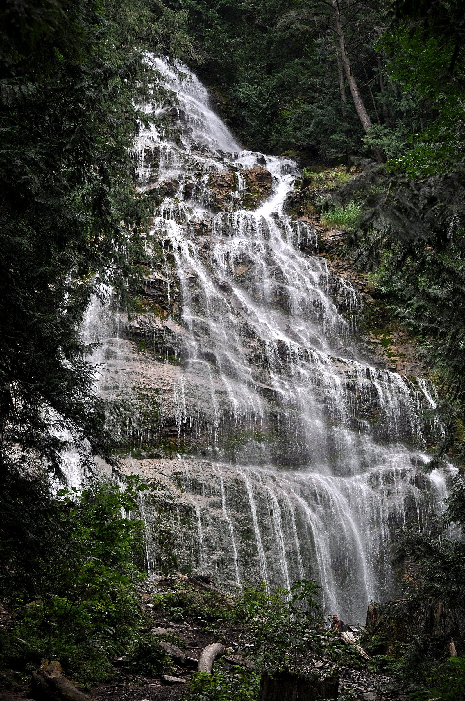
Butterfly Falls
By Armen Suny · Last verified Jun 2026
Photo Credits (2)
About Butterfly Falls
Butterfly Falls (coords ~49.0799, -121.7443) is a relatively small forested cascade in the upper Vedder/Chilliwack area of British Columbia. The falls sit on a smaller tributary and are not a developed park attraction, access is generally via forestry/side roads and a short unmarked trail. Water flow is typically highest in spring and early summer from snowmelt and rain; late summer flows may be reduced. Specific published measurements and visitor facilities appear limited, so some access details and exact height are not well documented.
Why This Waterfall Exists
Butterfly Falls flows over loose river sediment, primarily alluvium, laid down about 3 million years ago. These soft rocks erode readily, allowing the stream to carve a vertical drop into the landscape.
Nearby Falls Worth Visiting
Bridal Veil Falls (122 m) lies 11.3 kilometres to the north. Also nearby: Elk Creek Falls (100 m, 6.9 km) and Stapley Creek Falls (50 m, 8.4 km).
Trail & Hike Details
Trail Description
There is no widely published maintained trail to Butterfly Falls. Approaches reported by local visitors and informal trip notes typically describe a short, unmarked descent from a forestry road or roadside pullout. Expect uneven ground, tree roots, and potentially steep, muddy sections near the stream. Trail conditions depend on recent weather and maintenance in the area; signage and formal trail infrastructure are unlikely.
What to Expect
A forested setting with a small cascade and pool(s). Expect variable water flow depending on season (peak spring/early summer). Little to no facilities (no restrooms, railings, or official viewpoints). Views may require getting close to the stream on slippery rock or soft ground. Cell service may be patchy in parts of the approach.
Accessibility
Not wheelchair accessible. The approach is likely on unmaintained, uneven terrain with roots, mud, and steep sections, not suitable for strollers or mobility devices.
Frequently Asked Questions
🐶 Are Dogs Allowed at Butterfly Falls?
❌ Dogs are not allowed
Are There Any Fees or Permits Required?
🆖 No fees required
🏊 Is There Swimming at Butterfly Falls?
❌ Swimming is not allowed
When to Visit
Spring and early summer for highest flows and lush forest colors. Late summer and early fall are drier and may have lower flows but still pleasant for hiking. Winter access may be difficult due to snow, ice, or road closures; conditions can be hazardous.
Seasonal Access
The best time to visit is Spring, Summer, and Fall. Winter access may be limited. Check with the managing park or local authority for current conditions.
Safety Information
Hazards include slippery rocks near the falls, steep or unmarked trails, variable water flow (high in spring), limited cell coverage, and potential private or active logging areas. There are likely no railings, signage, or rescue services on-site. Carry a map, tell someone your plans, and exercise caution near water. If you encounter gates or posted closures, turn back. Weather can change quickly in the mountains; hypothermia risk exists even in summer when wet and wind-exposed.
Current Water Conditions
3.2 m³/s
Current discharge — how much water is flowing
Much lower than usual for this time of year
Based on 67 years of record
0.49 m
Water depth at gauge
7-Day Discharge Trend
What does this mean for your visit?
Flow is well below normal for this time of year, so the waterfall may be a trickle.
About This Gauge
7-Day Flow Outlook
Based on the WSC gauge SLESSE CREEK NEAR VEDDER CROSSING (3 km away).
Today
Barely Flowing
3.3 m³/s
5/10Tomorrow
Barely Flowing
3.3 m³/s
4/10Tue
Barely Flowing
3.3 m³/s
4/10Wed
Barely Flowing
3.3 m³/s
4/10Thu
Barely Flowing
3.4 m³/s
3/10Fri
Barely Flowing
3.1 m³/s
4/10Sat
Barely Flowing
3.0 m³/s
3/10Best window: Today — barely flowing flow, sunny (trip score 5/10).
Best time of year: this gauge typically runs highest from late April to late July, peaking in June.
How we calculate this
This is a transparent outlook, not a precise forecast. We take the waterfall's current flow strength (how it ranks against its historical normal for today, from the nearest WSC stream gauge), carry that ranking forward along the gauge's seasonal curve, and nudge it for forecast rain. Confidence is highest for the next day or two and falls further out. Always check official conditions and your own judgment before visiting — high flows can be dangerous.
Know when to go.
Get a free email alert when waterfalls near Chilliwack hit peak flow. We only send when conditions are worth the trip — no weekly newsletters, no spam.
Weather Forecast
Location & Access
Getting There
Approximate coordinates: 49.0799, -121.7443. The falls are located in the general Chilliwack/Glacier/Maple Falls area (roughly 12.9 miles from Chilliwack, 17.3 miles from Glacier, 22.7 miles from Maple Falls by local roads). Access is typically by vehicle on secondary/forestry roads off the main regional routes; the final approach is often an unsigned, short footpath or game trail. Visitors should use a detailed map or GPS coordinates and verify road conditions before travel, roads may be rough and seasonal.
Get Directions on Google MapsParking
Limited roadside parking only; no formal parking lot or facilities are known. Park well off the road shoulder, avoid blocking gates or driveways, and be prepared for uneven ground. Parking conditions may change with logging activity.
Elevation
247 metres above sea level
Coordinates
49.079854° N, -121.744329° W
Visitor Tips & Gear
1) Confirm exact location and road access before you go, forestry roads can be gated or rough. 2) Wear sturdy, waterproof footwear and watch for slippery rocks near the falls. 3) Park well off the roadway and avoid private driveways or blocked gates. 4) Bring a map/GPS and tell someone your plans; cell coverage may be limited. 5) Respect private property and posted closures; if in doubt, do not proceed beyond gates or signs. 6) Avoid getting into fast-moving water; currents and cold temperatures can be hazardous.
Where to Stay
Browse vacation cabins and private rentals nearby
Unique outdoor stays — tents, yurts, and treehouses
Rent a campervan or RV for your waterfall road trip
Some links are affiliate links. We may earn a commission at no extra cost to you.
Nearby Campground
Thurston Meadows Campground
0.5 km away
Nearby Hot Springs
Hot springs near Chilliwack, British Columbia
Dorr Fumarole Field
Dorr Fumarole Field reaches 194 degrees at 8,168 feet elevation on Mount Baker's active volcanic slopes, producing superheated ...

Sherman Crater Fumaroles
Sherman Crater Fumaroles register 266 degrees Fahrenheit at 9,463 feet elevation within the active volcanic crater atop Mount B...
Baker Hot Spring
Baker Hot Spring emerges at 108 degrees Fahrenheit on US Forest Service land in Mt. Baker National Forest, flowing 59.5 degrees...
Looking for a soak after your hike? Explore more hot springs near Chilliwack, British Columbia on SoakingSprings.
Explore British Columbia springsAdditional Information
Nearby Attractions
Chilliwack River and Vedder River areas, Chilliwack Lake Provincial Park, Bridal Veil Falls (further south), local hiking on Vedder Mountain. Note: distances and access routes vary.
Wildlife
Typical Lower Fraser Valley/Coastal Mountain wildlife: black bears, deer, small mammals, and occasionally cougars. Birds include songbirds and raptors. Be bear-aware and store food properly.
Cities near Butterfly Falls
Nearby Waterfalls
Writing about Butterfly Falls? Embed this waterfall on your site for free.