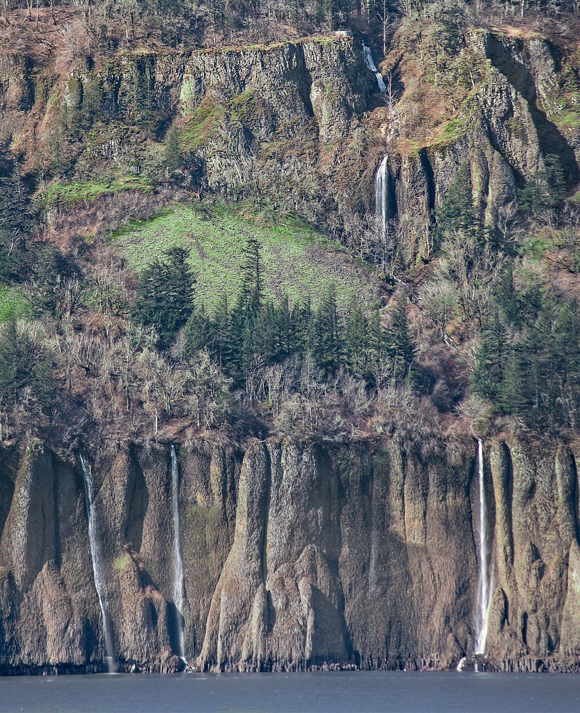
Bridal Veil Falls
Washington • 100 ft
By Armen Suny · Last verified Mar 2026
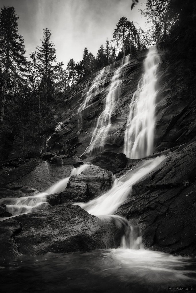
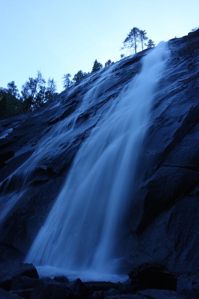
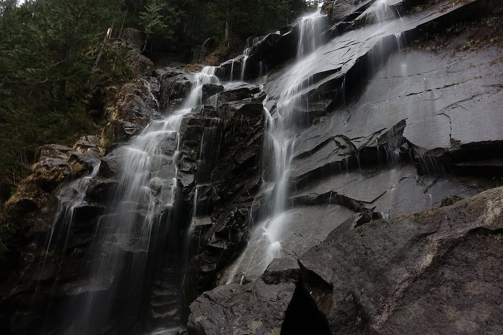
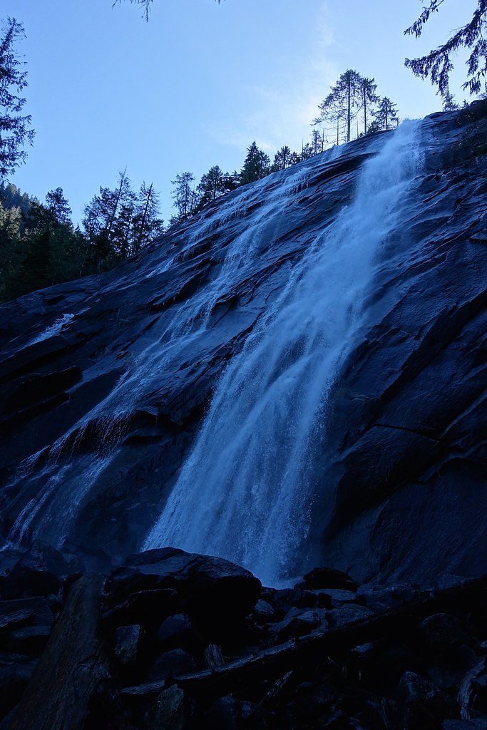
Photo Credits (5)
Difficulty
Moderate
Trail Length
4.0 miles
Trail Type
Out And Back
Elevation Gain
1,000 ft
About Bridal Veil Falls
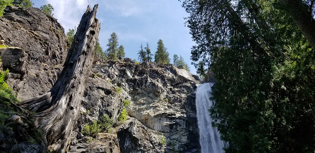
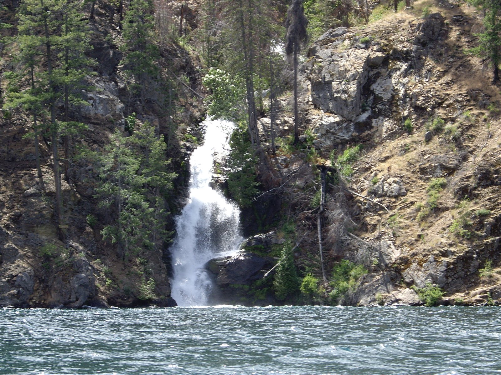
Bridal Veil Falls is a stunning two-tiered waterfall located in the Cascade Mountains of Washington, near the town of Index. Cascading roughly 100 feet in total, the falls drop through a tranquil forest canyon and make for excellent photo opportunities and a peaceful escape into nature. The falls sit within the Lake Chelan National Recreation Area, managed by the National Park Service (NPS), and are a popular destination for hikers and nature enthusiasts. The standard approach is a moderate out-and-back hike of about 4.0 miles round-trip with roughly 1,000 feet of elevation gain. If you’re planning an overnight stay, Lakeview Campground (Stehekin) is approximately 4.37 km away, making it an easy option for campers who want more time to explore the area.
The Setting
Bridal Veil Falls sits at 1,493 feet within Lake Chelan National Recreation Area, fed by the Stehekin River, in the foothills of Washington. At 100 feet, it is among the taller waterfalls in Washington.
Height: 100 feet
Trail & Hike Details
The Approach
The moderate 4.0-mile out-and-back trail gains 1,000 feet of elevation on the way to the falls.
Trail Description
The trail to Bridal Veil Falls is a moderately challenging 4.0-mile out-and-back that gains about 1,000 feet. The path is generally well-maintained but includes some steep sections and switchbacks; hikers will cross several small streams and are treated to mountain and forest views before reaching the two-tiered falls. Difficulty is rated moderate, and the hike is popular for day trips and photography.
What to Expect
The falls cascade 100 feet. Dogs are welcome.
Accessibility
The trail is not wheelchair accessible. Uneven terrain and elevation changes require steady footing.
Frequently Asked Questions
🐶 Are Dogs Allowed at Bridal Veil Falls?
✅ Dogs are allowed
Are There Any Fees or Permits Required?
🤑 Fee: $5.00
Permit required
A Northwest Forest Pass or America the Beautiful Pass is required to park at the trailhead.
🏊 Is There Swimming at Bridal Veil Falls?
❌ Swimming is not allowed
When to Visit
The best time to visit Bridal Veil Falls is in the spring or early summer when the waterfall is at its fullest. Fall offers beautiful foliage, while winter may bring snow and icy conditions.
Seasonal Access
The best time to visit is Spring, Summer, and Fall. Winter access may be limited. Check the National Park Service website for current conditions.
Safety Information
The trail can be slippery, especially after rain or during winter. Watch for loose rocks and roots. Be prepared for changing weather conditions.
Current Water Conditions
2,460 ft³/s
Current discharge — how much water is flowing
About average for this time of year
Based on 104 years of record
20.88 ft
Water depth at gauge
7-Day Discharge Trend
What does this mean for your visit?
Flow is about average for this time of year.
About This Gauge
7-Day Flow Outlook
Based on the USGS gauge STEHEKIN RIVER AT STEHEKIN, WA (8 km away).
Today
Moderate
2657 cfs
6/10Tomorrow
Moderate
2715 cfs
6/10Sat
Moderate
2674 cfs
6/10Sun
Moderate
2545 cfs
6/10Mon
Moderate
2356 cfs
9/10Tue
Moderate
2462 cfs
6/10Wed
Moderate
2198 cfs
9/10Best window: Mon — moderate flow, mostly sunny (trip score 9/10).
Best time of year: this gauge typically runs highest from late April to late July, peaking in June.
How we calculate this
This is a transparent outlook, not a precise forecast. We take the waterfall's current flow strength (how it ranks against its historical normal for today, from the nearest USGS stream gauge), carry that ranking forward along the gauge's seasonal curve, and nudge it for forecast rain. Confidence is highest for the next day or two and falls further out. Always check official conditions and your own judgment before visiting — high flows can be dangerous.
Know when to go.
Get a free email alert when waterfalls near Twisp hit peak flow. We only send when conditions are worth the trip — no weekly newsletters, no spam.
Weather Forecast
Location & Access
Getting There
Bridal Veil Falls is accessed via the Lake Serene Trailhead, located off Mount Index Road near Highway 2. The trailhead is well-marked and has a parking area.
Get Directions on Google MapsParking
There is a parking lot at the Lake Serene Trailhead, but it can fill up quickly, especially on weekends. Arrive early to secure a spot.
Elevation
1,493 feet above sea level
Coordinates
48.269626° N, -120.644021° W
Land Management
Managed by NPS
Visitor Tips & Gear
Wear sturdy hiking shoes, as the trail can be muddy and slippery in places. Bring plenty of water and snacks, and consider trekking poles for the steeper sections. Arrive early to avoid crowds and secure parking.
As an Amazon Associate, we earn from qualifying purchases.
With 4.0 miles and 1,000 ft of elevation gain, sturdy boots and trekking poles will help on this moderate trail. Sun exposure on the trail makes good sun protection a must in summer.
America the Beautiful Annual Pass
Covers entrance fees at 2,000+ federal recreation sites — required at most National Parks.

Polarized Sunglasses (Knockaround)
Cuts glare off the water so you actually see the falls — and your photos turn out better too.

Columbia Watertight II Rain Jacket
Packs into its own pocket, seam-sealed, and keeps you dry from spray and surprise rain.

Earth Pak Waterproof Dry Bag
Keeps your phone and gear dry when waterfall mist soaks everything else.

Waterproof Phone Pouch (AiRunTech)
Cheap insurance — take photos right next to the falls without killing your phone.

Timberland Euro Sprint Mid Waterproof
Trusted waterproof boot with premium leather and grippy rubber sole — reliable on rocky, wet trails.

TrailBuddy Trekking Poles
Lightweight aluminum, cork grips, and flip-locks that actually hold — a best-seller for good reason.
Where to Stay

Browse vacation cabins and private rentals nearby
Unique outdoor stays — tents, yurts, and treehouses
Rent a campervan or RV for your waterfall road trip
Some links are affiliate links. We may earn a commission at no extra cost to you.
Nearby Campground
Lakeview Campground (Stehekin)
2.7 miles away · 10 sites
Overview Campgrounds in Lake Chelan National Recreation Area are walk-in sites located in the Stehekin Valley at the head of Lake Chelan. Lakeview Campground is a five minute walk from the boat dock at Stehekin Landing. Stehekin is a remote community with limited facilities and is only accessible by foot, boat, or plane. There is a group shared space in Lakeview Campground reserved for backpackers heading out or coming back from a wilderness trip or PCT hikers with a valid PCTA permit. These sit
Book on Recreation.govNearby Hot Springs
Hot springs near Twisp, Washington
Sulphur Creek Hot Springs
Sulphur Creek Hot Springs flows at 99 degrees Fahrenheit at 2,973 feet elevation in Mount Baker National Forest's remote backco...
Gamma Hot Springs
Gamma Hot Springs produces 140-degree water at 5,397 feet elevation in the Mt. Baker National Forest, emerging 104.6 degrees ab...
Kennedy Hot Spring
Kennedy Hot Spring flows at 100 degrees at 3,520 feet elevation in the Mt. Baker National Forest, emerging 58.7 degrees above a...
Garland Mineral Springs
Garland Mineral Springs flows at 84 degrees in the Snoqualmie National Forest, producing water 39.6 degrees above ambient tempe...
Scenic Hot Springs
Scenic Hot Springs delivers genuinely hot water at 122 degrees Fahrenheit at 2,246 feet elevation in the Cascade Mountains near...
Baker Hot Spring
Baker Hot Spring emerges at 108 degrees Fahrenheit on US Forest Service land in Mt. Baker National Forest, flowing 59.5 degrees...
Looking for a soak after your hike? Explore more hot springs near Twisp, Washington on SoakingSprings.
Explore Washington springsAdditional Information
Nearby Attractions
Lake Serene, located further along the same trail, is a beautiful alpine lake worth visiting. The nearby town of Index offers rock climbing and scenic views.
Wildlife
The area is home to a variety of wildlife, including birds, deer, and occasionally black bears. Be cautious and follow Leave No Trace principles.
Cities near Bridal Veil Falls
Nearby Waterfalls
Other waterfalls named Bridal Veil Falls
24 other waterfalls share this name across the U.S.
Writing about Bridal Veil Falls? Embed this waterfall on your site for free.