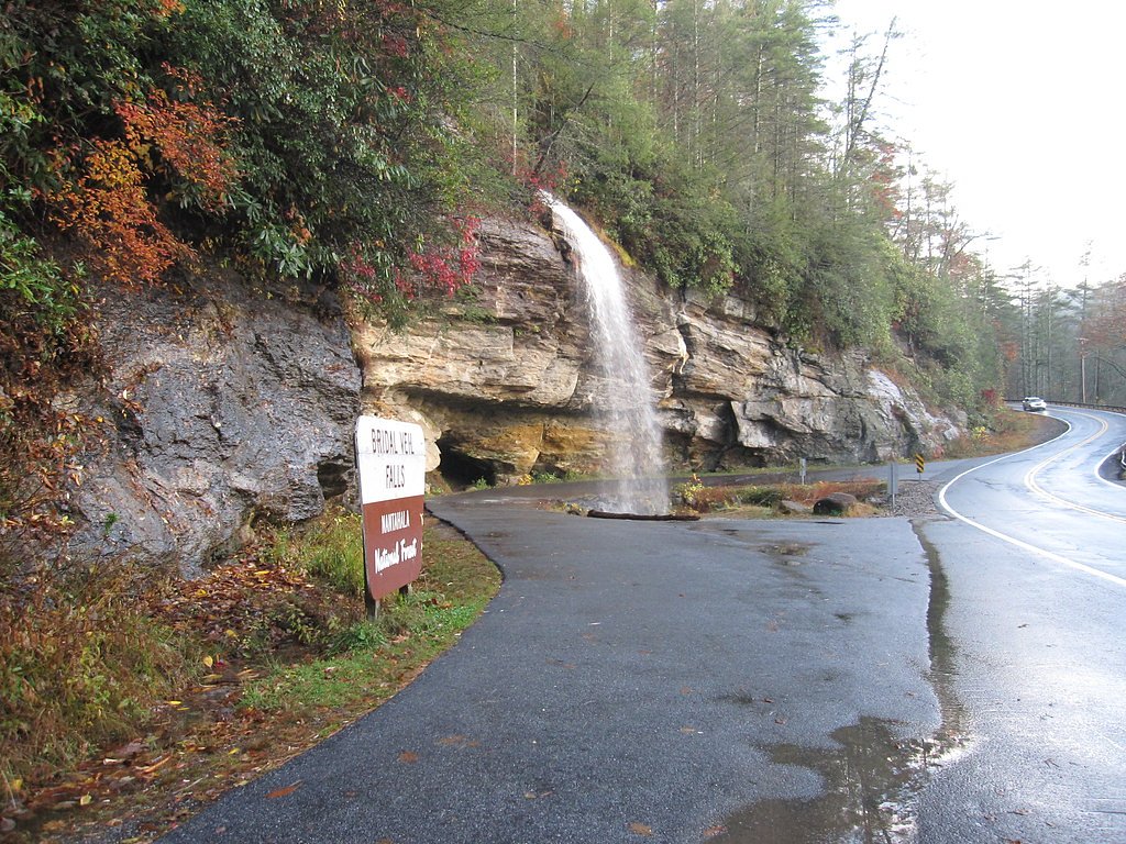
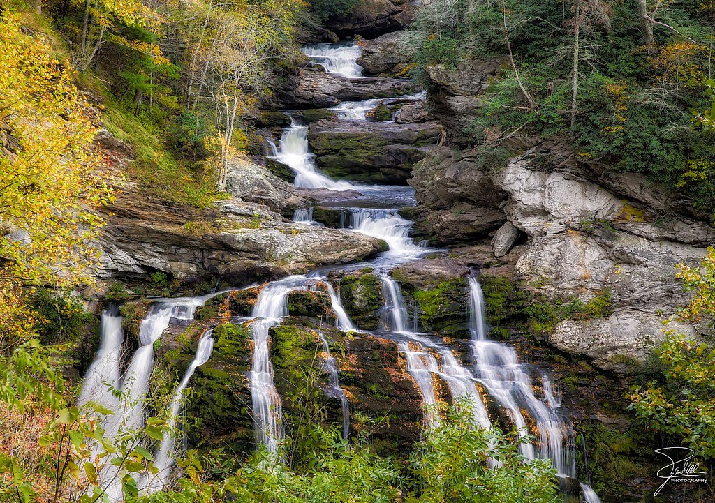
Bridal Veil Falls
North Carolina • 45 ft
By Armen Suny · Last verified Mar 2026
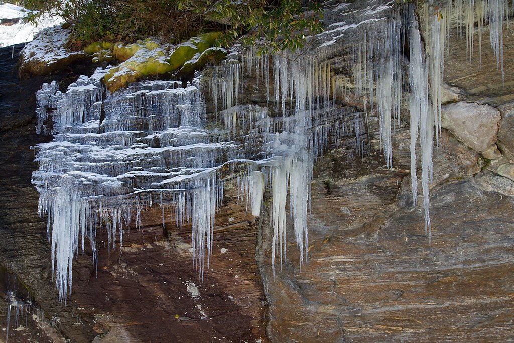
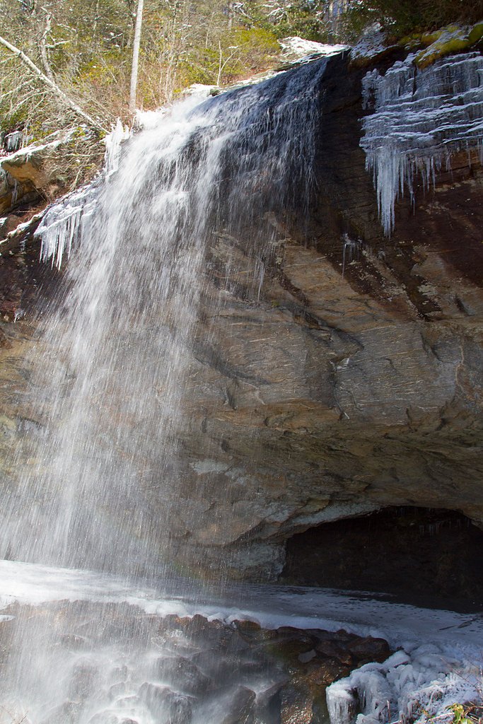
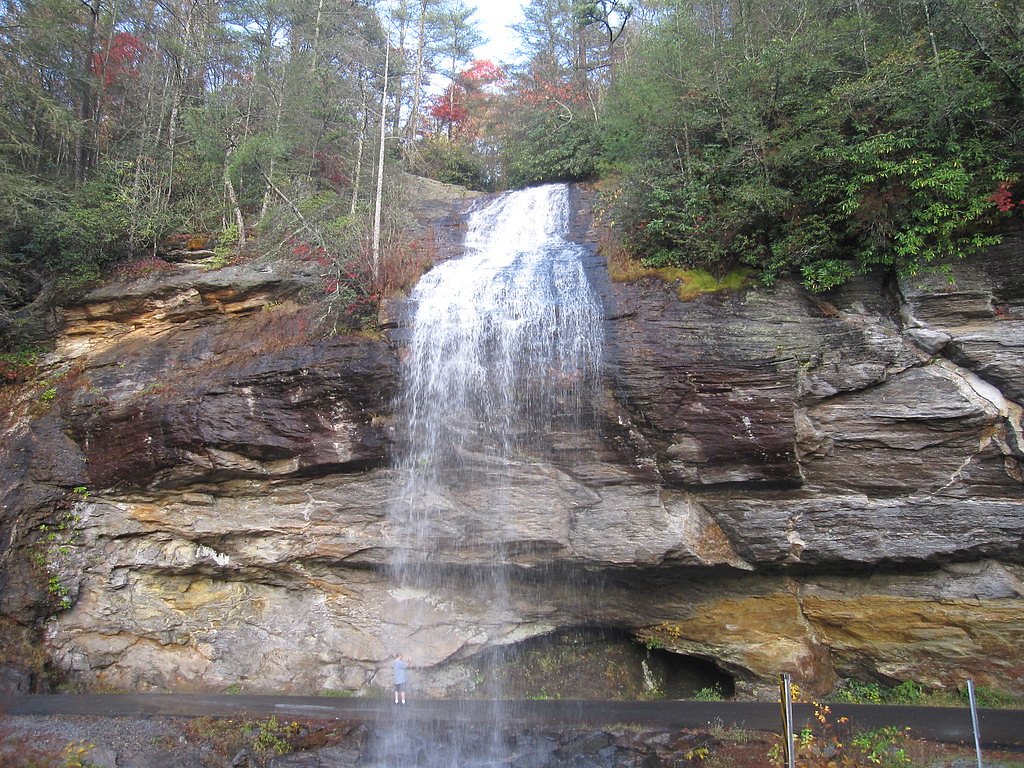
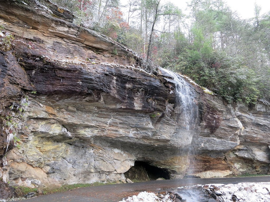

Photo Credits (5)
Difficulty
Moderate
Trail Length
2.4 miles
Trail Type
Out And Back
Elevation Gain
350 ft
About Bridal Veil Falls
Bridal Veil Falls in North Carolina is a unique and easily accessible waterfall located near Highlands, NC. It is part of the Nantahala National Forest and is notable for being one of the few waterfalls in the state that you can drive behind. The waterfall cascades over a rock ledge, creating a picturesque scene.
The Setting
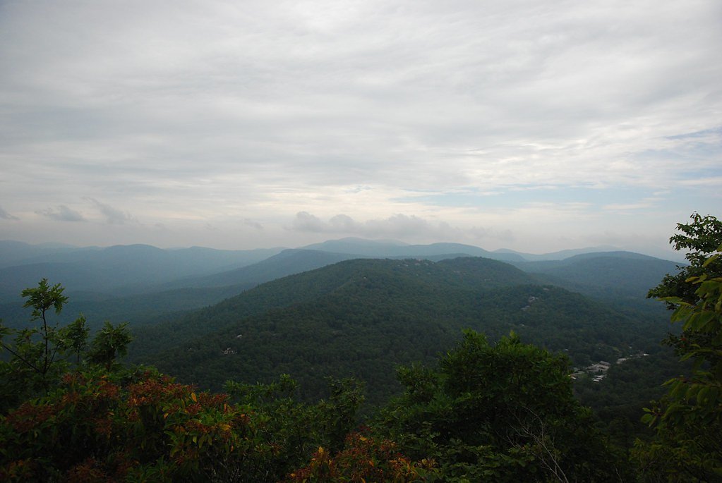
Bridal Veil Falls sits at 3,399 feet within Nantahala National Forest, fed by the Little Tennessee River, in the mountains of North Carolina. The falls drop 45 feet.
Height: 45 feet
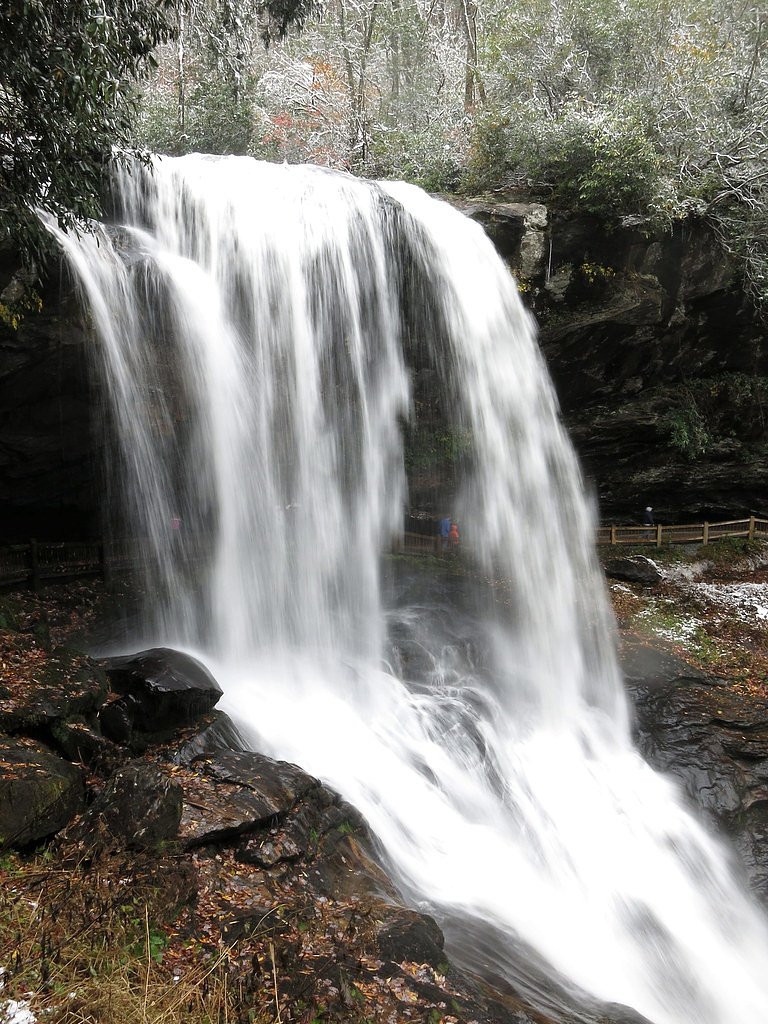
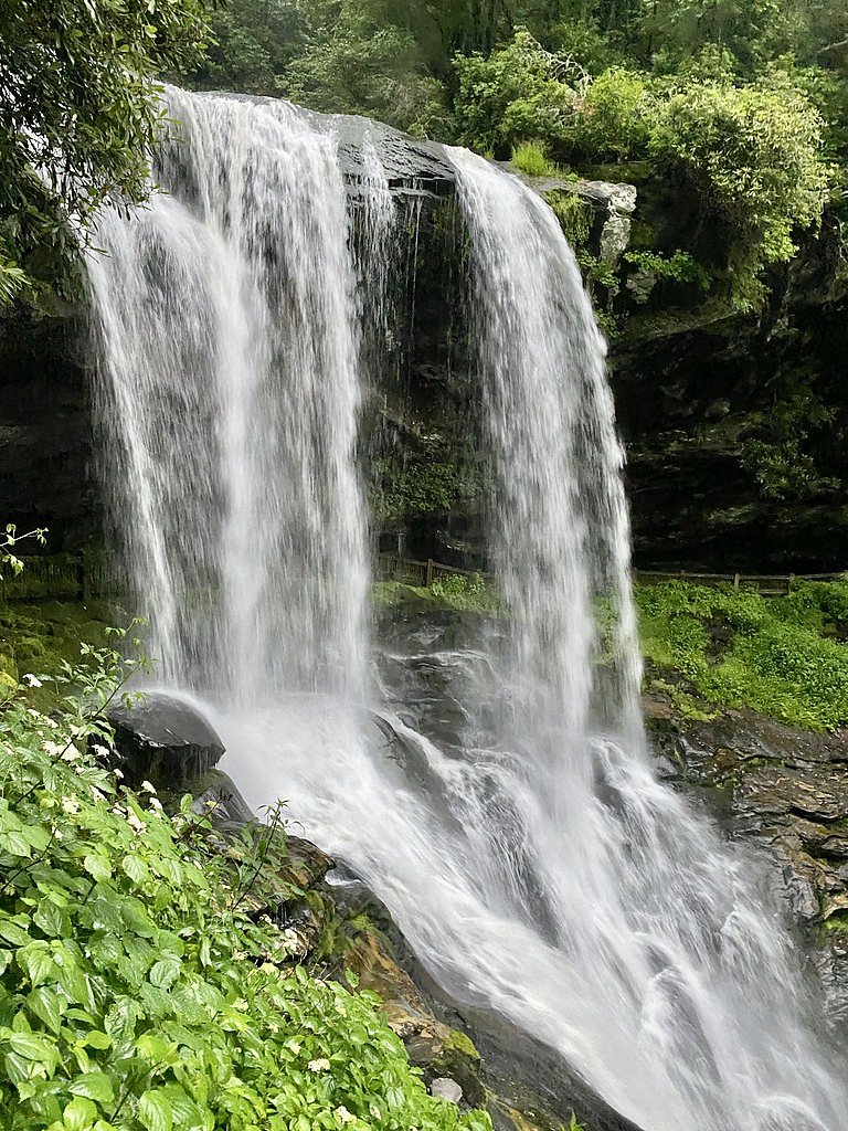
Nearby Falls Worth Visiting
Cullasaja Falls (250 ft) lies 3.9 miles to the northwest. Also nearby: Dry Falls (75 ft, 0.6 mi).
Trail & Hike Details
The Approach
The moderate hike follows Dry Falls (#TR9), a 2.4-mile out-and-back trail over pavement. Expect 350 feet of elevation gain. The trail is highly developed (Class 4).
USFS Trail
DRY FALLS #TR9
Trail Class
Highly Developed
Surface
USFS Segment
0.13 miTrail Description
No hiking is required to view Bridal Veil Falls. The waterfall is located directly off the highway, and visitors can park nearby to enjoy the view or even drive behind the falls when conditions allow.
What to Expect
The falls drop 45 feet. Dogs are welcome.
Accessibility
The trail is paved and may be accessible to wheelchairs and strollers. Contact the managing agency to confirm current conditions.
Frequently Asked Questions
🐶 Are Dogs Allowed at Bridal Veil Falls?
✅ Dogs are allowed
Are There Any Fees or Permits Required?
🆖 No fees required
🏊 Is There Swimming at Bridal Veil Falls?
❌ Swimming is not allowed
When to Visit
Spring and fall are the best times to visit, as the surrounding foliage enhances the beauty of the area. However, the falls are accessible year-round.
Seasonal Access
The best time to visit is Spring, Summer, and Fall. Winter access may be limited. Check with Nantahala National Forest for seasonal road closures.
Safety Information
Be cautious when driving behind the falls, as the road may be slippery. Avoid visiting during heavy rain or icy conditions. The parking area is small, so exercise caution when entering or exiting.
Current Water Conditions
159 ft³/s
Current discharge — how much water is flowing
Lower than usual for this time of year
Based on 82 years of record
1.63 ft
Water depth at gauge
7-Day Discharge Trend
What does this mean for your visit?
Flow is lower than usual for this time of year.
About This Gauge
This gauge is on a nearby waterway and may not reflect exact conditions at the falls.
7-Day Flow Outlook
Based on the USGS gauge LITTLE TENNESSEE RIVER NEAR PRENTISS, NC (16 km away).
Today
Low
181 cfs
3/10Tomorrow
Moderate
188 cfs
4/10Mon
Moderate
187 cfs
4/10Tue
Moderate
186 cfs
4/10Wed
Moderate
182 cfs
4/10Thu
Low
174 cfs
6/10Fri
Low
168 cfs
3/10Best window: Thu — low flow, sunny (trip score 6/10).
Best time of year: this gauge typically runs highest from mid February to late April, peaking in April.
How we calculate this
This is a transparent outlook, not a precise forecast. We take the waterfall's current flow strength (how it ranks against its historical normal for today, from the nearest USGS stream gauge), carry that ranking forward along the gauge's seasonal curve, and nudge it for forecast rain. Confidence is highest for the next day or two and falls further out. Always check official conditions and your own judgment before visiting — high flows can be dangerous.
Know when to go.
Get a free email alert when waterfalls near Highlands hit peak flow. We only send when conditions are worth the trip — no weekly newsletters, no spam.
Weather Forecast
Location & Access
Getting There
Bridal Veil Falls is located along US Highway 64, just 2.5 miles west of Highlands, North Carolina. The falls are visible from the road, making them very easy to access.
Get Directions on Google MapsParking
There is a small pull-off parking area near the falls, which can accommodate a few vehicles.
Elevation
3,399 feet above sea level
Coordinates
35.071770° N, -83.229485° W
Land Management
Managed by USFS
Visitor Tips & Gear
Visit early in the morning or during weekdays to avoid crowds, as the parking area is limited. Be cautious when driving behind the falls, especially during wet or icy conditions.
As an Amazon Associate, we earn from qualifying purchases.
With 2.4 miles and 350 ft of elevation gain, sturdy boots and trekking poles will help on this moderate trail. Sun exposure on the trail makes good sun protection a must in summer.

Polarized Sunglasses (Knockaround)
Cuts glare off the water so you actually see the falls — and your photos turn out better too.

Columbia Watertight II Rain Jacket
Packs into its own pocket, seam-sealed, and keeps you dry from spray and surprise rain.

Earth Pak Waterproof Dry Bag
Keeps your phone and gear dry when waterfall mist soaks everything else.

Waterproof Phone Pouch (AiRunTech)
Cheap insurance — take photos right next to the falls without killing your phone.

Timberland Euro Sprint Mid Waterproof
Trusted waterproof boot with premium leather and grippy rubber sole — reliable on rocky, wet trails.

TrailBuddy Trekking Poles
Lightweight aluminum, cork grips, and flip-locks that actually hold — a best-seller for good reason.
Where to Stay

Fun Pet-Friendly Highlands Retreat w/ Fenced Yard!

Spectacular Mountain Views With Your Own Private Hot Tub!

Red Top Tree House

Chalet at Peek's Creek
Browse vacation cabins and private rentals nearby
Unique outdoor stays — tents, yurts, and treehouses
Rent a campervan or RV for your waterfall road trip
Some links are affiliate links. We may earn a commission at no extra cost to you.
Nearby Campground
West Fork Campground (Clayton, GA)
8.7 miles away · 5 sites
Overview All Campsites at West Fork Campground are reservation only, you must reserve through recreation.gov or by calling 877-444-6777Visitors to this 5-site campground marvel over the picturesque bird's eye view of the world renowned Chattooga Wild and Scenic River. Situated along the west fork of the river, this area offers isolation and adventure all in one. Visitors often comment they feel as though they've been swept back in time and are looking out onto the great frontier of the past when
Book on Recreation.govAdditional Information
Nearby Attractions
Dry Falls (another popular waterfall nearby), Highlands, NC (a charming mountain town with shops and restaurants), Nantahala National Forest.
Wildlife
The area around the falls may have common Appalachian wildlife such as birds, squirrels, and deer.
Cities near Bridal Veil Falls
Nearby Waterfalls
Other waterfalls named Bridal Veil Falls
24 other waterfalls share this name across the U.S.
Writing about Bridal Veil Falls? Embed this waterfall on your site for free.