Bridal Veil Falls
By Armen Suny · Last verified Mar 2026
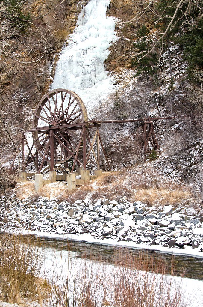
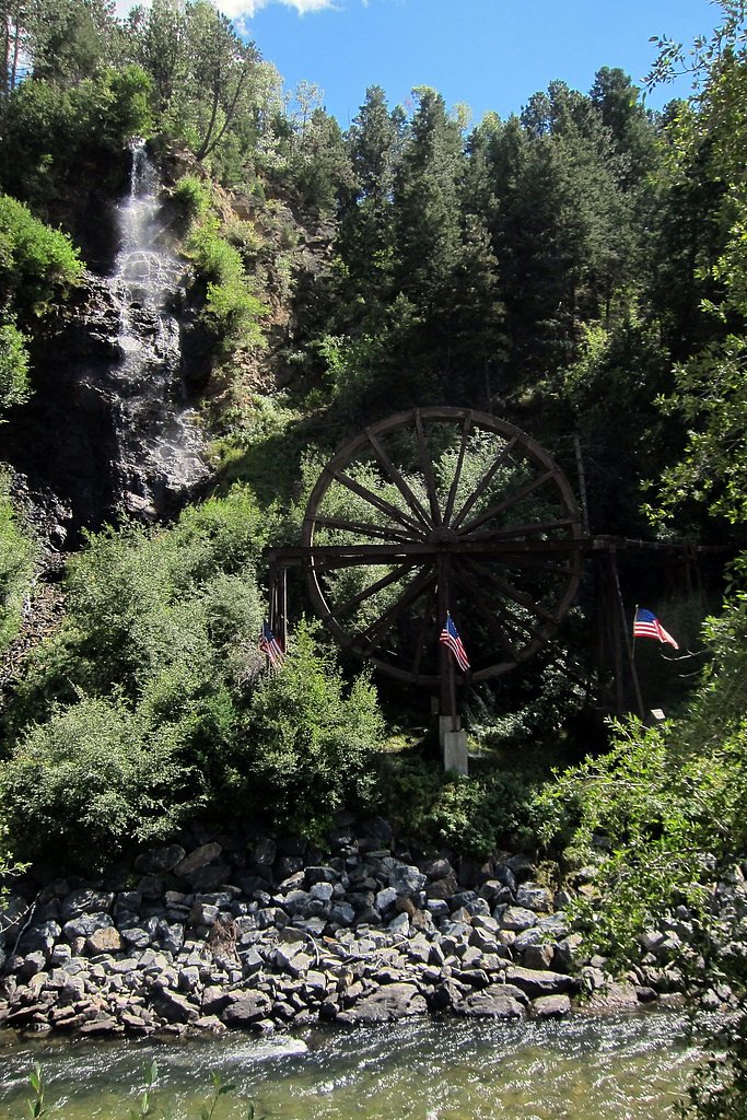
Photo Credits (5)
Difficulty
Moderate
Trail Length
2.4 miles
Trail Type
Out And Back
Elevation Gain
350 ft
About Bridal Veil Falls
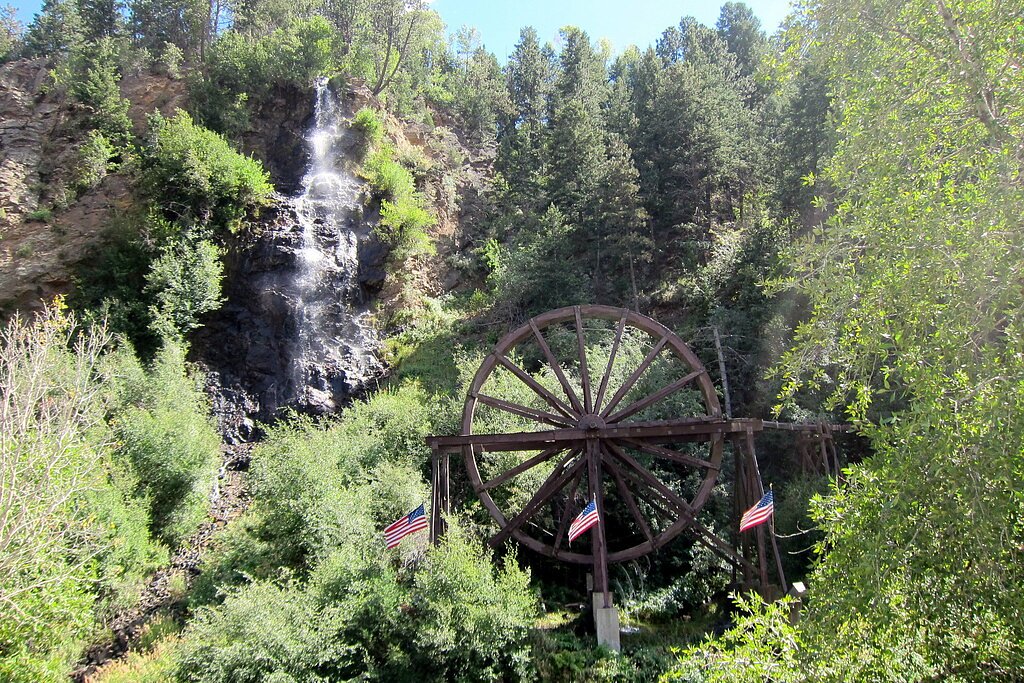
Bridal Veil Falls is a photogenic cascade tucked into Challis National Forest and managed by the U.S. Forest Service. The falls' veil-like drop and forested setting make it a rewarding goal for hikers and photographers looking for a short, scenic outing on public land. USFS trail information ties access to the Iron Creek - Stanley Lake Trail (Trail #7640), and many visitors include the falls as part of a broader day hike in the area. The full approach is described by local trail data as a moderate out-and-back outing of about 2.4 miles with roughly 350 feet of elevation gain, making it suitable for most reasonably fit day hikers. USFS GIS records also note a short native-surface segment (about 0.11 miles) on the Iron Creek - Stanley Lake Trail that serves the falls; expect forested singletrack and some steeper sections as you near the water. Note that developed campgrounds are not immediately adjacent to the falls—the nearest listed facility is Redfish Cabin, approximately 16.7 km away—so most visitors treat this as a day hike.
The Setting
Bridal Veil Falls sits at 7,274 feet within Challis National Forest, fed by the Valley Creek, in the high mountains of Idaho.
Trail & Hike Details
The Approach
The moderate hike follows Iron Creek Stanley Lake (#7640), a 2.4-mile out-and-back trail over natural surface. Expect 350 feet of elevation gain with grades of 12-20%. The trail is developed (Class 3).
USFS Trail
IRON CREEK - STANLEY LAKE #7640
Trail Class
Developed
Surface
Avg Grade
USFS Segment
0.11 miTrail Description
USFS Trail: IRON CREEK - STANLEY LAKE, Trail #7640. Trail type: out-and-back, total trail length listed as 2.4 miles with about 350 feet of elevation gain and a moderate difficulty rating. Surface: native material; expect natural tread that can be uneven and root-strewn. USFS data lists a short 0.11-mile GIS segment associated with the approach to the falls. Trail class: 3, with typical grade ranges of 12–20% on steeper pitches. That means the route includes some steeper, rougher trail sections where you may need steady footing and occasional use of hands for balance. Sturdy footwear and basic backcountry preparedness are recommended for this short but sometimes brisk hike.
What to Expect
Dogs are welcome.
Accessibility
The trail is not wheelchair accessible. Uneven terrain and elevation changes require steady footing.
Frequently Asked Questions
🐶 Are Dogs Allowed at Bridal Veil Falls?
✅ Dogs are allowed
Are There Any Fees or Permits Required?
🆖 No fees required
🏊 Is There Swimming at Bridal Veil Falls?
❌ Swimming is not allowed
When to Visit
Spring and early summer are ideal times to visit, as the waterfall flow is typically stronger due to snowmelt.
Seasonal Access
The best time to visit is Spring, Summer, and Fall. Access roads and trails may close during winter due to snow. Check with Challis National Forest for seasonal road closures.
Safety Information
Exercise caution near the canyon edges and stay on designated paths. The area may have uneven terrain, and weather conditions can change rapidly.
Current Water Conditions
343 ft³/s
Current discharge — how much water is flowing
About average for this time of year
Based on 88 years of record
1.58 ft
Water depth at gauge
7-Day Discharge Trend
What does this mean for your visit?
Flow is about average for this time of year.
About This Gauge
This gauge is on a nearby waterway and may not reflect exact conditions at the falls.
7-Day Flow Outlook
Based on the USGS gauge VALLEY CREEK AT STANLEY ID (14 km away).
Today
Roaring
376 cfs
6/10Tomorrow
Roaring
355 cfs
6/10Mon
Roaring
336 cfs
6/10Tue
Roaring
331 cfs
6/10Wed
Roaring
327 cfs
6/10Thu
Roaring
316 cfs
6/10Fri
Roaring
311 cfs
6/10Best window: Today — roaring flow, showers and thunderstorms (trip score 6/10).
Best time of year: this gauge typically runs highest from mid April to mid July, peaking in June.
How we calculate this
This is a transparent outlook, not a precise forecast. We take the waterfall's current flow strength (how it ranks against its historical normal for today, from the nearest USGS stream gauge), carry that ranking forward along the gauge's seasonal curve, and nudge it for forecast rain. Confidence is highest for the next day or two and falls further out. Always check official conditions and your own judgment before visiting — high flows can be dangerous.
Know when to go.
Get a free email alert when waterfalls near Stanley hit peak flow. We only send when conditions are worth the trip — no weekly newsletters, no spam.
Weather Forecast
Location & Access
Getting There
Bridal Veil Falls is located near Twin Falls, Idaho, in the Snake River Canyon. It can be accessed via the Centennial Waterfront Park or nearby viewpoints along the canyon rim. Directions may vary depending on the chosen access point.
Get Directions on Google MapsParking
Parking is available at Centennial Waterfront Park or other designated areas near the canyon rim. Availability may vary depending on the season and time of day.
Elevation
7,274 feet above sea level
Coordinates
44.211851° N, -115.106759° W
Land Management
Managed by USFS
Visitor Tips & Gear
Visit early in the morning or on weekdays to avoid crowds. Bring a camera to capture the scenic views. Be cautious near the edges of the canyon and stay on designated paths.
This trail sits at 7,274 ft above sea level
Elevated TrailUV radiation is roughly 29% stronger at this elevation than at sea level, and the dry air accelerates dehydration. Extra sun protection and fluids go a long way.
As an Amazon Associate, we earn from qualifying purchases.

Coppertone Sport SPF 50 Sunscreen
UV intensity jumps ~4% per 1,000 ft — at this elevation you can burn in half the time.

Sun Bum SPF 30 Lip Balm (3-Pack)
Lips have almost no natural UV protection and burn fast in thin, dry mountain air.

Liquid I.V. Electrolyte Packets
You lose moisture ~2x faster at elevation — electrolytes help you absorb water efficiently.

ROCKNIGHT Polarized UV400 Sunglasses
High-altitude glare off rock and water is intense — UV400 lenses block 99%+ of UVA/UVB.
As an Amazon Associate, we earn from qualifying purchases.
With 2.4 miles and 350 ft of elevation gain, sturdy boots and trekking poles will help on this moderate trail. Sun exposure on the trail makes good sun protection a must in summer.

Polarized Sunglasses (Knockaround)
Cuts glare off the water so you actually see the falls — and your photos turn out better too.

Columbia Watertight II Rain Jacket
Packs into its own pocket, seam-sealed, and keeps you dry from spray and surprise rain.

Earth Pak Waterproof Dry Bag
Keeps your phone and gear dry when waterfall mist soaks everything else.

Waterproof Phone Pouch (AiRunTech)
Cheap insurance — take photos right next to the falls without killing your phone.

Timberland Euro Sprint Mid Waterproof
Trusted waterproof boot with premium leather and grippy rubber sole — reliable on rocky, wet trails.

TrailBuddy Trekking Poles
Lightweight aluminum, cork grips, and flip-locks that actually hold — a best-seller for good reason.
Where to Stay

Redfish Riverside Inn

Stanley High Country Inn

Stanley Spacious Home with Panoramic Views

Timberhaven Cabin
Browse vacation cabins and private rentals nearby
Unique outdoor stays — tents, yurts, and treehouses
Rent a campervan or RV for your waterfall road trip
Some links are affiliate links. We may earn a commission at no extra cost to you.
Nearby Campground
REDFISH CABIN
10.4 miles away · 1 sites
Overview A stay at the historic Redfish Cabin is like having your own private Idaho! Nestled in the trees above the northern shore of Redfish Lake at an elevation of 6,570 feet, the historic (Civilian Conservation Corps 1930's era) cabin offers a perfect getaway for a small family or group of friends. The cabin is warm and cozy, the views are breathtaking, recreation opportunities abound and starry nights provide a gateway to heaven. And you can share it all with your canine family member. The Sa
Book on Recreation.govNearby Hot Springs
Hot springs near Stanley, Idaho
Grandjean Hot Spring
Grandjean Hot Spring sits at 5,000 feet in the Boise National Forest, just 60 feet from the road in some of the most dramatic h...
Sacajawea Hot Springs
Sacajawea Hot Springs blasts out at 153 degrees Fahrenheit at 5,000 feet elevation in the Boise National Forest, making it dang...

Stanley Hot Spring
Stanley Hot Spring sits just 66 feet from the Salmon River Scenic Byway at 6,220 feet elevation, making it one of the easiest t...
Cape Horn Warm Springs
Cape Horn Warm Springs sits at 6,555 feet in Boise County, one of the higher thermal features near Idaho City, producing 95-deg...
Elkhorn Hot Spring
Elkhorn Hot Spring, better known locally as Boat Box Hot Spring, delivers 136-degree water into a metal soaking tub built into ...
Bonneville Hot Springs
Bonneville Hot Springs pushes 185-degree Fahrenheit water from the earth in the Boise National Forest, feeding constructed soak...
Looking for a soak after your hike? Explore more hot springs near Stanley, Idaho on SoakingSprings.
Explore Idaho springsAdditional Information
Nearby Attractions
Shoshone Falls, Centennial Waterfront Park, Snake River Canyon Rim Trail
Wildlife
Visitors may spot birds, small mammals, and other wildlife typical of the Snake River Canyon area.
Cities near Bridal Veil Falls
Nearby Waterfalls
Other waterfalls named Bridal Veil Falls
24 other waterfalls share this name across the U.S.
Writing about Bridal Veil Falls? Embed this waterfall on your site for free.