Photo Credits (5)
Difficulty
Moderate
Trail Length
2.4 miles
Trail Type
Out And Back
Elevation Gain
300 ft
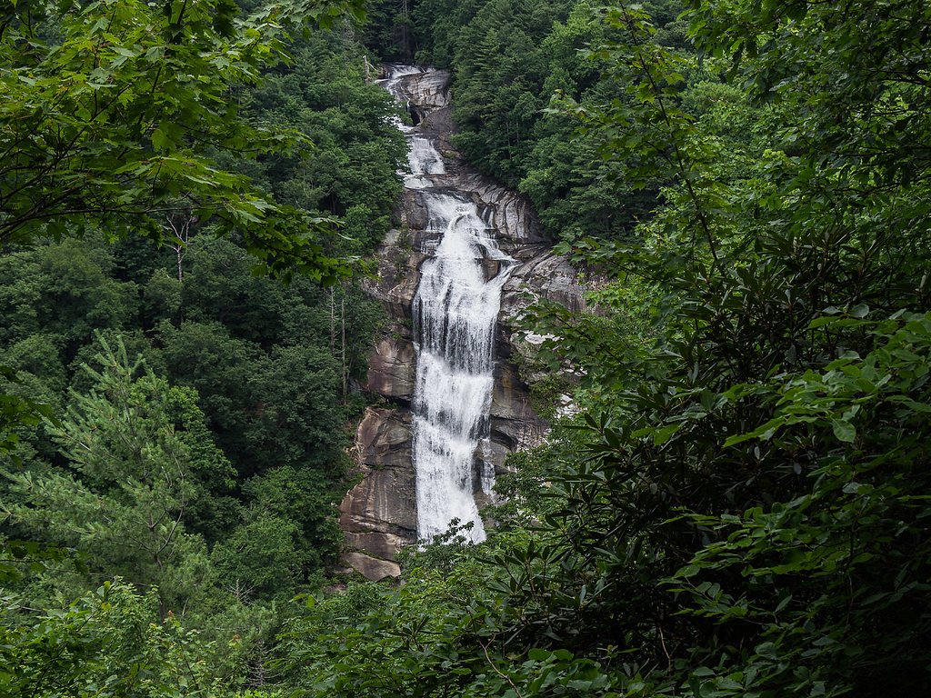
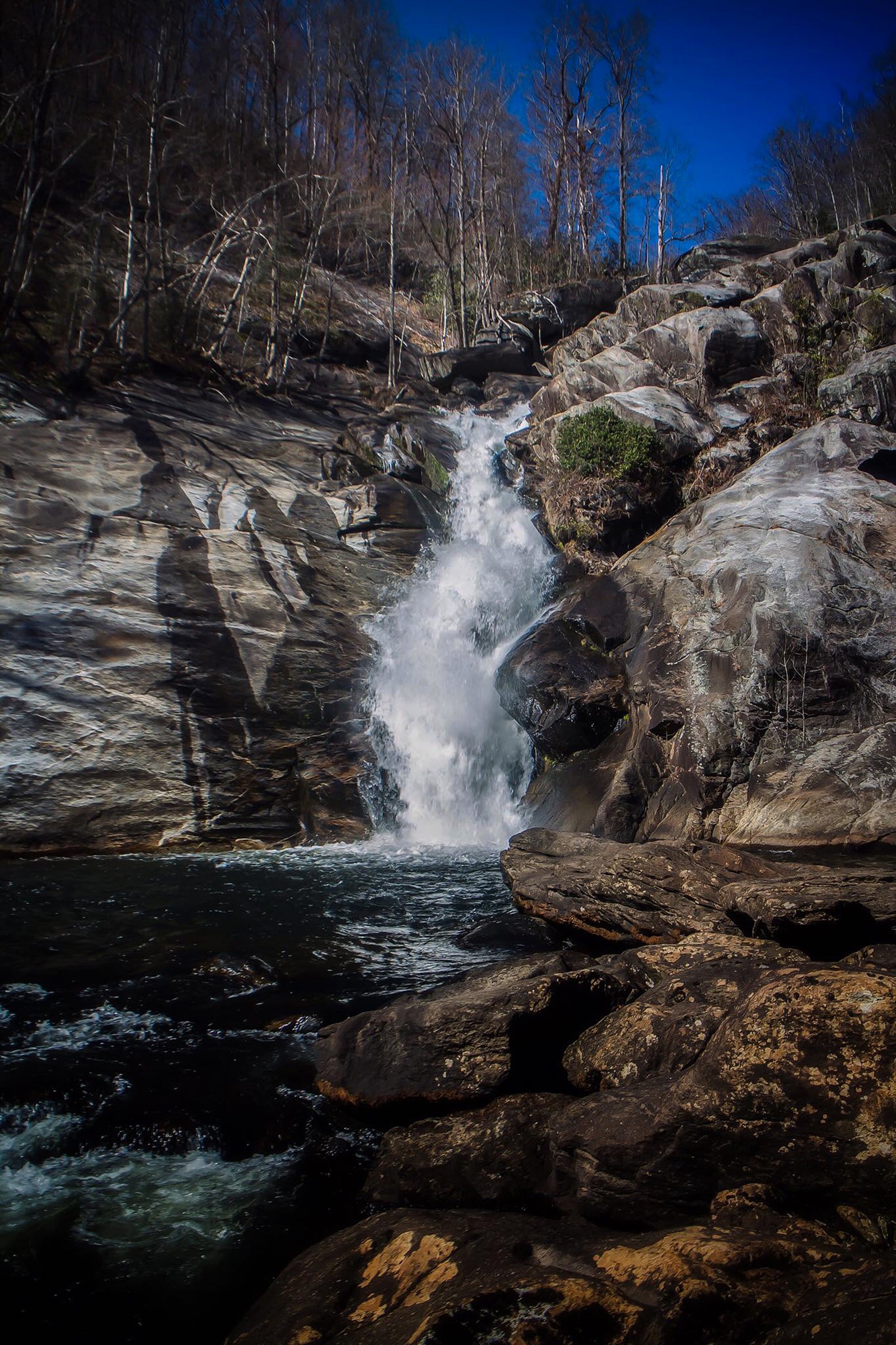
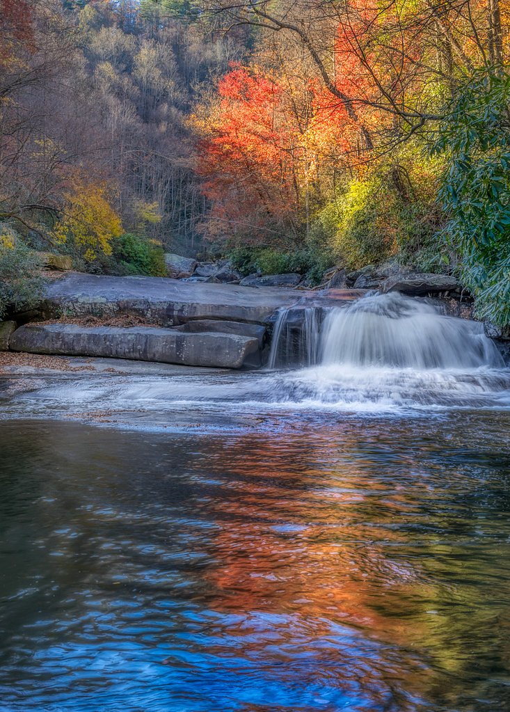
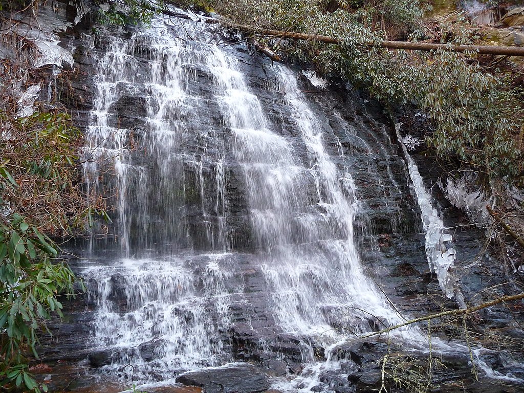
About Lower Falls
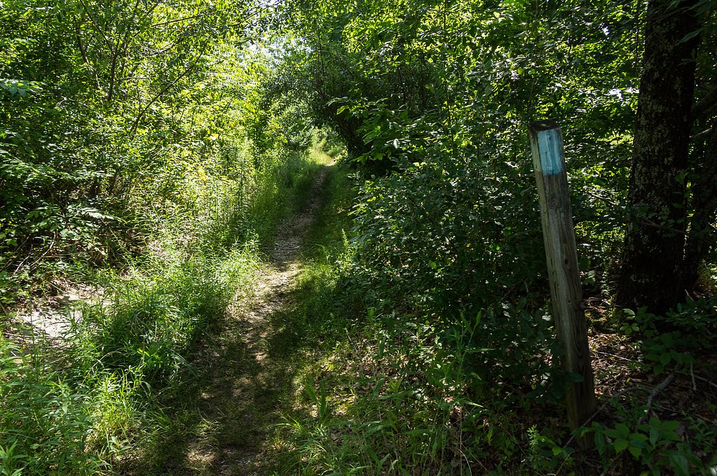
Lower Falls is a scenic cascade tucked into the woodlands of South Carolina, within the footprint of Sumter National Forest and near the mountain communities of Salem, Tamassee, and Cashiers. Framed by lush hardwoods and fern-carpeted banks, the falls make a peaceful destination for photographers and anyone looking to escape into a quiet forest setting. The site’s compact, picturesque drop and natural pool create a classic Southern Appalachian waterfall experience. The falls are most commonly visited on a moderate out-and-back hike: the route to Lower Falls is about 2.4 miles round-trip with roughly 300 feet of elevation gain, making it a rewarding half-day outing for casual hikers and families who are comfortable on uneven ground. The trail is well-marked and winds through mature forest, offering seasonal wildflowers and birdwatching opportunities along the way. Remember to wear sturdy shoes for the steeper sections and give yourself time to linger at the cascade to enjoy the calm atmosphere.
Nearby Falls Worth Visiting
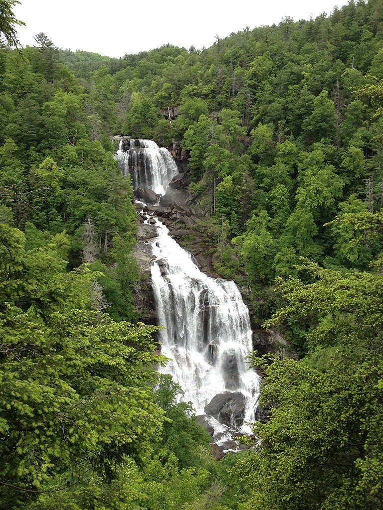
Whitewater Falls, the tallest waterfall in North Carolina at 411 feet, lies 7.1 miles to the northeast. Also nearby: Rainbow Falls (150 ft, 5.4 mi) and Spoonauger Falls (50 ft, 7.2 mi).
Trail & Hike Details
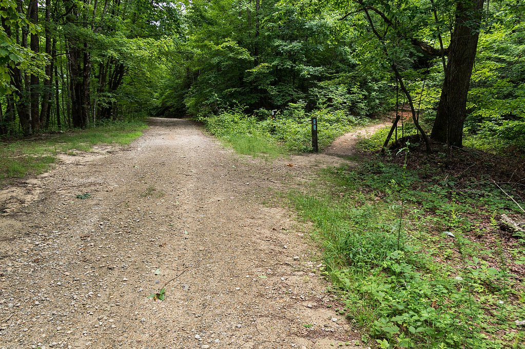
The Approach
The moderate 2.4-mile out-and-back trail gains 300 feet of elevation on the way to the falls.
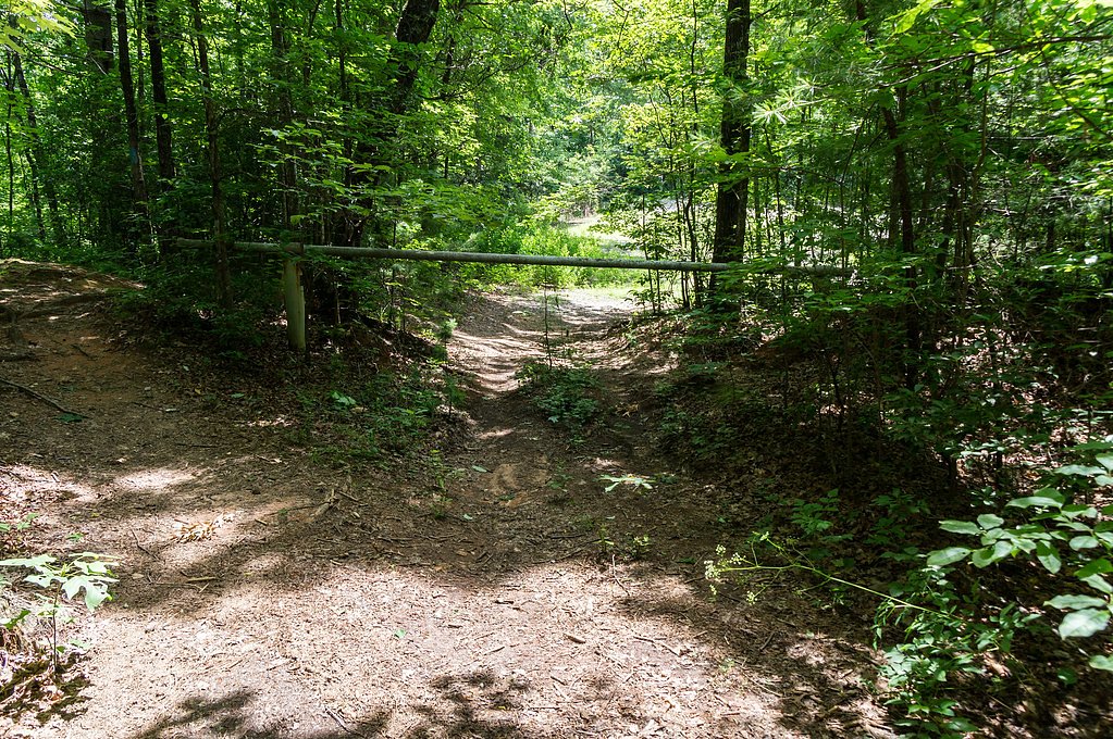
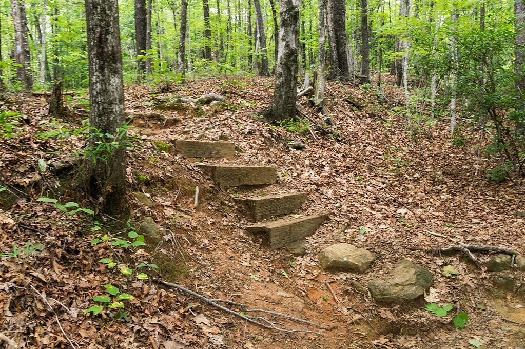
Trail Description
This is a moderate, out-and-back route of approximately 2.4 miles round-trip with about 300 feet of elevation gain. The path is well-marked and follows a natural forest footpath with a mix of gentle slopes and some steeper, uneven sections; expect typical singletrack tread through hardwood forest rather than paved surfaces. The trail is suitable for day hikers and those comfortable with moderate grade changes and occasional rocky or root-strewn stretches.
What to Expect
Dogs are welcome.
Accessibility
The trail is not wheelchair accessible. Uneven terrain and elevation changes require steady footing.
Frequently Asked Questions
🐶 Are Dogs Allowed at Lower Falls?
✅ Dogs are allowed
Are There Any Fees or Permits Required?
🆖 No fees required
🏊 Is There Swimming at Lower Falls?
❌ Swimming is not allowed
When to Visit
The best time to visit Lower Falls is during spring and fall when the weather is mild, and the surrounding foliage is at its most vibrant. Summer is also a popular time, but the trail may be busier.
Seasonal Access
The best time to visit is Spring, Summer, and Fall. Winter access may be limited.
Safety Information
Be cautious of slippery rocks near the waterfall and along the trail, especially after rain. Always stay on marked trails to avoid getting lost or encountering hazardous conditions.
Current Water Conditions
20 ft³/s
Current discharge — how much water is flowing
About average for this time of year
Based on 6 years of record
1.90 ft
Water depth at gauge
73°F
ComfortablePleasant for swimming
7-Day Discharge Trend
What does this mean for your visit?
Flow is about average for this time of year. The water is a comfortable 73 degrees F, pleasant for swimming.
About This Gauge
This gauge is on a nearby waterway and may not reflect exact conditions at the falls.
7-Day Flow Outlook
Based on the USGS gauge EASTATOEE CRK ON CLEO CHAPMAN HWY NEAR SUNSET, SC (15 km away).
Today
Moderate
24 cfs
4/10Tomorrow
Moderate
25 cfs
4/10Tue
Moderate
27 cfs
4/10Wed
Moderate
24 cfs
8/10Thu
Moderate
27 cfs
4/10Fri
Moderate
25 cfs
4/10Sat
Moderate
24 cfs
4/10Best window: Wed — moderate flow, sunny (trip score 8/10).
Best time of year: this gauge typically runs highest from early January to mid January, peaking in January.
How we calculate this
This is a transparent outlook, not a precise forecast. We take the waterfall's current flow strength (how it ranks against its historical normal for today, from the nearest USGS stream gauge), carry that ranking forward along the gauge's seasonal curve, and nudge it for forecast rain. Confidence is highest for the next day or two and falls further out. Always check official conditions and your own judgment before visiting — high flows can be dangerous.
Know when to go.
Get a free email alert when waterfalls near Salem hit peak flow. We only send when conditions are worth the trip — no weekly newsletters, no spam.
Weather Forecast
Location & Access
Getting There
Lower Falls is located approximately 7.1 miles from Salem, South Carolina. The trailhead can be accessed via Highway 107, and visitors should follow signs for the Sumter National Forest. GPS coordinates for the waterfall are 35.0165, -82.9938.
Get Directions on Google MapsParking
Parking is available at the trailhead, but spaces may be limited during peak seasons. Visitors are advised to arrive early to secure a spot.
Elevation
1,873 feet above sea level
Coordinates
35.016478° N, -82.993757° W
Visitor Tips & Gear
Start your hike early to avoid crowds and secure parking. Bring plenty of water, especially during warmer months, and wear sturdy hiking shoes. Be cautious of slippery rocks near the waterfall.
As an Amazon Associate, we earn from qualifying purchases.
With 2.4 miles and 300 ft of elevation gain, sturdy boots and trekking poles will help on this moderate trail. Sun exposure on the trail makes good sun protection a must in summer.

Polarized Sunglasses (Knockaround)
Cuts glare off the water so you actually see the falls — and your photos turn out better too.

Columbia Watertight II Rain Jacket
Packs into its own pocket, seam-sealed, and keeps you dry from spray and surprise rain.

Earth Pak Waterproof Dry Bag
Keeps your phone and gear dry when waterfall mist soaks everything else.

Waterproof Phone Pouch (AiRunTech)
Cheap insurance — take photos right next to the falls without killing your phone.

Timberland Euro Sprint Mid Waterproof
Trusted waterproof boot with premium leather and grippy rubber sole — reliable on rocky, wet trails.

TrailBuddy Trekking Poles
Lightweight aluminum, cork grips, and flip-locks that actually hold — a best-seller for good reason.
Where to Stay

Foxhunt at Sapphire Valley

Spectacular Mountain Views With Your Own Private Hot Tub!

Fairway Forest

The Wells Cashiers
Browse vacation cabins and private rentals nearby
Unique outdoor stays — tents, yurts, and treehouses
Rent a campervan or RV for your waterfall road trip
Some links are affiliate links. We may earn a commission at no extra cost to you.
Nearby Campground
West Fork Campground (Clayton, GA)
12.8 miles away · 5 sites
Overview All Campsites at West Fork Campground are reservation only, you must reserve through recreation.gov or by calling 877-444-6777Visitors to this 5-site campground marvel over the picturesque bird's eye view of the world renowned Chattooga Wild and Scenic River. Situated along the west fork of the river, this area offers isolation and adventure all in one. Visitors often comment they feel as though they've been swept back in time and are looking out onto the great frontier of the past when
Book on Recreation.govAdditional Information
Nearby Attractions
Nearby attractions include Whitewater Falls, Lake Jocassee, and the Foothills Trail.
Wildlife
The area is home to various wildlife, including birds, deer, and small mammals. Be cautious of snakes and other potentially hazardous animals.
Cities near Lower Falls
Nearby Waterfalls
Other waterfalls named Lower Falls
19 other waterfalls share this name across the U.S.
Writing about Lower Falls? Embed this waterfall on your site for free.