Lower Falls
By Armen Suny · Last verified May 2026
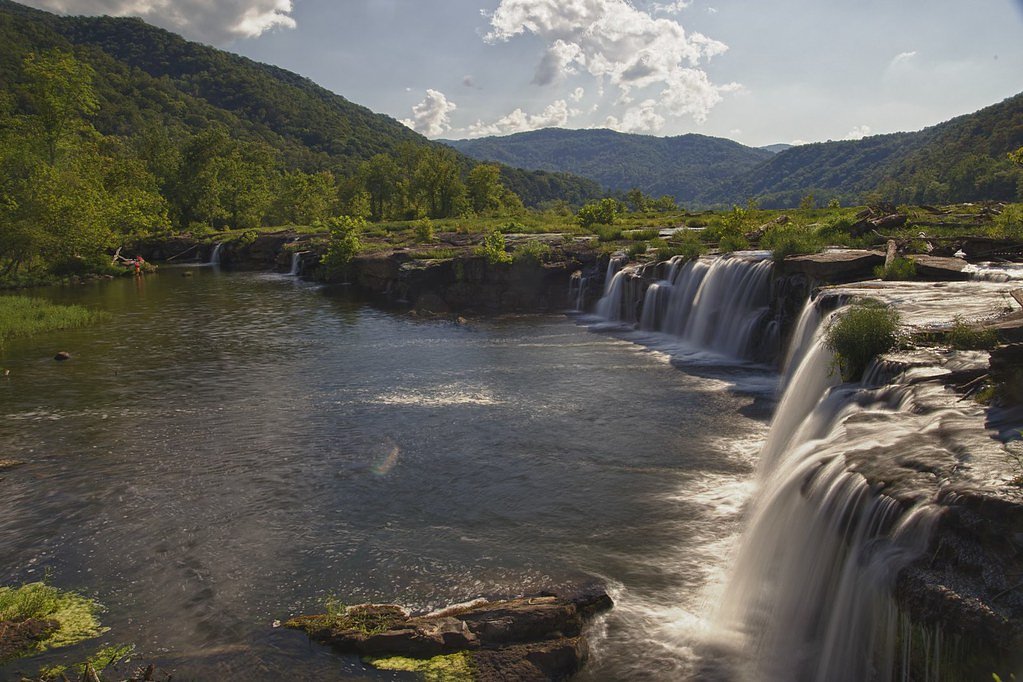
Photo Credits (3)
Difficulty
Moderate
Trail Length
5.6 miles
Trail Type
Out And Back
Elevation Gain
500 ft
About Lower Falls
Lower Falls is a scenic waterfall located in the Monongahela National Forest in West Virginia. It is part of the Cheat River system and is known for its serene surroundings and natural beauty. The waterfall is a popular destination for hikers and nature enthusiasts.
The Setting
Lower Falls sits at 568 feet along the Coal River, in the foothills of West Virginia.
Trail & Hike Details
The Approach
The moderate 5.6-mile out-and-back trail gains 500 feet of elevation on the way to the falls.
Trail Description
The trail to Lower Falls follows the Otter Creek Trail, which winds through lush forested areas and crosses several small streams. The trail is well-marked but may have muddy or uneven sections, especially after rain. Hikers will encounter a mix of flat terrain and moderate elevation changes before reaching the falls.
What to Expect
Dogs are welcome.
Accessibility
The trail is not wheelchair accessible. Uneven terrain and elevation changes require steady footing.
Frequently Asked Questions
🐶 Are Dogs Allowed at Lower Falls?
✅ Dogs are allowed
Are There Any Fees or Permits Required?
🆖 No fees required
🏊 Is There Swimming at Lower Falls?
❌ Swimming is not allowed
When to Visit
Spring and early summer are ideal for visiting Lower Falls, as the water flow is typically strongest during these seasons. Fall offers beautiful foliage, while summer provides warmer weather for hiking.
Seasonal Access
The best time to visit is Spring, Summer, and Fall. Winter access may be limited.
Safety Information
The trail may be slippery after rain, and stream crossings can be hazardous during high water levels. Always check weather conditions before your hike. Carry a map or GPS device, as cell service may be unreliable.
Current Water Conditions
2,160 ft³/s
Current discharge — how much water is flowing
Much higher than usual for this time of year
Based on 70 years of record
11.31 ft
Water depth at gauge
69°F
CoolRefreshing for swimming
7-Day Discharge Trend
What does this mean for your visit?
The water is flowing much higher than usual, expect an impressive display. Water temperature is a refreshing 69 degrees F, good for a quick swim. Mineral content is typical.
Water Quality
Conductance
Dissolved minerals in the water
About This Gauge
7-Day Flow Outlook
Based on the USGS gauge COAL RIVER AT TORNADO, WV (4 km away).
Today
Moderate
2160 cfs
6/10Tomorrow
Moderate
2008 cfs
8/10Thu
Moderate
2118 cfs
8/10Fri
Moderate
2516 cfs
6/10Sat
Moderate
3008 cfs
6/10Sun
Moderate
2913 cfs
6/10Mon
Moderate
2525 cfs
6/10Best window: Tomorrow — moderate flow, sunny (trip score 8/10).
Best time of year: this gauge typically runs highest from late January to mid April, peaking in March.
How we calculate this
This is a transparent outlook, not a precise forecast. We take the waterfall's current flow strength (how it ranks against its historical normal for today, from the nearest USGS stream gauge), carry that ranking forward along the gauge's seasonal curve, and nudge it for forecast rain. Confidence is highest for the next day or two and falls further out. Always check official conditions and your own judgment before visiting — high flows can be dangerous.
Know when to go.
Get a free email alert when waterfalls near St. Albans hit peak flow. We only send when conditions are worth the trip — no weekly newsletters, no spam.
Weather Forecast
Location & Access
Getting There
Lower Falls is accessible via the Otter Creek Wilderness area in the Monongahela National Forest. The trailhead can be reached by driving to the Otter Creek Trail, which is located off Forest Road 91. Visitors should check local maps and signage for the most accurate directions.
Get Directions on Google MapsParking
Parking is available at the trailhead for the Otter Creek Trail. The parking area is limited, so arriving early is recommended, especially during peak seasons.
Elevation
568 feet above sea level
Coordinates
38.374815° N, -81.859019° W
Visitor Tips & Gear
Wear sturdy hiking boots and bring plenty of water. Bug spray is recommended during warmer months. Cell phone service may be limited, so plan accordingly. Check weather conditions before your visit, as the trail can become muddy or slippery after rain.
As an Amazon Associate, we earn from qualifying purchases.
With 5.6 miles and 500 ft of elevation gain, sturdy boots and trekking poles will help on this moderate trail. Sun exposure on the trail makes good sun protection a must in summer.

Polarized Sunglasses (Knockaround)
Cuts glare off the water so you actually see the falls — and your photos turn out better too.

Columbia Watertight II Rain Jacket
Packs into its own pocket, seam-sealed, and keeps you dry from spray and surprise rain.

Earth Pak Waterproof Dry Bag
Keeps your phone and gear dry when waterfall mist soaks everything else.

Waterproof Phone Pouch (AiRunTech)
Cheap insurance — take photos right next to the falls without killing your phone.

Timberland Euro Sprint Mid Waterproof
Trusted waterproof boot with premium leather and grippy rubber sole — reliable on rocky, wet trails.

TrailBuddy Trekking Poles
Lightweight aluminum, cork grips, and flip-locks that actually hold — a best-seller for good reason.
Where to Stay

Holiday Inn Express Winfield - Teays Valley by IHG

Holiday Inn Express & Suites Cross Lanes by IHG

Wingate by Wyndham Hurricane WV

Sleep Inn & Suites Cross Lanes - South Charleston
Browse vacation cabins and private rentals nearby
Unique outdoor stays — tents, yurts, and treehouses
Rent a campervan or RV for your waterfall road trip
Some links are affiliate links. We may earn a commission at no extra cost to you.
Additional Information
Nearby Attractions
Other attractions in the Monongahela National Forest include Blackwater Falls, Seneca Rocks, and Dolly Sods Wilderness.
Wildlife
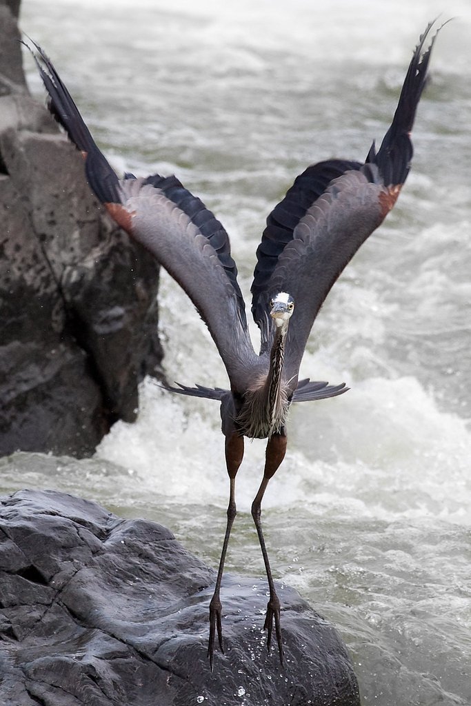
The area is home to a variety of wildlife, including deer, black bears, and numerous bird species. Be aware of your surroundings and store food securely.
Cities near Lower Falls
Nearby Waterfalls

Other waterfalls named Lower Falls
19 other waterfalls share this name across the U.S.
Writing about Lower Falls? Embed this waterfall on your site for free.