
Lower Falls
Oregon • 43 ft
By Armen Suny · Last verified Mar 2026
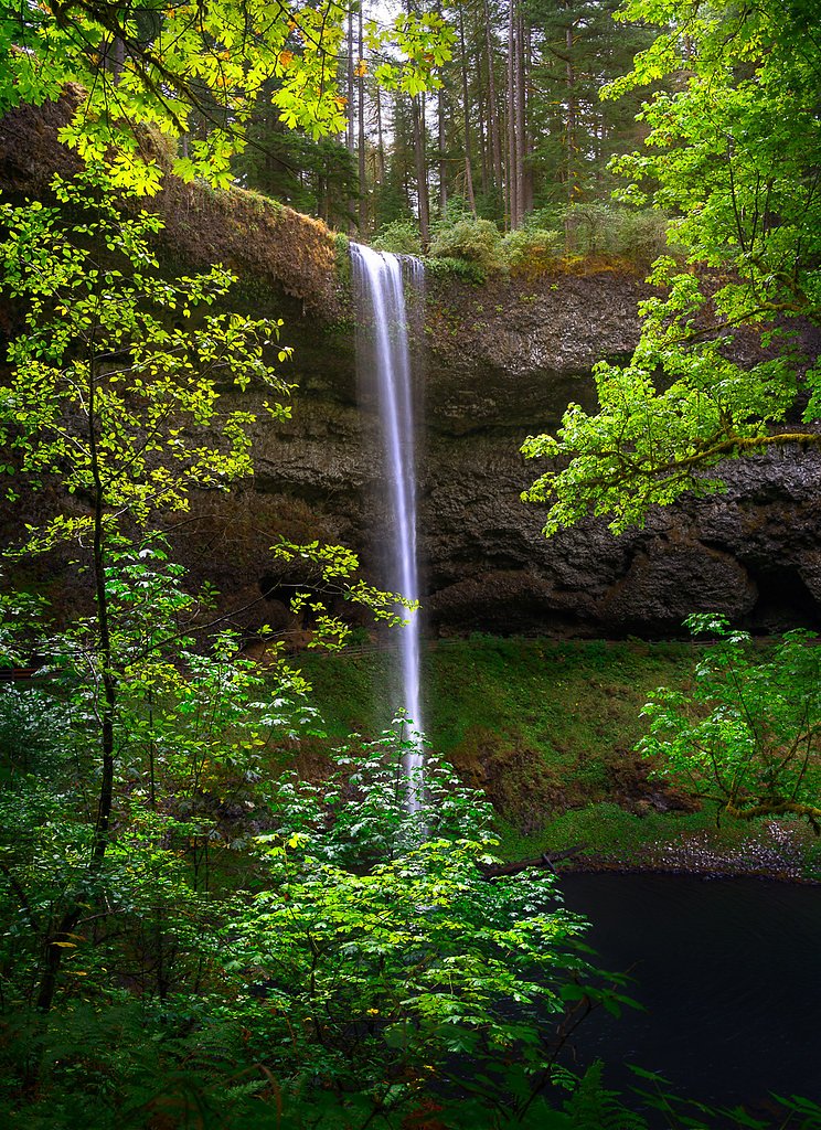
Photo Credits (5)
Difficulty
Easy
Trail Length
2.0 miles
Trail Type
Out And Back
Elevation Gain
200 ft
About Lower Falls
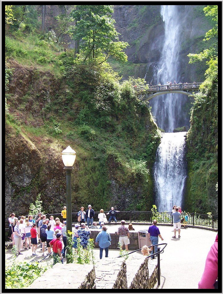
Lower Falls is a charming 43-foot cascade tucked into Central Oregon on public BLM lands. The falls sit on property managed by the Bureau of Land Management’s Prineville Central Oregon Field Office (designation: PUB), and the short approach rewards hikers with a framed plunge and tranquil forest surroundings. It’s an inviting destination for photographers and families looking for an accessible waterfall experience without a long backcountry trek. The route to the viewpoint is pleasantly approachable — an easy outing that suits most fitness levels. With a compact footprint and scenic river-adjacent stretches, Lower Falls makes a great half-day excursion for visitors exploring BLM-managed recreation sites across the region.
The Setting
Lower Falls sits at 3,865 feet within Prineville Central Oregon Field Office, fed by the Sf Crooked River, in the mountains of Oregon. The falls drop 43 feet.
Height: 43 feet
Trail & Hike Details
The Approach
The easy 2.0-mile out-and-back trail gains 200 feet of elevation on the way to the falls.
Trail Description
This is an easy, out-and-back route of roughly 2.0 miles round trip with about 200 feet of cumulative elevation gain. The trail is generally mostly flat with a few gentle inclines, making it suitable for casual hikers and families. There is no USFS trail number associated with this site (the land is managed by the BLM); USFS-specific surface/grade/class data are not applicable. Expect a short, well-marked path that provides straightforward access to the waterfall overlook.
What to Expect
The falls drop 43 feet. Dogs are welcome.
Accessibility
The trail is not wheelchair accessible. Uneven terrain and elevation changes require steady footing.
Frequently Asked Questions
🐶 Are Dogs Allowed at Lower Falls?
✅ Dogs are allowed
Are There Any Fees or Permits Required?
🤑 Fee: $5.00
🏊 Is There Swimming at Lower Falls?
❌ Swimming is not allowed
When to Visit
Spring and early summer are the best times to visit, as the waterfall is at its fullest due to snowmelt. Fall offers beautiful foliage, while summer provides warmer weather for hiking.
Seasonal Access
The best time to visit is Spring, Summer, and Fall. Winter access may be limited.
Safety Information
Exercise caution near the waterfall, as rocks can be slippery. Stay on designated trails to avoid accidents. Be prepared for changing weather conditions, especially in spring and fall.
Current Water Conditions
5 ft³/s
Current discharge — how much water is flowing
Lower than usual for this time of year
Based on 1 years of record
3.26 ft
Water depth at gauge
67°F
CoolRefreshing for swimming
7-Day Discharge Trend
What does this mean for your visit?
Flow is lower than usual for this time of year. Water temperature is a refreshing 67 degrees F, good for a quick swim. Expect crystal clear visibility and adequate dissolved oxygen levels. PH is normal at 8.5 and mineral content is moderate.
Water Quality
Dissolved Oxygen
GoodAdequate oxygen levels
pH
NormalWithin healthy range (6.5-8.5)
Water Clarity
Crystal clearExcellent visibility
Conductance
Dissolved minerals in the water
About This Gauge
This gauge is on a nearby waterway and may not reflect exact conditions at the falls.
7-Day Flow Outlook
Based on the USGS gauge SF CROOKED RIVER NEAR BELL BUTTE, NEAR PAULINA, OR (17 km away).
Today
Low
5 cfs
5/10Tomorrow
Moderate
7 cfs
4/10Sat
Moderate
7 cfs
5/10Sun
Low
6 cfs
6/10Mon
Low
6 cfs
6/10Tue
Low
6 cfs
6/10Wed
Low
6 cfs
6/10Best window: Sun — low flow, partly sunny (trip score 6/10).
Best time of year: this gauge typically runs highest from mid October to early December, peaking in November.
How we calculate this
This is a transparent outlook, not a precise forecast. We take the waterfall's current flow strength (how it ranks against its historical normal for today, from the nearest USGS stream gauge), carry that ranking forward along the gauge's seasonal curve, and nudge it for forecast rain. Confidence is highest for the next day or two and falls further out. Always check official conditions and your own judgment before visiting — high flows can be dangerous.
Know when to go.
Get a free email alert when waterfalls near Mitchell hit peak flow. We only send when conditions are worth the trip — no weekly newsletters, no spam.
Weather Forecast
Location & Access
Getting There
Lower Falls is accessible via Forest Road 90 in the Gifford Pinchot National Forest. Follow signs for the Lower Falls Recreation Area. The trailhead is located near the parking area.
Get Directions on Google MapsParking
There is a designated parking area at the Lower Falls Recreation Area. Parking may fill up quickly during peak seasons, so arriving early is recommended.
Elevation
3,865 feet above sea level
Coordinates
44.193330° N, -120.147369° W
Land Management
Managed by BLM
Visitor Tips & Gear
Arrive early to secure parking, especially during weekends and holidays. Wear sturdy shoes as the trail may be muddy in some sections. Bring a camera to capture the scenic views.
As an Amazon Associate, we earn from qualifying purchases.
This easy 2.0 miles hike is straightforward — comfortable trail shoes and plenty of water should do. Sun exposure on the trail makes good sun protection a must in summer.

Polarized Sunglasses (Knockaround)
Cuts glare off the water so you actually see the falls — and your photos turn out better too.

Columbia Watertight II Rain Jacket
Packs into its own pocket, seam-sealed, and keeps you dry from spray and surprise rain.

Earth Pak Waterproof Dry Bag
Keeps your phone and gear dry when waterfall mist soaks everything else.

Waterproof Phone Pouch (AiRunTech)
Cheap insurance — take photos right next to the falls without killing your phone.

JOBY GorillaPod Starter Kit
Wraps around railings and rocks for long-exposure waterfall shots — no flat surface needed.

Osprey Daylite Daypack
Light, organized, and just the right size for a day hike — fits water, snacks, and layers.
Where to Stay
Browse vacation cabins and private rentals nearby
Unique outdoor stays — tents, yurts, and treehouses
Rent a campervan or RV for your waterfall road trip
Some links are affiliate links. We may earn a commission at no extra cost to you.
Nearby Campground
Cold Springs Cabin - Ochoco NF (OR)
11.3 miles away · 1 sites
Overview Cold Springs Guard Station, constructed in 1934, is a historic site tucked into the Ochoco National Forest. It served a special role as the switchboard station connecting phone calls between various fire lookouts and guard stations during the summer months, as well as housing for the fire guard and his family. The current cabin replaced an earlier one that was destroyed by fire. Cold Springs Guard Station continued to be used by Forest Service employees into the 1990s, and remnants of it
Book on Recreation.govNearby Hot Springs
Hot springs near Mitchell, Oregon
Weberg Hot Spring
Weberg Hot Spring flows at 115°F at 4,936 feet in Harney County near Hines, creating a 69.8-degree differential above the 45.2°...
Warm Springs
Warm Springs flows at 84°F at 5,341 feet in Ochoco National Forest on US Forest Service land open to public access, creating a ...
Brisbois Ranch Springs
Brisbois Ranch Springs produces 72-degree water that flows 24.2 degrees above ambient temperature in Grant County's mountainous...
Springs At Tecolote Tunnel
Springs at Tecolote Tunnel flows at 93 degrees in what administrative records list as Harney County, California, though the loc...
Ritter Hot Springs
Ritter Hot Springs flows at 106°F in Grant County, Oregon, emerging at 2,710 feet elevation just 112 meters from Ritter Hot Spu...
Looking for a soak after your hike? Explore more hot springs near Mitchell, Oregon on SoakingSprings.
Explore Oregon springsAdditional Information
Nearby Attractions
Other waterfalls in the Lewis River Falls system, such as Middle Falls and Upper Falls, are located nearby and can be visited on the same trip.
Wildlife
The area is home to various wildlife, including deer, birds, and small mammals. Keep an eye out for wildlife along the trail.
Cities near Lower Falls
Nearby Waterfalls
Other waterfalls named Lower Falls
19 other waterfalls share this name across the U.S.
Writing about Lower Falls? Embed this waterfall on your site for free.