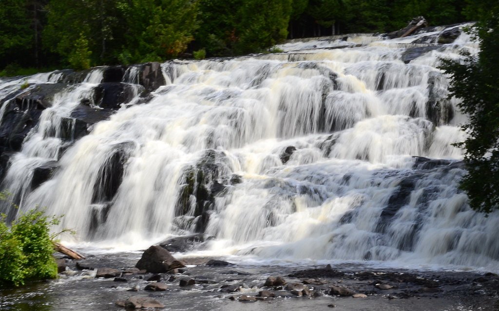
Lower Falls
By Armen Suny · Last verified Mar 2026
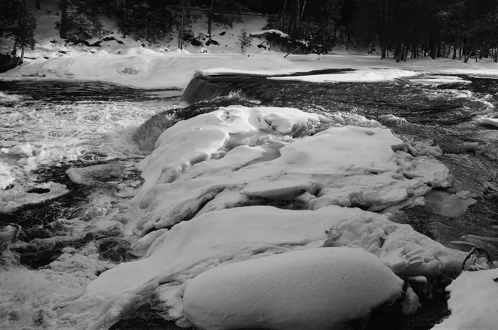
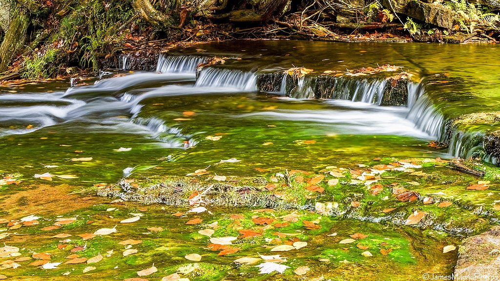

Photo Credits (5)
Difficulty
Moderate
Trail Length
2.4 miles
Trail Type
Out And Back
Elevation Gain
350 ft
About Lower Falls
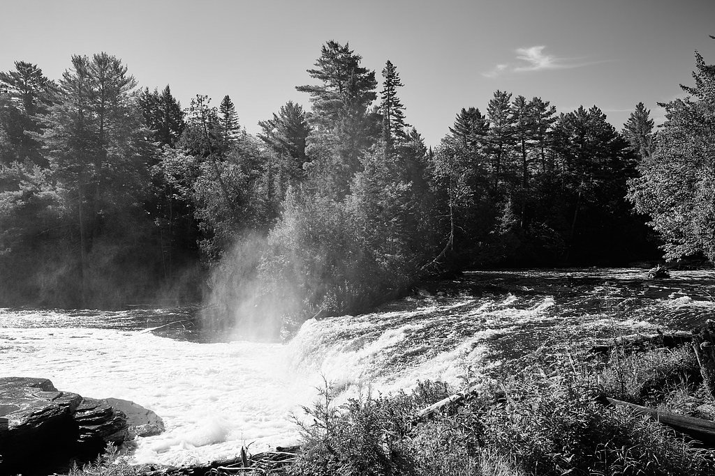
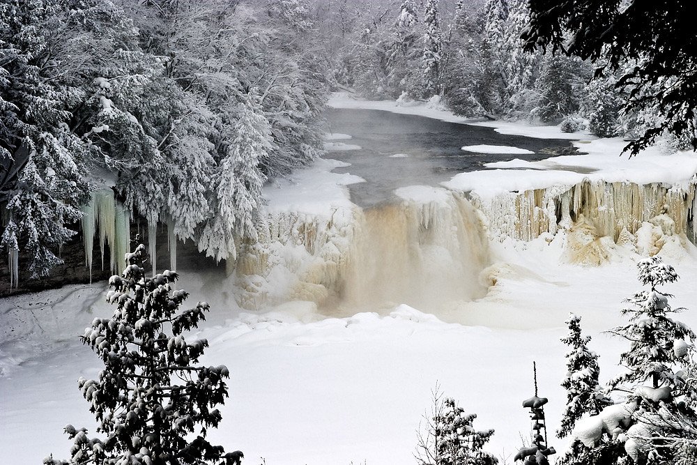
Lower Falls is the gentler counterpart to the larger upstream drop on the Tahquamenon River, where a series of smaller cascades spill and thread around a central island to create a variety of picture-postcard viewpoints. Visitors come for the close-up views of tumbling amber waters and the quiet, wooded setting that feels more intimate than the park’s main falls. Boardwalks and elevated viewing platforms make it easy to frame the cascades and enjoy the sound of running water from multiple angles. The land is owned and managed by SDNR and lies within the Baraga State Forest Area, designated SCA, which helps protect the surrounding forested corridors that feed the river. The setting is inviting for families and photographers alike, with easy access by car to the Lower Falls area and short walks that reward visitors with dramatic, up-close scenes of the river’s flow.
The Setting
Lower Falls sits at 715 feet within Baraga State Forest Area, fed by the Salmon Trout River, in the foothills of Michigan.
Trail & Hike Details
The Approach
The moderate 2.4-mile out-and-back trail gains 350 feet of elevation on the way to the falls.
Trail Description
The primary access to Lower Falls is an out-and-back route of about 2.4 miles round trip with roughly 350 feet of elevation gain and a moderate difficulty rating. Much of the immediate viewing area is served by boardwalks and constructed viewing platforms, but expect natural surface tread and some short, steeper sections on the approach—conditions that contribute to the moderate rating. Because the site is drive-accessible, hikers can shorten their walk and still reach the main overlooks; the trail remains family-friendly but is best suited to visitors wearing sturdy footwear. The trail type is listed as out-and-back, so plan to return the same way and allow extra time for photography and enjoying the falls.
What to Expect
Dogs are welcome.
Accessibility
The trail is not wheelchair accessible. Uneven terrain and elevation changes require steady footing.
Frequently Asked Questions
🐶 Are Dogs Allowed at Lower Falls?
✅ Dogs are allowed
Are There Any Fees or Permits Required?
🤑 Fee: $10.00
🏊 Is There Swimming at Lower Falls?
❌ Swimming is not allowed
When to Visit
Spring and early summer are ideal for viewing the falls at their fullest flow, while fall offers stunning foliage. Winter provides a unique experience with the falls partially frozen and surrounded by snow.
Seasonal Access
The best time to visit is Spring, Summer, Fall, and Winter.
Safety Information
Exercise caution near the water, as rocks can be slippery and currents strong. Stay on designated paths and viewing areas to avoid accidents.
Current Water Conditions
8 ft³/s
Current discharge — how much water is flowing
Much higher than usual for this time of year
Based on 21 years of record
0.40 ft
Water depth at gauge
57°F
ColdBracing — limit time in water
7-Day Discharge Trend
What does this mean for your visit?
The water is flowing much higher than usual, expect an impressive display. Water temperature is a bracing 57 degrees F, limit your time in the water.
About This Gauge
This gauge is on a nearby waterway and may not reflect exact conditions at the falls.
7-Day Flow Outlook
Based on the USGS gauge SALMON TROUT RIVER NEAR BIG BAY, MI (18 km away).
Today
Moderate
8 cfs
9/10Tomorrow
Moderate
8 cfs
9/10Sun
Moderate
9 cfs
6/10Mon
Strong
10 cfs
7/10Tue
Strong
10 cfs
7/10Wed
Strong
10 cfs
7/10Thu
Strong
9 cfs
7/10Best window: Today — moderate flow, mostly sunny (trip score 9/10).
Best time of year: this gauge typically runs highest from mid March to late May, peaking in April.
How we calculate this
This is a transparent outlook, not a precise forecast. We take the waterfall's current flow strength (how it ranks against its historical normal for today, from the nearest USGS stream gauge), carry that ranking forward along the gauge's seasonal curve, and nudge it for forecast rain. Confidence is highest for the next day or two and falls further out. Always check official conditions and your own judgment before visiting — high flows can be dangerous.
Know when to go.
Get a free email alert when waterfalls near Skanee hit peak flow. We only send when conditions are worth the trip — no weekly newsletters, no spam.
Weather Forecast
Location & Access
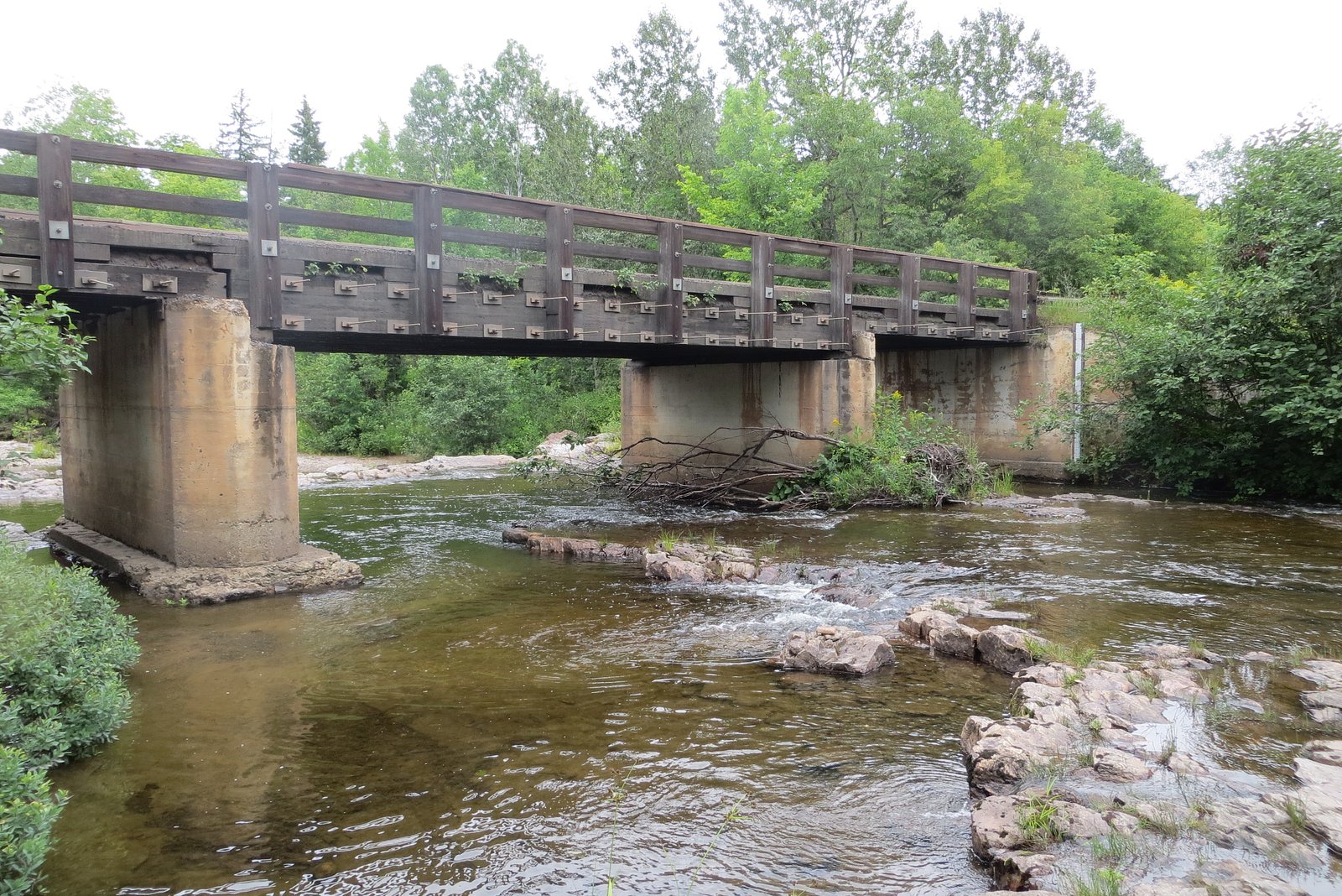
Getting There
Lower Falls is located within Tahquamenon Falls State Park in Michigan's Upper Peninsula. The falls are accessible via the park's main entrance, and clear signage will guide visitors to the Lower Falls area.
Get Directions on Google MapsParking
Ample parking is available near the Lower Falls area, with designated lots for visitors.
Elevation
715 feet above sea level
Coordinates
46.865482° N, -88.082348° W
Land Management
Managed by SDNR
Visitor Tips & Gear
Arrive early during peak seasons to secure parking and enjoy the falls with fewer crowds. Bring insect repellent during summer months, as mosquitoes can be prevalent. Wear sturdy shoes if you plan to explore the trails or get closer to the water.
As an Amazon Associate, we earn from qualifying purchases.
With 2.4 miles and 350 ft of elevation gain, sturdy boots and trekking poles will help on this moderate trail. Icy conditions are common in winter — traction cleats are a smart addition.

Columbia Watertight II Rain Jacket
Packs into its own pocket, seam-sealed, and keeps you dry from spray and surprise rain.

Polarized Sunglasses (Knockaround)
Cuts glare off the water so you actually see the falls — and your photos turn out better too.

Earth Pak Waterproof Dry Bag
Keeps your phone and gear dry when waterfall mist soaks everything else.

Waterproof Phone Pouch (AiRunTech)
Cheap insurance — take photos right next to the falls without killing your phone.

Timberland Euro Sprint Mid Waterproof
Trusted waterproof boot with premium leather and grippy rubber sole — reliable on rocky, wet trails.

TrailBuddy Trekking Poles
Lightweight aluminum, cork grips, and flip-locks that actually hold — a best-seller for good reason.
Where to Stay

Independence Stay Hotel and Long term suites

AC4 Northwoods Getaway w Jetted Tub

UP Escape in the Pines

Lakefront Lookout! Private Sand Beach on Superior
Browse vacation cabins and private rentals nearby
Unique outdoor stays — tents, yurts, and treehouses
Rent a campervan or RV for your waterfall road trip
Some links are affiliate links. We may earn a commission at no extra cost to you.
Additional Information
Nearby Attractions
Upper Falls, located about 4 miles upstream, is another must-see attraction in the park. The park also offers additional hiking trails, a brewery, and a visitor center.
Wildlife
The area is home to a variety of wildlife, including deer, black bears, and numerous bird species. Visitors may also spot fish in the river.
Cities near Lower Falls
Nearby Waterfalls

Other waterfalls named Lower Falls
19 other waterfalls share this name across the U.S.
Writing about Lower Falls? Embed this waterfall on your site for free.