Lower Falls
By Armen Suny · Last verified Mar 2026
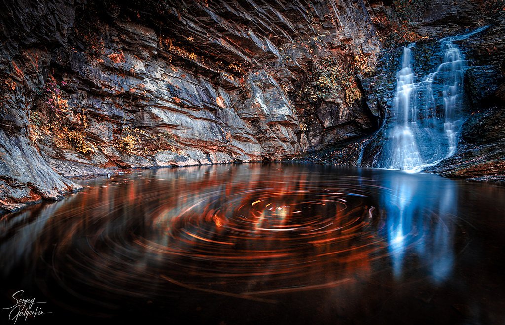

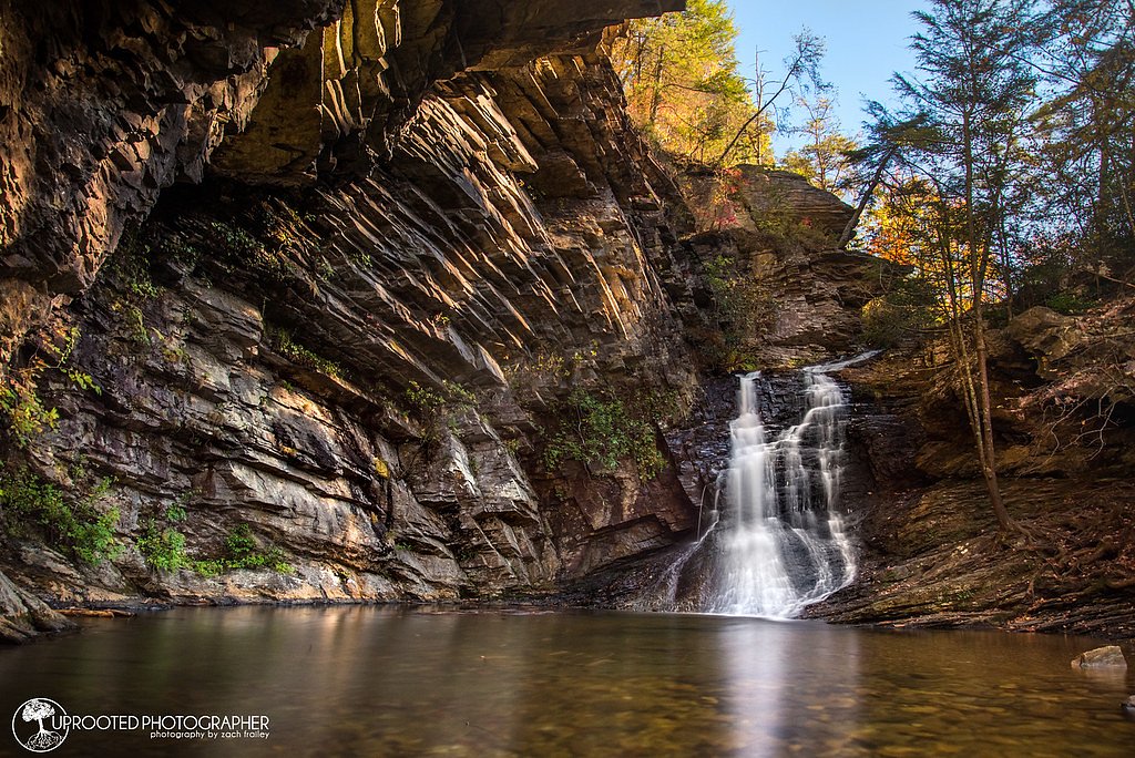
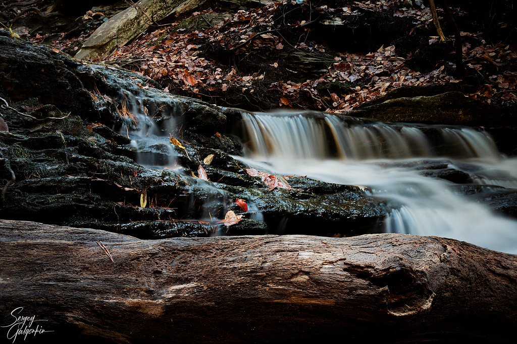
Photo Credits (5)
Difficulty
Easy
Trail Length
0.5 miles
Trail Type
Out And Back
Elevation Gain
100 ft
About Lower Falls
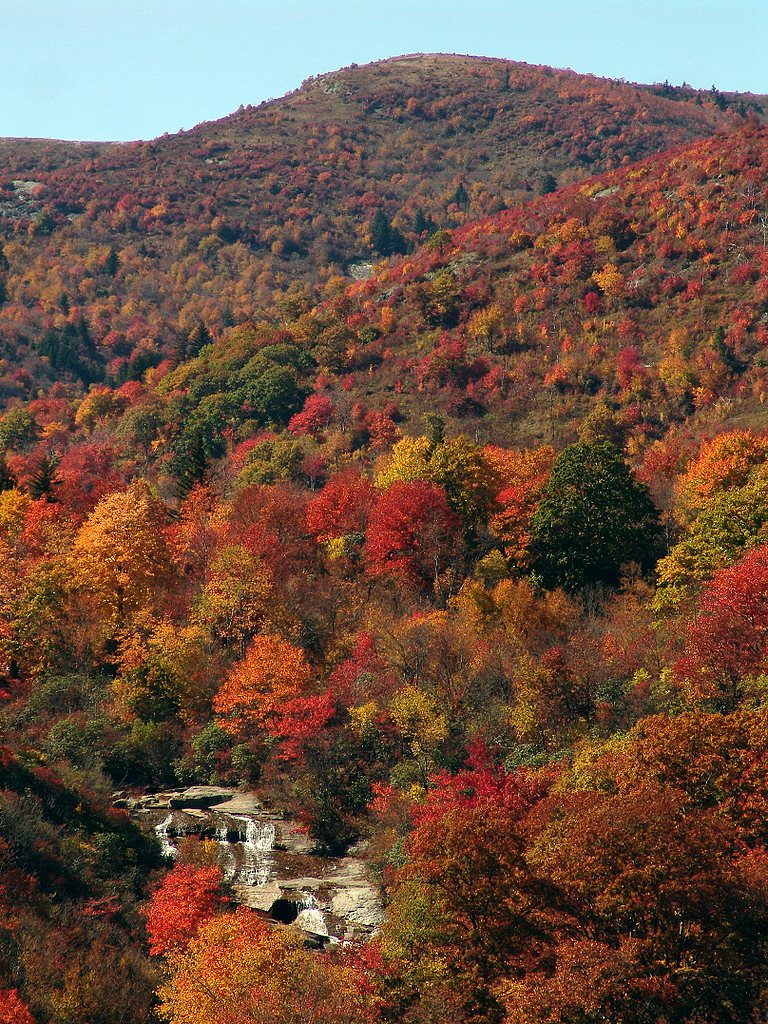
Lower Falls is a picturesque cascade tucked into the Graveyard Fields area of North Carolina, offering a tranquil spot for photographers and day hikers alike. The falls tumble over smooth bedrock into a shallow pool, framed by mossy banks and hardwood forest. This stretch of trail and the surrounding landscape are managed by the U.S. Forest Service as part of the Cherokee National Forest, so you’ll find well-marked access and stewardship consistent with National Forest lands. Because the approach is short and family-friendly, Lower Falls is a popular stop on a longer loop or as a standalone outing. The setting feels wild and accessible at once—an easy, rewarding experience for anyone who wants a quick nature escape without committing to a long backcountry trek.
The Setting
Lower Falls sits at 1,217 feet within Cherokee National Forest, fed by the Nantahala River, in the foothills of North Carolina.
Trail & Hike Details
The Approach
The easy hike follows Tapoco (#TR52A), a 0.5-mile out-and-back trail over natural surface. Expect 100 feet of elevation gain. The trail is moderately developed (Class 2).
USFS Trail
TAPOCO #TR52A
Trail Class
Moderately Developed
Surface
USFS Segment
0.81 miTrail Description
The route to Lower Falls is a short out-and-back hike of roughly 0.5 miles with about 100 feet of elevation change, rated easy. On USFS maps this is shown as the TAPOCO Trail, #TR52A (recorded GIS length 0.81 miles), Class 2. The tread is native material—rock, dirt, and exposed roots—so expect an unpaved surface that’s generally well-defined but can be uneven in spots. The approach descends through forested terrain with a few built steps and short boardwalk sections near wetter areas, leading directly to the base of the falls. With a gentle grade and minimal scrambling required, the trail is suitable for most visitors; however, wear sturdy shoes for traction on slick rock near the water.
What to Expect
Swimming is permitted. Dogs are welcome.
Accessibility
The trail is short and relatively flat, but the surface may be uneven. Contact the managing agency for accessibility details.
Frequently Asked Questions
🐶 Are Dogs Allowed at Lower Falls?
✅ Dogs are allowed
Are There Any Fees or Permits Required?
🆖 No fees required
🏊 Is There Swimming at Lower Falls?
✅ Swimming is allowed
When to Visit
The best time to visit is during spring and summer when the water flow is strong, or in the fall for vibrant foliage. Early mornings or weekdays are ideal to avoid crowds.
Seasonal Access
The best time to visit is Spring, Summer, and Fall. Winter access may be limited. Check with Cherokee National Forest for seasonal road closures.
Safety Information
The rocks near the waterfall can be slippery, so wear appropriate footwear and exercise caution. Be aware of sudden weather changes, as the area can experience heavy rain and fog. Always stay on marked trails.
Current Water Conditions
Based on a USGS gauge 20.8 miles away
218 ft³/s
Current discharge — how much water is flowing
Much lower than usual for this time of year
Based on 21 years of record
1.84 ft
Water depth at gauge
7-Day Discharge Trend
What does this mean for your visit?
Flow is well below normal for this time of year, so the waterfall may be a trickle.
About This Gauge
This gauge is on a regional waterway. Conditions at the falls may differ, especially after local rain.
7-Day Flow Outlook
Based on the USGS gauge NANTAHALA RIVER NEAR HEWITT, NC (33 km away).
Today
Moderate
218 cfs
9/10Tomorrow
Strong
253 cfs
7/10Wed
Strong
259 cfs
7/10Thu
Strong
280 cfs
7/10Fri
Strong
285 cfs
7/10Sat
Strong
293 cfs
7/10Sun
Strong
299 cfs
7/10Best window: Today — moderate flow, sunny (trip score 9/10).
Best time of year: this gauge typically runs highest from mid January to late January, peaking in December.
How we calculate this
This is a transparent outlook, not a precise forecast. We take the waterfall's current flow strength (how it ranks against its historical normal for today, from the nearest USGS stream gauge), carry that ranking forward along the gauge's seasonal curve, and nudge it for forecast rain. Confidence is highest for the next day or two and falls further out. Always check official conditions and your own judgment before visiting — high flows can be dangerous.
Know when to go.
Get a free email alert when waterfalls near Fontana Dam hit peak flow. We only send when conditions are worth the trip — no weekly newsletters, no spam.
Weather Forecast
Location & Access
Getting There
Lower Falls is located off the Blue Ridge Parkway at Milepost 418.8. Visitors can park at the Graveyard Fields Overlook and access the trailhead from there.
Get Directions on Google MapsParking
Parking is available at the Graveyard Fields Overlook. However, it can fill up quickly during peak seasons, so arriving early is recommended.
Elevation
1,217 feet above sea level
Coordinates
35.454554° N, -83.971891° W
Land Management
Managed by USFS
Visitor Tips & Gear
Arrive early to secure parking, especially during weekends and peak seasons. Wear sturdy shoes with good traction, as the rocks near the waterfall can be slippery. Bring water and snacks, as there are no facilities nearby.
As an Amazon Associate, we earn from qualifying purchases.
For this easy 0.5 miles trail, lightweight trail shoes and a water bottle are usually sufficient. Sun exposure on the trail makes good sun protection a must in summer.

Polarized Sunglasses (Knockaround)
Cuts glare off the water so you actually see the falls — and your photos turn out better too.

Columbia Watertight II Rain Jacket
Packs into its own pocket, seam-sealed, and keeps you dry from spray and surprise rain.

Earth Pak Waterproof Dry Bag
Keeps your phone and gear dry when waterfall mist soaks everything else.

Waterproof Phone Pouch (AiRunTech)
Cheap insurance — take photos right next to the falls without killing your phone.

JOBY GorillaPod Starter Kit
Wraps around railings and rocks for long-exposure waterfall shots — no flat surface needed.

Osprey Daylite Daypack
Light, organized, and just the right size for a day hike — fits water, snacks, and layers.
Where to Stay

Historic Tapoco Lodge Resort

The Lodge Nantahala River

The Junction

Quality Inn & Suites Robbinsville
Browse vacation cabins and private rentals nearby
Unique outdoor stays — tents, yurts, and treehouses
Rent a campervan or RV for your waterfall road trip
Some links are affiliate links. We may earn a commission at no extra cost to you.
Nearby Campground
SWAN CABIN
6.8 miles away · 1 sites
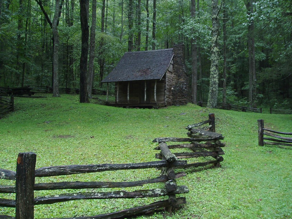
Overview Nestled in a remote area of Nantahala National Forest, this primitive log cabin was built in 1931 by Frank Swan in a different location, then later it was moved to its current location near the Joyce Kilmer-Slickrock Wilderness. The cabin and the surrounding meadows are named for the Swan Family, who came to the area from Pennsylvania in the late 19th century. Swan Cabin offers a peaceful, quiet retreat where visitors can relax on the front porch and enjoy birdsong and views of the surro
Book on Recreation.govAdditional Information
Nearby Attractions
Upper Falls, Graveyard Fields Loop Trail, Blue Ridge Parkway scenic overlooks
Wildlife
The area is home to various wildlife, including birds, deer, and occasionally black bears. Visitors should store food securely and be aware of their surroundings.
Cities near Lower Falls
Nearby Waterfalls
Other waterfalls named Lower Falls
19 other waterfalls share this name across the U.S.
Writing about Lower Falls? Embed this waterfall on your site for free.