Lower Falls
By Armen Suny · Last verified May 2026
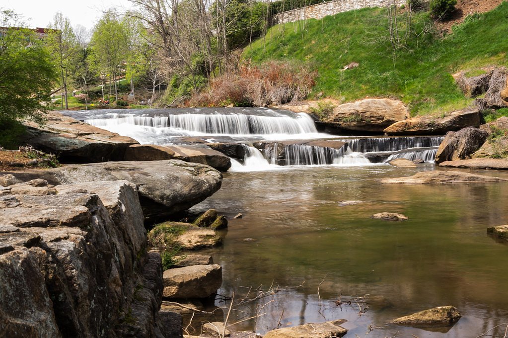
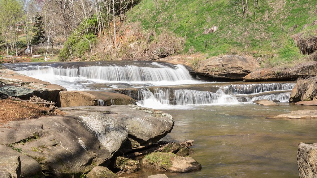
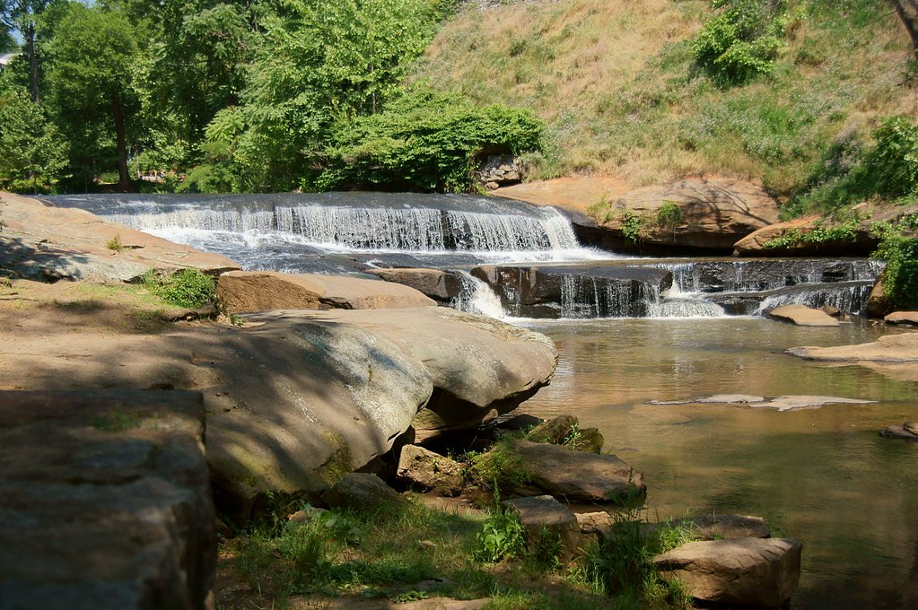
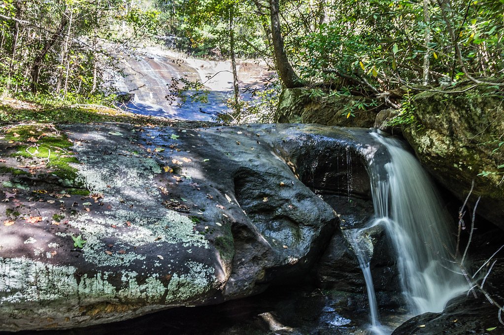
Photo Credits (5)
Difficulty
Moderate
Trail Length
2.4 miles
Trail Type
Out And Back
Elevation Gain
200 ft
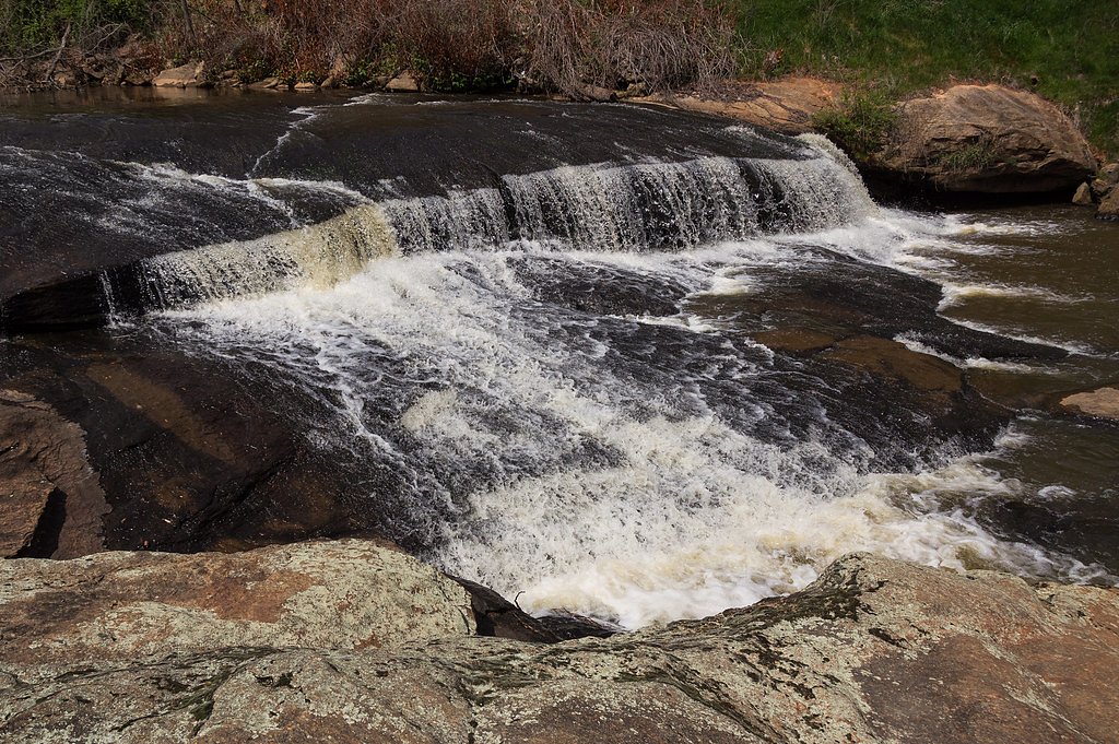
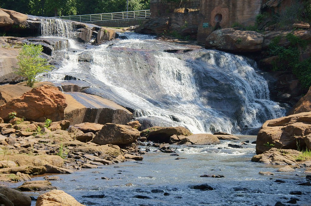
About Lower Falls
Lower Falls is a scenic waterfall in South Carolina tucked into Falls Park on the Reedy, a designated LREC managed by the City. The cascade and its surrounding greenery create a peaceful setting that draws hikers and nature lovers looking for a short, rewarding outing close to town. The route to the falls is a popular moderate hike: the out-and-back route covers about 2.4 miles round-trip with roughly 200 feet of elevation gain. The park atmosphere makes for easy access and pleasant views along the way, while the City’s stewardship helps preserve the area’s natural character.
The Setting
Lower Falls sits at 856 feet within Falls Park on the Reedy, fed by the Reedy River, in the foothills of South Carolina.
Trail & Hike Details
The Approach
The moderate 2.4-mile out and back trail gains 200 feet of elevation on the way to the falls.
Trail Description
This is a 2.4-mile out-and-back trail with approximately 200 feet of elevation gain and a moderate difficulty rating. The path passes through forested sections and may include uneven terrain and exposed roots, so sturdy footwear is recommended. Expect natural footing rather than paved surfaces; the hike’s grade is gentle to moderate over the course of the route.
What to Expect
Dogs are welcome.
Accessibility
The trail is not wheelchair accessible. Uneven terrain and elevation changes require steady footing.
Frequently Asked Questions
🐶 Are Dogs Allowed at Lower Falls?
✅ Dogs are allowed
Are There Any Fees or Permits Required?
🆖 No fees required
🏊 Is There Swimming at Lower Falls?
❌ Swimming is not allowed
When to Visit
Spring and fall are the best times to visit due to pleasant weather and vibrant foliage. Summer is also popular, but it may be more crowded.
Seasonal Access
The best time to visit is Spring, Summer, and Fall. Winter access may be limited.
Safety Information
Be cautious of slippery rocks near the waterfall. Stay on marked trails to avoid getting lost. Check weather conditions before visiting, as heavy rain can make the trail hazardous.
Current Water Conditions
14 ft³/s
Current discharge — how much water is flowing
Much lower than usual for this time of year
Based on 69 years of record
0.65 ft
Water depth at gauge
7-Day Discharge Trend
What does this mean for your visit?
Flow is well below normal for this time of year, so the waterfall may be a trickle.
About This Gauge
7-Day Flow Outlook
Based on the USGS gauge REEDY RIVER NEAR GREENVILLE, SC (6 km away).
Today
Barely Flowing
14 cfs
5/10Tomorrow
Low
17 cfs
3/10Sat
Barely Flowing
16 cfs
5/10Sun
Low
18 cfs
3/10Mon
Low
17 cfs
3/10Tue
Barely Flowing
15 cfs
5/10Wed
Barely Flowing
15 cfs
5/10Best window: Today — barely flowing flow, mostly sunny (trip score 5/10).
Best time of year: this gauge typically runs highest from early February to mid April, peaking in March.
How we calculate this
This is a transparent outlook, not a precise forecast. We take the waterfall's current flow strength (how it ranks against its historical normal for today, from the nearest USGS stream gauge), carry that ranking forward along the gauge's seasonal curve, and nudge it for forecast rain. Confidence is highest for the next day or two and falls further out. Always check official conditions and your own judgment before visiting — high flows can be dangerous.
Know when to go.
Get a free email alert when waterfalls near Judson hit peak flow. We only send when conditions are worth the trip — no weekly newsletters, no spam.
Weather Forecast
Location & Access
Getting There
Lower Falls is located within the Sumter National Forest in South Carolina. Access typically involves driving to a trailhead and hiking to the falls.
Get Directions on Google MapsParking
Parking is available at the trailhead, but spaces may be limited during peak seasons.
Hours
Elevation
856 feet above sea level
Coordinates
34.844130° N, -82.400460° W
Land Management
Managed by CITY
Visitor Tips & Gear
Visit early in the day to avoid crowds and secure parking. Bring plenty of water and wear sturdy shoes. Be cautious of slippery rocks near the waterfall.
As an Amazon Associate, we earn from qualifying purchases.
With 2.4 miles and 200 ft of elevation gain, sturdy boots and trekking poles will help on this moderate trail. Sun exposure on the trail makes good sun protection a must in summer.

Polarized Sunglasses (Knockaround)
Cuts glare off the water so you actually see the falls — and your photos turn out better too.

Columbia Watertight II Rain Jacket
Packs into its own pocket, seam-sealed, and keeps you dry from spray and surprise rain.

Earth Pak Waterproof Dry Bag
Keeps your phone and gear dry when waterfall mist soaks everything else.

Waterproof Phone Pouch (AiRunTech)
Cheap insurance — take photos right next to the falls without killing your phone.

Timberland Euro Sprint Mid Waterproof
Trusted waterproof boot with premium leather and grippy rubber sole — reliable on rocky, wet trails.

TrailBuddy Trekking Poles
Lightweight aluminum, cork grips, and flip-locks that actually hold — a best-seller for good reason.
Where to Stay

Holiday Inn Express & Suites Greenville S - Piedmont by IHG

Best Western Plus Greenville I-385 Inn & Suites

Best Western Plus Greenville South

Hyatt Place Greenville/Haywood
Browse vacation cabins and private rentals nearby
Unique outdoor stays — tents, yurts, and treehouses
Rent a campervan or RV for your waterfall road trip
Some links are affiliate links. We may earn a commission at no extra cost to you.
Additional Information
Nearby Attractions
Other waterfalls and hiking trails in Sumter National Forest.
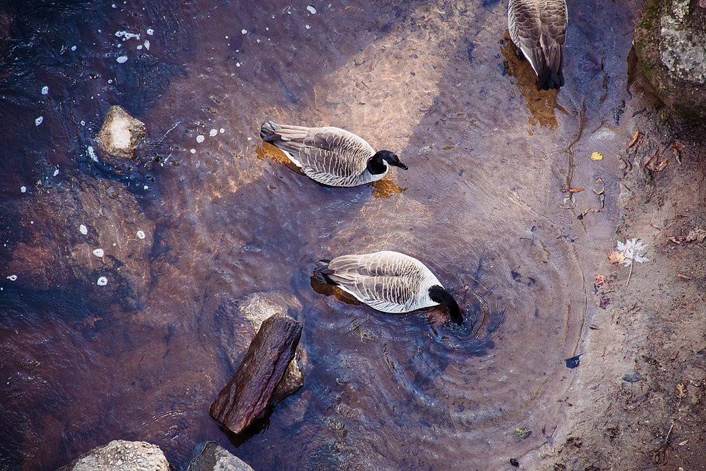
Wildlife
The area is home to various wildlife, including birds, deer, and small mammals. Be cautious of snakes and other potentially hazardous animals.
Cities near Lower Falls
Nearby Waterfalls
Other waterfalls named Lower Falls
19 other waterfalls share this name across the U.S.
Writing about Lower Falls? Embed this waterfall on your site for free.