
Photo Credits (5)
Difficulty
Moderate
Trail Length
2.4 miles
Trail Type
Out And Back
Elevation Gain
350 ft
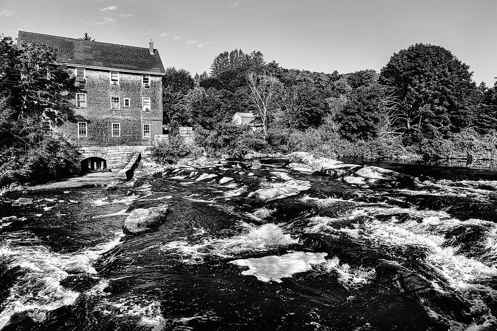
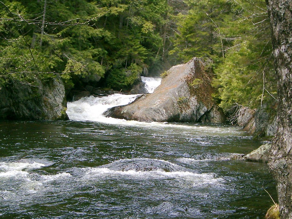
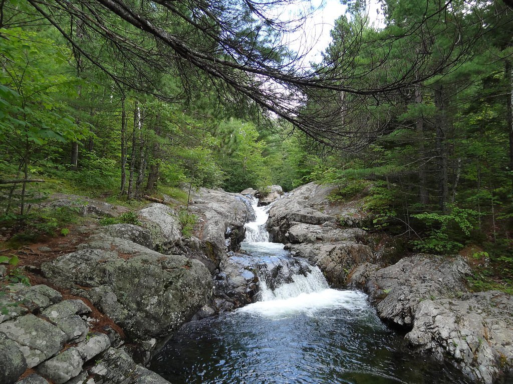
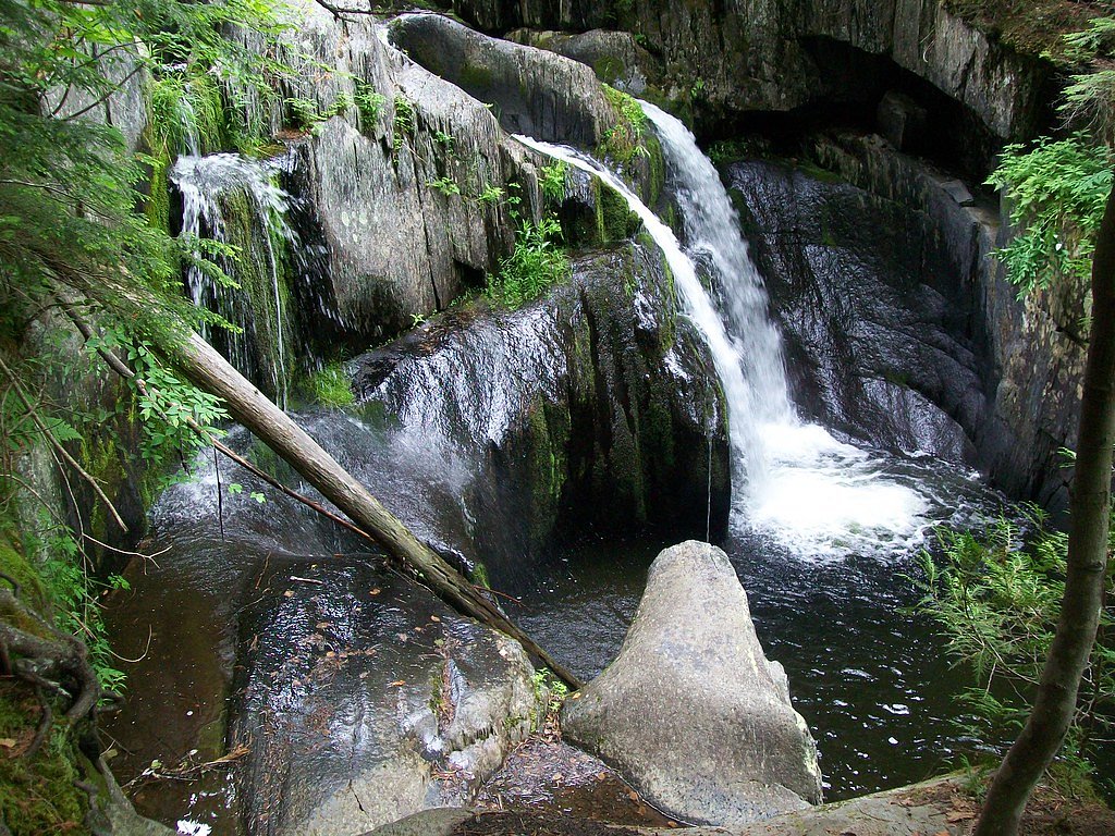
About Lower Falls
Lower Falls in Maine is a picturesque waterfall reached by a moderate hike rather than a quick roadside stop. The route to the falls is a 2.4-mile out-and-back that climbs about 350 feet, so visitors can expect a steady, scenic walk through typical Maine terrain before arriving at the cascade. The trail’s moderate rating makes it a good half-day outing for hikers looking for an achievable challenge and rewarding views. Bring sturdy shoes and a camera — the setting at the falls is peaceful and photogenic, making it a pleasant destination for hikers seeking a nature break. Because the approach requires a short but steady climb, the hike is best suited to those comfortable with moderate grades rather than casual stroller-accessible paths.
The Setting
Lower Falls sits at 604 feet along the Seboeis River, in the foothills of Maine.
Trail & Hike Details
The Approach
The moderate 2.4-mile out-and-back trail gains 350 feet of elevation on the way to the falls.
Trail Description
Trail type: Out-and-back. Distance: 2.4 miles (out-and-back). Elevation gain: ~350 feet. Difficulty: Moderate. Surface and official USFS trail class/number are not provided for this route. The trail follows a single path with steady grades rather than steep, technical sections, making it a straightforward hike for those prepared for a moderate uphill and downhill walk.
What to Expect
Swimming is permitted. Dogs are welcome.
Accessibility
The trail is not wheelchair accessible. Uneven terrain and elevation changes require steady footing.
Frequently Asked Questions
🐶 Are Dogs Allowed at Lower Falls?
✅ Dogs are allowed
Are There Any Fees or Permits Required?
🤑 Fee: $5.00
🏊 Is There Swimming at Lower Falls?
✅ Swimming is allowed
When to Visit
Spring and early summer are ideal for visiting, as the water flow is strongest during these seasons. Fall offers beautiful foliage, while summer provides opportunities for wading in the water.
Seasonal Access
The best time to visit is Spring, Summer, and Fall. Winter access may be limited.
Safety Information
The rocks near the falls can be slippery, especially when wet. Exercise caution when exploring the area. During spring, the water flow may be strong, so avoid getting too close to the edge.
Current Water Conditions
Based on a USGS gauge 15.6 miles away
201 ft³/s
Current discharge — how much water is flowing
About average for this time of year
Based on 28 years of record
5.51 ft
Water depth at gauge
7-Day Discharge Trend
What does this mean for your visit?
Flow is about average for this time of year.
About This Gauge
This gauge is on a regional waterway. Conditions at the falls may differ, especially after local rain.
7-Day Flow Outlook
Based on the USGS gauge Seboeis River near Shin Pond, Maine (25 km away).
Today
Low
226 cfs
3/10Tomorrow
Low
256 cfs
3/10Mon
Barely Flowing
261 cfs
5/10Tue
Barely Flowing
218 cfs
5/10Wed
Barely Flowing
210 cfs
3/10Thu
Low
214 cfs
4/10Fri
Low
224 cfs
3/10Best window: Mon — barely flowing flow, sunny (trip score 5/10).
Best time of year: this gauge typically runs highest from late March to late May, peaking in April.
How we calculate this
This is a transparent outlook, not a precise forecast. We take the waterfall's current flow strength (how it ranks against its historical normal for today, from the nearest USGS stream gauge), carry that ranking forward along the gauge's seasonal curve, and nudge it for forecast rain. Confidence is highest for the next day or two and falls further out. Always check official conditions and your own judgment before visiting — high flows can be dangerous.
Know when to go.
Get a free email alert when waterfalls near Island Falls hit peak flow. We only send when conditions are worth the trip — no weekly newsletters, no spam.
Weather Forecast
Location & Access
Getting There
Lower Falls is located in the White Mountain National Forest, near the town of Gilead, Maine. It is accessible via Route 113, which runs along the Wild River. The falls are part of the Wild River area.
Get Directions on Google MapsParking
There is a designated parking area near the falls, which is typically sufficient for visitors. However, it may fill up during peak seasons.
Elevation
604 feet above sea level
Coordinates
46.152272° N, -68.307808° W
Visitor Tips & Gear
Arrive early during summer weekends to secure parking. Bring bug spray during warmer months, as mosquitoes can be present. Wear sturdy shoes if you plan to explore the rocks near the falls.
As an Amazon Associate, we earn from qualifying purchases.
With 2.4 miles and 350 ft of elevation gain, sturdy boots and trekking poles will help on this moderate trail. Sun exposure on the trail makes good sun protection a must in summer.

Polarized Sunglasses (Knockaround)
Cuts glare off the water so you actually see the falls — and your photos turn out better too.

Columbia Watertight II Rain Jacket
Packs into its own pocket, seam-sealed, and keeps you dry from spray and surprise rain.

Earth Pak Waterproof Dry Bag
Keeps your phone and gear dry when waterfall mist soaks everything else.

Waterproof Phone Pouch (AiRunTech)
Cheap insurance — take photos right next to the falls without killing your phone.

Timberland Euro Sprint Mid Waterproof
Trusted waterproof boot with premium leather and grippy rubber sole — reliable on rocky, wet trails.

TrailBuddy Trekking Poles
Lightweight aluminum, cork grips, and flip-locks that actually hold — a best-seller for good reason.
Where to Stay

The Brookside Inn

All Season Fun and Cozy Home in Island Falls, ME

Peaceful Oakfield Cabin on Mattawamkeag River!

Sewall House Yoga Retreat
Browse vacation cabins and private rentals nearby
Unique outdoor stays — tents, yurts, and treehouses
Rent a campervan or RV for your waterfall road trip
Some links are affiliate links. We may earn a commission at no extra cost to you.
Nearby Campground
Katahdin Woods and Waters National Monument Camping and Huts
23.7 miles away · 27 sites
Overview Katahdin Woods and Waters National Monument is located in Maine’s north woods. Katahdin Woods and Waters protects part of an extraordinary natural and cultural landscape: the mountains, woods, and waters where the East Branch of the Penobscot River and its tributaries, including the Wassataquoik Stream and the Seboeis River, run freely. Campsites, lean-tos and huts located throughout the monument provide opportunities to stay overnight while hiking, biking, paddling and enjoying other re
Book on Recreation.govAdditional Information
Nearby Attractions
Other attractions in the White Mountain National Forest include Screw Auger Falls and Evans Notch. Hiking trails and scenic drives are also available in the area.
Wildlife
The area is home to a variety of wildlife, including birds, deer, and small mammals. Visitors may also spot fish in the river.
Cities near Lower Falls
Nearby Waterfalls
Other waterfalls named Lower Falls
19 other waterfalls share this name across the U.S.
Writing about Lower Falls? Embed this waterfall on your site for free.