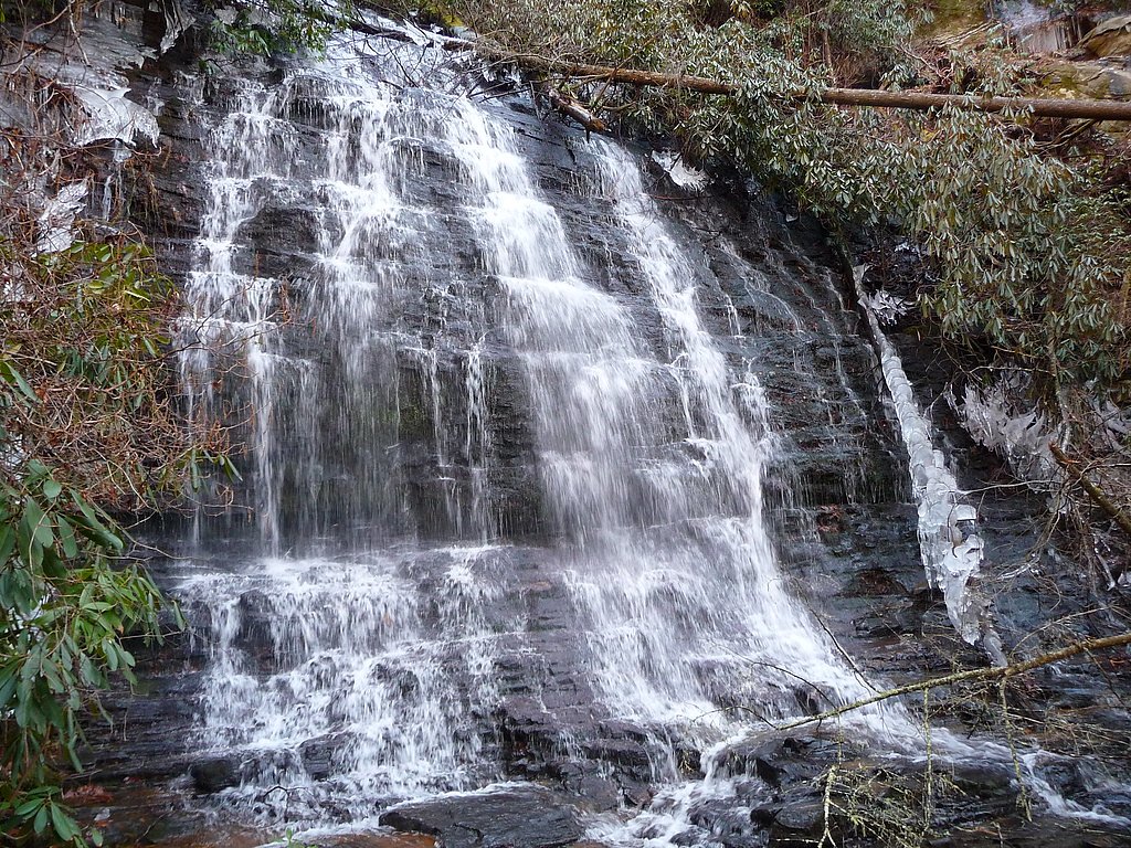
Spoonauger Falls
South Carolina • 50 ft
By Armen Suny · Last verified Mar 2026
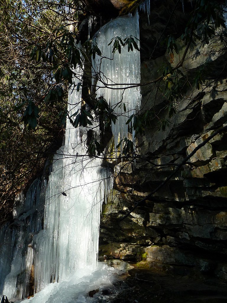

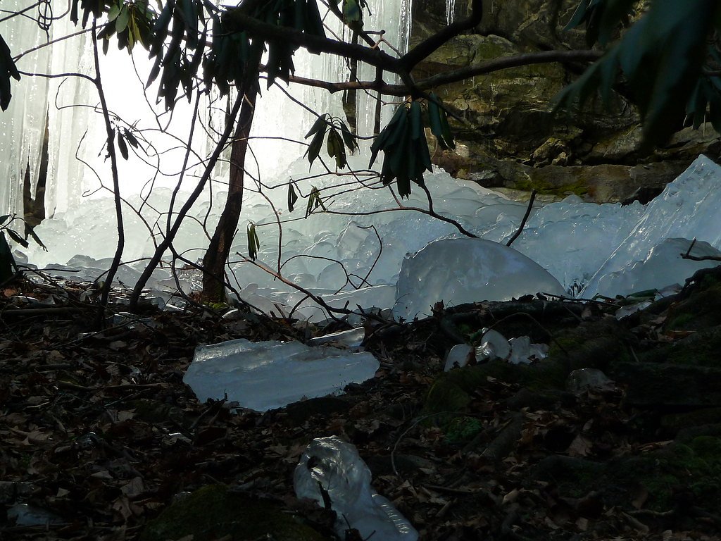
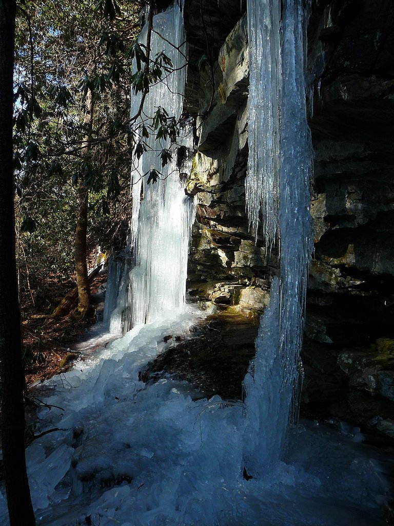

Photo Credits (5)
Difficulty
Moderate
Trail Length
2.4 miles
Trail Type
Out And Back
Elevation Gain
350 ft
About Spoonauger Falls
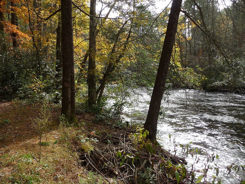
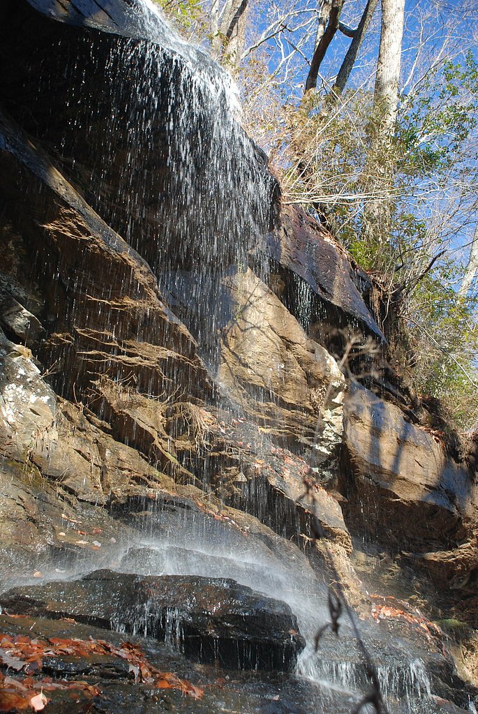
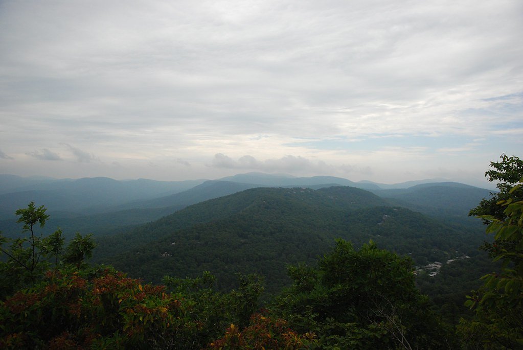
Spoonauger Falls is a picturesque, multi-tiered cascade tucked into the wooded slopes of Sumter National Forest, offering a photogenic drop of roughly 50 feet over moss-covered rock ledges. The falls’ gentle tiers and the surrounding rhododendron- and oak-lined stream make it a favorite stop for photographers and day-hikers looking for a classic Southern Appalachian creekside scene. The falls lie on public lands managed by the U.S. Forest Service; the broader region includes other USFS-managed wildlands, such as the nearby Ellicott Rock Wilderness — an 8,274-acre protected area that marks the tripoint of Georgia, North Carolina, and South Carolina and is part of the National Wilderness Preservation System. The hike to Spoonauger Falls rewards a short outing with tranquil water-and-woods scenery. The trail is a manageable outing for regular hikers and is often combined with picnics or a night at one of the local campgrounds — West Fork Campground (Clayton, GA) sits about 9.07 km from the falls if you’re planning an overnight stay. Bring a camera and sturdy shoes: the creekside approach and layered falls provide great composition and a peaceful place to linger before heading back out.
The Setting
Spoonauger Falls sits at 2,264 feet along the Chattooga River, in the hills of South Carolina. The falls drop 50 feet.
Height: 50 feet
Nearby Falls Worth Visiting
Kings Creek Falls (70 ft) lies 0.6 miles to the south.
Trail & Hike Details
The Approach
The moderate 2.4-mile out-and-back trail gains 350 feet of elevation on the way to the falls.
Trail Description
Trail to Spoonauger Falls: 2.4 miles round-trip (out-and-back) with approximately 350 feet of elevation gain, rated moderate difficulty. The route follows a well-marked forest path with a generally gentle incline as it parallels the creek toward the falls; surface is typical natural trail tread (roots and leaf litter) and conditions can be slick after rain. The waterfall itself drops about 50 feet across multiple tiers near the trail terminus. Managed by the U.S. Forest Service within Sumter National Forest, the trail is suitable for most hikers prepared for a moderate, short-day hike.
What to Expect
The falls drop 50 feet. Dogs are welcome.
Accessibility
The trail is not wheelchair accessible. Uneven terrain and elevation changes require steady footing.
Frequently Asked Questions
🐶 Are Dogs Allowed at Spoonauger Falls?
✅ Dogs are allowed
Are There Any Fees or Permits Required?
🆖 No fees required
🏊 Is There Swimming at Spoonauger Falls?
❌ Swimming is not allowed
When to Visit
Spring and early summer are ideal times to visit, as the waterfall flow is strongest due to seasonal rains. Fall offers beautiful foliage, while winter provides a quieter experience.
Seasonal Access
The best time to visit is Spring, Summer, and Fall. Winter access may be limited.
Safety Information
Exercise caution near the waterfall, as rocks can be slippery. Be aware of changing weather conditions, and avoid the trail during heavy rain to prevent flooding hazards.
Current Water Conditions
61 ft³/s
Current discharge — how much water is flowing
Lower than usual for this time of year
Based on 16 years of record
0.90 ft
Water depth at gauge
70°F
WarmVery comfortable
7-Day Discharge Trend
What does this mean for your visit?
Flow is lower than usual for this time of year. Water temperature is a refreshing 70 degrees F, good for a quick swim.
About This Gauge
7-Day Flow Outlook
Based on the USGS gauge CHATTOOGA RIVER AT BURRELLS FORD, NR PINE MTN, GA (1 km away).
Today
Low
71 cfs
3/10Tomorrow
Moderate
88 cfs
4/10Sun
Moderate
78 cfs
4/10Mon
Moderate
87 cfs
4/10Tue
Moderate
81 cfs
4/10Wed
Moderate
78 cfs
4/10Thu
Moderate
93 cfs
4/10Best window: Tomorrow — moderate flow, patchy fog then chance showers and thunderstorms (trip score 4/10).
Best time of year: this gauge typically runs highest from early January to early February, peaking in February.
How we calculate this
This is a transparent outlook, not a precise forecast. We take the waterfall's current flow strength (how it ranks against its historical normal for today, from the nearest USGS stream gauge), carry that ranking forward along the gauge's seasonal curve, and nudge it for forecast rain. Confidence is highest for the next day or two and falls further out. Always check official conditions and your own judgment before visiting — high flows can be dangerous.
Know when to go.
Get a free email alert when waterfalls near Cashiers hit peak flow. We only send when conditions are worth the trip — no weekly newsletters, no spam.
Weather Forecast
Location & Access
Getting There
Spoonauger Falls is located near the Chattooga River in the Sumter National Forest. The trailhead can be accessed from Burrells Ford Road, which is off Highway 107. The trailhead is well-marked and easy to find.
Get Directions on Google MapsParking
Parking is available at the Burrells Ford Campground parking area, which is free of charge.
Elevation
2,264 feet above sea level
Coordinates
34.974533° N, -83.109595° W
Visitor Tips & Gear
Wear sturdy shoes as the trail may be muddy, especially after rain. Bring insect repellent during warmer months to protect against mosquitoes. Arrive early to secure parking, as the area can get busy on weekends.
As an Amazon Associate, we earn from qualifying purchases.
With 2.4 miles and 350 ft of elevation gain, sturdy boots and trekking poles will help on this moderate trail. Sun exposure on the trail makes good sun protection a must in summer.

Polarized Sunglasses (Knockaround)
Cuts glare off the water so you actually see the falls — and your photos turn out better too.

Columbia Watertight II Rain Jacket
Packs into its own pocket, seam-sealed, and keeps you dry from spray and surprise rain.

Earth Pak Waterproof Dry Bag
Keeps your phone and gear dry when waterfall mist soaks everything else.

Waterproof Phone Pouch (AiRunTech)
Cheap insurance — take photos right next to the falls without killing your phone.

Timberland Euro Sprint Mid Waterproof
Trusted waterproof boot with premium leather and grippy rubber sole — reliable on rocky, wet trails.

TrailBuddy Trekking Poles
Lightweight aluminum, cork grips, and flip-locks that actually hold — a best-seller for good reason.
Where to Stay

Spectacular Mountain Views With Your Own Private Hot Tub!

Foxhunt at Sapphire Valley

The Wells Cashiers

Red Top Tree House
Browse vacation cabins and private rentals nearby
Unique outdoor stays — tents, yurts, and treehouses
Rent a campervan or RV for your waterfall road trip
Some links are affiliate links. We may earn a commission at no extra cost to you.
Nearby Campground
West Fork Campground (Clayton, GA)
5.6 miles away · 5 sites
Overview All Campsites at West Fork Campground are reservation only, you must reserve through recreation.gov or by calling 877-444-6777Visitors to this 5-site campground marvel over the picturesque bird's eye view of the world renowned Chattooga Wild and Scenic River. Situated along the west fork of the river, this area offers isolation and adventure all in one. Visitors often comment they feel as though they've been swept back in time and are looking out onto the great frontier of the past when
Book on Recreation.govAdditional Information
Nearby Attractions
Nearby attractions include the Chattooga River, Burrells Ford Campground, and King Creek Falls.
Wildlife
The area is home to various wildlife, including birds, deer, and small mammals. Visitors may also encounter salamanders and other amphibians near the creek.
Cities near Spoonauger Falls
Nearby Waterfalls

Writing about Spoonauger Falls? Embed this waterfall on your site for free.