Difficulty
Moderate
Trail Length
2.4 miles
Trail Type
Out And Back
Elevation Gain
350 ft
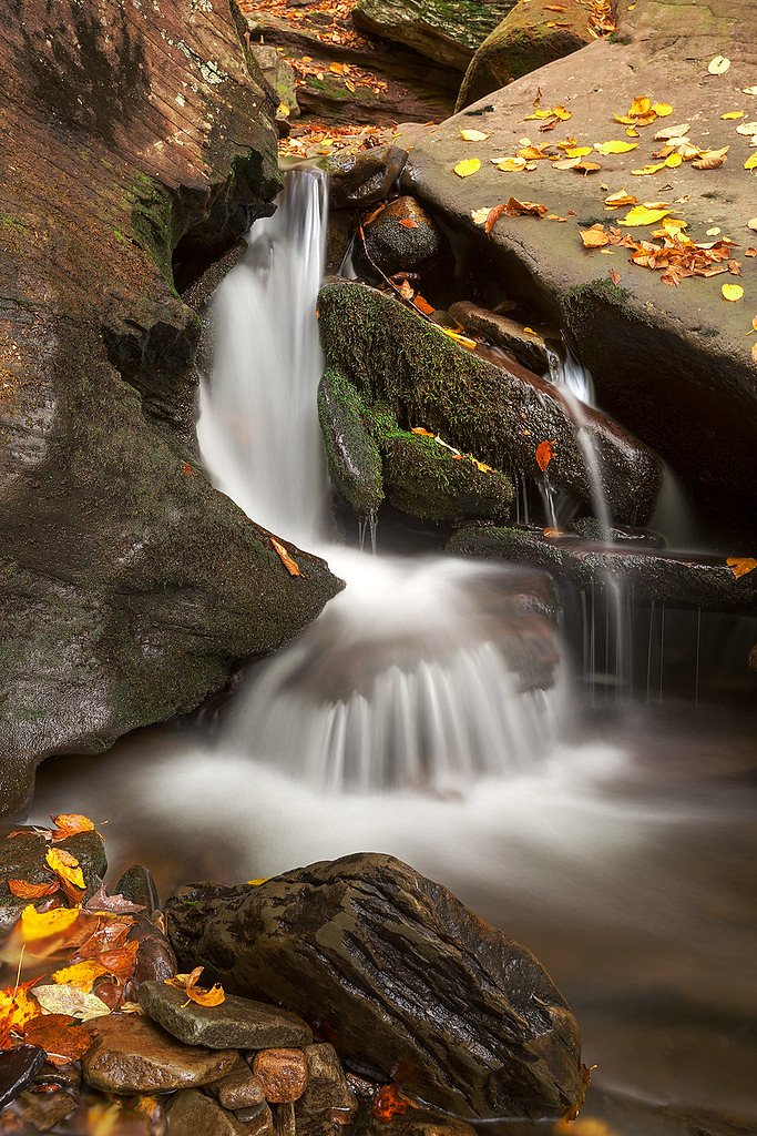
About Ridgeway Falls
Ridgeway Falls is a small, picturesque waterfall in Pennsylvania that offers a quiet, tucked-away setting for hikers and nature lovers. The falls’ modest drop and the surrounding wooded scenery make it a peaceful spot for a short outing or photography—its low profile means you can often enjoy the site with fewer crowds than larger, better-known waterfalls. Access to the falls is via a moderate 2.4-mile out-and-back trail that gains about 350 feet of elevation, making it a satisfying half-day hike for those comfortable with moderate inclines. There isn’t an official managing-agency trail number provided with the available information, so plan for a simple, natural trail experience and bring appropriate footwear and water.
The Setting
Ridgeway Falls sits at 1,132 feet along the Lackawaxen River, in the foothills of Pennsylvania.
Trail & Hike Details
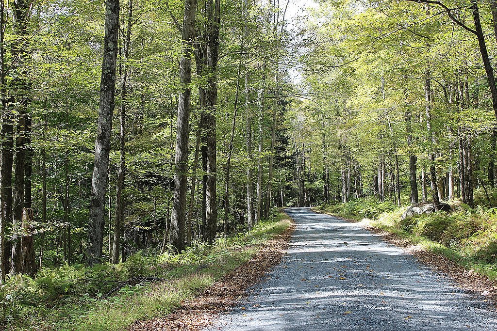
The Approach
The moderate 2.4-mile out-and-back trail gains 350 feet of elevation on the way to the falls.
Trail Description
Trail length: 2.4 miles (out-and-back). Elevation gain: approximately 350 feet. Difficulty: Moderate. The route is a forested out-and-back that leads to Ridgeway Falls; hikers should expect natural, unpaved footing through wooded areas. Official USFS trail surface, grade, and class data are not available for this route.
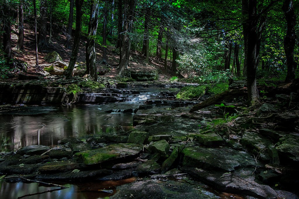
What to Expect
Visitors can expect a quiet and scenic waterfall surrounded by natural beauty. The area may be less developed, so plan accordingly.
Accessibility
The trail is not wheelchair accessible. Uneven terrain and elevation changes require steady footing.
Frequently Asked Questions
🐶 Are Dogs Allowed at Ridgeway Falls?
❌ Dogs are not allowed
Are There Any Fees or Permits Required?
🆖 No fees required
🏊 Is There Swimming at Ridgeway Falls?
❌ Swimming is not allowed
When to Visit
Spring and fall are ideal for visiting due to pleasant weather and vibrant foliage. Summer is also a good time, but it may be busier.
Seasonal Access
The best time to visit is Spring, Summer, and Fall. Winter access may be limited.
Safety Information
Be cautious of slippery rocks near the waterfall. Check weather conditions before visiting, as trails may become muddy or hazardous.
Current Water Conditions
180 ft³/s
Current discharge — how much water is flowing
About average for this time of year
Based on 5 years of record
3.81 ft
Water depth at gauge
63°F
CoolRefreshing for swimming
7-Day Discharge Trend
What does this mean for your visit?
Flow is about average for this time of year. Water temperature is a refreshing 63 degrees F, good for a quick swim.
About This Gauge
7-Day Flow Outlook
Based on the USGS gauge Lackawaxen River near Baoba, PA (5 km away).
Today
Moderate
194 cfs
6/10Tomorrow
Moderate
188 cfs
8/10Mon
Moderate
167 cfs
6/10Tue
Moderate
205 cfs
6/10Wed
Moderate
202 cfs
6/10Thu
Moderate
155 cfs
9/10Fri
Moderate
185 cfs
6/10Best window: Thu — moderate flow, mostly sunny (trip score 9/10).
Best time of year: this gauge typically runs highest from early March to late March, peaking in March.
How we calculate this
This is a transparent outlook, not a precise forecast. We take the waterfall's current flow strength (how it ranks against its historical normal for today, from the nearest USGS stream gauge), carry that ranking forward along the gauge's seasonal curve, and nudge it for forecast rain. Confidence is highest for the next day or two and falls further out. Always check official conditions and your own judgment before visiting — high flows can be dangerous.
Know when to go.
Get a free email alert when waterfalls near Hawley hit peak flow. We only send when conditions are worth the trip — no weekly newsletters, no spam.
Weather Forecast
Location & Access
Getting There
Ridgeway Falls is located near the town of Ridgeway, Pennsylvania. Access to the falls may require navigating local roads and potentially a short hike.
Get Directions on Google MapsParking
Parking availability is unclear, but visitors may need to park along nearby roads or at a designated trailhead if available.
Elevation
1,132 feet above sea level
Coordinates
41.425368° N, -75.104895° W
Visitor Tips & Gear
Wear sturdy footwear and bring water. Be prepared for potentially uneven terrain. Check local conditions before visiting.
As an Amazon Associate, we earn from qualifying purchases.
With 2.4 miles and 350 ft of elevation gain, sturdy boots and trekking poles will help on this moderate trail. Sun exposure on the trail makes good sun protection a must in summer.

Columbia Watertight II Rain Jacket
Packs into its own pocket, seam-sealed, and keeps you dry from spray and surprise rain.

Earth Pak Waterproof Dry Bag
Keeps your phone and gear dry when waterfall mist soaks everything else.

Waterproof Phone Pouch (AiRunTech)
Cheap insurance — take photos right next to the falls without killing your phone.

Timberland Euro Sprint Mid Waterproof
Trusted waterproof boot with premium leather and grippy rubber sole — reliable on rocky, wet trails.

TrailBuddy Trekking Poles
Lightweight aluminum, cork grips, and flip-locks that actually hold — a best-seller for good reason.

Polarized Sunglasses (Knockaround)
Cuts glare off the water so you actually see the falls — and your photos turn out better too.
Where to Stay

Comfort Inn Pocono Lakes Region

Silver Birches Resort

Lakeside, Dock, Hot Tub, Kayaks, Arcade, Playset

Tanglwood Resort
Browse vacation cabins and private rentals nearby
Unique outdoor stays — tents, yurts, and treehouses
Rent a campervan or RV for your waterfall road trip
Some links are affiliate links. We may earn a commission at no extra cost to you.
Nearby Campground
Alosa Campsites
24.6 miles away · 6 sites
Overview The Alosa Campsites are boat-in only sites located on the west (Pennsylvanian) shore of the Delaware River near Bushkill, Pennsylvania. The side of the river with the campsites will be on your right while traveling downstream. This section of the river offers unspoiled views, excellent boating, fishing, and birding opportunities within the Delaware Water Gap National Recreation Area and the Middle Delaware National Scenic and Recreational River. These reservation-only campsites are avail
Book on Recreation.govAdditional Information
Nearby Attractions
Explore the nearby town of Ridgeway or other natural attractions in the area.
Wildlife
The area may feature local wildlife such as birds, deer, and small mammals.
Cities near Ridgeway Falls
Nearby Waterfalls
Writing about Ridgeway Falls? Embed this waterfall on your site for free.