

Photo Credits (5)
Difficulty
Moderate
Trail Length
2.4 miles
Trail Type
Out And Back
Elevation Gain
350 ft
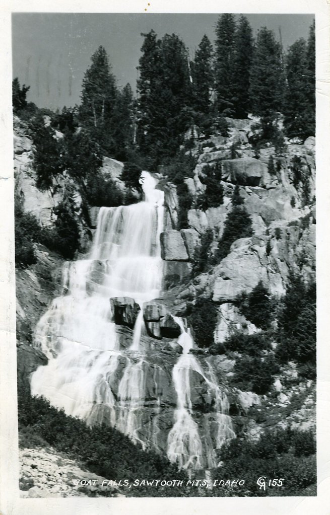
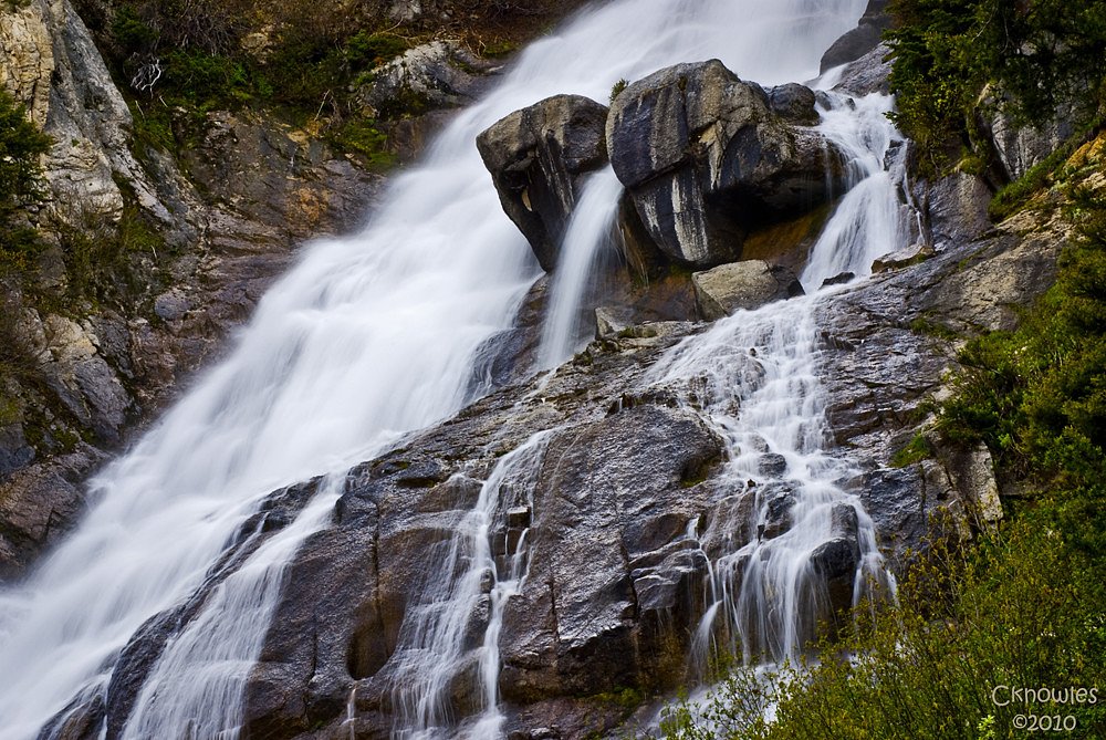
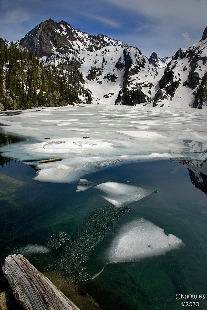
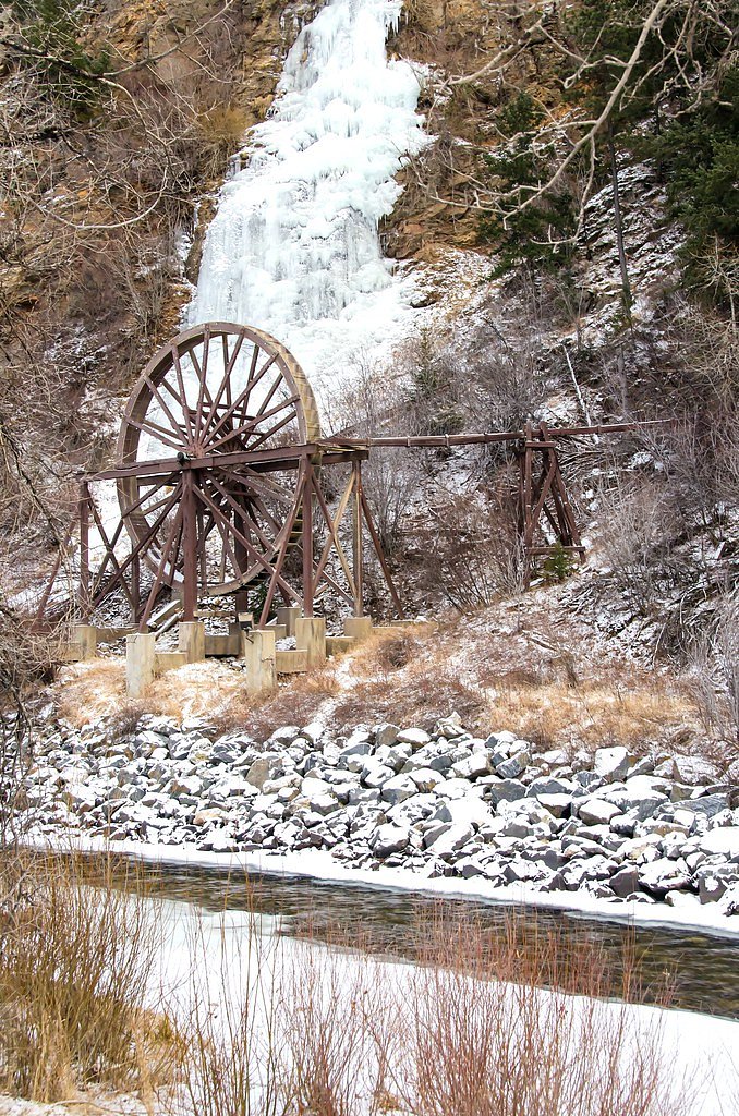
About Goat Falls
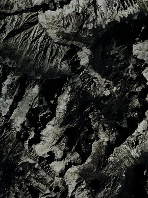
Goat Falls tumbles out of alpine Goat Lake into a narrow, rocky chute in the heart of Idaho’s Sawtooth Wilderness. Fed by the lake often described as the highest alpine lake in the Sawtooth Mountains that’s accessible by trail, the falls carve a dramatic backdrop of granite and subalpine forest. The site sits within the Sawtooth Wilderness of the Sawtooth National Recreation Area, managed by the U.S. Forest Service, and rewards hikers with classic high-country scenery and photographic viewpoints at the final approach. The hike to the falls is compact but scenic, making it a great half-day outing for hikers prepared for uneven terrain. If you’re looking to extend your stay, REDFISH CABIN is roughly 8.6 km away and provides nearby camping options. Bring sturdy footwear and be ready for changing mountain weather—packed lunches and a camera are recommended for the waterfall and lake views.
The Setting
Goat Falls sits at 8,097 feet along the Valley Creek, in the high alpine of Idaho.
Trail & Hike Details
The Approach
The moderate 2.4-mile out-and-back trail gains 350 feet of elevation on the way to the falls.
Trail Description
This is a 2.4-mile out-and-back trail with approximately 350 feet of elevation gain and is rated moderate. The route features uneven, rocky tread with several stream crossings and some steep sections; the final approach to Goat Lake and the falls involves a steep scramble over loose rocks. Proper footwear and basic scrambling experience will make the climb safer and more enjoyable. Expect short steep grades and rocky footing rather than a smooth, paved surface.
What to Expect
Dogs are welcome.
Accessibility
The trail is not wheelchair accessible. Uneven terrain and elevation changes require steady footing.
Frequently Asked Questions
🐶 Are Dogs Allowed at Goat Falls?
✅ Dogs are allowed
Are There Any Fees or Permits Required?
🤑 Fee: $5.00
Permit required
A wilderness permit is required for hiking in the Sawtooth Wilderness. Permits are self-issued at the trailhead and free of charge.
🏊 Is There Swimming at Goat Falls?
❌ Swimming is not allowed
When to Visit
The best time to visit Goat Falls is late spring through early fall, when the trail is free of snow and the waterfall is flowing strongly from snowmelt.
Seasonal Access
The best time to visit is Spring, Summer, and Fall. Access roads and trails may close during winter due to snow.
Safety Information
The trail includes steep and rocky sections that can be hazardous, especially in wet or icy conditions. Stream crossings may be challenging during high water. Always check weather conditions before your hike and carry appropriate gear.
Current Water Conditions
255 ft³/s
Current discharge — how much water is flowing
Lower than usual for this time of year
Based on 88 years of record
1.36 ft
Water depth at gauge
7-Day Discharge Trend
What does this mean for your visit?
Flow is lower than usual for this time of year.
About This Gauge
This gauge is on a nearby waterway and may not reflect exact conditions at the falls.
7-Day Flow Outlook
Based on the USGS gauge VALLEY CREEK AT STANLEY ID (9 km away).
Today
Moderate
291 cfs
4/10Tomorrow
Moderate
312 cfs
4/10Sun
Moderate
277 cfs
5/10Mon
Moderate
277 cfs
4/10Tue
Moderate
265 cfs
4/10Wed
Moderate
255 cfs
4/10Thu
Moderate
218 cfs
8/10Best window: Thu — moderate flow, mostly sunny (trip score 8/10).
Best time of year: this gauge typically runs highest from mid April to mid July, peaking in June.
How we calculate this
This is a transparent outlook, not a precise forecast. We take the waterfall's current flow strength (how it ranks against its historical normal for today, from the nearest USGS stream gauge), carry that ranking forward along the gauge's seasonal curve, and nudge it for forecast rain. Confidence is highest for the next day or two and falls further out. Always check official conditions and your own judgment before visiting — high flows can be dangerous.
Know when to go.
Get a free email alert when waterfalls near Stanley hit peak flow. We only send when conditions are worth the trip — no weekly newsletters, no spam.
Weather Forecast
Location & Access
Getting There
Goat Falls is accessed via the Iron Creek Trailhead, located near Stanley, Idaho. From the trailhead, hikers follow the Alpine Way Trail before taking a spur trail to Goat Lake, which provides views of Goat Falls along the way.
Get Directions on Google MapsParking
Parking is available at the Iron Creek Trailhead, but it can fill up quickly during peak seasons. Arrive early to secure a spot.
Elevation
8,097 feet above sea level
Coordinates
44.176295° N, -115.017865° W
Visitor Tips & Gear
Start early to avoid afternoon thunderstorms in summer. Bring plenty of water, as the trail can be strenuous. Trekking poles are recommended for the steep sections. Be prepared for sudden weather changes, especially at higher elevations.
This trail sits at 8,097 ft — the air is noticeably thinner
High AltitudeSome visitors experience headaches, fatigue, or shortness of breath at this elevation. Take it slow, stay hydrated, and consider supplemental oxygen if you're coming from a lower altitude.
As an Amazon Associate, we earn from qualifying purchases.

Coppertone Sport SPF 50 Sunscreen
UV intensity jumps ~4% per 1,000 ft — at this elevation you can burn in half the time.

Sun Bum SPF 30 Lip Balm (3-Pack)
Lips have almost no natural UV protection and burn fast in thin, dry mountain air.

Liquid I.V. Electrolyte Packets
You lose moisture ~2x faster at elevation — electrolytes help you absorb water efficiently.

ROCKNIGHT Polarized UV400 Sunglasses
High-altitude glare off rock and water is intense — UV400 lenses block 99%+ of UVA/UVB.

Boost Oxygen 10L Canister (2-Pack)
Portable supplemental oxygen for quick relief from headaches and shortness of breath.

Altitude Rx OxyBoost Complex
Antioxidant formula designed to support your body's natural altitude acclimation.
As an Amazon Associate, we earn from qualifying purchases.
With 2.4 miles and 350 ft of elevation gain, sturdy boots and trekking poles will help on this moderate trail. Sun exposure on the trail makes good sun protection a must in summer.

Polarized Sunglasses (Knockaround)
Cuts glare off the water so you actually see the falls — and your photos turn out better too.

Columbia Watertight II Rain Jacket
Packs into its own pocket, seam-sealed, and keeps you dry from spray and surprise rain.

Earth Pak Waterproof Dry Bag
Keeps your phone and gear dry when waterfall mist soaks everything else.

Waterproof Phone Pouch (AiRunTech)
Cheap insurance — take photos right next to the falls without killing your phone.

Timberland Euro Sprint Mid Waterproof
Trusted waterproof boot with premium leather and grippy rubber sole — reliable on rocky, wet trails.

TrailBuddy Trekking Poles
Lightweight aluminum, cork grips, and flip-locks that actually hold — a best-seller for good reason.
Where to Stay

Redfish Riverside Inn

Stanley High Country Inn

Stanley Spacious Home with Panoramic Views

Timberhaven Cabin
Browse vacation cabins and private rentals nearby
Unique outdoor stays — tents, yurts, and treehouses
Rent a campervan or RV for your waterfall road trip
Some links are affiliate links. We may earn a commission at no extra cost to you.
Nearby Campground
REDFISH CABIN
5.4 miles away · 1 sites
Overview A stay at the historic Redfish Cabin is like having your own private Idaho! Nestled in the trees above the northern shore of Redfish Lake at an elevation of 6,570 feet, the historic (Civilian Conservation Corps 1930's era) cabin offers a perfect getaway for a small family or group of friends. The cabin is warm and cozy, the views are breathtaking, recreation opportunities abound and starry nights provide a gateway to heaven. And you can share it all with your canine family member. The Sa
Book on Recreation.govNearby Hot Springs
Hot springs near Stanley, Idaho

Stanley Hot Spring
Stanley Hot Spring sits just 66 feet from the Salmon River Scenic Byway at 6,220 feet elevation, making it one of the easiest t...
Grandjean Hot Spring
Grandjean Hot Spring sits at 5,000 feet in the Boise National Forest, just 60 feet from the road in some of the most dramatic h...
Sacajawea Hot Springs
Sacajawea Hot Springs blasts out at 153 degrees Fahrenheit at 5,000 feet elevation in the Boise National Forest, making it dang...
Elkhorn Hot Spring
Elkhorn Hot Spring, better known locally as Boat Box Hot Spring, delivers 136-degree water into a metal soaking tub built into ...
Rosalys Warm Spring
Rosalys Warm Spring surfaces at 106 degrees Fahrenheit and 6,560 feet elevation near Sun Valley, one of the higher-altitude the...

Mormon Bend Hot Spring
Mormon Bend Hot Spring flows at exactly 100 degrees Fahrenheit along the Salmon River Scenic Byway in Custer County, hitting th...
Looking for a soak after your hike? Explore more hot springs near Stanley, Idaho on SoakingSprings.
Explore Idaho springsAdditional Information
Nearby Attractions
Nearby attractions include Redfish Lake, Stanley Lake, and other trails in the Sawtooth Wilderness.
Wildlife
The area is home to deer, elk, black bears, and various bird species. Be cautious and carry bear spray when hiking in this region.
Cities near Goat Falls
Nearby Waterfalls
Writing about Goat Falls? Embed this waterfall on your site for free.