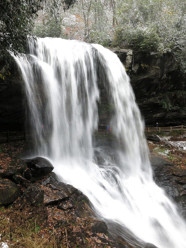
Dry Falls
North Carolina • 75 ft
By Armen Suny · Last verified Mar 2026
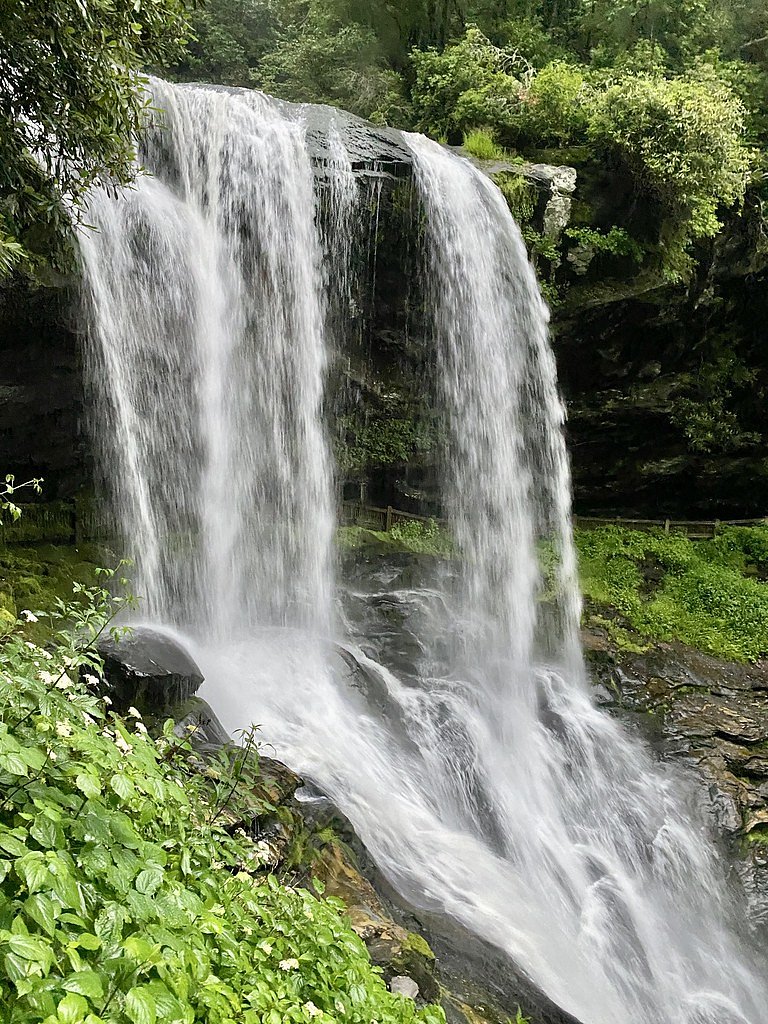
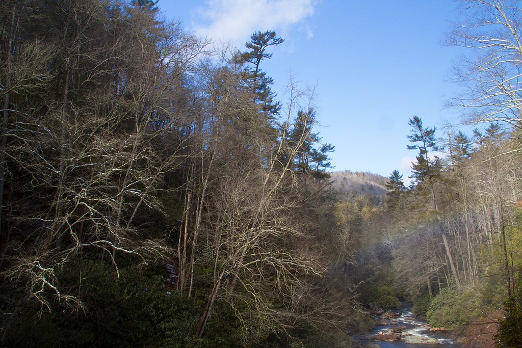
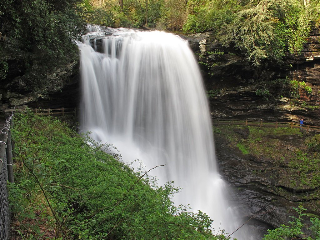
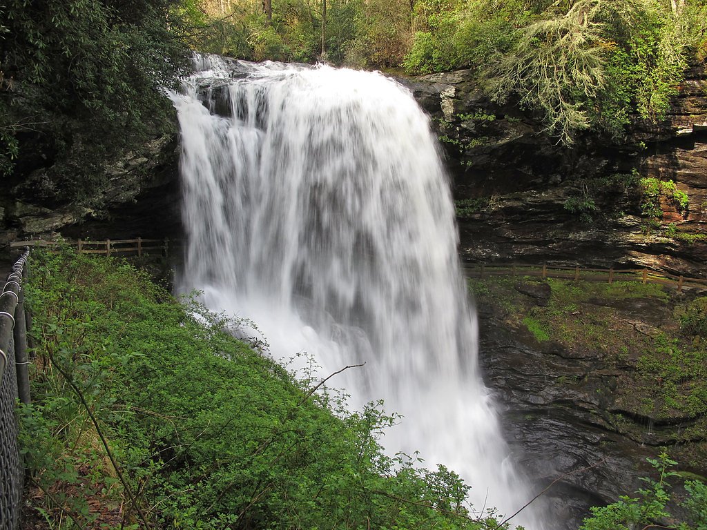

Photo Credits (5)
Difficulty
Easy
Trail Length
0.3 miles
Trail Type
Out And Back
Elevation Gain
50 ft
About Dry Falls
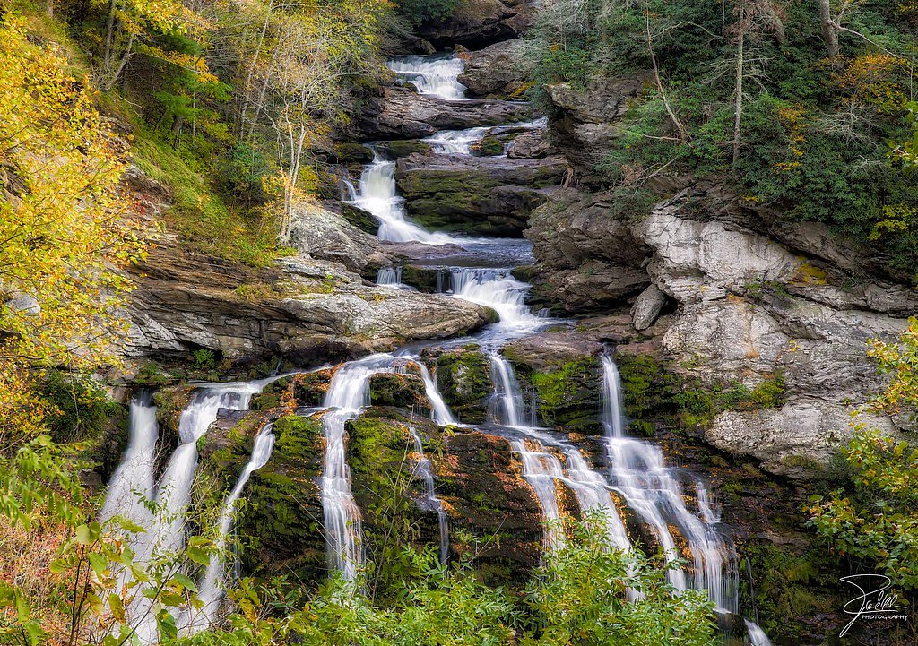
Dry Falls is a stunning 75-foot waterfall located in the Nantahala National Forest near Highlands, North Carolina. Its name comes from the unique feature that allows visitors to walk behind the waterfall without getting wet, depending on water flow conditions. The waterfall is part of the Cullasaja River and is a popular destination for its beauty and accessibility.
The Setting
Dry Falls sits at 3,346 feet within Nantahala National Forest, fed by the Little Tennessee River, in the mountains of North Carolina. The falls drop 75 feet.
Height: 75 feet
Nearby Falls Worth Visiting
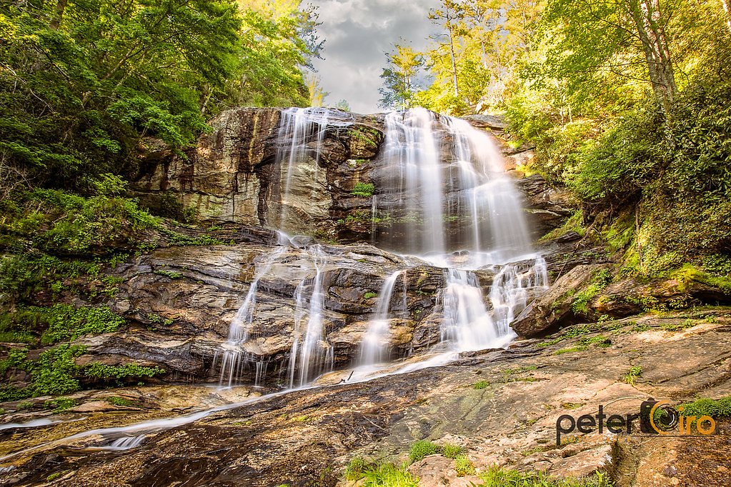
Cullasaja Falls (250 ft) lies 3.8 miles to the northwest. Also nearby: Bridal Veil Falls (45 ft, 0.6 mi).
Trail & Hike Details
The Approach
The easy hike follows Dry Falls (#TR9), a 0.3-mile out-and-back trail over pavement. Expect 50 feet of elevation gain. The trail is highly developed (Class 4).
USFS Trail
DRY FALLS #TR9
Trail Class
Highly Developed
Surface
USFS Segment
0.13 miTrail Description
The trail to Dry Falls is a short, paved path with a slight descent leading to the base of the waterfall. Visitors can walk behind the falls for a unique perspective. The trail is well-maintained and suitable for most visitors, though it may be slippery when wet.
What to Expect
The falls drop 75 feet. Dogs are welcome.
Accessibility
The trail is paved and may be accessible to wheelchairs and strollers. Contact the managing agency to confirm current conditions.
Frequently Asked Questions
🐶 Are Dogs Allowed at Dry Falls?
✅ Dogs are allowed
Are There Any Fees or Permits Required?
🤑 Fee: $3.00
🏊 Is There Swimming at Dry Falls?
❌ Swimming is not allowed
When to Visit
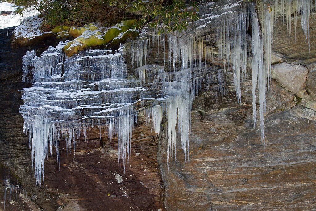
Spring and summer are ideal for lush greenery and higher water flow, while fall offers stunning foliage. Winter visits may provide a quieter experience, but icy conditions are possible.
Seasonal Access
The best time to visit is Spring, Summer, and Fall. Winter access may be limited. Check with Nantahala National Forest for seasonal road closures.
Safety Information
The trail can be slippery, especially near the waterfall. Stay on the designated path and avoid climbing on rocks. Be cautious of sudden weather changes, and do not attempt to swim or wade near the falls.
Current Water Conditions
169 ft³/s
Current discharge — how much water is flowing
Lower than usual for this time of year
Based on 82 years of record
1.67 ft
Water depth at gauge
7-Day Discharge Trend
What does this mean for your visit?
Flow is lower than usual for this time of year.
About This Gauge
This gauge is on a nearby waterway and may not reflect exact conditions at the falls.
7-Day Flow Outlook
Based on the USGS gauge LITTLE TENNESSEE RIVER NEAR PRENTISS, NC (16 km away).
Today
Moderate
193 cfs
6/10Tomorrow
Moderate
204 cfs
6/10Tue
Moderate
202 cfs
6/10Wed
Moderate
198 cfs
6/10Thu
Moderate
214 cfs
6/10Fri
Moderate
195 cfs
6/10Sat
Moderate
194 cfs
6/10Best window: Today — moderate flow, showers and thunderstorms likely (trip score 6/10).
Best time of year: this gauge typically runs highest from mid February to late April, peaking in April.
How we calculate this
This is a transparent outlook, not a precise forecast. We take the waterfall's current flow strength (how it ranks against its historical normal for today, from the nearest USGS stream gauge), carry that ranking forward along the gauge's seasonal curve, and nudge it for forecast rain. Confidence is highest for the next day or two and falls further out. Always check official conditions and your own judgment before visiting — high flows can be dangerous.
Know when to go.
Get a free email alert when waterfalls near Highlands hit peak flow. We only send when conditions are worth the trip — no weekly newsletters, no spam.
Weather Forecast
Location & Access
Getting There
Dry Falls is located off U.S. Highway 64, about 3.5 miles west of Highlands, North Carolina. The parking area is well-marked and easily accessible by car.
Get Directions on Google MapsParking
There is a designated parking area with ample space for visitors. A small fee may be required for parking, so visitors should bring cash.
Elevation
3,346 feet above sea level
Coordinates
35.068529° N, -83.239039° W
Land Management
Managed by USFS
Visitor Tips & Gear
Wear sturdy, non-slip shoes as the trail can be wet and slippery. Arrive early during peak seasons to secure parking. Bring a rain jacket or poncho if you plan to walk behind the falls, as you may get misted. Check weather conditions before visiting, as heavy rain can make the trail more challenging.
As an Amazon Associate, we earn from qualifying purchases.
For this easy 0.3 miles trail, lightweight trail shoes and a water bottle are usually sufficient. Sun exposure on the trail makes good sun protection a must in summer.

Polarized Sunglasses (Knockaround)
Cuts glare off the water so you actually see the falls — and your photos turn out better too.

Columbia Watertight II Rain Jacket
Packs into its own pocket, seam-sealed, and keeps you dry from spray and surprise rain.

Earth Pak Waterproof Dry Bag
Keeps your phone and gear dry when waterfall mist soaks everything else.

Waterproof Phone Pouch (AiRunTech)
Cheap insurance — take photos right next to the falls without killing your phone.

JOBY GorillaPod Starter Kit
Wraps around railings and rocks for long-exposure waterfall shots — no flat surface needed.

Osprey Daylite Daypack
Light, organized, and just the right size for a day hike — fits water, snacks, and layers.
Where to Stay

Fun Pet-Friendly Highlands Retreat w/ Fenced Yard!

Spectacular Mountain Views With Your Own Private Hot Tub!

Red Top Tree House

Chalet at Peek's Creek
Browse vacation cabins and private rentals nearby
Unique outdoor stays — tents, yurts, and treehouses
Rent a campervan or RV for your waterfall road trip
Some links are affiliate links. We may earn a commission at no extra cost to you.
Nearby Campground
West Fork Campground (Clayton, GA)
8.6 miles away · 5 sites
Overview All Campsites at West Fork Campground are reservation only, you must reserve through recreation.gov or by calling 877-444-6777Visitors to this 5-site campground marvel over the picturesque bird's eye view of the world renowned Chattooga Wild and Scenic River. Situated along the west fork of the river, this area offers isolation and adventure all in one. Visitors often comment they feel as though they've been swept back in time and are looking out onto the great frontier of the past when
Book on Recreation.govAdditional Information
Nearby Attractions
Other waterfalls along U.S. Highway 64, such as Bridal Veil Falls and Cullasaja Falls, are worth visiting. The town of Highlands offers dining, shopping, and additional outdoor activities.
Wildlife
The area is home to various bird species, small mammals, and occasional deer. Visitors may also see wildflowers and native plants.
Cities near Dry Falls
Nearby Waterfalls

Writing about Dry Falls? Embed this waterfall on your site for free.