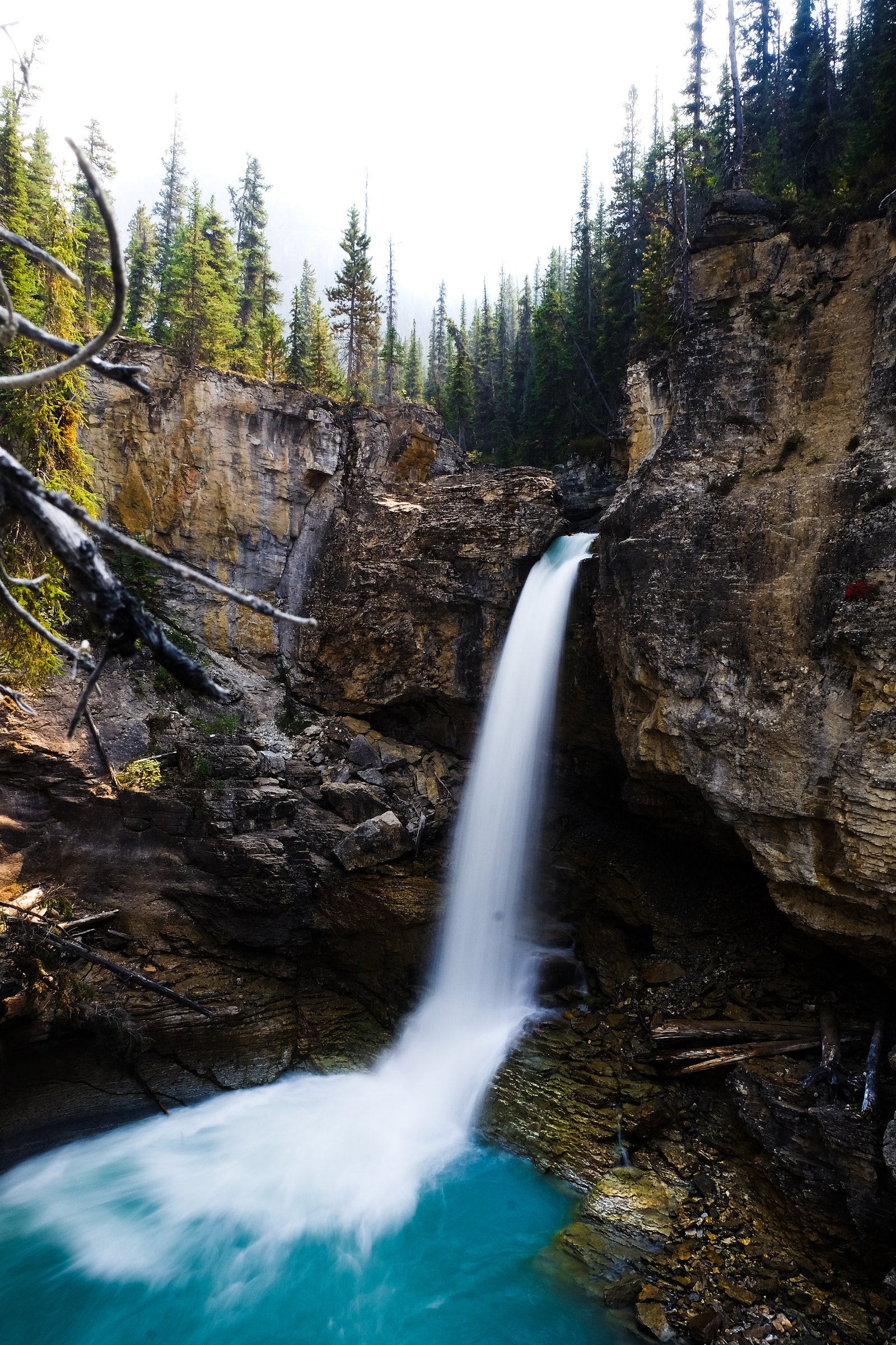
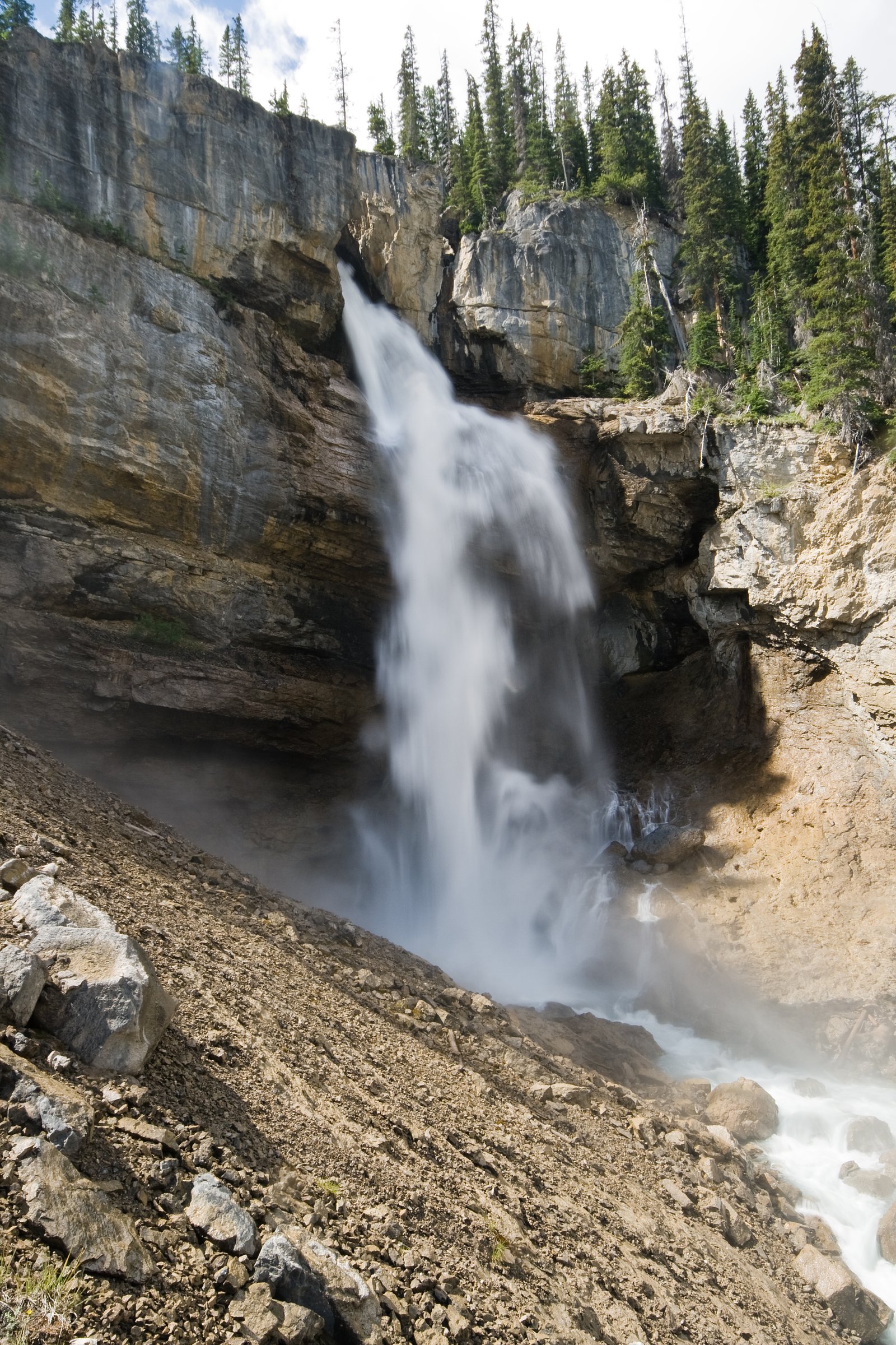
Tangle Creek
Alberta • Jasper National Park • 48 m
By Armen Suny · Last verified Jun 2026
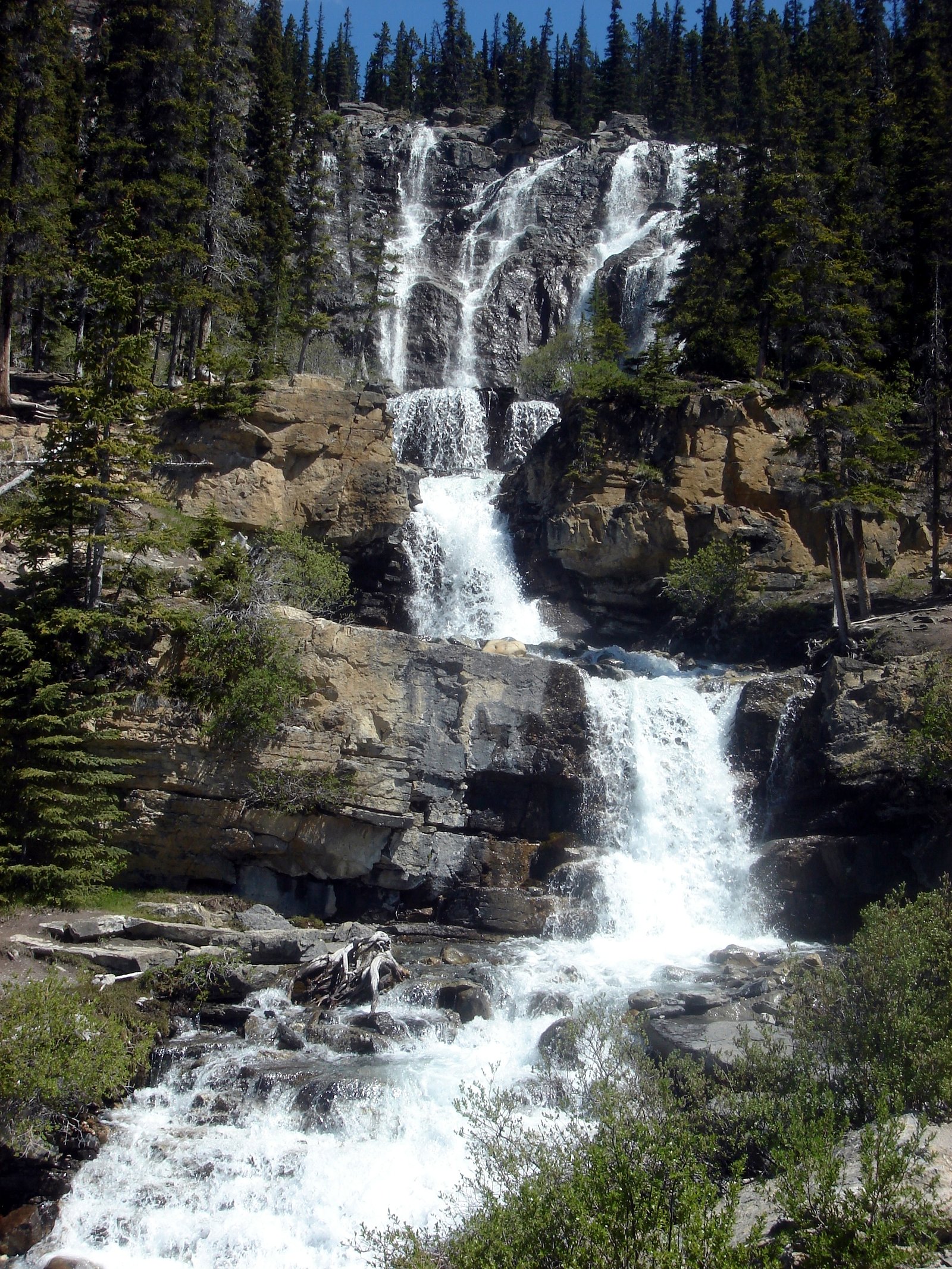
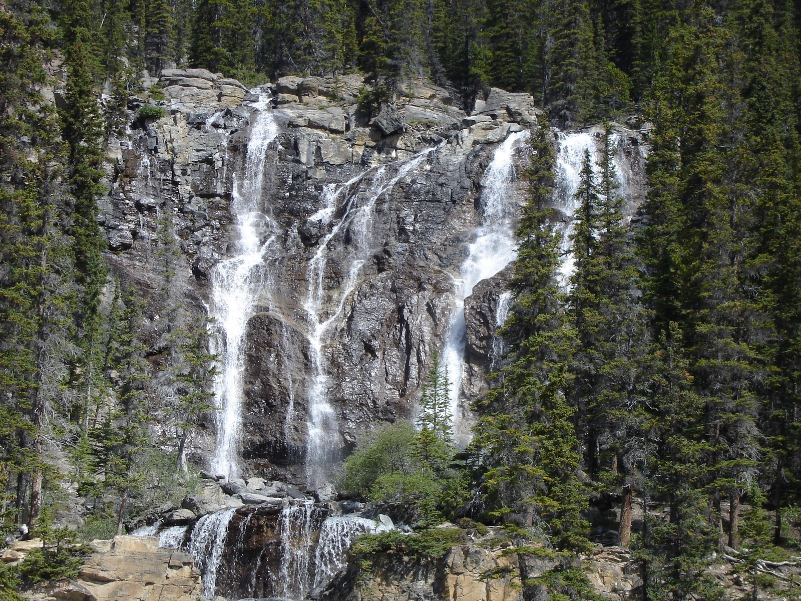
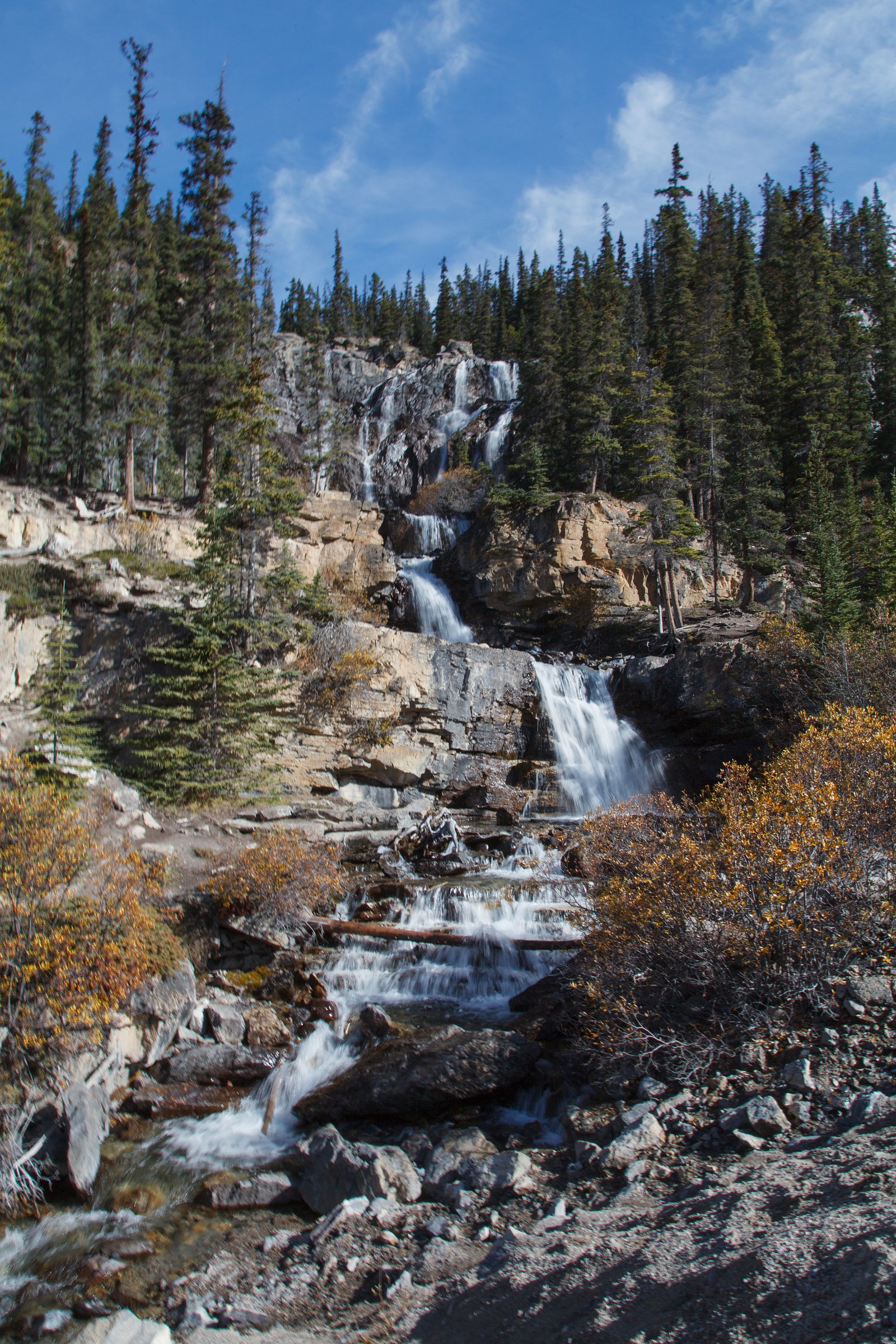
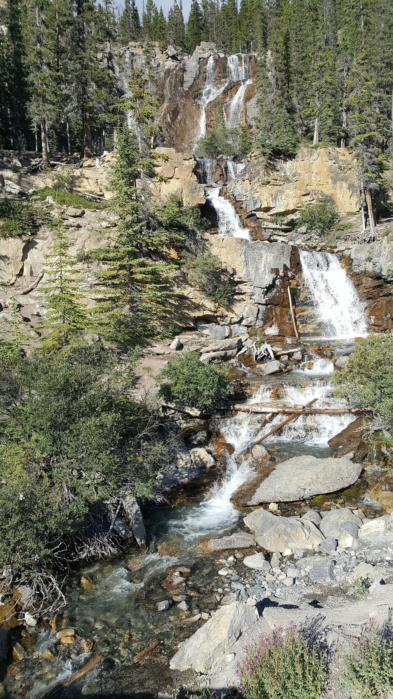
Photo Credits (5)
Difficulty
Drive Up
Trail Length
0.2 km
Trail Type
Out And Back
Elevation Gain
3 m
About Tangle Creek
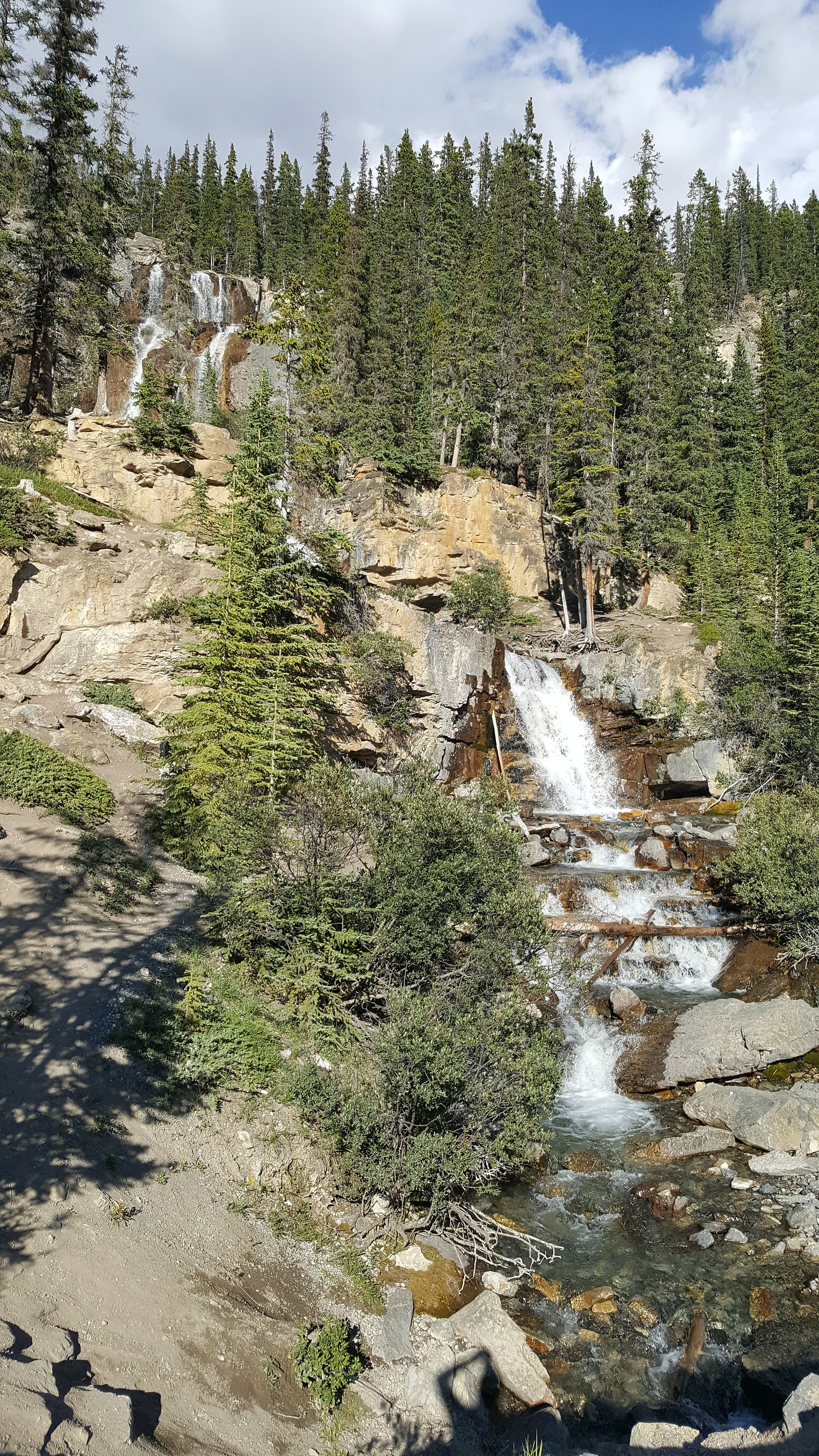
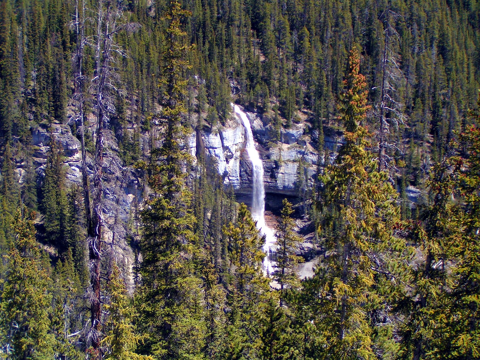
Tangle Creek (often referred to locally as Tangle Falls or Tangle Creek Falls) is a small, multi-tiered cascade located along the Icefields Parkway (Highway 93) in the Jasper/Columbia Icefield region of Alberta. The falls are visible from a roadside pullout and offer a quick, scenic stop for travelers on the parkway. Coordinates provided: 52.2678, -117.2853. The site is roughly 63.8 miles (by road) from the town of Jasper. Exact naming and classification vary between sources; some guides list it as a roadside cascade rather than a large single-drop waterfall.
The Setting
Tangle Creek sits at 1,892 metres within Jasper National Park, in the high mountains of Alberta. At 48 metres, it is among the taller waterfalls in Alberta.
Why This Waterfall Exists
Tangle Creek flows over layered sedimentary rock laid down about 323-419 million years ago. Over time, the stream has worn through these layers at different rates, creating a 159-foot drop that forms the waterfall.
Nearby Falls Worth Visiting
Bridal Veil Falls, the tallest waterfall in Alberta at 366 metres, lies 18.5 kilometres to the east. Also nearby: Panther Falls (66 m, 18.2 km) and Stanley falls (12 m, 6.4 km).
Trail & Hike Details
The Approach
No hiking required. Tangle Creek is accessible by vehicle with a roadside viewing area.
Trail Description
From the small pullout along the Icefields Parkway, a short, mostly flat path (gravel/packed dirt) leads to one or more roadside viewpoints. The walking distance is minimal and the viewpoint is close to the road. Surfaces may be uneven and there may be a few short steps or a slight slope to reach the best vantage points.
What to Expect
The falls plunge 48 metres over layered sedimentary rock.
Accessibility
This waterfall is viewable from a vehicle-accessible area. No hiking is required.
Frequently Asked Questions
🐶 Are Dogs Allowed at Tangle Creek?
❌ Dogs are not allowed
Are There Any Fees or Permits Required?
🆖 No fees required
🏊 Is There Swimming at Tangle Creek?
❌ Swimming is not allowed
When to Visit
Late spring and early summer (snowmelt) usually produce higher flows and more dramatic cascades. Summer offers the most reliable access and mild weather. Fall provides color and fewer crowds. Winter can produce striking ice formations but may limit safe access due to road and trail conditions.
Seasonal Access
The best time to visit is Spring, Summer, Fall, and Winter. Check with Jasper National Park for current conditions.
Safety Information
Hazards: passing traffic, limited roadside parking, wet/slippery rocks near the stream, steep or unstable banks, rapidly changing mountain weather, and wildlife. In winter, icy conditions and reduced visibility increase risk. Carry basic safety equipment, wear appropriate footwear, do not climb on wet or mossy rocks, and keep well back from the water’s edge. Check Parks Canada and Alberta transportation for road and weather advisories before traveling.
Current Water Conditions
8.4 m³/s
Current discharge — how much water is flowing
Much higher than usual for this time of year
Based on 67 years of record
1.17 m
Water depth at gauge
7-Day Discharge Trend
What does this mean for your visit?
The water is flowing much higher than usual, expect an impressive display.
About This Gauge
7-Day Flow Outlook
Based on the WSC gauge SUNWAPTA RIVER AT ATHABASCA GLACIER (7 km away).
Today
Roaring
11 m³/s
6/10Tomorrow
Roaring
10 m³/s
6/10Tue
Roaring
9.6 m³/s
8/10Wed
Roaring
9.7 m³/s
8/10Thu
Roaring
9.7 m³/s
8/10Fri
Roaring
10 m³/s
6/10Sat
Roaring
9.7 m³/s
9/10Best window: Sat — roaring flow, mainly sunny (trip score 9/10).
Best time of year: this gauge typically runs highest from early July to mid August, peaking in July.
How we calculate this
This is a transparent outlook, not a precise forecast. We take the waterfall's current flow strength (how it ranks against its historical normal for today, from the nearest WSC stream gauge), carry that ranking forward along the gauge's seasonal curve, and nudge it for forecast rain. Confidence is highest for the next day or two and falls further out. Always check official conditions and your own judgment before visiting — high flows can be dangerous.
Know when to go.
Get a free email alert when waterfalls near Jasper hit peak flow. We only send when conditions are worth the trip — no weekly newsletters, no spam.
Weather Forecast
Location & Access
Getting There
Tangle Creek is accessed from the Icefields Parkway (Highway 93). From Jasper, drive southeast on Highway 93 for approximately the distance shown (about 63.8 miles). There is a small pullout/parking area on the highway; the falls are viewable from the pullout with a short walk. Always follow highway signs and posted pullout markers.
Get Directions on Google MapsParking
Small roadside pullout/parking area adjacent to the Icefields Parkway. Limited spaces and no formal facilities. Pullouts can fill quickly during peak summer hours; do not stop on the shoulder of the highway.
Elevation
1,892 metres above sea level
Coordinates
52.267803° N, -117.285297° W
Land Management
Managed by Parks Canada Agency
Visitor Tips & Gear
• Use designated pullouts, do not stop in traffic lanes. • Summer: arrive early morning or later afternoon to avoid peak tour-bus traffic. • Winter: road and weather conditions can be hazardous; bring traction devices, check road reports, and exercise extreme caution. • No formal facilities, bring water and pack out trash. • Cell service is intermittent along parts of the Icefields Parkway. • Maintain safe distance from edges and wet rocks; they can be slippery.
This trail sits at 6,207 ft above sea level
Elevated TrailUV radiation is roughly 25% stronger at this elevation than at sea level, and the dry air accelerates dehydration. Extra sun protection and fluids go a long way.
As an Amazon Associate, we earn from qualifying purchases.

Coppertone Sport SPF 50 Sunscreen
UV intensity jumps ~4% per 1,000 ft — at this elevation you can burn in half the time.

Sun Bum SPF 30 Lip Balm (3-Pack)
Lips have almost no natural UV protection and burn fast in thin, dry mountain air.

Liquid I.V. Electrolyte Packets
You lose moisture ~2x faster at elevation — electrolytes help you absorb water efficiently.

ROCKNIGHT Polarized UV400 Sunglasses
High-altitude glare off rock and water is intense — UV400 lenses block 99%+ of UVA/UVB.
As an Amazon Associate, we earn from qualifying purchases.
For this easy 0.2 km trail, lightweight trail shoes and a water bottle are usually sufficient. Icy conditions are common in winter — traction cleats are a smart addition.

Columbia Watertight II Rain Jacket
Packs into its own pocket, seam-sealed, and keeps you dry from spray and surprise rain.

Polarized Sunglasses (Knockaround)
Cuts glare off the water so you actually see the falls — and your photos turn out better too.

Earth Pak Waterproof Dry Bag
Keeps your phone and gear dry when waterfall mist soaks everything else.

Waterproof Phone Pouch (AiRunTech)
Cheap insurance — take photos right next to the falls without killing your phone.

Kahtoola MICROspikes
Cult-favorite traction cleats that grip ice and wet rock — essential for winter waterfall hikes.

JOBY GorillaPod Starter Kit
Wraps around railings and rocks for long-exposure waterfall shots — no flat surface needed.
Where to Stay
Browse vacation cabins and private rentals nearby
Unique outdoor stays — tents, yurts, and treehouses
Rent a campervan or RV for your waterfall road trip
Some links are affiliate links. We may earn a commission at no extra cost to you.
Nearby Campground
Columbia Icefield Campground
7.6 km away
Additional Information
Nearby Attractions
Other Icefields Parkway highlights within driving distance include Sunwapta Falls, Athabasca Falls, Columbia Icefield/Glacier Discovery Centre, Parker Ridge, and scenic viewpoints along the parkway. Exact order and distance depend on direction of travel.
Wildlife
Common sightings along the Icefields Parkway include elk, deer, mountain goats, bighorn sheep, and occasionally moose and bears. Always observe wildlife from a safe distance and do not approach or feed animals.
Cities near Tangle Creek
Nearby Waterfalls
Writing about Tangle Creek? Embed this waterfall on your site for free.