Photo Credits (5)
Difficulty
Easy
Trail Length
1.6 km
Trail Type
Out And Back
Elevation Gain
46 m
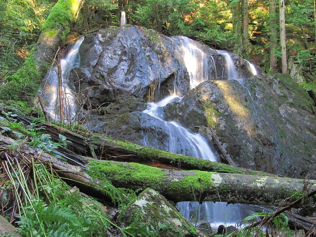
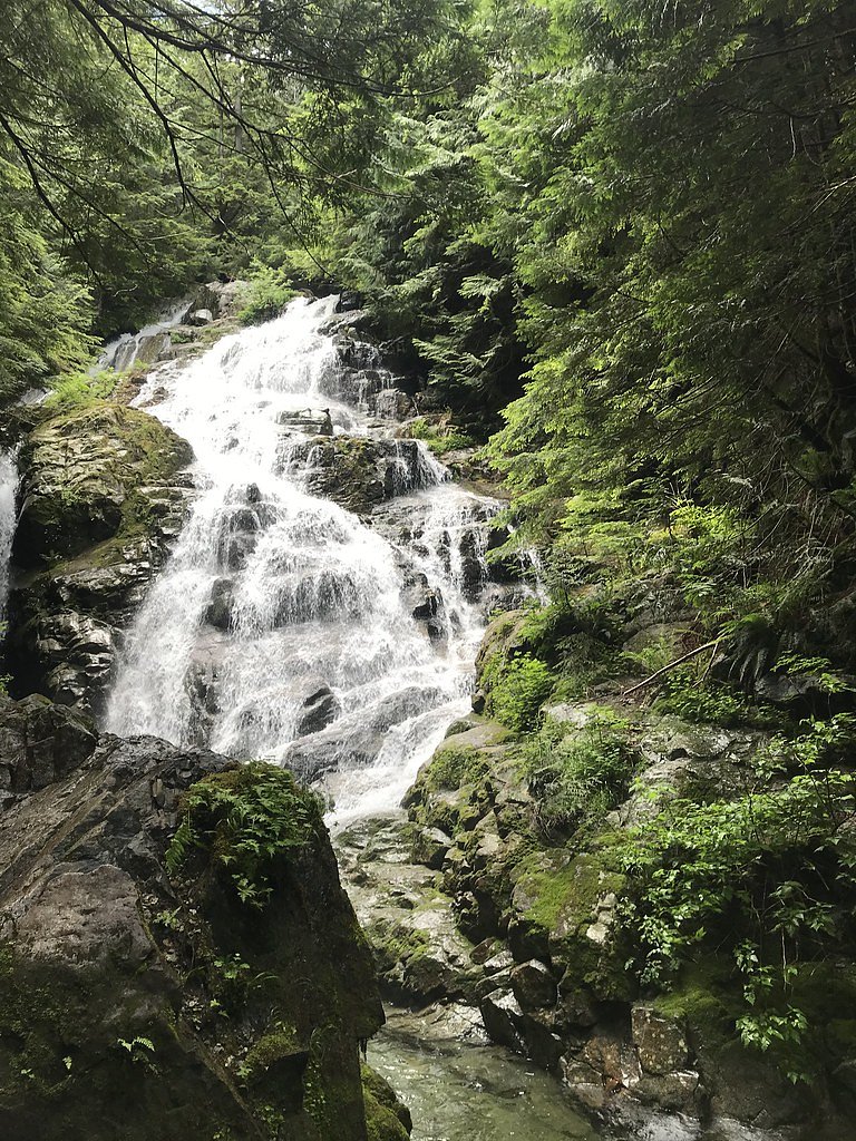
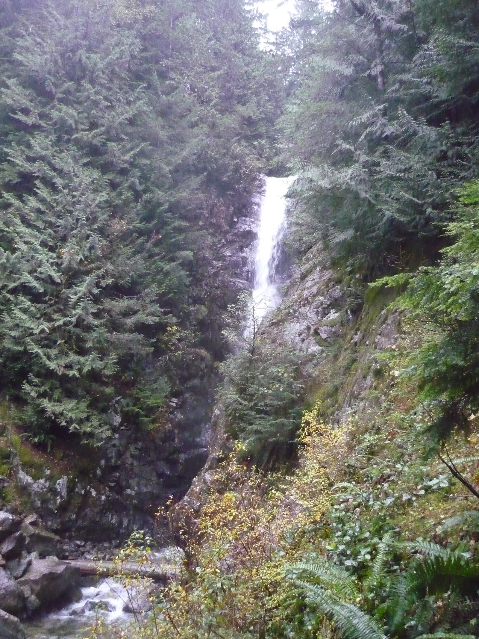
About Twin Falls
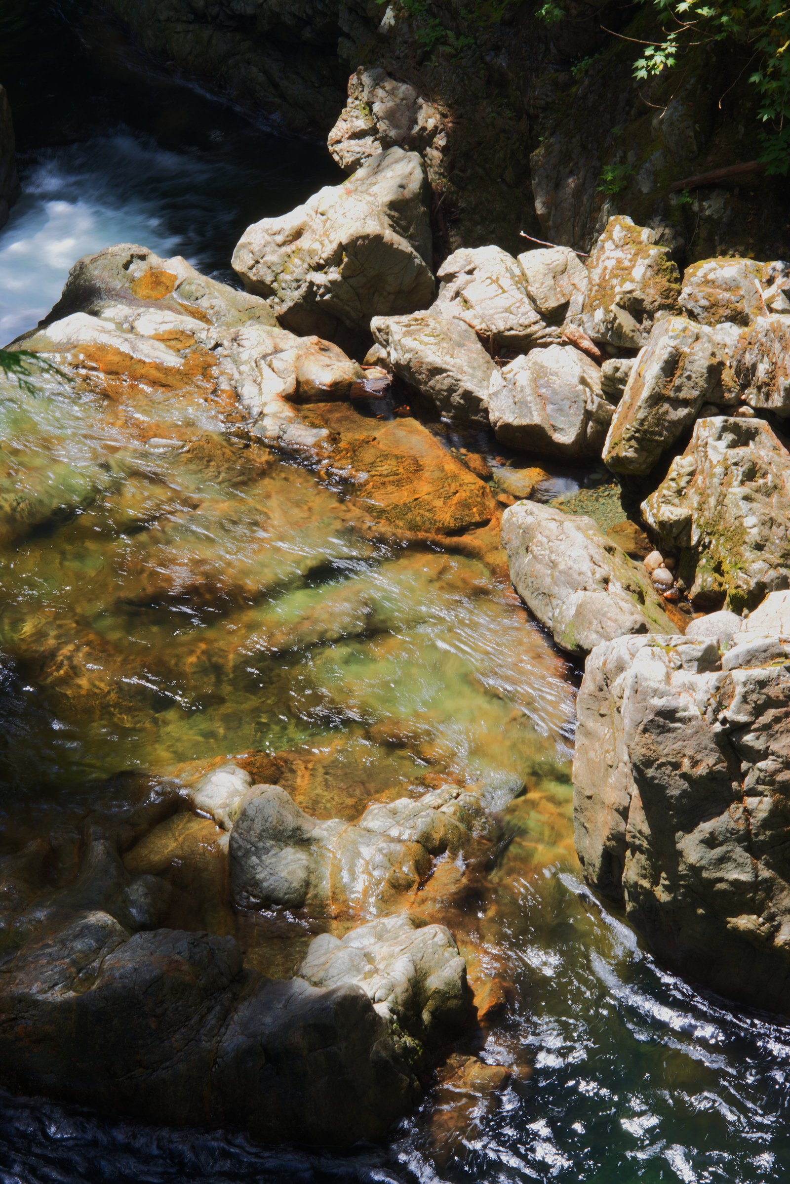
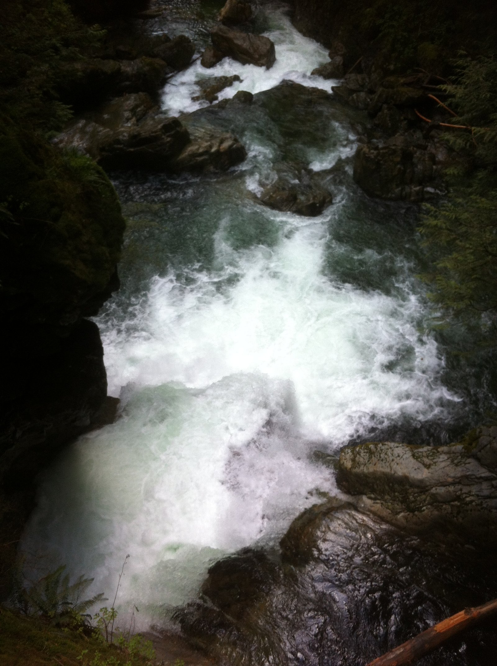
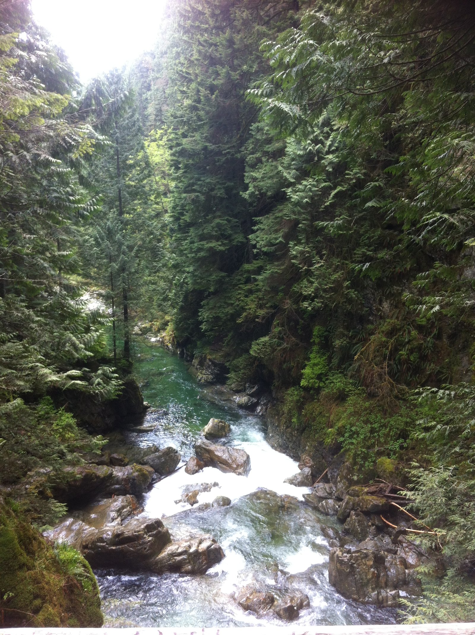
Twin Falls (coordinates 49.3414, -123.016) is a small, forested waterfall located on the North Shore near Vancouver. The falls are set in a typical coastal temperate rainforest environment with a short trail that follows a stream through cedars and firs. Water flow is seasonal and typically highest in spring and after heavy rain. Specific published measurements for the falls' height are not consistently reported; visitors generally describe it as a modest multi-tiered cascade rather than a single tall drop.
Why This Waterfall Exists
Twin Falls flows over loose river sediment, primarily alluvium, laid down about 3 million years ago. These soft rocks erode readily, allowing the stream to carve a vertical drop into the landscape.
Nearby Falls Worth Visiting
Norvan Falls (22 m) lies 8.2 kilometres to the north. Also nearby: Upper Norvan Falls (20 m, 8.4 km).
Trail & Hike Details
The Approach
The easy 1.6-km out-and-back trail gains 46 metres of elevation on the way to the falls.
Trail Description
The walk to Twin Falls is a short, mostly forested trail that follows a creek. Expect a combination of packed dirt, roots, occasional rock steps and short stair sections. The route is generally suitable for families and casual hikers but can be muddy and slippery after rain. The approach usually brings you to viewing locations above or beside the cascade rather than extensive developed infrastructure.
What to Expect
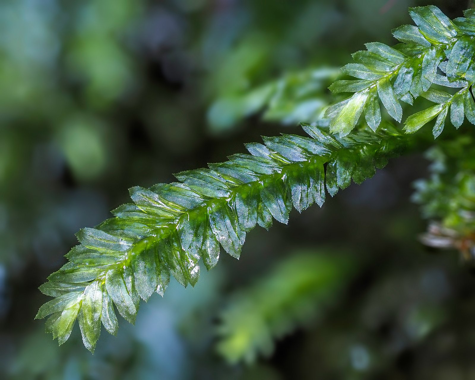
A shaded, mossy forest setting with a small cascade. Flow varies seasonally, high in spring/runoff and after heavy rains, lower in dry summer periods. Trails can be wet, muddy and slippery; fallen logs, exposed roots and narrow sections are common. Expect limited facilities and possibly other day visitors on weekends.
Accessibility
The trail is not wheelchair accessible. Uneven terrain and elevation changes require steady footing.
Frequently Asked Questions
🐶 Are Dogs Allowed at Twin Falls?
❌ Dogs are not allowed
Are There Any Fees or Permits Required?
🆖 No fees required
🏊 Is There Swimming at Twin Falls?
❌ Swimming is not allowed
When to Visit
Late winter and spring typically offer the best water flow. For fewer people and milder conditions, visit weekday mornings. Avoid visiting right after heavy rain if you are not experienced with slippery or flooded trails.
Seasonal Access
The best time to visit is Spring, Summer, and Fall. Winter access may be limited. Check with the managing park or local authority for current conditions.
Safety Information
Hazards include slippery rocks and roots, steep or unstable stream banks, rapidly changing water levels after rain, cold water temperatures, and limited cell service in parts. Use caution near the water, keep children close to trails, and avoid cliff edges. In winter, trails can be icy, traction devices are recommended. If unsure of conditions, postpone the visit.
Current Water Conditions
2.1 m³/s
Current discharge — how much water is flowing
Lower than usual for this time of year
Based on 95 years of record
0.85 m
Water depth at gauge
7-Day Discharge Trend
What does this mean for your visit?
Flow is lower than usual for this time of year.
About This Gauge
7-Day Flow Outlook
Based on the WSC gauge SEYMOUR RIVER NEAR NORTH VANCOUVER (1 km away).
Today
Low
2.1 m³/s
5/10Tomorrow
Low
1.9 m³/s
5/10Tue
Low
1.8 m³/s
5/10Wed
Low
1.7 m³/s
5/10Thu
Moderate
1.8 m³/s
5/10Fri
Moderate
1.7 m³/s
6/10Sat
Moderate
1.7 m³/s
5/10Best window: Fri — moderate flow, cloudy (trip score 6/10).
Best time of year: this gauge typically runs highest from late April to late June, peaking in May.
How we calculate this
This is a transparent outlook, not a precise forecast. We take the waterfall's current flow strength (how it ranks against its historical normal for today, from the nearest WSC stream gauge), carry that ranking forward along the gauge's seasonal curve, and nudge it for forecast rain. Confidence is highest for the next day or two and falls further out. Always check official conditions and your own judgment before visiting — high flows can be dangerous.
Know when to go.
Get a free email alert when waterfalls near Vancouver hit peak flow. We only send when conditions are worth the trip — no weekly newsletters, no spam.
Weather Forecast
Location & Access
Getting There
The falls are on the North Shore near Lynn Valley / North Vancouver (approx. 9–10 miles from downtown Vancouver). Use the provided coordinates (49.3414, -123.016) for the trailhead. Expect narrow local roads and limited signage; a short drive from major connector roads. Public transit may get you close but a final short drive or walk is usually required.
Get Directions on Google MapsParking
Small parking areas or street parking may be available near the trailhead. Parking is often limited, especially on weekends and in good weather. Park responsibly and obey posted restrictions. Consider arriving early on busy days.
Elevation
137 metres above sea level
Coordinates
49.341426° N, -123.015992° W
Visitor Tips & Gear
• Wear sturdy, grippy footwear, trails and rocks can be very slippery. • Check recent weather and local trail reports; flow and access change with conditions. • Arrive early on weekends to secure parking and avoid crowds. • Stay on designated trails and respect signage, stream banks and rocks are unstable. • Leave no trace and pack out any trash. • Mobile reception may be limited in some spots; let someone know your plan if hiking alone.
As an Amazon Associate, we earn from qualifying purchases.
This easy 1.6 km hike is straightforward — comfortable trail shoes and plenty of water should do. Sun exposure on the trail makes good sun protection a must in summer.

Polarized Sunglasses (Knockaround)
Cuts glare off the water so you actually see the falls — and your photos turn out better too.

Columbia Watertight II Rain Jacket
Packs into its own pocket, seam-sealed, and keeps you dry from spray and surprise rain.

Earth Pak Waterproof Dry Bag
Keeps your phone and gear dry when waterfall mist soaks everything else.

Waterproof Phone Pouch (AiRunTech)
Cheap insurance — take photos right next to the falls without killing your phone.

JOBY GorillaPod Starter Kit
Wraps around railings and rocks for long-exposure waterfall shots — no flat surface needed.

Osprey Daylite Daypack
Light, organized, and just the right size for a day hike — fits water, snacks, and layers.
Where to Stay
Browse vacation cabins and private rentals nearby
Unique outdoor stays — tents, yurts, and treehouses
Rent a campervan or RV for your waterfall road trip
Some links are affiliate links. We may earn a commission at no extra cost to you.
Nearby Campground
Mount Seymour Group Campsite
5.2 km away
Additional Information
Nearby Attractions
Nearby North Shore attractions may include Lynn Canyon Park and its suspension bridge and trails, various short coastal rainforest trails, and regional parks on the North Shore. Exact nearby features depend on the precise local parking/trailhead used.
Wildlife
Typical coastal temperate rainforest wildlife, birds, small mammals (squirrels, raccoons), deer. Black bears and cougars are present in the broader region but encounters are uncommon in well-used day-use areas; always store food securely and follow wildlife safety guidance.
Cities near Twin Falls
Nearby Waterfalls

Other waterfalls named Twin Falls
21 other waterfalls share this name across Canada.
Writing about Twin Falls? Embed this waterfall on your site for free.