Photo Credits (2)
Difficulty
Moderate
Trail Length
10.0 km
Trail Type
Loop
Elevation Gain
443 m
About Mystery Falls
Mystery Falls (coordinates ~49.346, -122.9767) is a small, locally known waterfall in the South Surrey/White Rock area of British Columbia near the Canada–U.S. border. Publicly available, authoritative information about this specific waterfall is limited. Reports from local visitors suggest a woodland setting with a seasonal stream and modest cascades rather than a large plunge. Access, exact height, and official management (park vs. private land) are not well documented; some descriptions indicate it may be best visited after spring snowmelt or significant rainfall for stronger flow.
Why This Waterfall Exists
Mystery Falls flows over hard intrusive rock laid down about 66-101 million years ago. These resistant rocks form a durable ledge that water cannot easily wear away, creating the falls where softer material downstream has already eroded.
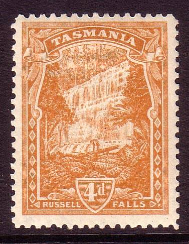
Nearby Falls Worth Visiting
Russell Falls (25 m) lies 6.6 kilometres to the northeast. Also nearby: Sunshine Falls (12 m, 4.5 km).
Trail & Hike Details
The Approach
The moderate 10.0-km loop trail gains 443 metres of elevation on the way to the falls.
Trail Description
Specific trail details for Mystery Falls are not well documented. Visitor accounts for comparable small waterfalls in the South Surrey area typically describe short, sometimes informal forest trails that may be muddy, rooty, and narrow. Trails may be unblazed and can include short steep sections, requiring careful footing. If an official park trail exists nearby, use marked trails and trailheads. If you cannot find an established trailhead, local parks, visitor centers, or municipal websites for Surrey/White Rock may provide guidance.
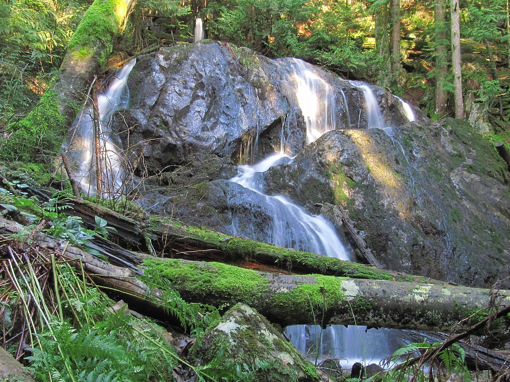
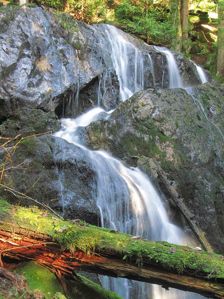
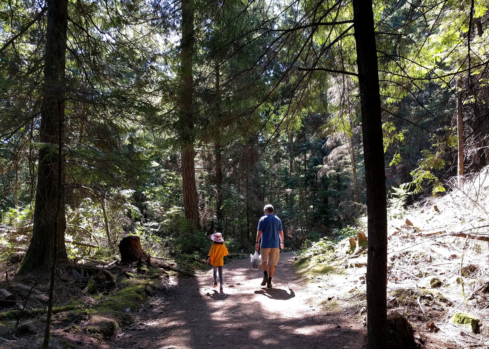
What to Expect
Expect a modest cascade or series of small drops rather than a large, single-drop waterfall. Flow is likely seasonal, highest in spring and after heavy rain and reduced in late summer. Surroundings are likely temperate coastal forest with moss, ferns, and mixed conifer/deciduous trees. Terrain may include wet rock, fallen logs, and muddy sections. Cell service may be intermittent in heavily treed ravines.
Accessibility
The trail involves steep, uneven terrain with significant elevation change and is not accessible to mobility devices.
Frequently Asked Questions
🐶 Are Dogs Allowed at Mystery Falls?
❌ Dogs are not allowed
Are There Any Fees or Permits Required?
🆖 No fees required
🏊 Is There Swimming at Mystery Falls?
❌ Swimming is not allowed
When to Visit
Spring (late March–May) and after heavy rains are typically best for water flow. Summer offers easier hiking conditions but reduced flow. Avoid visiting during or immediately after severe storms when flashier streams can pose hazards.
Seasonal Access
The best time to visit is Spring, Summer, and Fall. Winter access may be limited. Check with the managing park or local authority for current conditions.
Safety Information
Hazards may include slippery rocks, steep or unstable banks, flashier stream flows after heavy rain, and fall risk near edges. Because official information is limited, conditions may change (e.g., logging, trail washouts, or private property closures). Stay on established trails, keep a safe distance from the water and edges, and avoid visiting alone if possible. Be mindful of border proximity, do not cross international boundaries inadvertently.
Current Water Conditions
2.1 m³/s
Current discharge — how much water is flowing
Lower than usual for this time of year
Based on 95 years of record
0.85 m
Water depth at gauge
7-Day Discharge Trend
What does this mean for your visit?
Flow is lower than usual for this time of year.
About This Gauge
7-Day Flow Outlook
Based on the WSC gauge SEYMOUR RIVER NEAR NORTH VANCOUVER (2 km away).
Today
Low
2.1 m³/s
5/10Tomorrow
Low
1.9 m³/s
5/10Tue
Low
1.8 m³/s
5/10Wed
Low
1.7 m³/s
5/10Thu
Low
1.7 m³/s
5/10Fri
Low
1.6 m³/s
5/10Sat
Moderate
1.7 m³/s
5/10Best window: Today — low flow, fog (trip score 5/10).
Best time of year: this gauge typically runs highest from late April to late June, peaking in May.
How we calculate this
This is a transparent outlook, not a precise forecast. We take the waterfall's current flow strength (how it ranks against its historical normal for today, from the nearest WSC stream gauge), carry that ranking forward along the gauge's seasonal curve, and nudge it for forecast rain. Confidence is highest for the next day or two and falls further out. Always check official conditions and your own judgment before visiting — high flows can be dangerous.
Know when to go.
Get a free email alert when waterfalls near Vancouver hit peak flow. We only send when conditions are worth the trip — no weekly newsletters, no spam.
Weather Forecast
Location & Access
Getting There
Approximate location: 49.346 N, -122.9767 W, roughly 11–28 miles from nearby population centers (Vancouver, Point Roberts, Blaine). Getting there typically requires driving to the South Surrey / White Rock area and following local roads or unmarked forest tracks. Exact trailhead information is not confirmed; visitors should confirm access locally (municipal parks, Crown land status, or private-property restrictions) before travel. Because this site is close to the Canada–U.S. border, be aware of border-crossing regulations if approaching from the U.S. side.
Get Directions on Google MapsParking
Parking details are unclear. Visitor reports for similar small local waterfalls often note limited roadside parking or small pullouts and recommend using official parking areas for nearby parks if available. Do not block driveways or private roads; parking may be restricted or limited.
Elevation
536 metres above sea level
Coordinates
49.345973° N, -122.976655° W
Visitor Tips & Gear
1) Verify access before visiting, the waterfall may be on or near private property. 2) Wear sturdy, waterproof footwear with good traction; rocks will be slippery. 3) Stay on established trails where present; avoid creating new paths and minimize erosion. 4) Carry a map or GPS and note the coordinates before you go. 5) Be respectful of local residents and posted signs. 6) If visiting in high flow conditions, keep a safe distance from the cascade and unstable banks.
As an Amazon Associate, we earn from qualifying purchases.
With 10.0 km and 443 m of elevation gain, sturdy boots and trekking poles will help on this moderate trail. Sun exposure on the trail makes good sun protection a must in summer.

Polarized Sunglasses (Knockaround)
Cuts glare off the water so you actually see the falls — and your photos turn out better too.

Columbia Watertight II Rain Jacket
Packs into its own pocket, seam-sealed, and keeps you dry from spray and surprise rain.

Earth Pak Waterproof Dry Bag
Keeps your phone and gear dry when waterfall mist soaks everything else.

Waterproof Phone Pouch (AiRunTech)
Cheap insurance — take photos right next to the falls without killing your phone.

Timberland Euro Sprint Mid Waterproof
Trusted waterproof boot with premium leather and grippy rubber sole — reliable on rocky, wet trails.

TrailBuddy Trekking Poles
Lightweight aluminum, cork grips, and flip-locks that actually hold — a best-seller for good reason.
Where to Stay
Browse vacation cabins and private rentals nearby
Unique outdoor stays — tents, yurts, and treehouses
Rent a campervan or RV for your waterfall road trip
Some links are affiliate links. We may earn a commission at no extra cost to you.
Nearby Campground
Mount Seymour Group Campsite
2.4 km away
Additional Information
Nearby Attractions
Nearby population centers and points of interest include South Surrey/White Rock (beaches and waterfront), Boundary Bay Regional Park, and proximity to the Canada–U.S. border (Peace Arch and Pacific Highway border crossings). Vancouver is the nearest major city.
Wildlife
Typical coastal British Columbia wildlife may be present: songbirds, small mammals (squirrels, raccoons), deer, and potentially coyotes. Ticks, mosquitoes, and black bears are possible in some forested areas, check local advisories.
Cities near Mystery Falls
Nearby Waterfalls
Other waterfalls named Mystery Falls
2 other waterfalls share this name across Canada.
Writing about Mystery Falls? Embed this waterfall on your site for free.