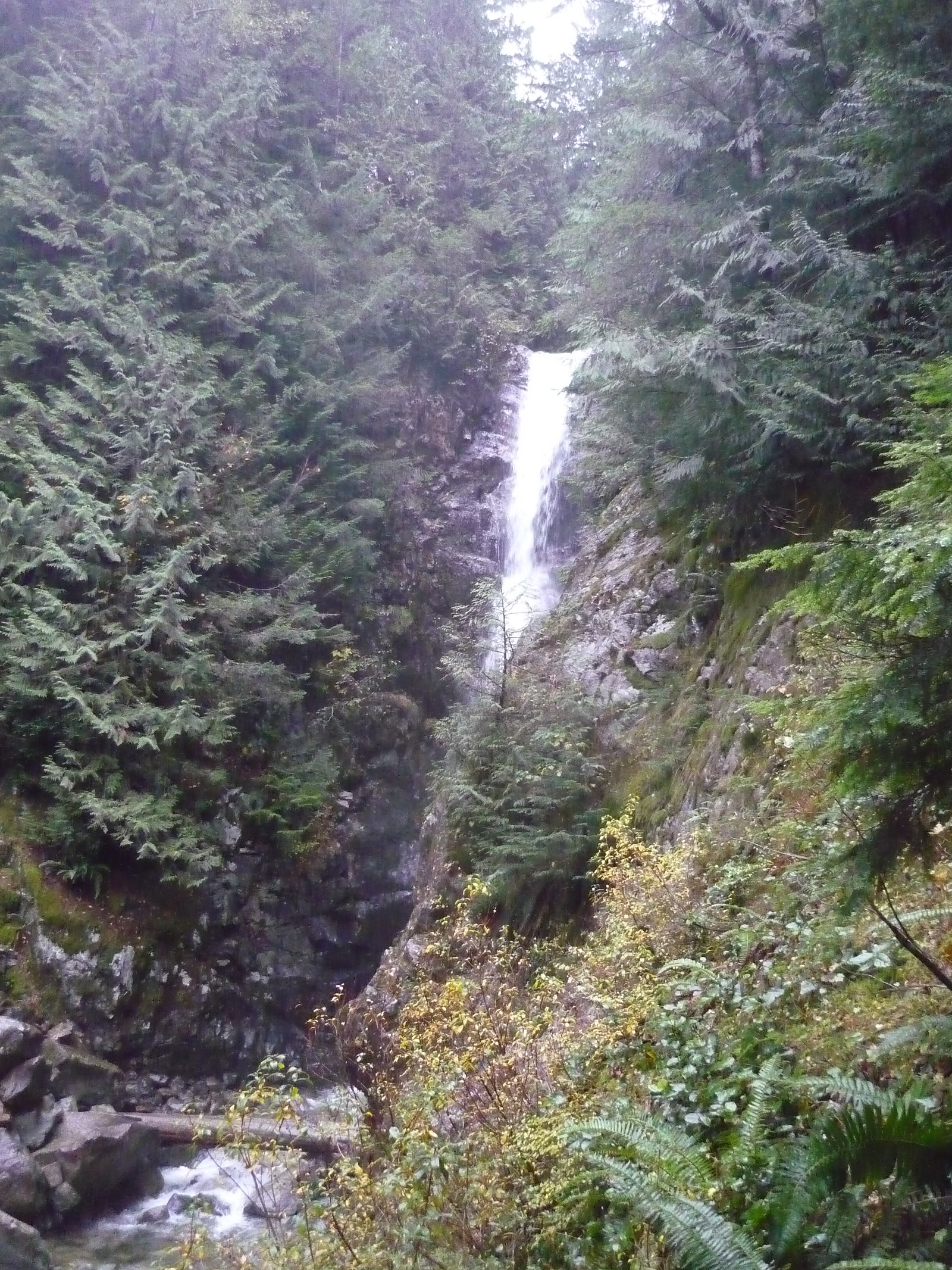
Upper Norvan Falls
British Columbia • 20 m
By Armen Suny · Last verified Jun 2026

Photo Credits (1)
Difficulty
Moderate
Trail Length
14.0 km
Trail Type
Out And Back
Elevation Gain
195 m
About Upper Norvan Falls
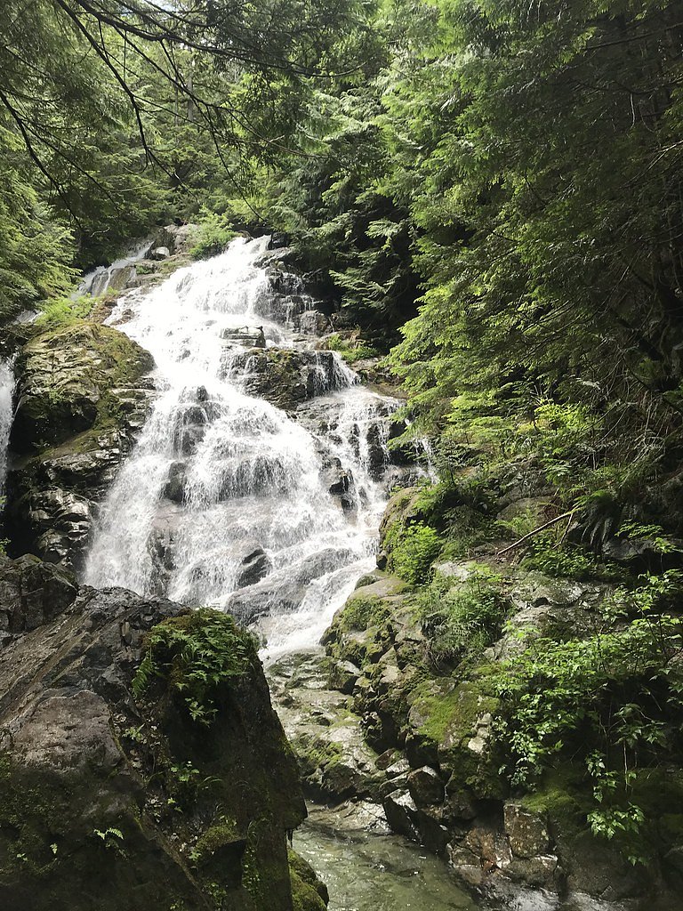
Upper Norvan Falls is one of the cascades on the Norvan River system in the North Vancouver hills just north of the city of Vancouver. The falls are reached via trails that climb through coastal temperate forest and alpine-like ridgelines; upper cascades beyond the main Norvan Falls are less visited and may require route-finding or short scrambles. Conditions can vary seasonally with high flows in spring and lower flows in late summer.
The Setting
Upper Norvan Falls sits at 552 metres in the hills of British Columbia. The falls drop 20 metres.
Why This Waterfall Exists
Upper Norvan Falls flows over hard intrusive rock laid down about 66-145 million years ago. These resistant rocks form a durable ledge that water cannot easily wear away, creating a 65-foot drop where softer material downstream has already eroded.
Trail & Hike Details
The Approach
The moderate 14.0-km out-and-back trail gains 195 metres of elevation on the way to the falls.
Trail Description
Trails to Norvan Falls typically begin on well-used forest trails that gain elevation through mixed second-growth and mature forest. The route to the main Norvan Falls is on maintained trail for much of the way, with some sections of roots, rocks and short steep pitches. Reaching upper cascades may require following less-defined side trails, streamside scrambling, or short route-finding. Expect muddy sections after rain and exposed roots/rocks on steeper pitches. Trail signage varies; carry a map or download an offline trail map and follow established paths to minimize environmental impact.
What to Expect
The falls drop 20 metres over hard intrusive rock.
Accessibility
The trail is not wheelchair accessible. Uneven terrain and elevation changes require steady footing.
Frequently Asked Questions
🐶 Are Dogs Allowed at Upper Norvan Falls?
❌ Dogs are not allowed
Are There Any Fees or Permits Required?
🆖 No fees required
🏊 Is There Swimming at Upper Norvan Falls?
❌ Swimming is not allowed
When to Visit
Late spring (snowmelt) for the most impressive flows and wildflowers, early summer for generally good trail conditions, and fall for cooler temperatures and foliage. Winter access is possible but trails can be icy or snow-covered; extra caution and traction devices may be required.
Seasonal Access
The best time to visit is Spring, Summer, Fall, and Winter. Check with the managing park or local authority for current conditions.
Safety Information
Hazards include slippery rocks and roots, steep drop-offs near cascades, fast-moving water and cold pools, changing weather, and possible limited cellphone reception. Wear appropriate footwear, avoid getting too close to edges, do not climb wet rocks near the falls, and do not attempt river crossings during high flows. If hiking in winter or early spring, expect icy sections and consider traction devices. Carry a basic first-aid kit and tell someone your route and expected return time.
Current Water Conditions
1.0 m³/s
Current discharge — how much water is flowing
Much lower than usual for this time of year
Based on 13 years of record
1.61 m
Water depth at gauge
7-Day Discharge Trend
What does this mean for your visit?
Flow is well below normal for this time of year, so the waterfall may be a trickle.
About This Gauge
7-Day Flow Outlook
Based on the WSC gauge CAPILANO RIVER ABOVE EASTCAP CREEK (7 km away).
Today
Barely Flowing
0.9 m³/s
4/10Tomorrow
Barely Flowing
1.0 m³/s
4/10Tue
Barely Flowing
1.0 m³/s
4/10Wed
Barely Flowing
1.1 m³/s
4/10Thu
Barely Flowing
1.0 m³/s
3/10Fri
Barely Flowing
0.8 m³/s
4/10Sat
Barely Flowing
0.8 m³/s
3/10Best window: Today — barely flowing flow, fog (trip score 4/10).
Best time of year: this gauge typically runs highest from mid May to mid June, peaking in November.
How we calculate this
This is a transparent outlook, not a precise forecast. We take the waterfall's current flow strength (how it ranks against its historical normal for today, from the nearest WSC stream gauge), carry that ranking forward along the gauge's seasonal curve, and nudge it for forecast rain. Confidence is highest for the next day or two and falls further out. Always check official conditions and your own judgment before visiting — high flows can be dangerous.
Know when to go.
Get a free email alert when waterfalls near Vancouver hit peak flow. We only send when conditions are worth the trip — no weekly newsletters, no spam.
Weather Forecast
Location & Access
Getting There
The falls are located in the North Vancouver / Lynn Headwaters area north of Vancouver (coordinates ~49.4163, -123.0282). Access is typically from trailheads in the Lynn Valley / Lynn Headwaters corridor. Expect a drive from central Vancouver of roughly 20–40 minutes depending on traffic. Public transit options to nearby trailheads are limited; many visitors drive or use ride services to reach trailhead parking.
Get Directions on Google MapsParking
Parking at trailheads in the Lynn Headwaters/Norvan area is limited and can fill early on weekends and holidays. Some trailheads have small municipal or park parking areas; overflow parking on nearby streets may be restricted. Plan to arrive early and be prepared for a short additional walk if parking is full.
Elevation
552 metres above sea level
Coordinates
49.416282° N, -123.028246° W
Visitor Tips & Gear
1) Arrive early on weekends to secure parking. 2) Wear sturdy, broken-in hiking shoes with good traction, sections can be slippery. 3) Carry the 10 essentials (water, layers, rain protection, map, first-aid). 4) Stay on established trails to protect sensitive vegetation and avoid unstable slopes. 5) Check recent trip reports or local trail resources for trail conditions, closures, and river level warnings before you go. 6) Leave no trace and pack out all waste.
As an Amazon Associate, we earn from qualifying purchases.
With 14.0 km and 195 m of elevation gain, sturdy boots and trekking poles will help on this moderate trail. Icy conditions are common in winter — traction cleats are a smart addition.

Columbia Watertight II Rain Jacket
Packs into its own pocket, seam-sealed, and keeps you dry from spray and surprise rain.

Polarized Sunglasses (Knockaround)
Cuts glare off the water so you actually see the falls — and your photos turn out better too.

Earth Pak Waterproof Dry Bag
Keeps your phone and gear dry when waterfall mist soaks everything else.

Waterproof Phone Pouch (AiRunTech)
Cheap insurance — take photos right next to the falls without killing your phone.

Timberland Euro Sprint Mid Waterproof
Trusted waterproof boot with premium leather and grippy rubber sole — reliable on rocky, wet trails.

TrailBuddy Trekking Poles
Lightweight aluminum, cork grips, and flip-locks that actually hold — a best-seller for good reason.
Where to Stay
Browse vacation cabins and private rentals nearby
Unique outdoor stays — tents, yurts, and treehouses
Rent a campervan or RV for your waterfall road trip
Some links are affiliate links. We may earn a commission at no extra cost to you.
Nearby Campground
Mount Seymour Group Campsite
8.6 km away
Additional Information
Nearby Attractions
Lynn Canyon Suspension Bridge and regional trails in North Vancouver, Lower Seymour Conservation Reserve trails, and nearby provincial/municipal parks and viewpoints. Grouse Mountain and Capilano areas are also within a broader visitor region north of Vancouver.
Wildlife
Typical coastal temperate forest wildlife: black-tailed deer, bird species, small mammals, and occasionally black bears and coyotes. Ticks and biting insects can be present in warmer months. Keep food secured and observe wildlife from a distance.
Cities near Upper Norvan Falls
Nearby Waterfalls

Writing about Upper Norvan Falls? Embed this waterfall on your site for free.