

Photo Credits (5)
Difficulty
Moderate
Trail Length
2.4 miles
Trail Type
Out And Back
Elevation Gain
350 ft
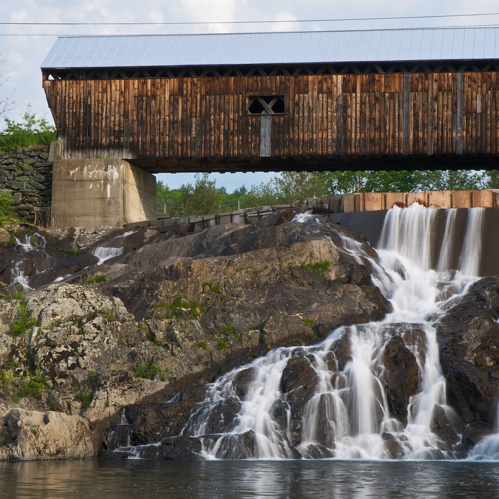
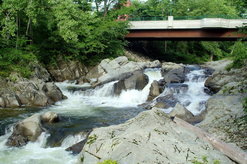
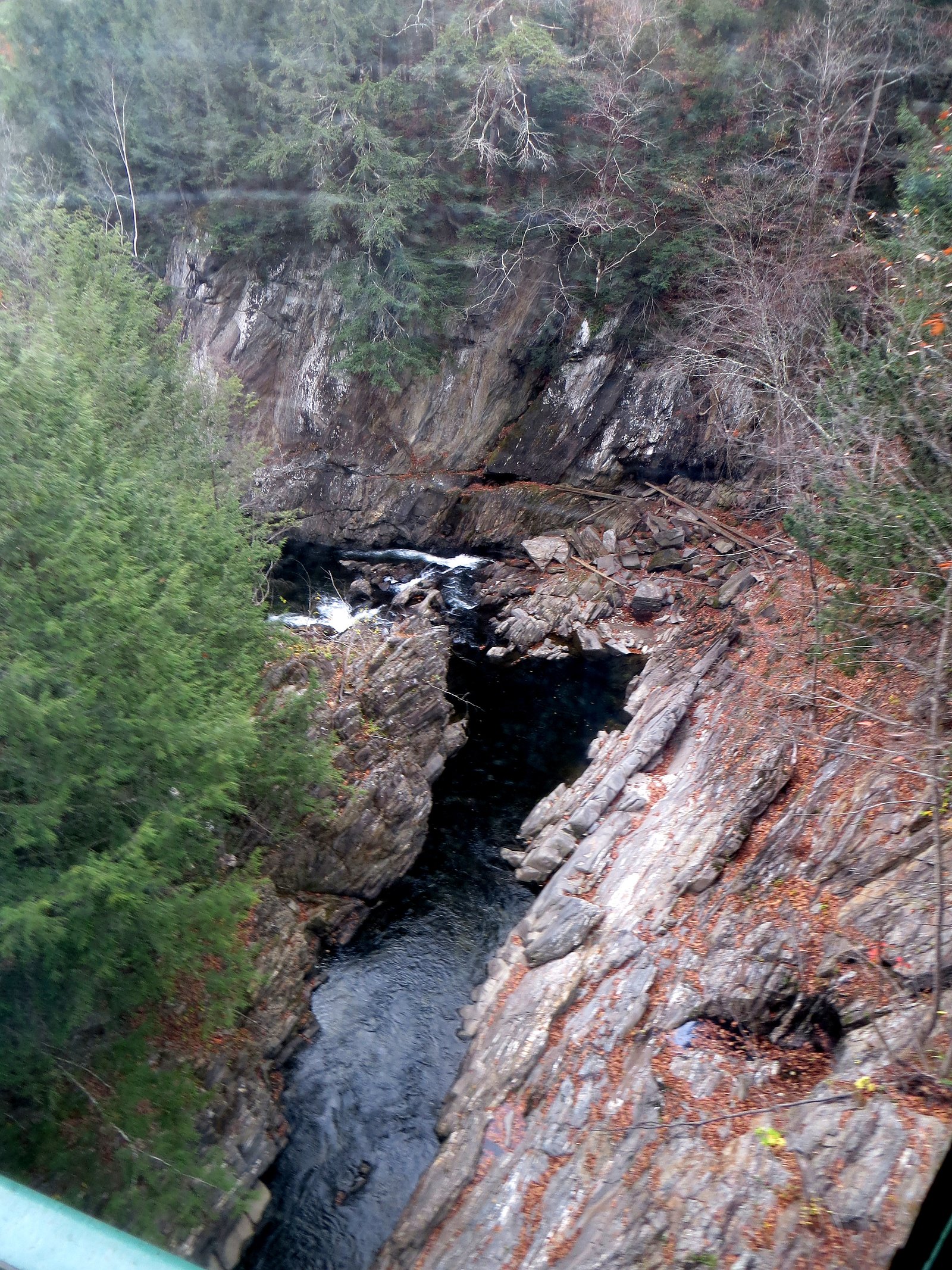
About Twin Falls
Twin Falls offers a charming pair of cascades set back in Vermont’s quiet woodlands, a scenic reward for hikers and nature lovers. The falls and surrounding parcel are privately owned but protected through a Vermont Land Trust easement and managed by a nonprofit organization, so visitors are asked to respect the land steward’s rules and stay on designated routes. The setting feels intimate rather than commercial, making it a favorite for photographers and those seeking a peaceful short‑day outing. Access to the falls is via a moderate 2.4‑mile out‑and‑back trail that gains about 350 feet in elevation. The route is straightforward in routing and best suited to hikers comfortable with a steady, moderate climb; bring sturdy footwear and plan for a round trip of roughly 2.4 miles. Because the site sits on conserved private land, expect limited facilities and follow Leave No Trace principles to help preserve this special spot.
The Setting
Twin Falls sits at 282 feet within Vermont Land Trust Easement, fed by the Williams River, in the coastal lowlands of Vermont.
Trail & Hike Details
The Approach
The moderate 2.4-mile out-and-back trail gains 350 feet of elevation on the way to the falls.
Trail Description
Route: 2.4 miles out-and-back; Elevation gain: ~350 ft; Difficulty: Moderate. The trail is an out-and-back hike of approximately 2.4 miles total with a steady 350-foot climb, rated moderate for fitness and footing. No USFS trail number, surface, grade, or official class information was provided in the available data; hikers should anticipate typical wooded-trail conditions and prepare accordingly (sturdy shoes, water, and awareness of variable footing).
What to Expect
Dogs are welcome.
Accessibility
The trail is not wheelchair accessible. Uneven terrain and elevation changes require steady footing.
Frequently Asked Questions
🐶 Are Dogs Allowed at Twin Falls?
✅ Dogs are allowed
Are There Any Fees or Permits Required?
🆖 No fees required
🏊 Is There Swimming at Twin Falls?
❌ Swimming is not allowed
When to Visit
Spring and early summer are ideal for visiting, as the water flow is typically strongest during these seasons.
Seasonal Access
The best time to visit is Spring, Summer, and Fall. Winter access may be limited.
Safety Information
Exercise caution near the falls as rocks can be slippery. Avoid visiting during heavy rain or icy conditions.
Current Water Conditions
75 ft³/s
Current discharge — how much water is flowing
About average for this time of year
Based on 39 years of record
2.54 ft
Water depth at gauge
7-Day Discharge Trend
What does this mean for your visit?
Flow is about average for this time of year.
About This Gauge
This gauge is on a nearby waterway and may not reflect exact conditions at the falls.
7-Day Flow Outlook
Based on the USGS gauge WILLIAMS RIVER NEAR ROCKINGHAM VT (9 km away).
Today
Low
75 cfs
6/10Tomorrow
Low
69 cfs
6/10Fri
Low
64 cfs
6/10Sat
Moderate
73 cfs
4/10Sun
Moderate
73 cfs
4/10Mon
Moderate
67 cfs
5/10Tue
Moderate
60 cfs
4/10Best window: Today — low flow, mostly sunny (trip score 6/10).
Best time of year: this gauge typically runs highest from early March to mid May, peaking in April.
How we calculate this
This is a transparent outlook, not a precise forecast. We take the waterfall's current flow strength (how it ranks against its historical normal for today, from the nearest USGS stream gauge), carry that ranking forward along the gauge's seasonal curve, and nudge it for forecast rain. Confidence is highest for the next day or two and falls further out. Always check official conditions and your own judgment before visiting — high flows can be dangerous.
Know when to go.
Get a free email alert when waterfalls near North Westminster hit peak flow. We only send when conditions are worth the trip — no weekly newsletters, no spam.
Weather Forecast
Location & Access
Getting There
Twin Falls is located near the town of Richford, Vermont. Access is typically via local roads, and the trailhead is not far from the parking area.
Get Directions on Google MapsParking
There is a small parking area near the trailhead, but space may be limited during peak seasons.
Elevation
282 feet above sea level
Coordinates
43.116600° N, -72.453600° W
Land Management
Managed by NGO
Visitor Tips & Gear
Arrive early during weekends or holidays to secure parking. Wear sturdy shoes as the trail may be muddy or slippery, especially after rain.
As an Amazon Associate, we earn from qualifying purchases.
With 2.4 miles and 350 ft of elevation gain, sturdy boots and trekking poles will help on this moderate trail. Sun exposure on the trail makes good sun protection a must in summer.

Polarized Sunglasses (Knockaround)
Cuts glare off the water so you actually see the falls — and your photos turn out better too.

Columbia Watertight II Rain Jacket
Packs into its own pocket, seam-sealed, and keeps you dry from spray and surprise rain.

Earth Pak Waterproof Dry Bag
Keeps your phone and gear dry when waterfall mist soaks everything else.

Waterproof Phone Pouch (AiRunTech)
Cheap insurance — take photos right next to the falls without killing your phone.

Timberland Euro Sprint Mid Waterproof
Trusted waterproof boot with premium leather and grippy rubber sole — reliable on rocky, wet trails.

TrailBuddy Trekking Poles
Lightweight aluminum, cork grips, and flip-locks that actually hold — a best-seller for good reason.
Where to Stay

Manchester View

Seesaw's Lodge

Brook Road Inn

The Upper Pass Lodge
Browse vacation cabins and private rentals nearby
Unique outdoor stays — tents, yurts, and treehouses
Rent a campervan or RV for your waterfall road trip
Some links are affiliate links. We may earn a commission at no extra cost to you.
Nearby Campground
SURRY MOUNTAIN LAKE BEACH
10.3 miles away · 3 sites
Overview Surry Mountain Lake Beach is a U.S. Army Corps of Engineers day use facility located on the Ashuelot River in Surry, New Hampshire.Recreation Swimming, sunbathing, picnicking, paddling and fishing are just a few of the favorite activities enjoyed at Surry Mountain Lake Beach. A boat ramp is available for small boats, kayaks and canoes. There are picnic tables and grills located throughout the park, as well as a playground.Facilities Surry Mountain Lake Beach has restrooms with flush toil
Book on Recreation.govNearby Hot Springs
Hot springs near North Westminster, Vermont
Sand Spring
Sand Spring surfaces at 75°F in Williamstown, Massachusetts — one of the few thermal features in New England. At just 670 feet ...

Lebanon Spring
Lebanon Spring discharges at 72°F at 663 feet elevation in Columbia County, flowing 24 degrees above ambient air temperature ju...
Looking for a soak after your hike? Explore more hot springs near North Westminster, Vermont on SoakingSprings.
Explore Vermont springsAdditional Information
Nearby Attractions
Nearby attractions include Jay Peak Resort and the Missisquoi Valley Rail Trail.
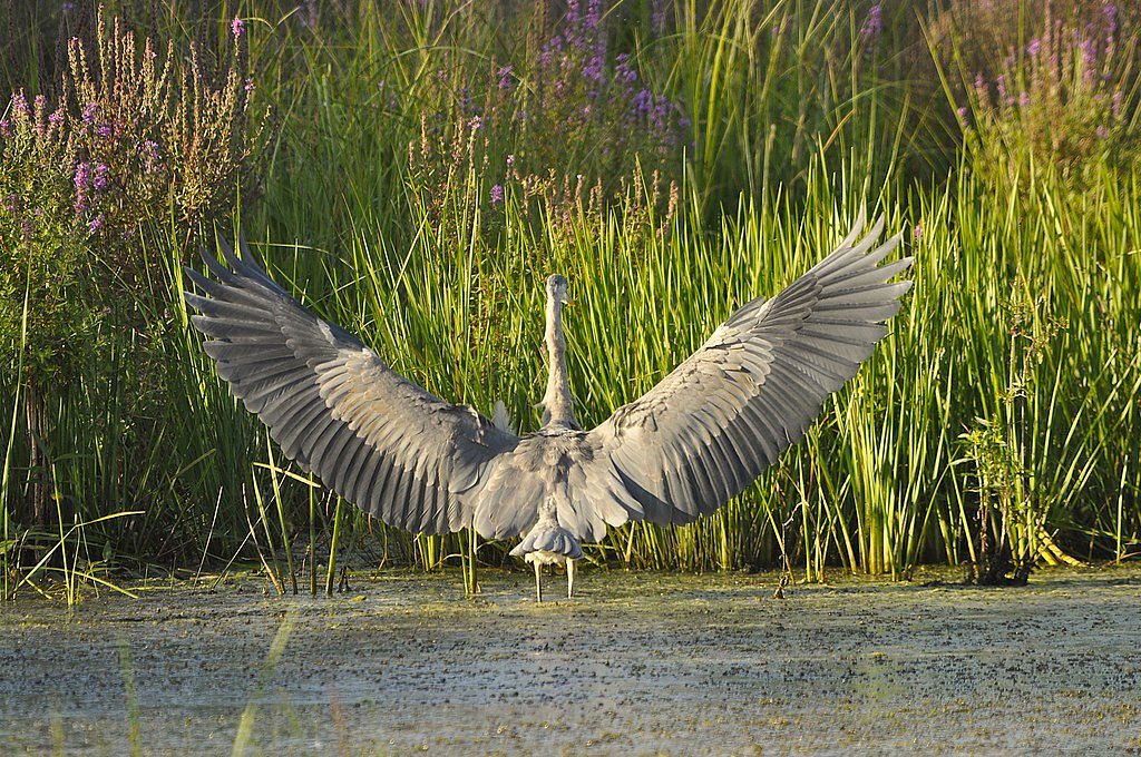
Wildlife
The area is home to various bird species, small mammals, and occasional deer sightings.
Cities near Twin Falls
Nearby Waterfalls
Other waterfalls named Twin Falls
21 other waterfalls share this name across the U.S.
Writing about Twin Falls? Embed this waterfall on your site for free.