
Photo Credits (5)
Difficulty
Easy
Trail Length
1.5 miles
Trail Type
Out And Back
Elevation Gain
200 ft
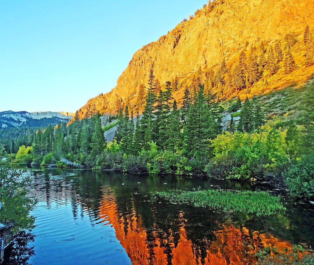
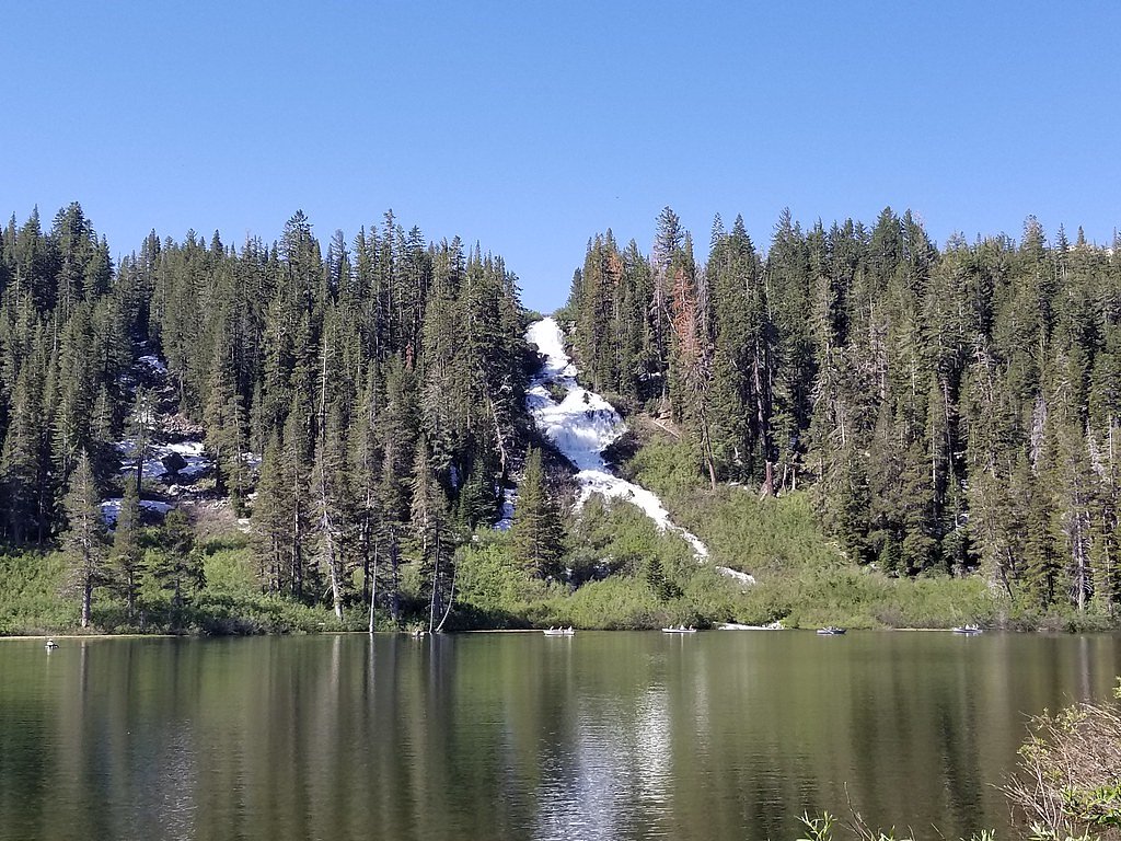
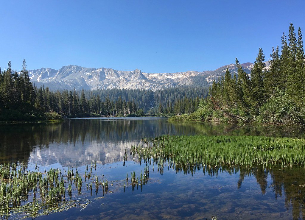
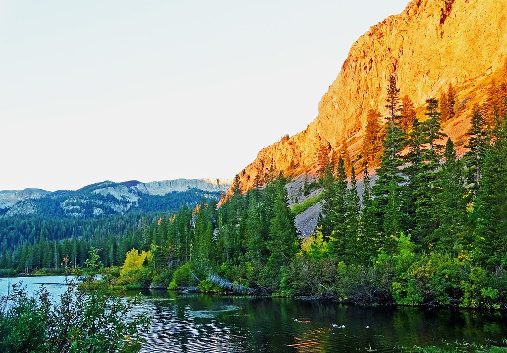
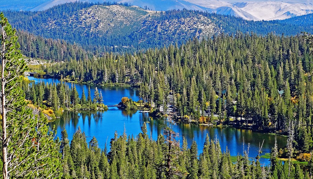
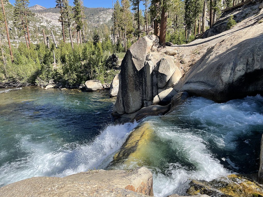
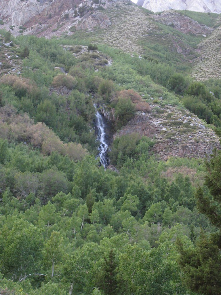
About Twin Falls
Twin Falls sits in the Sierra Nevada under the care of the U.S. Forest Service, tucked into the Inyo National Forest. The waterfall lives up to its name with two close-running cascades framed by forested slopes, making it an inviting destination for photographers, families, and day hikers. Access to the falls is via the RIM Trail, USFS Trail #2723, so you’ll be following an established Forest Service route rather than a remote scramble. Because the site is managed by the USFS, nearby recreation amenities are easy to find: New Shady Rest Campground is about 5.78 km away and serves as a convenient basecamp for an overnight stay. Whether you’re stopping in on a longer Sierra drive or planning a short nature outing, Twin Falls offers a compact, scenic reward without committing to a long backcountry trek.
The Setting
Twin Falls sits at 8,835 feet within Inyo National Forest, in the high alpine of California.
Nearby Falls Worth Visiting
Rainbow Falls (101 ft) lies 4.1 miles to the west. Also nearby: Lower Rainbow Falls (101 ft, 4.5 mi).
Trail & Hike Details
The Approach
The easy hike follows Rim (#2723), a 1.5-mile out-and-back trail over natural surface. Expect 200 feet of elevation gain with grades of 12-20%. The trail is minimally developed (Class 1).
USFS Trail
RIM #2723
Trail Class
Minimally Developed
Surface
Avg Grade
Trail Description
The hike to Twin Falls is an easy, out-and-back route along the USFS RIM Trail (Trail #2723). The trail is 1.5 miles round-trip with roughly 200 feet of elevation gain, typically rated easy and suitable for most visitors. USFS trail data list it as a Class 1 route with a native-material surface and a typical grade of 12–20%, so expect a straightforward footpath with some short, moderately steeper stretches rather than technical obstacles. Well-suited to day hikers and families, the trail provides a quick, scenic approach to the falls and connects conveniently to nearby camping at New Shady Rest Campground.
What to Expect
Dogs are welcome.
Accessibility
The trail is not wheelchair accessible. Uneven terrain and elevation changes require steady footing.
Frequently Asked Questions
🐶 Are Dogs Allowed at Twin Falls?
✅ Dogs are allowed
Are There Any Fees or Permits Required?
🤑 Fee: $5.00
🏊 Is There Swimming at Twin Falls?
❌ Swimming is not allowed
When to Visit
The best time to visit Twin Falls is in the spring or early summer when the snowmelt ensures a strong flow of water. Fall is also a great time to visit for cooler weather and fewer crowds.
Seasonal Access
The best time to visit is Spring, Summer, and Fall. Access roads and trails may close during winter due to snow. Check with Inyo National Forest for seasonal road closures.
Safety Information
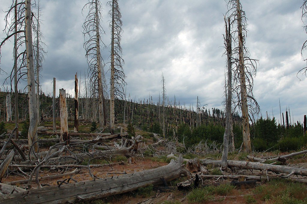
Be cautious of slippery rocks near the falls. Stay on marked trails to avoid getting lost or damaging the environment. Check weather conditions before visiting, as the trail may be icy or muddy during certain times of the year.
Current Water Conditions
124 ft³/s
Current discharge — how much water is flowing
About average for this time of year
Based on 15 years of record
3.87 ft
Water depth at gauge
53°F
ColdBracing — limit time in water
7-Day Discharge Trend
What does this mean for your visit?
Flow is about average for this time of year. Water temperature is a bracing 53 degrees F, limit your time in the water.
About This Gauge
7-Day Flow Outlook
Based on the USGS gauge MF SAN JOAQUIN R NR MAMMOTH LAKES CA (7 km away).
Today
Barely Flowing
124 cfs
5/10Tomorrow
Barely Flowing
129 cfs
5/10Mon
Barely Flowing
113 cfs
5/10Tue
Barely Flowing
106 cfs
5/10Wed
Barely Flowing
104 cfs
5/10Thu
Barely Flowing
103 cfs
5/10Fri
Barely Flowing
99 cfs
5/10Best window: Today — barely flowing flow, mostly sunny (trip score 5/10).
Best time of year: this gauge typically runs highest from early April to early July, peaking in May.
How we calculate this
This is a transparent outlook, not a precise forecast. We take the waterfall's current flow strength (how it ranks against its historical normal for today, from the nearest USGS stream gauge), carry that ranking forward along the gauge's seasonal curve, and nudge it for forecast rain. Confidence is highest for the next day or two and falls further out. Always check official conditions and your own judgment before visiting — high flows can be dangerous.
Know when to go.
Get a free email alert when waterfalls near Mammoth Lakes hit peak flow. We only send when conditions are worth the trip — no weekly newsletters, no spam.
Weather Forecast
Location & Access
Getting There
Twin Falls is located near Mammoth Lakes, California, in the Inyo National Forest. The trailhead can typically be accessed via Lake Mary Road, which is well-marked and easy to navigate.
Get Directions on Google MapsParking
Parking is available at the trailhead, but it may be limited during peak seasons. Arrive early to secure a spot.
Elevation
8,835 feet above sea level
Coordinates
37.611603° N, -119.010132° W
Land Management
Managed by USFS
Visitor Tips & Gear
Wear sturdy shoes as the trail may have uneven sections. Arrive early during weekends or holidays to avoid crowds. Bring a camera to capture the stunning views.
This trail sits at 8,835 ft — the air is noticeably thinner
High AltitudeSome visitors experience headaches, fatigue, or shortness of breath at this elevation. Take it slow, stay hydrated, and consider supplemental oxygen if you're coming from a lower altitude.
As an Amazon Associate, we earn from qualifying purchases.

Coppertone Sport SPF 50 Sunscreen
UV intensity jumps ~4% per 1,000 ft — at this elevation you can burn in half the time.

Sun Bum SPF 30 Lip Balm (3-Pack)
Lips have almost no natural UV protection and burn fast in thin, dry mountain air.

Liquid I.V. Electrolyte Packets
You lose moisture ~2x faster at elevation — electrolytes help you absorb water efficiently.

ROCKNIGHT Polarized UV400 Sunglasses
High-altitude glare off rock and water is intense — UV400 lenses block 99%+ of UVA/UVB.

Boost Oxygen 10L Canister (2-Pack)
Portable supplemental oxygen for quick relief from headaches and shortness of breath.

Altitude Rx OxyBoost Complex
Antioxidant formula designed to support your body's natural altitude acclimation.
As an Amazon Associate, we earn from qualifying purchases.
This easy 1.5 miles hike is straightforward — comfortable trail shoes and plenty of water should do. Sun exposure on the trail makes good sun protection a must in summer.

Polarized Sunglasses (Knockaround)
Cuts glare off the water so you actually see the falls — and your photos turn out better too.

Columbia Watertight II Rain Jacket
Packs into its own pocket, seam-sealed, and keeps you dry from spray and surprise rain.

Earth Pak Waterproof Dry Bag
Keeps your phone and gear dry when waterfall mist soaks everything else.

Waterproof Phone Pouch (AiRunTech)
Cheap insurance — take photos right next to the falls without killing your phone.

JOBY GorillaPod Starter Kit
Wraps around railings and rocks for long-exposure waterfall shots — no flat surface needed.

Osprey Daylite Daypack
Light, organized, and just the right size for a day hike — fits water, snacks, and layers.
Where to Stay

Edelweiss Lodge

Austria Hof Lodge

White Mountain Lodge #2329

Holiday Haus
Browse vacation cabins and private rentals nearby
Unique outdoor stays — tents, yurts, and treehouses
Rent a campervan or RV for your waterfall road trip
Some links are affiliate links. We may earn a commission at no extra cost to you.
Nearby Campground
NEW SHADY REST CAMPGROUND
3.6 miles away · 94 sites
Overview New Shady Rest Campground is a large facility convenient to numerous outdoor activities and attractions in the eastern Sierra Nevada Mountains. The campground is popular for hiking, mountain biking, sightseeing and hitting the adjacent town of Mammoth Lakes for shopping and dining. The facility accommodates both tents and RVs.Recreation The Mammoth Lakes area has much to keep campers busy. The majestic scenery and challenging trails are an obvious draw for hikers and mountain bikers. Ski
Book on Recreation.govNearby Hot Springs
Hot springs near Mammoth Lakes, California

Fumaroles
Fumaroles vent superheated steam high in the Sierra at 8,167 feet, where the geothermal system expresses itself through mountai...

Reds Meadow Hot Springs
Reds Meadow Hot Springs flows at an impressive 115°F high in the Eastern Sierra at 7,638 feet elevation, delivering water 72 de...
Fish Creek Hot Springs
Fish Creek Hot Springs, also called Iva Bell Hot Springs, emerges at 110°F deep in Sierra National Forest's backcountry at 7,24...

Unnamed Spring Mono County 2
At 7,313 feet elevation, this 72-degree thermal spring near Mammoth Lakes flows just 45 meters from El Camino Sierra Road in ha...
Casa Diablo Hot Springs And Geyser
Casa Diablo Hot Springs and Geyser erupts at 199 degrees Fahrenheit—one of California's most extreme geothermal features. Locat...

Chance Spring
Chance Spring emerges modestly at 73 degrees Fahrenheit from land managed by Los Angeles Department of Water and Power near Mam...
Looking for a soak after your hike? Explore more hot springs near Mammoth Lakes, California on SoakingSprings.
Explore California springsAdditional Information
Nearby Attractions
Lake Mary, Mammoth Lakes Basin, and Devil's Postpile National Monument are all nearby attractions worth visiting.
Wildlife
The area is home to a variety of wildlife, including birds, squirrels, and occasionally deer. Be cautious of bears and store food properly.
Cities near Twin Falls
Nearby Waterfalls
Other waterfalls named Twin Falls
21 other waterfalls share this name across the U.S.
Writing about Twin Falls? Embed this waterfall on your site for free.