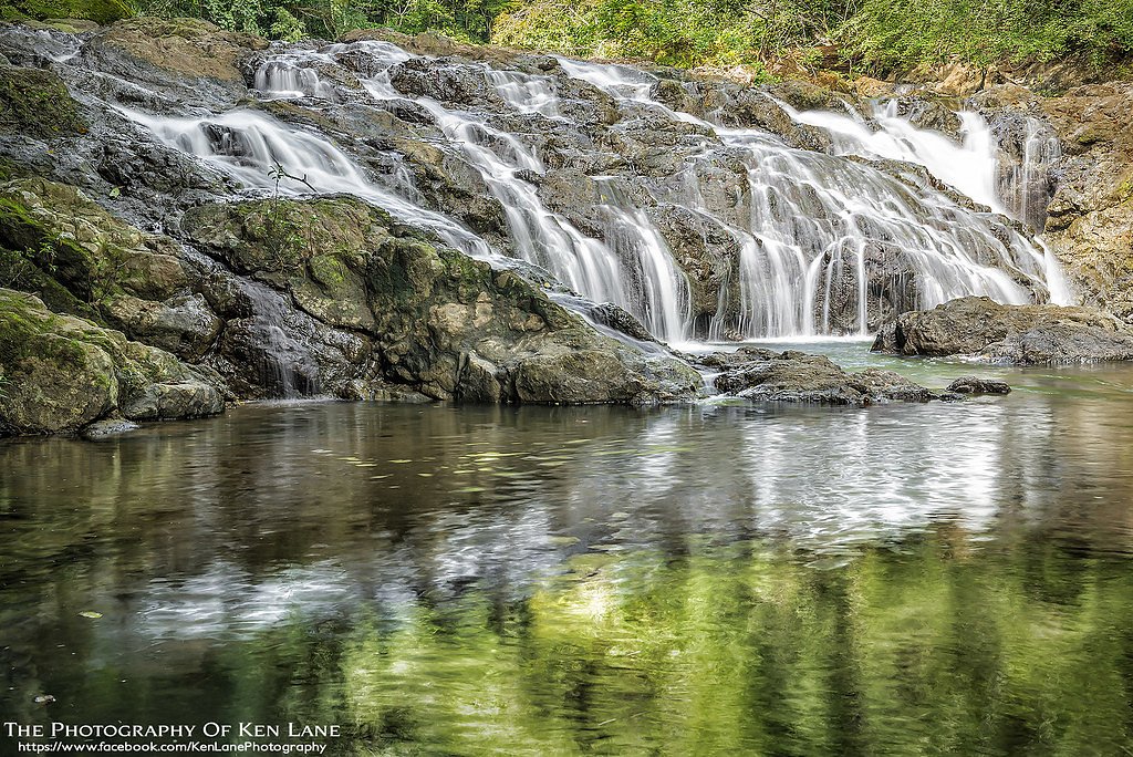
Santeetlah Bluff Falls
By Armen Suny · Last verified May 2026
Difficulty
Moderate
Trail Length
2.4 miles
Trail Type
Out And Back
Elevation Gain
350 ft
About Santeetlah Bluff Falls
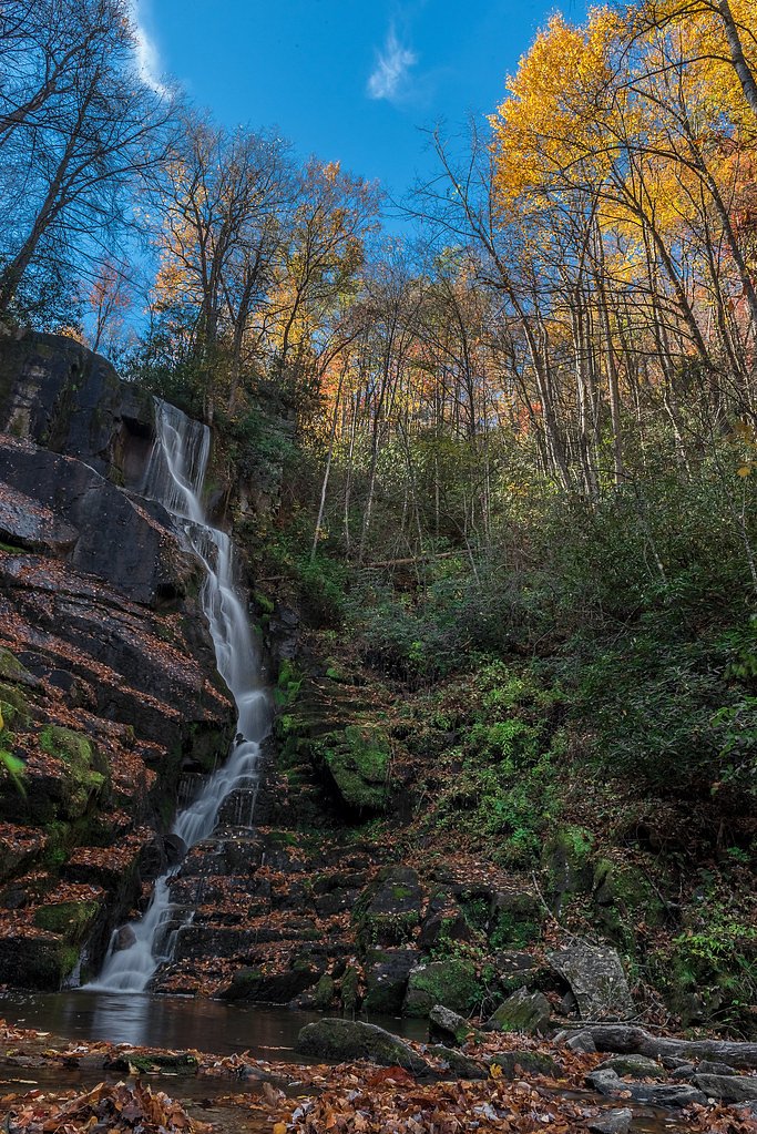
Santeetlah Bluff Falls is a small, scenic waterfall located in the Nantahala National Forest in North Carolina. It is surrounded by lush forest and offers a peaceful, secluded experience for visitors.
The Setting
Santeetlah Bluff Falls sits at 3,681 feet within Nantahala National Forest, fed by the Valley River, in the mountains of North Carolina.
Trail & Hike Details
The Approach
The moderate hike follows Swan Cabin (#TR2816), a 2.4-mile out-and-back trail over natural surface. Expect 350 feet of elevation gain. The trail is developed (Class 3).
USFS Trail
SWAN CABIN #TR2816
Trail Class
Developed
Surface
USFS Segment
0.37 miTrail Description
The trail to Santeetlah Bluff Falls is short and relatively easy, winding through a dense forest. The path may be narrow and uneven in places, but it is generally well-marked and manageable for most visitors.
What to Expect
Dogs are welcome.
Accessibility
The trail is not wheelchair accessible. Uneven terrain and elevation changes require steady footing.
Frequently Asked Questions
🐶 Are Dogs Allowed at Santeetlah Bluff Falls?
✅ Dogs are allowed
Are There Any Fees or Permits Required?
🆖 No fees required
🏊 Is There Swimming at Santeetlah Bluff Falls?
❌ Swimming is not allowed
When to Visit
Spring and early summer are ideal for visiting, as the waterfall flow is typically strongest during these seasons.
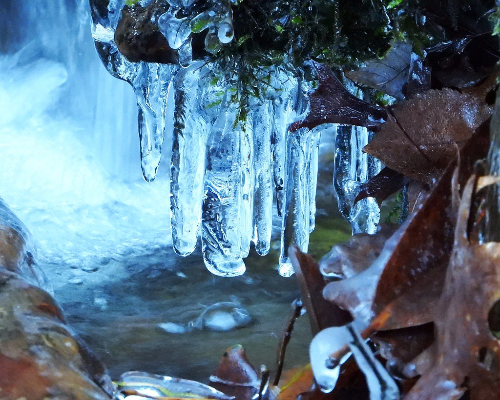
Seasonal Access
The best time to visit is Spring, Summer, and Fall. Winter access may be limited. Check with Nantahala National Forest for seasonal road closures.
Safety Information
Be cautious of slippery rocks near the waterfall. Cell service may be limited in the area, so plan accordingly and let someone know your itinerary.
Current Water Conditions
82 ft³/s
Current discharge — how much water is flowing
About average for this time of year
1.85 ft
Water depth at gauge
7-Day Discharge Trend
What does this mean for your visit?
Flow is about average for this time of year.
About This Gauge
This gauge is on a nearby waterway and may not reflect exact conditions at the falls.
7-Day Flow Outlook
Based on the USGS gauge VALLEY RIVER AT TOMOTLA, NC (22 km away).
Today
Moderate
95 cfs
6/10Tomorrow
Moderate
105 cfs
6/10Tue
Moderate
106 cfs
6/10Wed
Moderate
101 cfs
6/10Thu
Moderate
113 cfs
6/10Fri
Moderate
109 cfs
6/10Sat
Moderate
106 cfs
6/10Best window: Today — moderate flow, patchy fog then showers and thunderstorms likely (trip score 6/10).
Best time of year: this gauge typically runs highest from mid January to mid April, peaking in March.
How we calculate this
This is a transparent outlook, not a precise forecast. We take the waterfall's current flow strength (how it ranks against its historical normal for today, from the nearest USGS stream gauge), carry that ranking forward along the gauge's seasonal curve, and nudge it for forecast rain. Confidence is highest for the next day or two and falls further out. Always check official conditions and your own judgment before visiting — high flows can be dangerous.
Know when to go.
Get a free email alert when waterfalls near Lake Santeetlah hit peak flow. We only send when conditions are worth the trip — no weekly newsletters, no spam.
Weather Forecast
Location & Access
Getting There
Santeetlah Bluff Falls is located near the Cherohala Skyway in the Nantahala National Forest. Access typically involves driving along forest service roads, which may be unpaved and require a high-clearance vehicle during certain seasons.
Get Directions on Google MapsParking
Parking is available at a small pull-off area near the trailhead. Space may be limited, so plan accordingly.
Elevation
3,681 feet above sea level
Coordinates
35.340556° N, -83.996944° W
Land Management
Managed by USFS
Visitor Tips & Gear
Wear sturdy shoes as the trail may be uneven. Check weather conditions before visiting, as the forest service roads can become muddy or difficult to navigate after heavy rain.
As an Amazon Associate, we earn from qualifying purchases.
With 2.4 miles and 350 ft of elevation gain, sturdy boots and trekking poles will help on this moderate trail. Sun exposure on the trail makes good sun protection a must in summer.

Columbia Watertight II Rain Jacket
Packs into its own pocket, seam-sealed, and keeps you dry from spray and surprise rain.

Earth Pak Waterproof Dry Bag
Keeps your phone and gear dry when waterfall mist soaks everything else.

Waterproof Phone Pouch (AiRunTech)
Cheap insurance — take photos right next to the falls without killing your phone.

Timberland Euro Sprint Mid Waterproof
Trusted waterproof boot with premium leather and grippy rubber sole — reliable on rocky, wet trails.

TrailBuddy Trekking Poles
Lightweight aluminum, cork grips, and flip-locks that actually hold — a best-seller for good reason.

Polarized Sunglasses (Knockaround)
Cuts glare off the water so you actually see the falls — and your photos turn out better too.
Where to Stay

The Junction

Mistletoe Cabin- Private cabin w views, Hottub, pet friendly

Quality Inn & Suites Robbinsville

Stonebrook Lodge Murphy
Browse vacation cabins and private rentals nearby
Unique outdoor stays — tents, yurts, and treehouses
Rent a campervan or RV for your waterfall road trip
Some links are affiliate links. We may earn a commission at no extra cost to you.
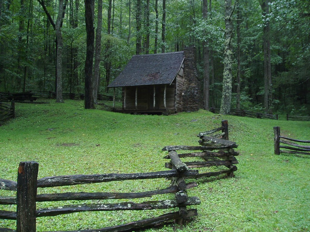
Nearby Campground
SWAN CABIN
1.4 miles away · 1 sites
Overview Nestled in a remote area of Nantahala National Forest, this primitive log cabin was built in 1931 by Frank Swan in a different location, then later it was moved to its current location near the Joyce Kilmer-Slickrock Wilderness. The cabin and the surrounding meadows are named for the Swan Family, who came to the area from Pennsylvania in the late 19th century. Swan Cabin offers a peaceful, quiet retreat where visitors can relax on the front porch and enjoy birdsong and views of the surro
Book on Recreation.govAdditional Information
Nearby Attractions
The Cherohala Skyway offers stunning scenic drives and overlooks. Nearby hiking trails in the Nantahala National Forest provide additional opportunities for exploration.
Wildlife
The area is home to a variety of wildlife, including birds, deer, and small mammals. Be cautious of snakes and other potentially hazardous animals.
Cities near Santeetlah Bluff Falls
Nearby Waterfalls
Writing about Santeetlah Bluff Falls? Embed this waterfall on your site for free.