Little Falls
Nova Scotia • North River Wilderness Area
By Armen Suny · Last verified Jun 2026
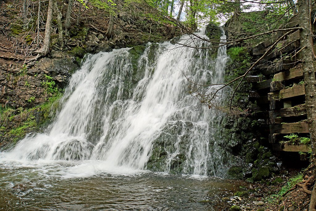
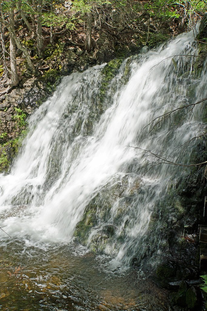
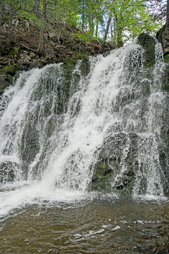
Photo Credits (5)
About Little Falls
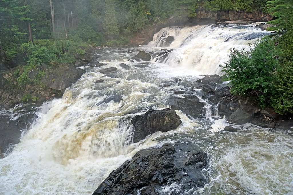
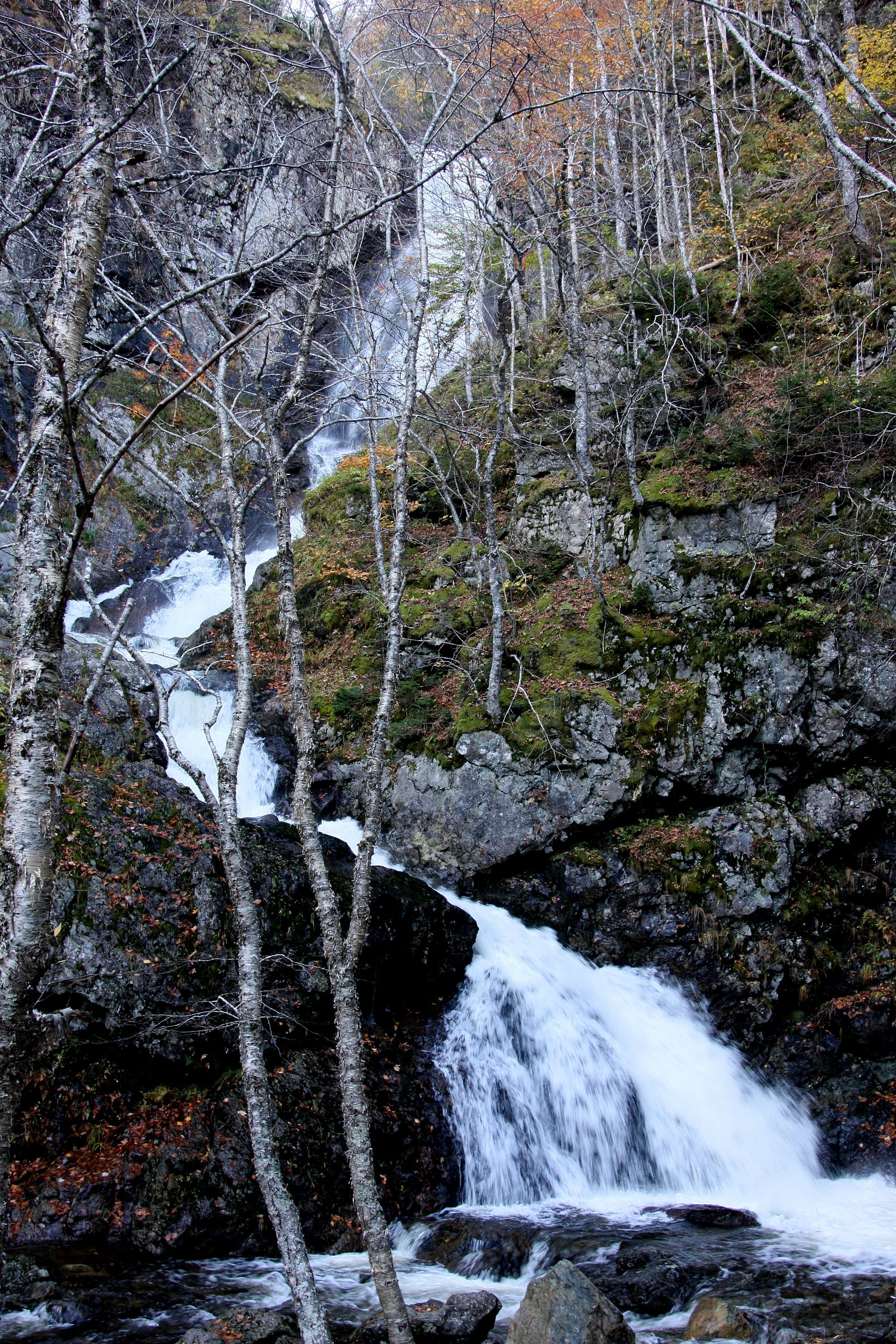
Little Falls (near coordinates 46.3165, -60.6699) is a small, forested creek cascade located on Cape Breton Island near Baddeck, Nova Scotia. The falls are typically a modest multi-step cascade rather than a single high drop and are set in mixed Acadian forest. Exact features (number of drops, pool depth, and official name usage) may vary by map and local usage; visitors should treat descriptions as approximate and confirm local access before visiting.
The Setting
Little Falls sits at 47 metres within North River Wilderness Area, in the coastal lowlands of Nova Scotia.
Why This Waterfall Exists
Little Falls flows over hard intrusive rock laid down about 539 million to 1.0 billion years ago. These resistant rocks form a durable ledge that water cannot easily wear away, creating the falls where softer material downstream has already eroded.
Nearby Falls Worth Visiting
Uisge Ban Falls, the tallest waterfall in Nova Scotia at 101 metres, lies 14.8 kilometres to the southwest. Also nearby: North River Falls (32 m, 6.4 km).
Trail & Hike Details
Trail Description
Visitors will typically follow a short footpath through mixed forest to reach the creek and cascade. The trail surface may be uneven with roots, rocks, and occasional muddy sections; there may be small rock scrambles or banks to descend to get closer to the water. The immediate approach to the falls is likely informal (not fenced or developed), and signage may be limited or absent.
What to Expect
A modest, scenic cascade set in forest. Spring and after heavy rain produce the strongest flows; summer often has lower flow but good foliage. Expect slippery rocks and wet approaches, limited facilities (no toilets or maintained picnic areas), and potential for biting insects in warm months. The falls may be small compared with large, well-known waterfalls, many visitors come for the quiet forest setting and short nature walk.
Accessibility
The site is likely not wheelchair accessible. Trails are informal, may be narrow, have uneven surfaces, and include slopes and natural obstacles.
Frequently Asked Questions
🐶 Are Dogs Allowed at Little Falls?
❌ Dogs are not allowed
Are There Any Fees or Permits Required?
🆖 No fees required
🏊 Is There Swimming at Little Falls?
❌ Swimming is not allowed
When to Visit
Late spring (snowmelt and spring rains) for the fullest flow; early summer for milder weather and foliage; fall for color. Winter access may be possible but trails and banks can be icy and dangerous, only attempt with appropriate winter gear and experience.
Seasonal Access
The best time to visit is Spring, Summer, Fall, and Winter. Check with North River Wilderness Area for current conditions.
Safety Information
• Slippery rocks and wet banks: exercise caution near the waterline, falls to rocks or into cold water can cause serious injury. • Cold, fast water: pools and currents may be colder and stronger than they appear. Avoid swimming unless you have local confirmation that it is safe. • Changing conditions: heavy rain can rapidly increase flow and make approaches hazardous. • Insects: bring repellant for black flies and mosquitoes in spring/summer. • Wildlife: store food securely and keep distance from larger animals (moose, bears). • Limited services: no guaranteed cell service or facilities; carry essentials and tell someone your plans.
Current Water Conditions
1.9 m³/s
Current discharge — how much water is flowing
About average for this time of year
Based on 59 years of record
0.56 m
Water depth at gauge
7-Day Discharge Trend
What does this mean for your visit?
Flow is about average for this time of year.
About This Gauge
This gauge is on a nearby waterway and may not reflect exact conditions at the falls.
7-Day Flow Outlook
Based on the WSC gauge INDIAN BROOK AT INDIAN BROOK (12 km away).
Today
Moderate
2.1 m³/s
6/10Tomorrow
Moderate
2.2 m³/s
6/10Tue
Moderate
2.1 m³/s
8/10Wed
Moderate
2.4 m³/s
6/10Thu
Strong
2.4 m³/s
7/10Fri
Moderate
2.0 m³/s
6/10Sat
Moderate
1.9 m³/s
6/10Best window: Tue — moderate flow, cloudy (trip score 8/10).
Best time of year: this gauge typically runs highest from early April to late May, peaking in May.
How we calculate this
This is a transparent outlook, not a precise forecast. We take the waterfall's current flow strength (how it ranks against its historical normal for today, from the nearest WSC stream gauge), carry that ranking forward along the gauge's seasonal curve, and nudge it for forecast rain. Confidence is highest for the next day or two and falls further out. Always check official conditions and your own judgment before visiting — high flows can be dangerous.
Know when to go.
Get a free email alert when waterfalls near Baddeck hit peak flow. We only send when conditions are worth the trip — no weekly newsletters, no spam.
Weather Forecast
Location & Access
Getting There
Approximate coordinates: 46.3165, -60.6699. The site is roughly 14.0 miles from Baddeck and about 29.4 miles from Sydney (as provided). Access is typically by paved and secondary roads followed by a short walk; the precise trailhead may be unmarked and could require use of a GPS device or local directions. Expect local logging or gravel side roads in the area, confirm conditions before travel.
Get Directions on Google MapsParking
Parking is likely informal roadside or a small pullout near the trailhead; there are probably no developed parking lots, restrooms, or maintained facilities. Park off the travel way where permitted and avoid blocking gates or driveways. If unsure, return to the nearest town (Baddeck) for authorized parking.
Elevation
47 metres above sea level
Coordinates
46.316457° N, -60.669931° W
Land Management
Managed by Nova Scotia Environment and Climate Change
Visitor Tips & Gear
• Use GPS coordinates and local maps; trailheads may be unmarked. • Wear sturdy, water-resistant footwear with good traction. • Bring insect repellent (black flies and mosquitoes can be abundant in late spring/early summer). • There are likely no services or potable water near the falls, carry water and snacks. • Leave no trace: pack out trash and avoid disturbing vegetation or streambanks. • Respect private property; if access requires crossing private land, obtain permission. • Cell coverage may be limited, tell someone your plans and expected return time.
Where to Stay
Browse vacation cabins and private rentals nearby
Unique outdoor stays — tents, yurts, and treehouses
Rent a campervan or RV for your waterfall road trip
Some links are affiliate links. We may earn a commission at no extra cost to you.
Nearby Campground
joyful journeys
9.6 km away
Additional Information
Nearby Attractions
Baddeck village and services (~14 miles), Bras d'Or Lake (regional attraction), the Alexander Graham Bell National Historic Site (in Baddeck), and sections of the Cabot Trail and Cape Breton scenery within driving distance. Exact proximity to these attractions depends on the route taken.
Wildlife
Typical Cape Breton Island wildlife: white-tailed deer, black bear (occasional), moose (regional), foxes, and a variety of songbirds and raptors (including bald eagles in some areas). Also expect black flies and mosquitoes seasonally. Observe wildlife from a distance and secure food.
Cities near Little Falls
Nearby Waterfalls
Other waterfalls named Little Falls
27 other waterfalls share this name across Canada.
Writing about Little Falls? Embed this waterfall on your site for free.