Photo Credits (5)
Difficulty
Drive Up
Trail Length
0.2 km
Trail Type
Out And Back
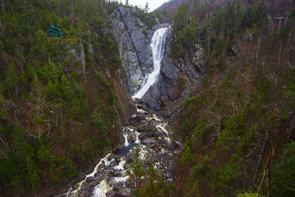
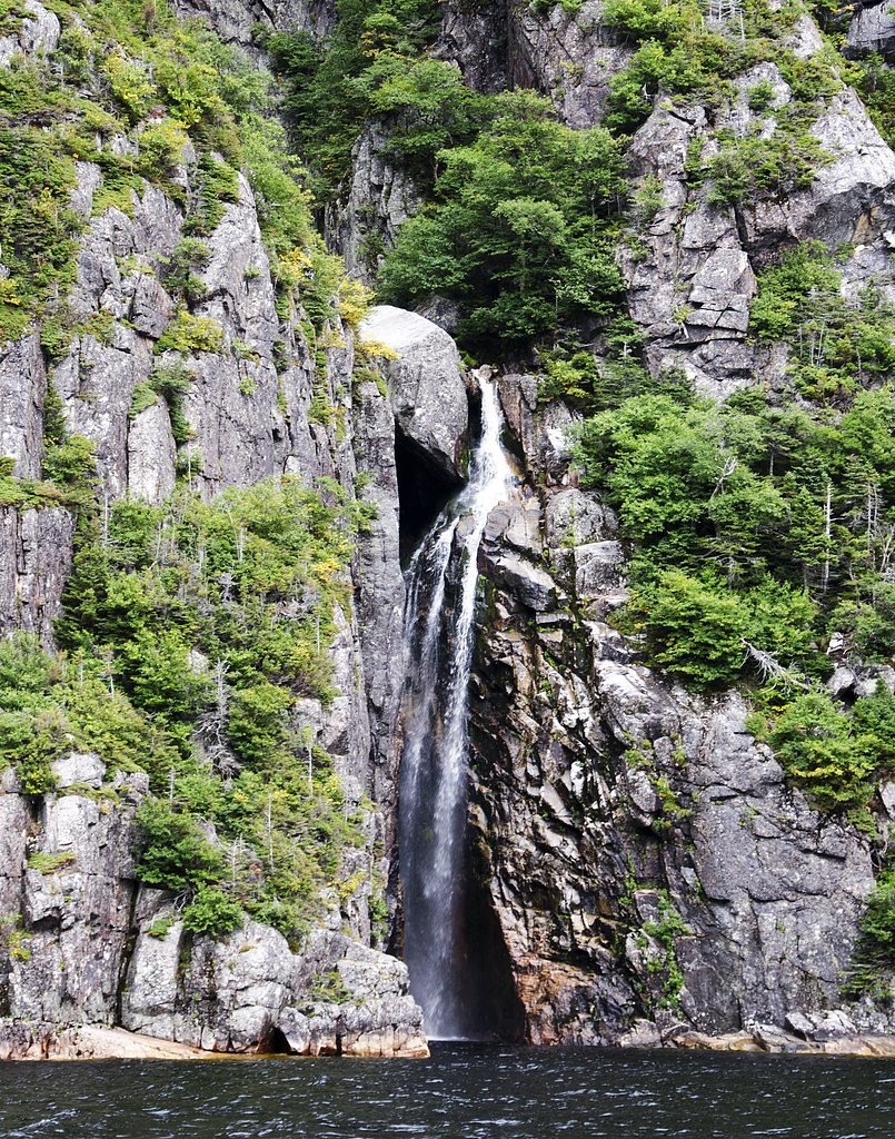
About Little Falls
Little Falls is a small, likely seasonally variable waterfall on a tributary in western Newfoundland, located inland from the Deer Lake area. The falls sit in a largely forested, rural landscape and are most notable for natural scenery rather than large vertical drop. Access appears to be informal and may require travel on back roads or a short, possibly unmarked trail; some visitor reports indicate limited infrastructure. Specifics about the exact drop and formed viewing platforms are not well documented and may vary with seasonal flow.
Why This Waterfall Exists
Little Falls flows over layered sedimentary rock, primarily sandstone, laid down about 299-359 million years ago. These soft rocks erode readily, allowing the stream to carve a vertical drop into the landscape.
Trail & Hike Details
The Approach
No hiking required. Little Falls is accessible by vehicle with a roadside viewing area.
Trail Description
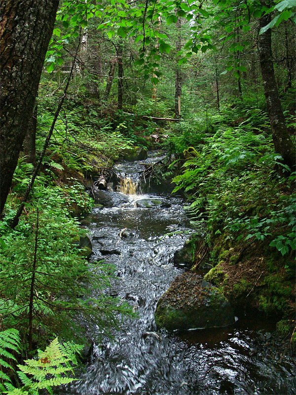
Trail details are not well documented. Approaches may range from a short walk from a roadside pullout to a bushwhack through mixed forest and wetlands. Trails, if present, may be unmarked and uneven with roots, rocks and muddy sections. Expect limited maintenance and no built infrastructure such as boardwalks or railings.
What to Expect
A remote, wooded setting with a small waterfall on a stream. Flow is seasonal, higher in spring and after heavy rain, lower in late summer or drought. Terrain may be rocky and uneven near the stream; banks can be steep or unstable in places. Little to no facilities (no restrooms, signage, or developed viewpoints). Limited cell coverage is possible.
Accessibility
This waterfall is viewable from a vehicle-accessible area. No hiking is required.
Frequently Asked Questions
🐶 Are Dogs Allowed at Little Falls?
❌ Dogs are not allowed
Are There Any Fees or Permits Required?
🆖 No fees required
🏊 Is There Swimming at Little Falls?
❌ Swimming is not allowed
When to Visit
Late spring for peak flow and early summer for easier trail conditions. Fall offers color but lower flows. Winter can create ice formations but is hazardous and requires winter skills and equipment.
Seasonal Access
The best time to visit is Spring, Summer, and Fall. Winter access may be limited. Check with the managing park or local authority for current conditions.
Safety Information
Hazards include slippery rocks and steep or unstable banks, cold water and strong currents at times, seasonal high flows (spring melt/rain), poor or no cell coverage, rough or gated logging roads, and biting insects in summer. Winter conditions bring ice, deep snow and significant additional risk; specialized equipment and experience are required. Always use caution near water and edges, wear appropriate footwear, and inform someone of your plans.
Current Water Conditions
0.1 m³/s
Current discharge — how much water is flowing
About average for this time of year
Based on 40 years of record
0.89 m
Water depth at gauge
7-Day Discharge Trend
What does this mean for your visit?
Flow is about average for this time of year.
About This Gauge
This gauge is on a nearby waterway and may not reflect exact conditions at the falls.
7-Day Flow Outlook
Based on the WSC gauge BOOT BROOK AT TRANS-CANADA HIGHWAY (14 km away).
Today
Moderate
0.1 m³/s
5/10Tomorrow
Moderate
0.1 m³/s
6/10Tue
Moderate
0.1 m³/s
6/10Wed
Moderate
0.1 m³/s
5/10Thu
Moderate
0.1 m³/s
6/10Fri
Moderate
0.1 m³/s
6/10Sat
Moderate
0.1 m³/s
5/10Best window: Tomorrow — moderate flow, light drizzle (trip score 6/10).
Best time of year: this gauge typically runs highest from early April to late May, peaking in May.
How we calculate this
This is a transparent outlook, not a precise forecast. We take the waterfall's current flow strength (how it ranks against its historical normal for today, from the nearest WSC stream gauge), carry that ranking forward along the gauge's seasonal curve, and nudge it for forecast rain. Confidence is highest for the next day or two and falls further out. Always check official conditions and your own judgment before visiting — high flows can be dangerous.
Know when to go.
Get a free email alert when waterfalls near Deer Lake hit peak flow. We only send when conditions are worth the trip — no weekly newsletters, no spam.
Weather Forecast
Location & Access
Getting There
Coordinates: 49.3505, -57.2397. Little Falls is located in western Newfoundland, roughly 16–45 miles driving distance from nearby towns such as Deer Lake (≈16.4 miles), Buchans (≈41.9 miles) and Trout River (≈43.6 miles). Access is typically by paved and unpaved rural roads; the final approach may be along logging roads or forest tracks. A high-clearance vehicle may be helpful. Expect limited or no signage; use GPS coordinates and local topo maps.
Get Directions on Google MapsParking
Parking is likely informal (roadside pullout or small clearing). There is no known formal parking lot or developed trailhead. Park clear of the roadway and avoid blocking access.
Elevation
58 metres above sea level
Coordinates
49.350503° N, -57.239727° W
Visitor Tips & Gear
1) Use the provided coordinates and a reliable map/GPS. 2) Wear sturdy, water-resistant footwear and expect mud. 3) Bring insect repellent in summer; black flies and mosquitoes can be numerous. 4) Leave no trace: pack out trash and avoid disturbing vegetation. 5) Tell someone your plans; cell service may be unreliable. 6) Check local road conditions, rural and logging roads may be closed or rough. 7) Exercise caution on wet rocks and near edges.
Where to Stay
Browse vacation cabins and private rentals nearby
Unique outdoor stays — tents, yurts, and treehouses
Rent a campervan or RV for your waterfall road trip
Some links are affiliate links. We may earn a commission at no extra cost to you.
Nearby Campground
Sir Richard Squires Memorial Provincial Park
5 km away
Additional Information
Nearby Attractions
Deer Lake (town and services), Humber River valley and regional forests. Gros Morne National Park and other west Newfoundland attractions may be reachable by car but distances vary, check driving times before planning.
Wildlife
Typical western Newfoundland wildlife may include moose, small mammals, and a variety of birds. Insect activity (mosquitoes, black flies) can be high in summer. Visitors should be aware of local wildlife and avoid disturbing animals.
Cities near Little Falls
Nearby Waterfalls
Other waterfalls named Little Falls
27 other waterfalls share this name across Canada.
Writing about Little Falls? Embed this waterfall on your site for free.