
Photo Credits (5)
Difficulty
Moderate
Trail Length
2.4 miles
Trail Type
Out And Back
Elevation Gain
350 ft
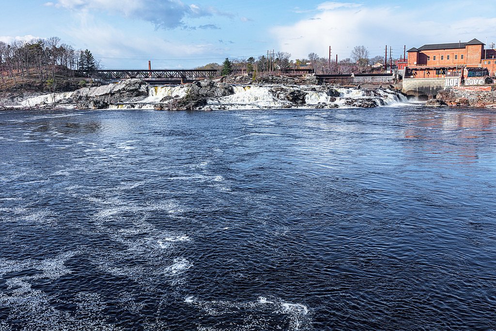
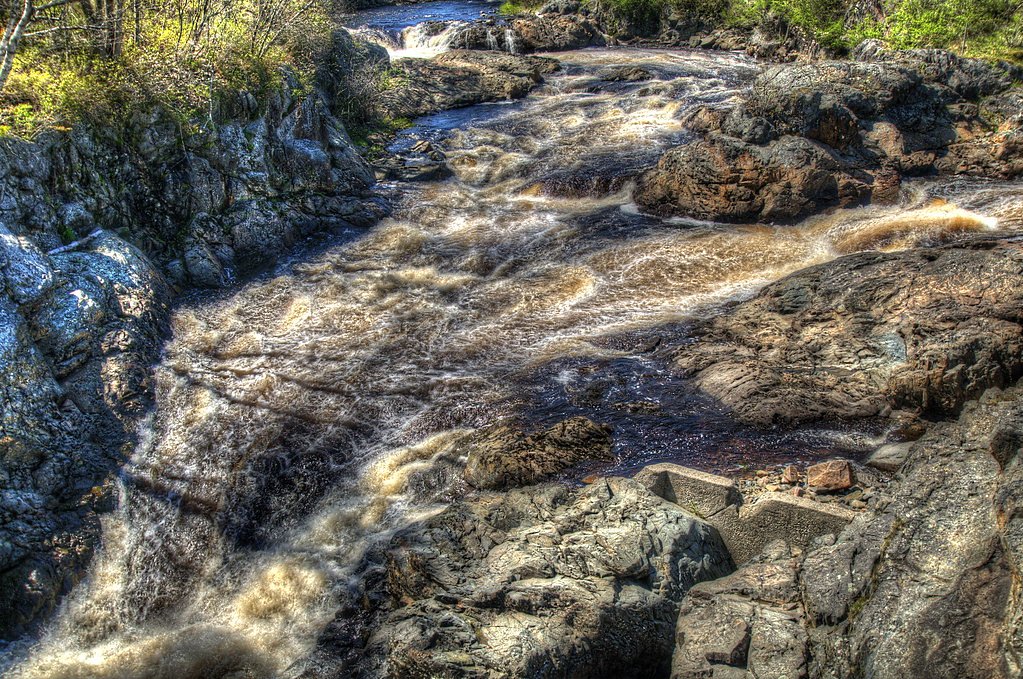
About Little Falls
Little Falls is a small, picturesque cascade set along the Machias River land unit. The cascade is at its most dramatic in spring when snowmelt swells the flow, but its tranquil pool and forested banks make it a pleasant destination any time of year. The site is designated CONE within the Machias River land unit and is privately owned; management is listed as UNKL, so visitors should be mindful of posted access information and landowner rules. Reaching Little Falls rewards hikers with a short yet satisfying outing: the commonly used route is a 2.4-mile out-and-back with roughly 350 feet of elevation gain and is rated moderate. Expect a mostly natural, wooded setting with the kind of quiet, local charm that draws nearby day hikers—good footwear and readiness for uneven footing will make the visit more enjoyable.
The Setting
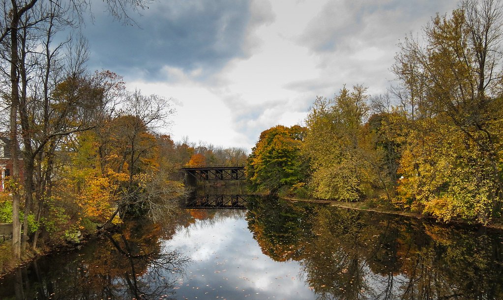
Little Falls sits at 148 feet within Machias River, fed by the Libby Brook, in the coastal lowlands of Maine.
Trail & Hike Details
The Approach
The moderate 2.4-mile out-and-back trail gains 350 feet of elevation on the way to the falls.
Trail Description
Trail: 2.4-mile out-and-back; Elevation gain: ~350 ft; Difficulty: Moderate. There is no formal USFS trail number or published surface/grade/class data for this route. Trail infrastructure is limited, and hiking typically follows a primitive—often unmarked—path through forested terrain alongside the Machias River land unit. Because the falls and approaches lie on privately owned land (designation CONE, manager listed as UNKL), expect natural tread (roots, rocks, and mud in wet seasons) and variable footing. Visitors should plan for uneven terrain, bring sturdy footwear, and respect any posted signs or access restrictions.
What to Expect
Visitors can expect a small, tranquil waterfall surrounded by natural beauty. The area may be quiet and less crowded, making it ideal for relaxation or photography.
Accessibility
The trail is not wheelchair accessible. Uneven terrain and elevation changes require steady footing.
Frequently Asked Questions
🐶 Are Dogs Allowed at Little Falls?
❌ Dogs are not allowed
Are There Any Fees or Permits Required?
🆖 No fees required
🏊 Is There Swimming at Little Falls?
❌ Swimming is not allowed
When to Visit
Spring is the best time to visit due to higher water flow from snowmelt. Summer and fall are also good options for pleasant weather and scenic views.
Seasonal Access
The best time to visit is Spring, Summer, and Fall. Winter access may be limited.
Safety Information
Visitors should be cautious of slippery rocks near the waterfall and uneven terrain. Always stay aware of your surroundings and avoid venturing too close to the water's edge.
Current Water Conditions
13 ft³/s
Current discharge — how much water is flowing
About average for this time of year
Based on 25 years of record
1.85 ft
Water depth at gauge
7-Day Discharge Trend
What does this mean for your visit?
Flow is about average for this time of year.
About This Gauge
This gauge is on a nearby waterway and may not reflect exact conditions at the falls.
7-Day Flow Outlook
Based on the USGS gauge Libby Brook near Northfield, Maine (9 km away).
Today
Moderate
14 cfs
6/10Tomorrow
Strong
16 cfs
7/10Sun
Strong
18 cfs
7/10Mon
Moderate
16 cfs
8/10Tue
Moderate
17 cfs
6/10Wed
Moderate
16 cfs
6/10Thu
Moderate
18 cfs
6/10Best window: Mon — moderate flow, patchy fog then sunny (trip score 8/10).
Best time of year: this gauge typically runs highest from mid March to early May, peaking in April.
How we calculate this
This is a transparent outlook, not a precise forecast. We take the waterfall's current flow strength (how it ranks against its historical normal for today, from the nearest USGS stream gauge), carry that ranking forward along the gauge's seasonal curve, and nudge it for forecast rain. Confidence is highest for the next day or two and falls further out. Always check official conditions and your own judgment before visiting — high flows can be dangerous.
Know when to go.
Get a free email alert when waterfalls near Milbridge hit peak flow. We only send when conditions are worth the trip — no weekly newsletters, no spam.
Weather Forecast
Location & Access
Getting There
Little Falls is located near the town of Gorham, Maine. It is accessible via local roads, and visitors should use GPS or local maps to navigate to the area.
Get Directions on Google MapsParking
Parking availability is limited and may consist of roadside parking or small designated areas nearby. Visitors should plan accordingly and avoid blocking private property or roadways.
Elevation
148 feet above sea level
Coordinates
44.860352° N, -67.801112° W
Land Management
Managed by UNKL
Visitor Tips & Gear
Visit during spring for the best water flow. Wear sturdy shoes if exploring the area, as the terrain may be uneven. Bring insect repellent during warmer months.
As an Amazon Associate, we earn from qualifying purchases.
With 2.4 miles and 350 ft of elevation gain, sturdy boots and trekking poles will help on this moderate trail. Sun exposure on the trail makes good sun protection a must in summer.

Polarized Sunglasses (Knockaround)
Cuts glare off the water so you actually see the falls — and your photos turn out better too.

Columbia Watertight II Rain Jacket
Packs into its own pocket, seam-sealed, and keeps you dry from spray and surprise rain.

Earth Pak Waterproof Dry Bag
Keeps your phone and gear dry when waterfall mist soaks everything else.

Waterproof Phone Pouch (AiRunTech)
Cheap insurance — take photos right next to the falls without killing your phone.

Timberland Euro Sprint Mid Waterproof
Trusted waterproof boot with premium leather and grippy rubber sole — reliable on rocky, wet trails.

TrailBuddy Trekking Poles
Lightweight aluminum, cork grips, and flip-locks that actually hold — a best-seller for good reason.
Where to Stay

Robinson's Cottages

Orange Lake Airstream

Twin Bucks Cabin

Harbor Bend House - River View in the Center of Town
Browse vacation cabins and private rentals nearby
Unique outdoor stays — tents, yurts, and treehouses
Rent a campervan or RV for your waterfall road trip
Some links are affiliate links. We may earn a commission at no extra cost to you.
Additional Information
Nearby Attractions
The town of Gorham offers local shops and dining options. Other natural attractions in the area may include hiking trails and scenic spots.
Wildlife
The area around Little Falls may feature common Maine wildlife such as birds, deer, and small mammals.
Cities near Little Falls
Nearby Waterfalls
Other waterfalls named Little Falls
27 other waterfalls share this name across the U.S.
Writing about Little Falls? Embed this waterfall on your site for free.