Little Falls
By Armen Suny · Last verified Mar 2026
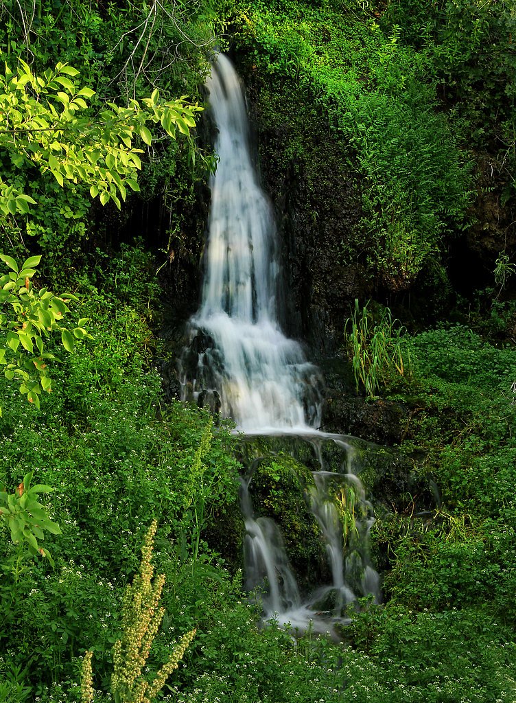
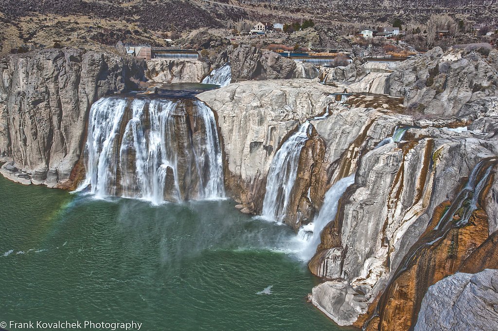
Photo Credits (5)
Difficulty
Moderate
Trail Length
2.4 miles
Trail Type
Out And Back
Elevation Gain
350 ft
About Little Falls
Little Falls is a small, picturesque cascade tucked into the forests of Boise National Forest and managed by the U.S. Forest Service. Its compact, photogenic drop and peaceful wooded setting make it a rewarding short outing for hikers and photographers who want a quiet nature stop without a long approach. The waterfall is reached via a moderate out-and-back route of 2.4 miles with approximately 350 feet of elevation gain, a profile that suits fit families and day hikers. The closest developed camping is the Payette River: South Fork campground, about 14.2 km from the trailhead; before you go, check current conditions and access with the Boise National Forest ranger district to confirm seasonal closures or trail updates.
The Setting
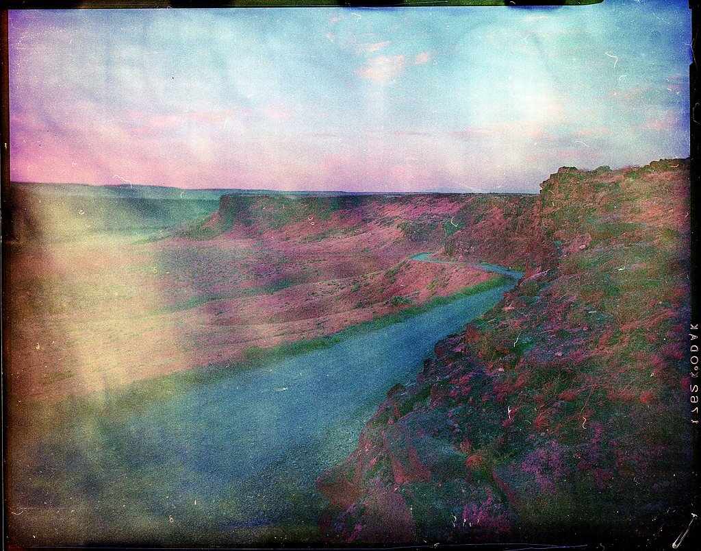
Little Falls sits at 3,399 feet within Boise National Forest, fed by the South Fork Payette River, in the mountains of Idaho.
Trail & Hike Details
The Approach
The moderate 2.4-mile out-and-back trail gains 350 feet of elevation on the way to the falls.
Trail Description
Length: 2.4 miles (out-and-back). Elevation gain: ~350 feet. Difficulty: Moderate. Trail type: Out-and-back. Surface, grade and USFS trail class are not specified in the available USFS data, so expect variable natural tread and consult Boise National Forest for the latest trail condition reports and any route-specific details.
What to Expect
Visitors can expect a peaceful natural setting with a small waterfall surrounded by Idaho's scenic landscapes. The area may be less crowded compared to larger waterfalls.
Accessibility
The trail is not wheelchair accessible. Uneven terrain and elevation changes require steady footing.
Frequently Asked Questions
🐶 Are Dogs Allowed at Little Falls?
❌ Dogs are not allowed
Are There Any Fees or Permits Required?
🆖 No fees required
🏊 Is There Swimming at Little Falls?
❌ Swimming is not allowed
When to Visit
Spring and early summer are typically the best times to visit, as water flow is likely to be higher due to snowmelt.
Seasonal Access
The best time to visit is Spring, Summer, and Fall. Winter access may be limited. Check with Boise National Forest for seasonal road closures.
Safety Information
Visitors should be cautious of slippery rocks near the waterfall and be prepared for changing weather conditions. Always stay on marked trails if available.
Current Water Conditions
1,140 ft³/s
Current discharge — how much water is flowing
Lower than usual for this time of year
Based on 84 years of record
4.30 ft
Water depth at gauge
7-Day Discharge Trend
What does this mean for your visit?
Flow is lower than usual for this time of year.
About This Gauge
This gauge is on a nearby waterway and may not reflect exact conditions at the falls.
7-Day Flow Outlook
Based on the USGS gauge SOUTH FORK PAYETTE RIVER AT LOWMAN, ID (11 km away).
Today
Roaring
1264 cfs
6/10Tomorrow
Roaring
1273 cfs
6/10Tue
Roaring
1120 cfs
9/10Wed
Strong
1003 cfs
10/10Thu
Strong
963 cfs
10/10Fri
Strong
1003 cfs
10/10Sat
Strong
990 cfs
10/10Best window: Wed — strong flow, sunny (trip score 10/10).
Best time of year: this gauge typically runs highest from mid April to mid July, peaking in June.
How we calculate this
This is a transparent outlook, not a precise forecast. We take the waterfall's current flow strength (how it ranks against its historical normal for today, from the nearest USGS stream gauge), carry that ranking forward along the gauge's seasonal curve, and nudge it for forecast rain. Confidence is highest for the next day or two and falls further out. Always check official conditions and your own judgment before visiting — high flows can be dangerous.
Know when to go.
Get a free email alert when waterfalls near Lowman hit peak flow. We only send when conditions are worth the trip — no weekly newsletters, no spam.
Weather Forecast
Location & Access
Getting There
Little Falls is located in Idaho, but specific directions to the site may vary depending on the region. Visitors are advised to consult local maps or GPS for accurate navigation.
Get Directions on Google MapsParking
Parking availability is unclear, but there may be small parking areas nearby. Visitors should plan accordingly and check for updates before visiting.
Elevation
3,399 feet above sea level
Coordinates
44.072396° N, -115.762612° W
Land Management
Managed by USFS
Visitor Tips & Gear
Bring sturdy footwear and be prepared for uneven terrain. Check weather conditions before visiting, and carry water and snacks.
As an Amazon Associate, we earn from qualifying purchases.
With 2.4 miles and 350 ft of elevation gain, sturdy boots and trekking poles will help on this moderate trail. Sun exposure on the trail makes good sun protection a must in summer.

Polarized Sunglasses (Knockaround)
Cuts glare off the water so you actually see the falls — and your photos turn out better too.

Columbia Watertight II Rain Jacket
Packs into its own pocket, seam-sealed, and keeps you dry from spray and surprise rain.

Earth Pak Waterproof Dry Bag
Keeps your phone and gear dry when waterfall mist soaks everything else.

Waterproof Phone Pouch (AiRunTech)
Cheap insurance — take photos right next to the falls without killing your phone.

Timberland Euro Sprint Mid Waterproof
Trusted waterproof boot with premium leather and grippy rubber sole — reliable on rocky, wet trails.

TrailBuddy Trekking Poles
Lightweight aluminum, cork grips, and flip-locks that actually hold — a best-seller for good reason.
Where to Stay

Idaho City Hotel

The Gold Mine Hotel

On-Site Creek and Trails Huge Garden Valley Estate

Hot Tub Soaks & Spot Wildlife! Garden Valley Cabin
Browse vacation cabins and private rentals nearby
Unique outdoor stays — tents, yurts, and treehouses
Rent a campervan or RV for your waterfall road trip
Some links are affiliate links. We may earn a commission at no extra cost to you.
Nearby Campground
Payette River: South Fork
8.8 miles away · 0 sites
ALERT - The Swirly Canyon segment of the South Fork Payette River stretch offers opportunities for camping and fishing in a scenic mountain area. The BLM's South Fork Recreation Site is an undeveloped camping spot along the river.
Book on Recreation.govNearby Hot Springs
Hot springs near Lowman, Idaho

Danskin Creek Hot Spring
Danskin Creek Hot Spring flows at a soak-ready 106 degrees Fahrenheit, emerging just 58 feet from Banks Lowman Road in the Bois...
Pine Flat Hot Springs
Pine Flat Hot Springs erupts at 138 degrees Fahrenheit on Forest Service land in Boise National Forest, just 110 meters from Ba...

Dan Hodges Hot Spring
Dan Hodges Hot Spring emerges at 140 degrees Fahrenheit right along Riverview Way in Boise County, just 90 feet from the road. ...
Corder Hot Spring
Corder Hot Spring sits just nine feet from Fry Drive near Idaho City, making it among the most accessible thermal springs in Bo...
Donlay Ranch Hot Spring
Donlay Ranch Hot Spring flows at 131 degrees Fahrenheit just 115 feet from Southfork Road in the Boise National Forest, combini...
Hot Spring Campground
Hot Spring Campground takes its name from the 124°F thermal source that surfaces at 3,120 feet along the Banks-Lowman Highway i...
Looking for a soak after your hike? Explore more hot springs near Lowman, Idaho on SoakingSprings.
Explore Idaho springsAdditional Information
Nearby Attractions
Nearby attractions may include other natural landmarks or hiking trails in Idaho. Research local guides for more information.
Wildlife
The area may feature typical Idaho wildlife such as birds, deer, and small mammals. Visitors should be cautious and respectful of wildlife.
Cities near Little Falls
Nearby Waterfalls
Other waterfalls named Little Falls
27 other waterfalls share this name across the U.S.
Writing about Little Falls? Embed this waterfall on your site for free.