
Uisge Ban Falls
Nova Scotia • 101 m
By Armen Suny · Last verified Jun 2026
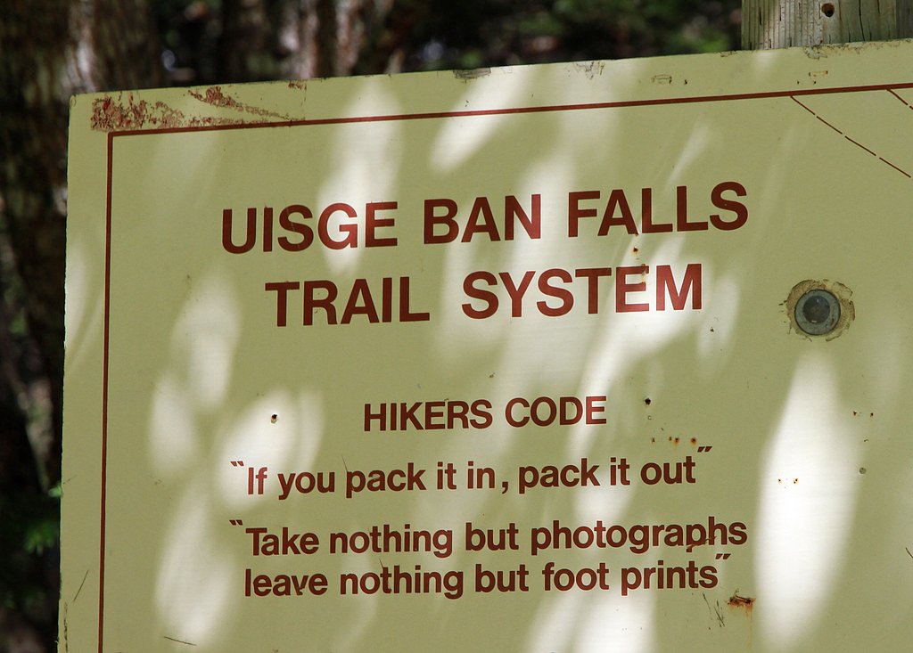
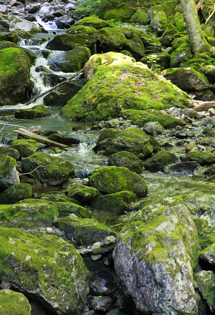
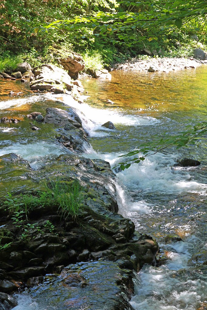
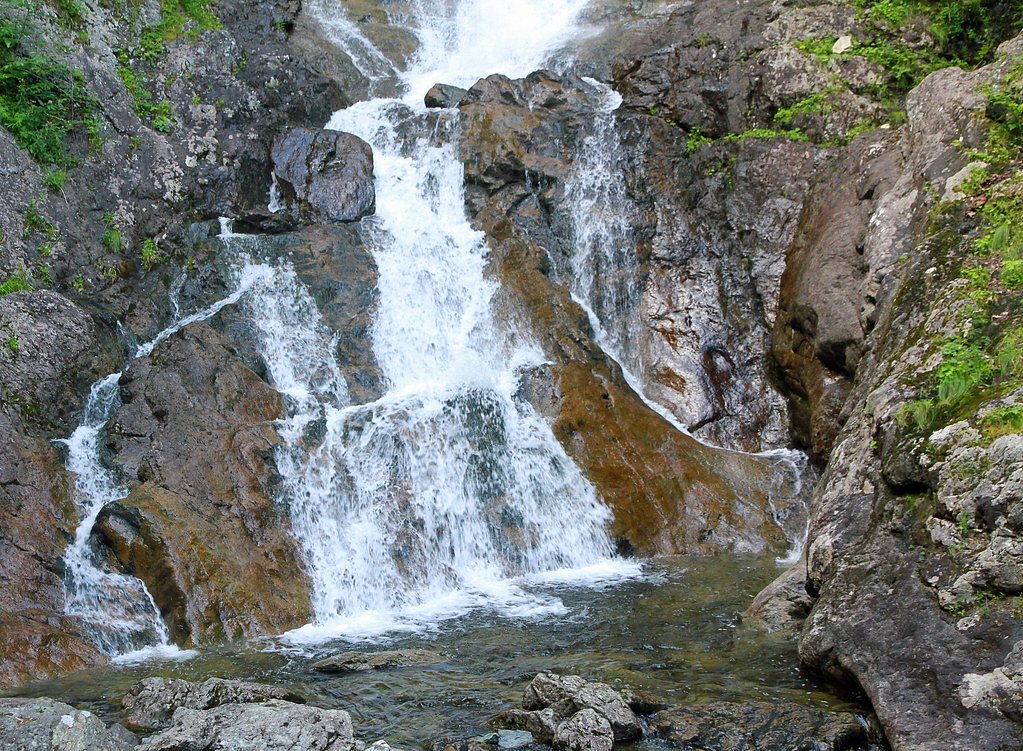
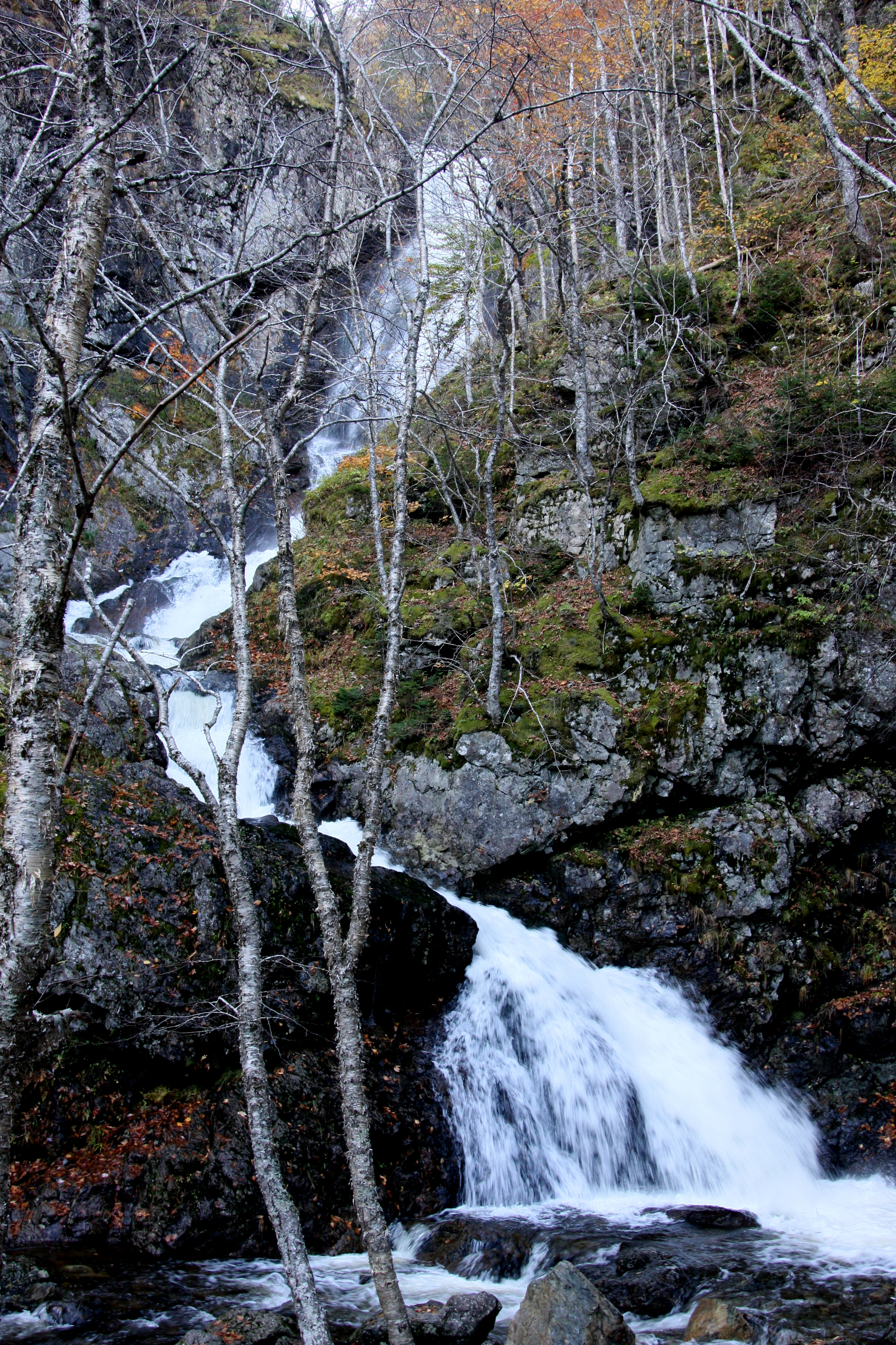
Photo Credits (5)
Difficulty
Easy
Trail Length
2.9 km
Trail Type
Out And Back
Elevation Gain
121 m
About Uisge Ban Falls
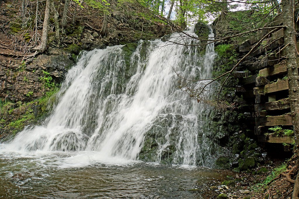
Uisge Ban Falls (also seen spelled Uisage Bàn or Uisge Bàn) is a scenic multi-tiered waterfall on a tributary near Baddeck in Cape Breton, Nova Scotia. The falls cascade through a mixed forest of spruce and hardwoods and are a popular short-hike destination for visitors to the Baddeck area. Water flow is typically highest in spring and after heavy rain; summer and fall visits offer lush forest and fall colour respectively.
The Setting
Uisge Ban Falls sits at 192 metres in the foothills of Nova Scotia. At 101 metres, it is among the taller waterfalls in Nova Scotia.
Why This Waterfall Exists
Uisge Ban Falls flows over hard intrusive rock laid down about 485 million to 1.0 billion years ago. These resistant rocks form a durable ledge that water cannot easily wear away, creating a 330-foot drop where softer material downstream has already eroded.
Trail & Hike Details
The Approach
The easy 2.9-km out-and-back trail gains 121 metres of elevation on the way to the falls.
Trail Description
The trail to Uisge Ban Falls follows a forested stream corridor with roots, rocks, and some uneven footing. Expect a single out-and-back route that descends toward the stream and the waterfall; there may be short steep sections and wet/slippery rock or boardwalks in places. The exact layout may include short viewpoints above or below the main cascade. Trail conditions can vary seasonally and after storms.
What to Expect
The falls plunge a dramatic 101 metres over hard intrusive rock.
Accessibility
The trail is not wheelchair accessible. Uneven terrain and elevation changes require steady footing.
Frequently Asked Questions
🐶 Are Dogs Allowed at Uisge Ban Falls?
❌ Dogs are not allowed
Are There Any Fees or Permits Required?
🆖 No fees required
🏊 Is There Swimming at Uisge Ban Falls?
❌ Swimming is not allowed
When to Visit
Late spring for highest water flow; early summer for lush forest and fewer wet trails; early fall for foliage. Avoid visits immediately after heavy storms if concerned about trail washouts or high water.
Seasonal Access
The best time to visit is Spring, Summer, and Fall. Winter access may be limited. Check with the managing park or local authority for current conditions.
Safety Information
Watch for slippery rocks, wet/muddy sections, and steep drop-offs near the stream. Water levels can rise quickly after rains. Carry basic first-aid supplies, be prepared for limited cell coverage, and avoid approaching the edge of falls. Expect biting insects in warm months and perform tick checks after hiking. If hiking in winter, trails can be icy and hazardous without appropriate gear.
Current Water Conditions
2.2 m³/s
Current discharge — how much water is flowing
Higher than usual for this time of year
Based on 21 years of record
1.06 m
Water depth at gauge
7-Day Discharge Trend
What does this mean for your visit?
The water is flowing higher than usual for this time of year.
About This Gauge
This gauge is on a nearby waterway and may not reflect exact conditions at the falls.
7-Day Flow Outlook
Based on the WSC gauge MIDDLE RIVER AT MACLENNANS CROSS (12 km away).
Today
Roaring
2.5 m³/s
6/10Tomorrow
Strong
2.3 m³/s
10/10Tue
Strong
2.1 m³/s
9/10Wed
Roaring
2.9 m³/s
6/10Thu
Roaring
3.3 m³/s
6/10Fri
Roaring
2.7 m³/s
6/10Sat
Strong
2.7 m³/s
8/10Best window: Tomorrow — strong flow, sunny (trip score 10/10).
Best time of year: this gauge typically runs highest from early April to late May, peaking in April.
How we calculate this
This is a transparent outlook, not a precise forecast. We take the waterfall's current flow strength (how it ranks against its historical normal for today, from the nearest WSC stream gauge), carry that ranking forward along the gauge's seasonal curve, and nudge it for forecast rain. Confidence is highest for the next day or two and falls further out. Always check official conditions and your own judgment before visiting — high flows can be dangerous.
Know when to go.
Get a free email alert when waterfalls near Baddeck hit peak flow. We only send when conditions are worth the trip — no weekly newsletters, no spam.
Weather Forecast
Location & Access
Getting There
The falls are located near Baddeck, Nova Scotia (coordinates approx. 46.2115, -60.789). Access is by local roads off the main route serving the Baddeck area; expect a short drive from Baddeck (roughly 7 miles). Cell service may be limited in places; follow local signs to the trailhead.
Get Directions on Google MapsParking
There is a small, signed trailhead parking area near the start of the trail. Parking is limited and may be unpaved; during busy times you may need to arrive early or find alternative legal parking. Overnight parking or camping at the trailhead is likely not permitted.
Elevation
192 metres above sea level
Coordinates
46.211536° N, -60.788988° W
Visitor Tips & Gear
Wear sturdy, grippy footwear and be prepared for muddy or wet trail sections. Bring insect repellent in spring/summer and check for ticks after hiking. Arrive earlier in the day to secure parking. Leave no trace, pack out garbage. Cell service may be intermittent; tell someone your plans if hiking alone. Confirm local rules for dogs and seasonal advisories before visiting.
As an Amazon Associate, we earn from qualifying purchases.
This easy 2.9 km hike is straightforward — comfortable trail shoes and plenty of water should do. Sun exposure on the trail makes good sun protection a must in summer.

Polarized Sunglasses (Knockaround)
Cuts glare off the water so you actually see the falls — and your photos turn out better too.

Columbia Watertight II Rain Jacket
Packs into its own pocket, seam-sealed, and keeps you dry from spray and surprise rain.

Earth Pak Waterproof Dry Bag
Keeps your phone and gear dry when waterfall mist soaks everything else.

Waterproof Phone Pouch (AiRunTech)
Cheap insurance — take photos right next to the falls without killing your phone.

JOBY GorillaPod Starter Kit
Wraps around railings and rocks for long-exposure waterfall shots — no flat surface needed.

Osprey Daylite Daypack
Light, organized, and just the right size for a day hike — fits water, snacks, and layers.
Where to Stay
Browse vacation cabins and private rentals nearby
Unique outdoor stays — tents, yurts, and treehouses
Rent a campervan or RV for your waterfall road trip
Some links are affiliate links. We may earn a commission at no extra cost to you.
Nearby Campground
Baddeck Cabot Trail Campground
14.3 km away
Additional Information
Nearby Attractions
Baddeck village (services and accommodations), Alexander Graham Bell National Historic Site (Baddeck), scenic drives of Cape Breton Island and nearby provincial parks. Cape Breton Highlands National Park is further to the north.
Wildlife
Typical Cape Breton fauna may be present: white-tailed deer, small mammals, songbirds, and occasionally moose in the region. Take standard wildlife precautions and store food securely.
Cities near Uisge Ban Falls
Nearby Waterfalls
Writing about Uisge Ban Falls? Embed this waterfall on your site for free.