
Photo Credits (5)
Difficulty
Moderate
Trail Length
2.4 miles
Trail Type
Out And Back
Elevation Gain
350 ft
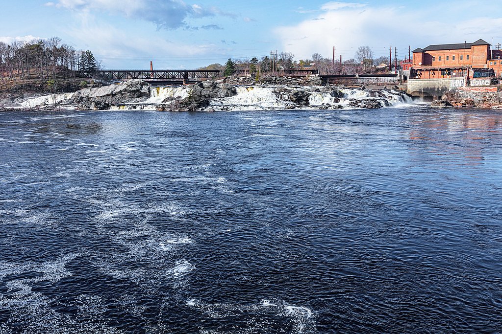
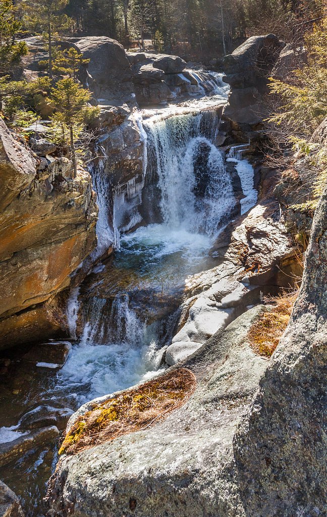
About Little Falls
Little Falls is a small but picturesque waterfall located in Maine, known for its serene surroundings and easy accessibility. It is a popular spot for locals and visitors seeking a peaceful natural retreat.
The Setting
Little Falls sits at 75 feet along the St. Croix River, in the coastal lowlands of Maine.
Trail & Hike Details
The Approach
The moderate 2.4-mile out-and-back trail gains 350 feet of elevation on the way to the falls.
Trail Description
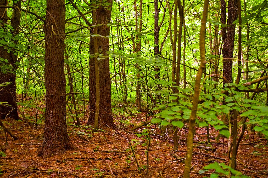
The trail to Little Falls is short and easy, making it suitable for most visitors, including families with children. The path is relatively flat and may pass through wooded areas before reaching the waterfall.
What to Expect
Dogs are welcome.
Accessibility
The trail is not wheelchair accessible. Uneven terrain and elevation changes require steady footing.
Frequently Asked Questions
🐶 Are Dogs Allowed at Little Falls?
✅ Dogs are allowed
Are There Any Fees or Permits Required?
🆖 No fees required
🏊 Is There Swimming at Little Falls?
❌ Swimming is not allowed
When to Visit
Spring and early summer are ideal for visiting Little Falls, as the water flow is typically stronger due to snowmelt and rainfall.
Seasonal Access
The best time to visit is Spring, Summer, and Fall. Winter access may be limited.
Safety Information
Exercise caution near the water, as rocks may be slippery. Be aware of ticks and other insects, especially during warmer months.
Current Water Conditions
Based on a USGS gauge 15.4 miles away
1,340 ft³/s
Current discharge — how much water is flowing
About average for this time of year
Based on 66 years of record
5.20 ft
Water depth at gauge
7-Day Discharge Trend
What does this mean for your visit?
Flow is about average for this time of year.
About This Gauge
This gauge is on a regional waterway. Conditions at the falls may differ, especially after local rain.
7-Day Flow Outlook
Based on the USGS gauge St. Croix River at Baring, Maine (25 km away).
Today
Roaring
1436 cfs
6/10Tomorrow
Roaring
1662 cfs
6/10Mon
Roaring
1526 cfs
8/10Tue
Roaring
1427 cfs
6/10Wed
Roaring
1490 cfs
6/10Thu
Roaring
1704 cfs
6/10Fri
Roaring
1499 cfs
6/10Best window: Mon — roaring flow, patchy fog then mostly sunny (trip score 8/10).
Best time of year: this gauge typically runs highest from early March to late May, peaking in April.
How we calculate this
This is a transparent outlook, not a precise forecast. We take the waterfall's current flow strength (how it ranks against its historical normal for today, from the nearest USGS stream gauge), carry that ranking forward along the gauge's seasonal curve, and nudge it for forecast rain. Confidence is highest for the next day or two and falls further out. Always check official conditions and your own judgment before visiting — high flows can be dangerous.
Know when to go.
Get a free email alert when waterfalls near Eastport hit peak flow. We only send when conditions are worth the trip — no weekly newsletters, no spam.
Weather Forecast
Location & Access
Getting There
Little Falls is located near the town of Gorham, Maine. It can be accessed via local roads, and specific directions may vary depending on your starting point. Check local maps or GPS for the most accurate route.
Get Directions on Google MapsParking
Parking availability is limited and may consist of roadside parking or small designated areas nearby. Visitors should plan accordingly and avoid blocking private property.
Elevation
75 feet above sea level
Coordinates
44.916744° N, -67.271377° W
Visitor Tips & Gear
Visit after recent rainfall for the best water flow. Wear sturdy shoes as the trail may be uneven in some areas. Arrive early to secure parking, especially during weekends or peak seasons.
As an Amazon Associate, we earn from qualifying purchases.
With 2.4 miles and 350 ft of elevation gain, sturdy boots and trekking poles will help on this moderate trail. Sun exposure on the trail makes good sun protection a must in summer.

Polarized Sunglasses (Knockaround)
Cuts glare off the water so you actually see the falls — and your photos turn out better too.

Columbia Watertight II Rain Jacket
Packs into its own pocket, seam-sealed, and keeps you dry from spray and surprise rain.

Earth Pak Waterproof Dry Bag
Keeps your phone and gear dry when waterfall mist soaks everything else.

Waterproof Phone Pouch (AiRunTech)
Cheap insurance — take photos right next to the falls without killing your phone.

Timberland Euro Sprint Mid Waterproof
Trusted waterproof boot with premium leather and grippy rubber sole — reliable on rocky, wet trails.

TrailBuddy Trekking Poles
Lightweight aluminum, cork grips, and flip-locks that actually hold — a best-seller for good reason.
Where to Stay

Robinson's Cottages

Treadwell Inn

Sunset Tides

Updated Historic Water St 2 Bdr, 2 Bath apartment.
Browse vacation cabins and private rentals nearby
Unique outdoor stays — tents, yurts, and treehouses
Rent a campervan or RV for your waterfall road trip
Some links are affiliate links. We may earn a commission at no extra cost to you.
Additional Information
Nearby Attractions
The town of Gorham offers additional outdoor activities, local shops, and dining options. Other nearby natural attractions may include hiking trails and scenic spots.
Wildlife
The area around Little Falls is home to common Maine wildlife, such as birds, squirrels, and deer. Visitors should be mindful of their surroundings.
Cities near Little Falls
Other waterfalls named Little Falls
27 other waterfalls share this name across the U.S.
Writing about Little Falls? Embed this waterfall on your site for free.