Photo Credits (5)
Difficulty
Moderate
Trail Length
2.4 miles
Trail Type
Out And Back
Elevation Gain
350 ft
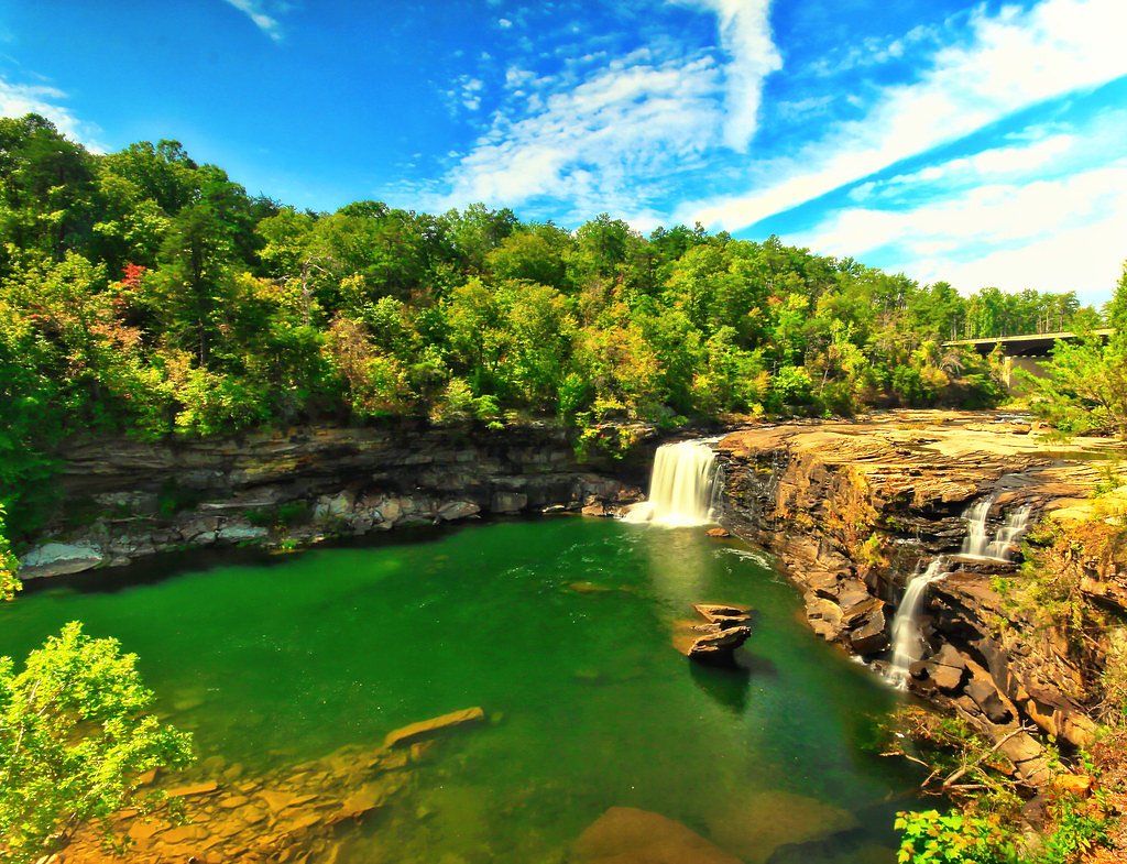
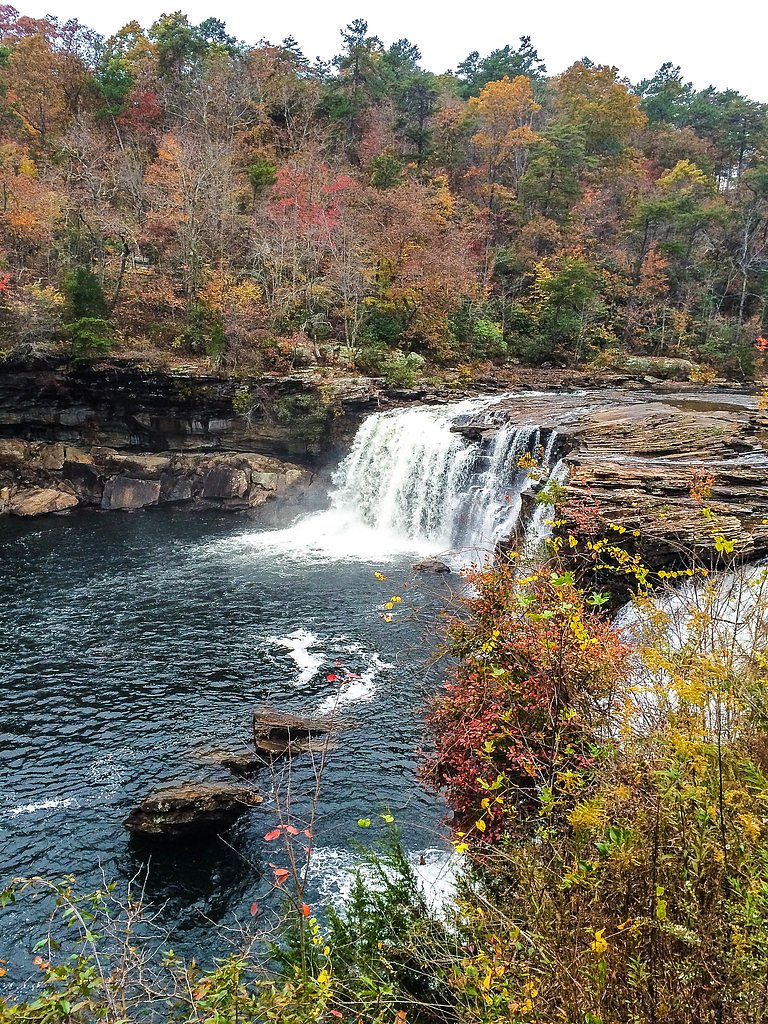
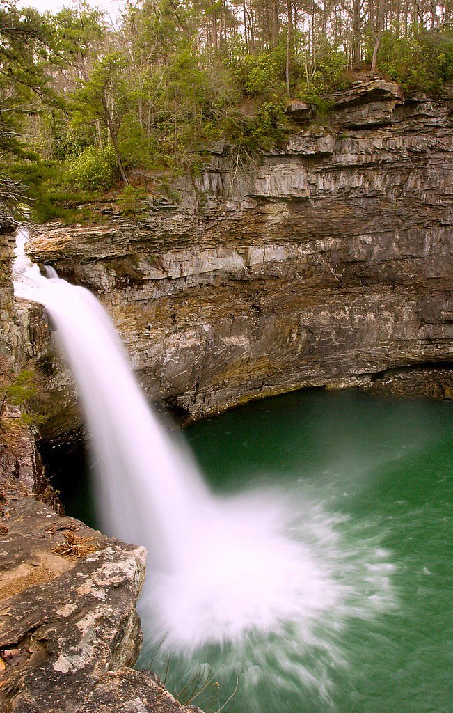
About Little Falls
Little Falls is a small, scenic waterfall tucked into wooded country in Alabama, prized for its peaceful setting and the rocky plunge pool at the base. The falls are a compact but rewarding destination — you’ll find a tranquil cascade framed by trees and boulders that make for pleasant photo opportunities and a quiet place to sit and listen to the stream. Access is via a short, moderately challenging hike: the route to Little Falls is a 2.4-mile out-and-back with about 350 feet of elevation gain. The trail’s modest length makes it an ideal half-day outing for hikers who enjoy a bit of uphill work in exchange for an easy-to-reach, scenic waterfall destination.
The Setting
Little Falls sits at 1,263 feet along the South Sauty Creek, in the foothills of Alabama.
Trail & Hike Details
The Approach
The moderate 2.4-mile out-and-back trail gains 350 feet of elevation on the way to the falls.
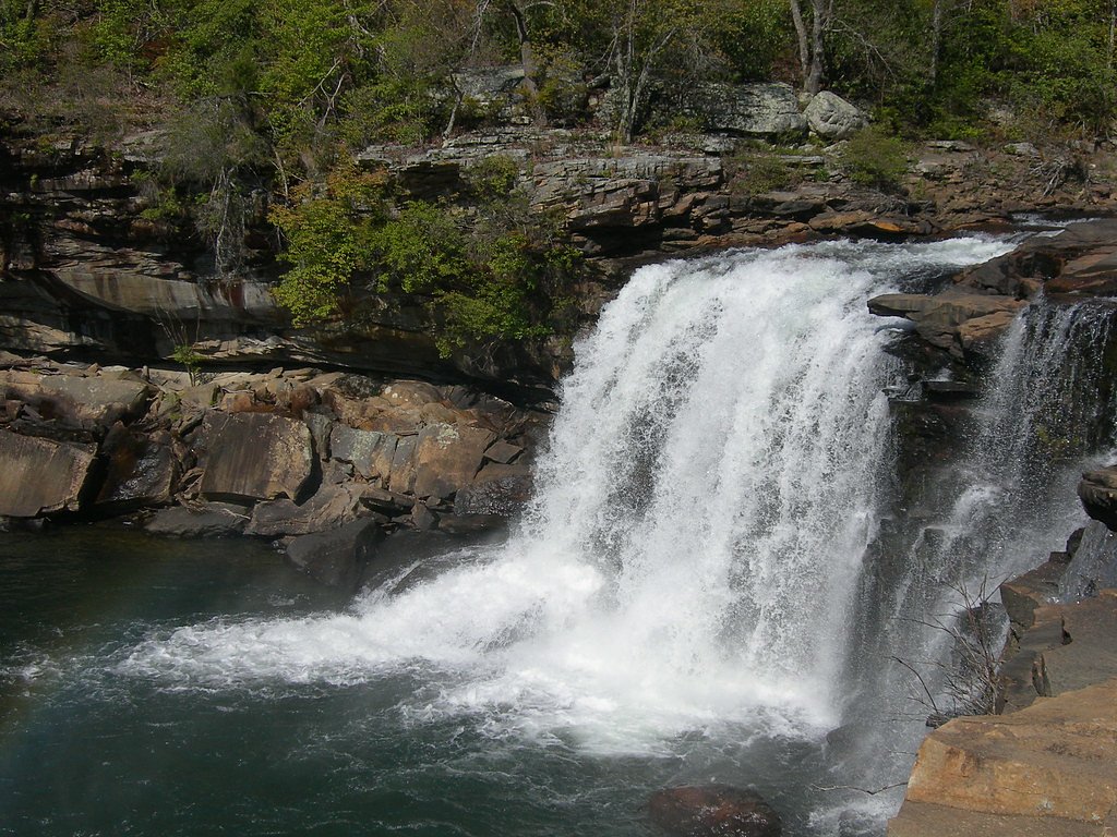
Trail Description
This is a 2.4-mile out-and-back trail with roughly 350 feet of total elevation gain and a moderate difficulty rating. The path winds through a wooded area and includes short uphill sections; it finishes at the falls, which sit among rocks with a small pool at the base. Overall the trail is relatively short but requires steady footing on natural forest tread and is best suited to hikers comfortable with moderate grades.
What to Expect
Swimming is permitted. Dogs are welcome.
Accessibility
The trail is not wheelchair accessible. Uneven terrain and elevation changes require steady footing.
Frequently Asked Questions
🐶 Are Dogs Allowed at Little Falls?
✅ Dogs are allowed
Are There Any Fees or Permits Required?
🆖 No fees required
🏊 Is There Swimming at Little Falls?
✅ Swimming is allowed
When to Visit
Spring and early summer are ideal times to visit, as the waterfall is typically more active due to seasonal rainfall.
Seasonal Access
The best time to visit is Spring, Summer, and Fall. Winter access may be limited.
Safety Information
Exercise caution on wet or slippery rocks near the waterfall. Be aware of changing water levels, especially after heavy rainfall.
Current Water Conditions
Based on a USGS gauge 29.1 miles away
12 ft³/s
Current discharge — how much water is flowing
About average for this time of year
Based on 15 years of record
7.51 ft
Water depth at gauge
7-Day Discharge Trend
What does this mean for your visit?
Flow is about average for this time of year.
About This Gauge
This gauge is on a regional waterway. Conditions at the falls may differ, especially after local rain.
7-Day Flow Outlook
Based on the USGS gauge SOUTH SAUTY CREEK NEAR RAINSVILLE, ALA (47 km away).
Today
Roaring
14 cfs
6/10Tomorrow
Roaring
12 cfs
6/10Tue
Roaring
15 cfs
6/10Wed
Roaring
11 cfs
6/10Thu
Roaring
22 cfs
6/10Fri
Roaring
20 cfs
6/10Sat
Roaring
14 cfs
6/10Best window: Today — roaring flow, patchy fog then chance showers and thunderstorms (trip score 6/10).
Best time of year: this gauge typically runs highest from mid February to late March, peaking in February.
How we calculate this
This is a transparent outlook, not a precise forecast. We take the waterfall's current flow strength (how it ranks against its historical normal for today, from the nearest USGS stream gauge), carry that ranking forward along the gauge's seasonal curve, and nudge it for forecast rain. Confidence is highest for the next day or two and falls further out. Always check official conditions and your own judgment before visiting — high flows can be dangerous.
Know when to go.
Get a free email alert when waterfalls near Trenton hit peak flow. We only send when conditions are worth the trip — no weekly newsletters, no spam.
Weather Forecast
Location & Access
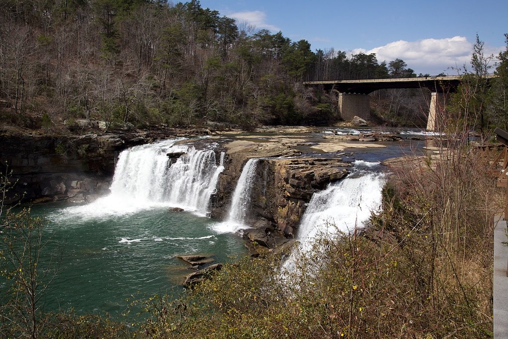
Getting There
Little Falls is located near the town of Geraldine, Alabama. Access is typically via local roads, and visitors should use GPS or local maps to navigate to the area.
Get Directions on Google MapsParking
Parking availability may vary depending on the specific access point. Visitors are advised to check local resources or visitor reports for the most up-to-date information.
Elevation
1,263 feet above sea level
Coordinates
34.846504° N, -85.641001° W
Visitor Tips & Gear
Wear sturdy shoes as the trail may have uneven terrain. Bring water and snacks, and consider visiting during the spring or after rainfall for the best water flow.
As an Amazon Associate, we earn from qualifying purchases.
With 2.4 miles and 350 ft of elevation gain, sturdy boots and trekking poles will help on this moderate trail. Sun exposure on the trail makes good sun protection a must in summer.

Polarized Sunglasses (Knockaround)
Cuts glare off the water so you actually see the falls — and your photos turn out better too.

Columbia Watertight II Rain Jacket
Packs into its own pocket, seam-sealed, and keeps you dry from spray and surprise rain.

Earth Pak Waterproof Dry Bag
Keeps your phone and gear dry when waterfall mist soaks everything else.

Waterproof Phone Pouch (AiRunTech)
Cheap insurance — take photos right next to the falls without killing your phone.

Timberland Euro Sprint Mid Waterproof
Trusted waterproof boot with premium leather and grippy rubber sole — reliable on rocky, wet trails.

TrailBuddy Trekking Poles
Lightweight aluminum, cork grips, and flip-locks that actually hold — a best-seller for good reason.
Where to Stay

Dogwood Cottage with Private Fire Pit & Sleeps 6

The Hickory Tiny Home in Menlo

Cloudland at McLemore Resort Lookout Mountain, Curio by Hilton

The Fox Tail Pine Treehouse at Treetop Escapes
Browse vacation cabins and private rentals nearby
Unique outdoor stays — tents, yurts, and treehouses
Rent a campervan or RV for your waterfall road trip
Some links are affiliate links. We may earn a commission at no extra cost to you.
Nearby Campground
Chickamauga Battlefield Group Campground
22.1 miles away · 9 sites
Overview THIS IS NOT A PUBLIC CAMPGROUND. SCOUTS AND CIVIC ORGANIZATIONS ONLY. These sites are for overnight camping by organized non-profit (501c) youth groups (scouts, church youth groups) under adult supervision for the purpose of education of the historic resources of the battlefield. Due to limited space and facilities, camping for solely recreational purposes is not allowed. Groups must choose sites according to the size of their group. Recreation Hiking, biking, and horseback riding are p
Book on Recreation.govAdditional Information
Nearby Attractions
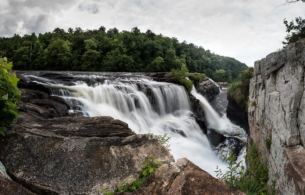
Nearby attractions include High Falls Park and other natural areas in the region.
Wildlife
The area is home to various birds, small mammals, and insects. Visitors may also encounter fish or amphibians near the water.
Cities near Little Falls
Nearby Waterfalls
Other waterfalls named Little Falls
27 other waterfalls share this name across the U.S.
Writing about Little Falls? Embed this waterfall on your site for free.