Horseshoe Falls
British Columbia • Wells Gray Park • 16 m
By Armen Suny · Last verified Jun 2026
Difficulty
Hard
Trail Length
28.0 km
Trail Type
Out And Back
About Horseshoe Falls
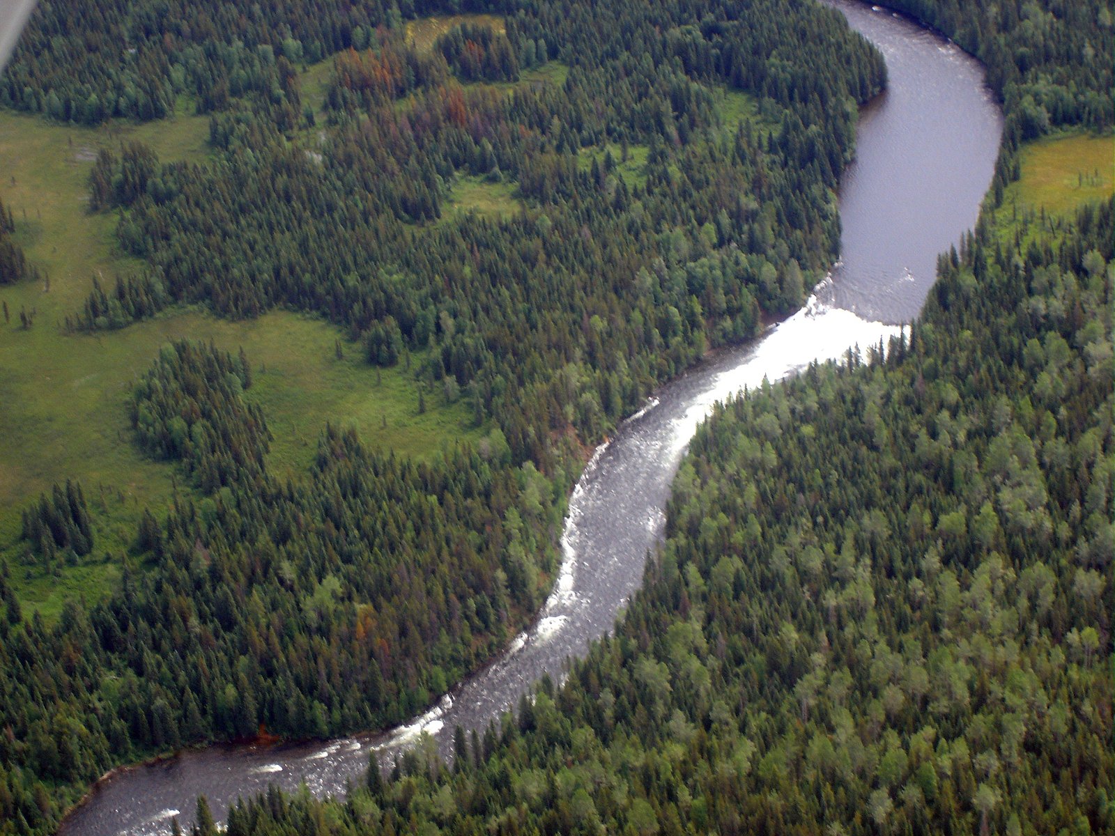
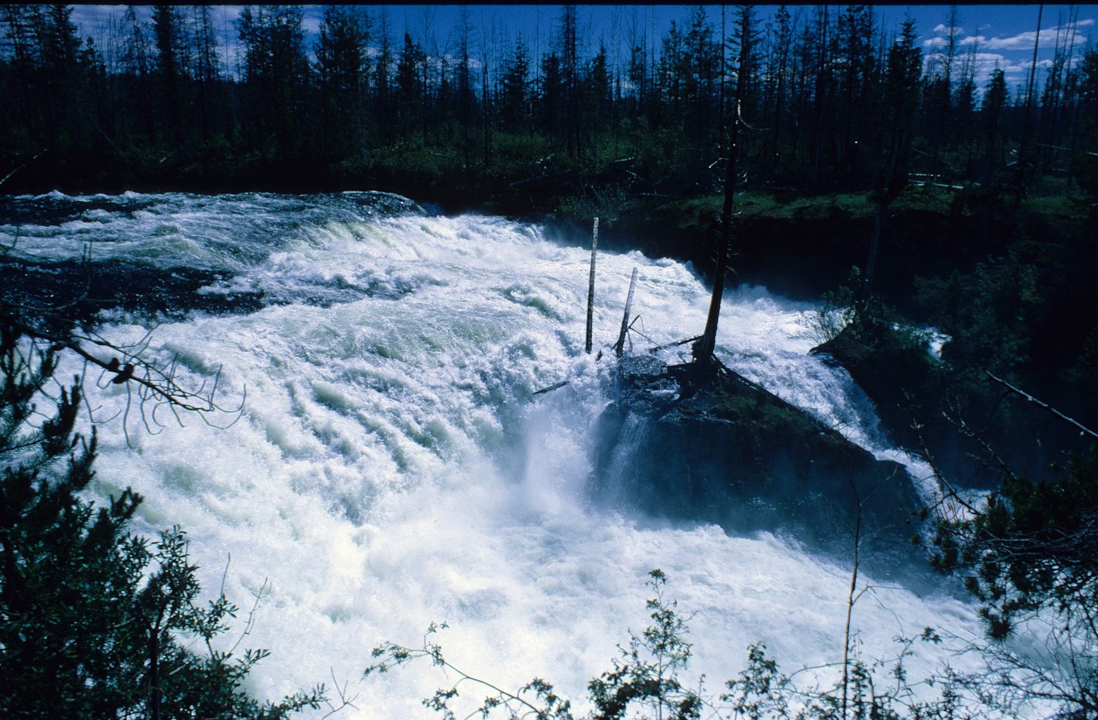
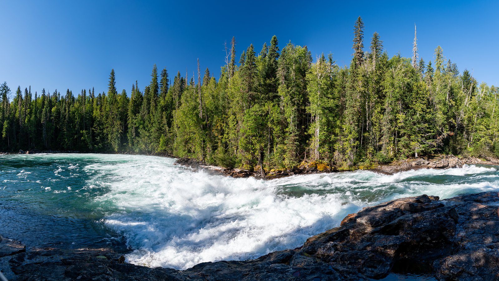
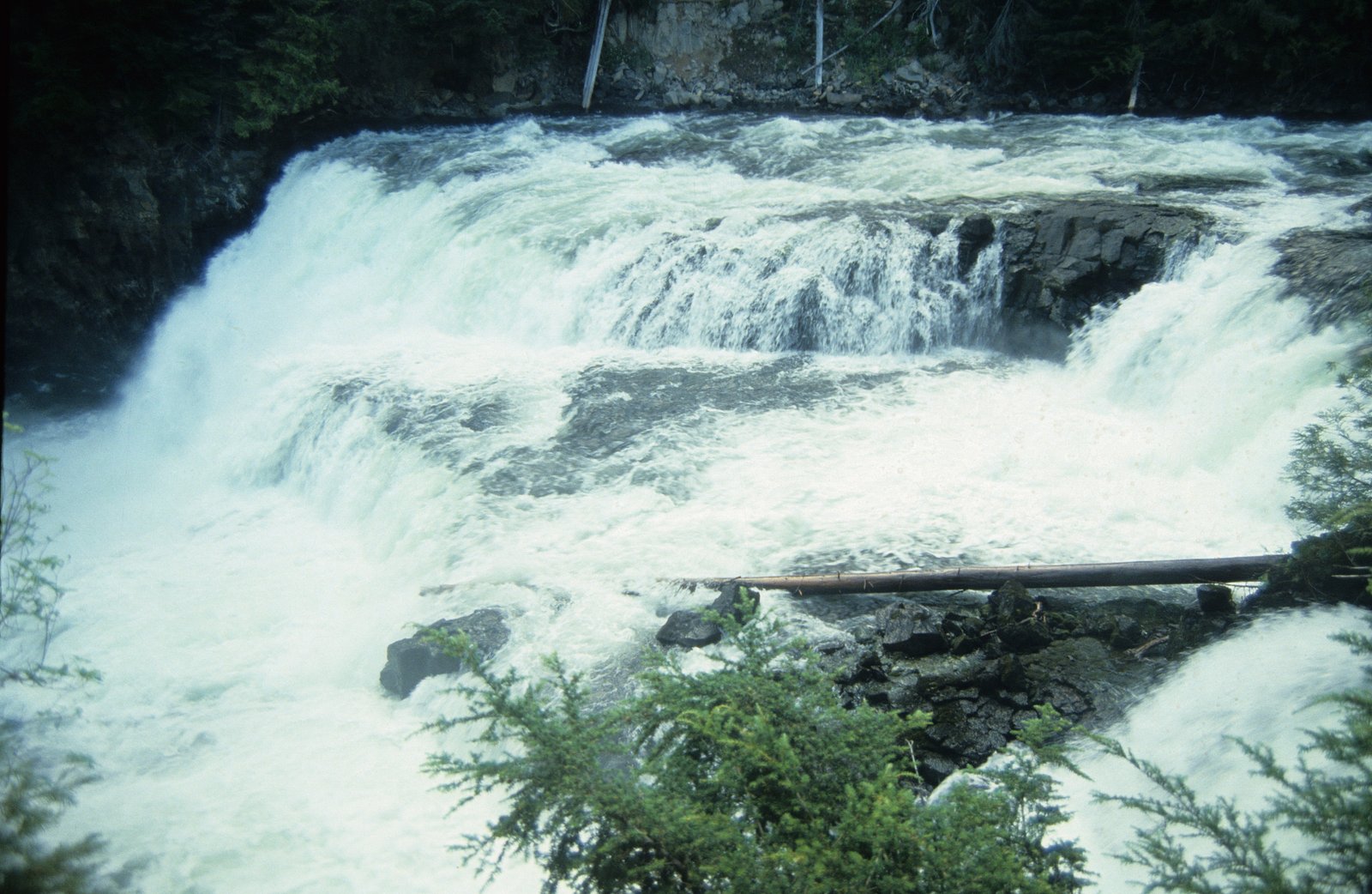
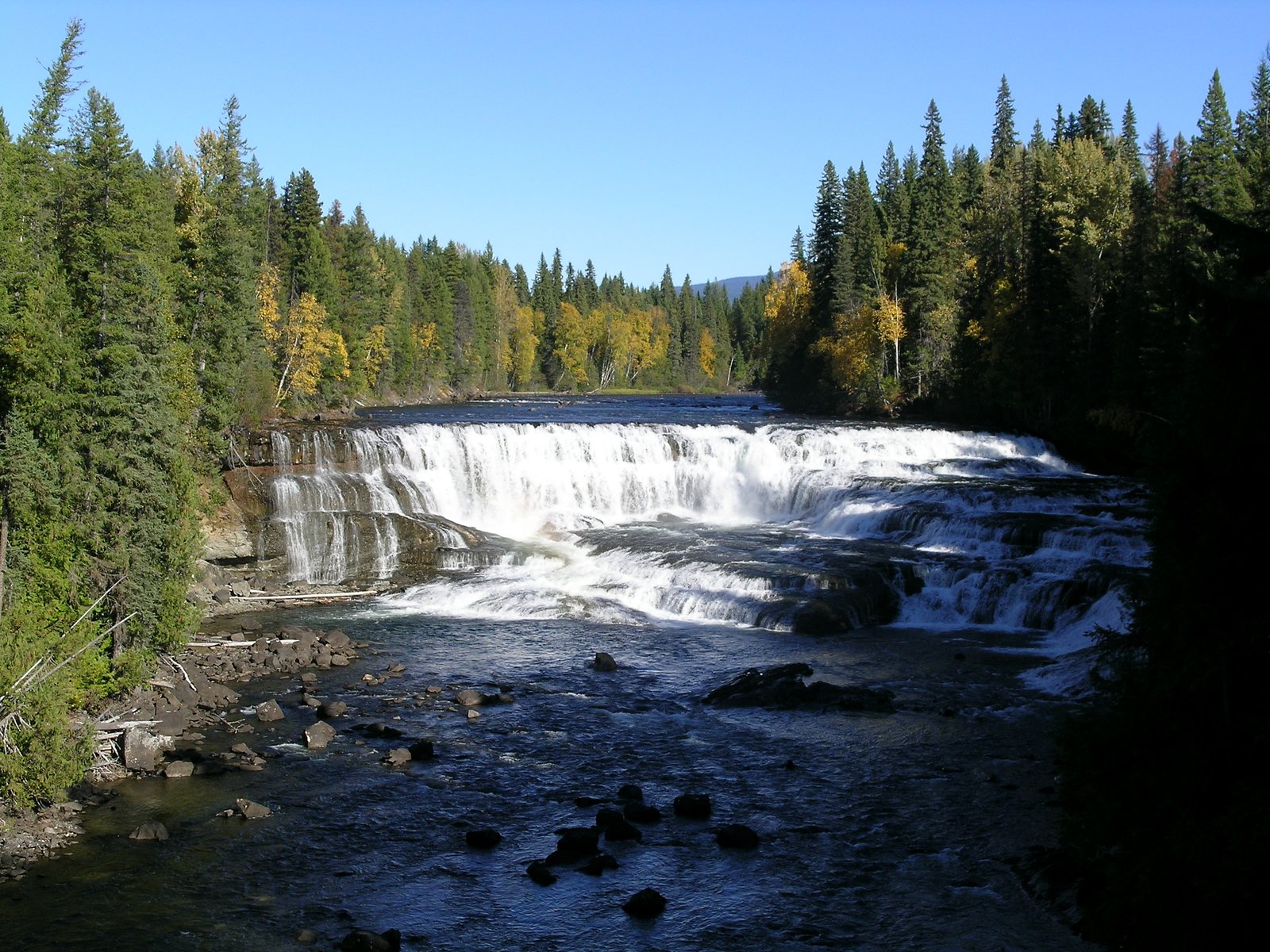
Horseshoe Falls is one of seven waterfalls on the Murtle River west of Murtle Lake in Wells Gray Provincial Park, east-central British Columbia, Canada. Horseshoe Falls has two steps, 100 m (328 ft) apart; the upper drop is 6 m (20 ft) high and the lower and much wider drop is 10 m (33 ft) high.
The Setting
Horseshoe Falls sits at 947 metres within Wells Gray Park, in the mountains of British Columbia. The falls drop 16 metres.
Why This Waterfall Exists
Horseshoe Falls flows over hard volcanic rock, primarily basalt, laid down about 3 million years ago. These resistant rocks form a durable ledge that water cannot easily wear away, creating a 53-foot drop where softer material downstream has already eroded.
Nearby Falls Worth Visiting
Dawson Falls (20 m) lies 11.9 kilometres to the southwest. Also nearby: McDougall Falls (14 m, 11.1 km) and Majerus Falls (12 m, 3.4 km).
Trail & Hike Details
Trail Description
There is little to no formal trail information published for this specific Horseshoe Falls. Approaches may be via short social/boot-packed trails or cross-country travel from a road pullout. Trails, if present, are likely unmaintained and can include steep or uneven sections, loose rock, and wet/brushy ground. Navigation with a map/GPS and basic route-finding skills may be required.
What to Expect
The falls drop 16 metres over hard volcanic rock.
Accessibility
The trail involves steep, uneven terrain with significant elevation change and is not accessible to mobility devices.
Frequently Asked Questions
🐶 Are Dogs Allowed at Horseshoe Falls?
❌ Dogs are not allowed
Are There Any Fees or Permits Required?
🆖 No fees required
🏊 Is There Swimming at Horseshoe Falls?
❌ Swimming is not allowed
When to Visit
Late spring for highest flows and dramatic water volume; summer and early fall for easiest access and drier roads. Avoid visiting during freeze-thaw periods or heavy rain where access roads may be impassable or the site may be hazardous.
Seasonal Access
The best time to visit is Spring, Summer, Fall, and Winter. Check with Wells Gray Park for current conditions.
Safety Information
Hazards may include: slippery rocks and wet banks; unstable cliff edges; strong currents near or below the falls; hypothermia risk from cold water; remote location with limited or no cell service; seasonal road closures and poor road conditions; wildlife encounters (bears, moose). Use caution near edges, wear appropriate footwear, avoid approaching the lip of the falls, and tell someone your route and expected return time. If visiting in winter, be prepared for deep snow, ice, and avalanche risk on nearby slopes.
Current Water Conditions
Based on a Water Survey of Canada gauge 44.2 km away
382.0 m³/s
Current discharge — how much water is flowing
About average for this time of year
Based on 87 years of record
3.70 m
Water depth at gauge
7-Day Discharge Trend
What does this mean for your visit?
Flow is about average for this time of year.
About This Gauge
This gauge is on a regional waterway. Conditions at the falls may differ, especially after local rain.
7-Day Flow Outlook
Based on the WSC gauge CLEARWATER RIVER NEAR CLEARWATER STATION (44 km away).
Today
Moderate
407 m³/s
5/10Tomorrow
Moderate
420 m³/s
5/10Tue
Moderate
388 m³/s
8/10Wed
Moderate
360 m³/s
6/10Thu
Moderate
347 m³/s
6/10Fri
Moderate
366 m³/s
5/10Sat
Moderate
366 m³/s
5/10Best window: Tue — moderate flow, sunny (trip score 8/10).
Best time of year: this gauge typically runs highest from early May to early August, peaking in June.
How we calculate this
This is a transparent outlook, not a precise forecast. We take the waterfall's current flow strength (how it ranks against its historical normal for today, from the nearest WSC stream gauge), carry that ranking forward along the gauge's seasonal curve, and nudge it for forecast rain. Confidence is highest for the next day or two and falls further out. Always check official conditions and your own judgment before visiting — high flows can be dangerous.
Weather Forecast
Location & Access
Getting There
The waterfall is in a remote part of central BC. Access may require driving on secondary or resource (forest/logging) roads off the nearest paved highway. Expect unpaved roads that may be rough, gated, or seasonally closed; high-clearance vehicles and 4WD may be recommended. Use the provided coordinates in a GPS device or mapping app. Cell service is likely limited or unavailable in the area.
Get Directions on Google MapsParking
There is likely informal roadside parking or a small pullout near the trailhead or at the end of a logging road. Do not block gates or private driveways. Facilities (toilets, trash cans) are likely not present.
Elevation
947 metres above sea level
Coordinates
52.052170° N, -120.022936° W
Land Management
Managed by Government of British Columbia
Visitor Tips & Gear
• Use the exact coordinates in a reliable GPS or mapping app. • Travel on resource roads cautiously; check local road reports and closures. • Wear sturdy, waterproof footwear and expect slippery rocks near the falls. • Carry a printed map and compass or offline map, don’t rely solely on cell service. • Bring bear spray and know how to use it. • Leave no trace: pack out all trash and avoid disturbing vegetation or wildlife. • If you plan to use private or gated roads, obtain permission where required.
Where to Stay
Browse vacation cabins and private rentals nearby
Unique outdoor stays — tents, yurts, and treehouses
Rent a campervan or RV for your waterfall road trip
Some links are affiliate links. We may earn a commission at no extra cost to you.
Nearby Campground
Murtle River Camp
6 km away
Additional Information
Nearby Attractions
This area of central British Columbia may have other natural attractions such as provincial parks, lakes, and river access points. Specific nearby attractions are not confirmed for this exact location and may include backcountry recreation and forestry features; use local tourism or park resources for verified nearby sites.
Wildlife
Typical interior-BC wildlife may be present: black bear, moose, deer, coyotes, small mammals, and a variety of birds. Practice bear-aware behaviour and store food securely.
Nearby Waterfalls
Other waterfalls named Horseshoe Falls
14 other waterfalls share this name across Canada.
Writing about Horseshoe Falls? Embed this waterfall on your site for free.