Horseshoe Falls
Ontario • 51 m
By Armen Suny · Last verified Jun 2026
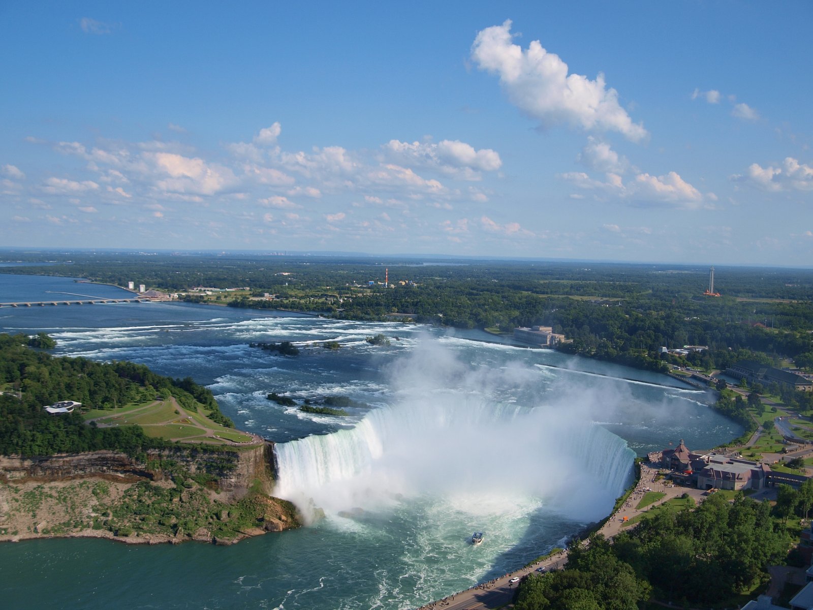
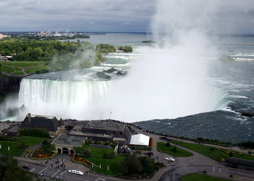
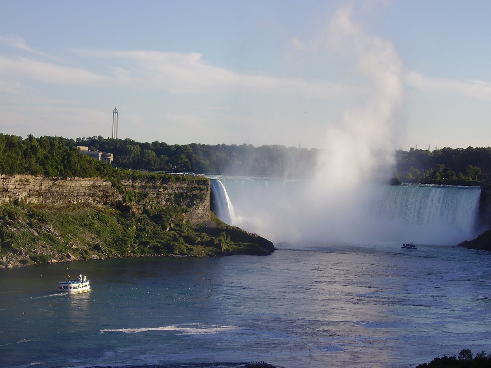
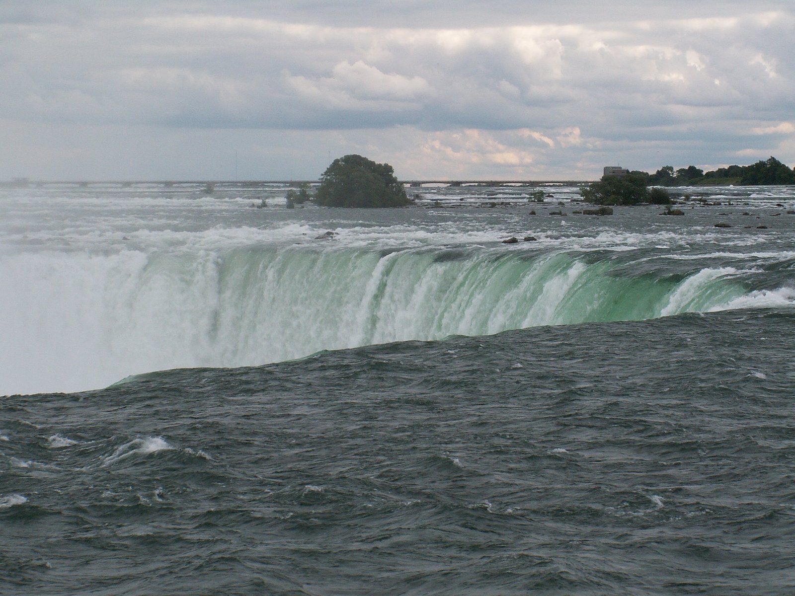

Photo Credits (5)
Difficulty
Drive Up
About Horseshoe Falls
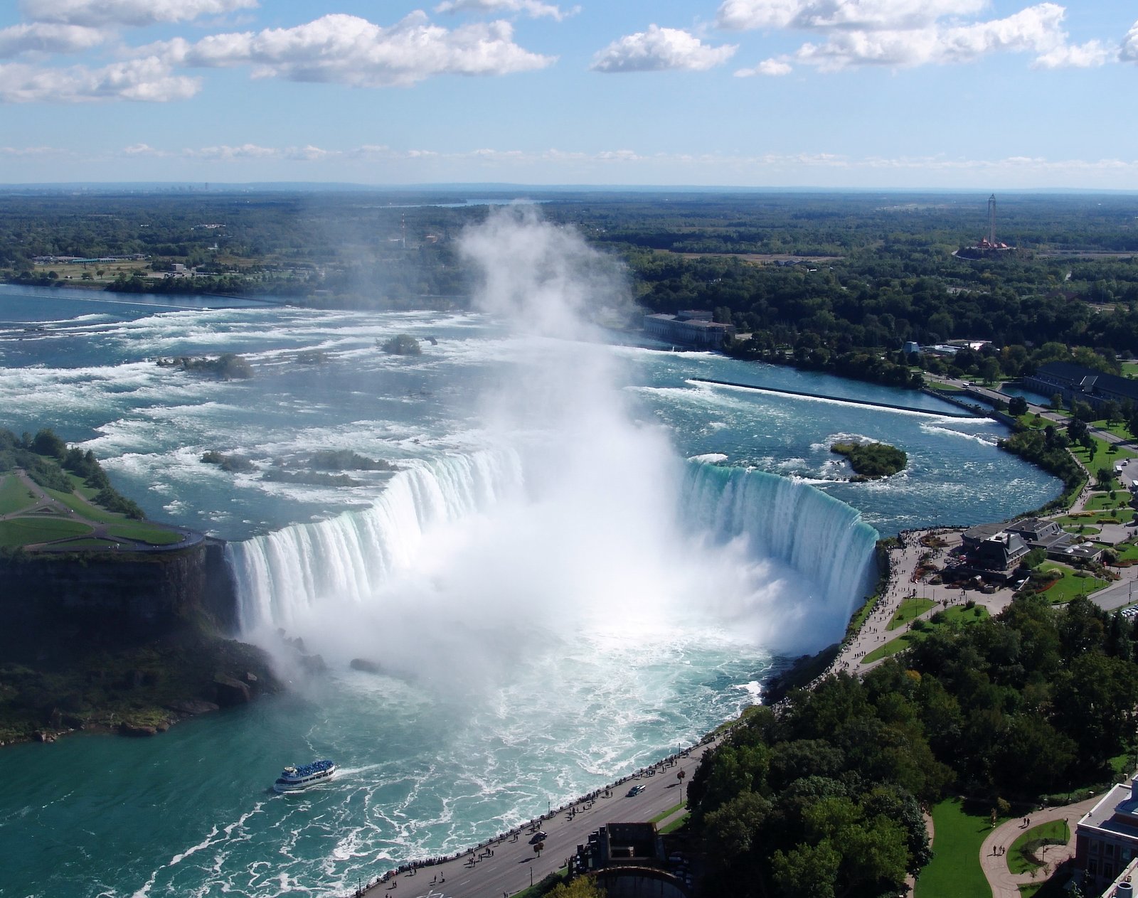
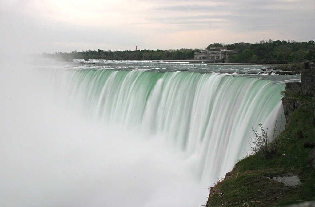
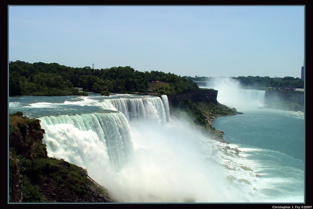
Horseshoe Falls is the largest of the three waterfalls that collectively form Niagara Falls on the Niagara River along the Canada–United States border. Approximately 90% of the Niagara River, after around half the water is diverted for hydropower generation, flows over Horseshoe Falls. The remaining 10% flows over American Falls and Bridal Veil Falls. It is located between Terrapin Point on Goat Island in the US state of New York, and Table Rock in the Canadian province of Ontario. These falls are also referred to as the Canadian Falls.
The Setting
Horseshoe Falls sits at 99 metres in the coastal lowlands of Ontario. At 51 metres, it is among the taller waterfalls in Ontario.
Why This Waterfall Exists
Horseshoe Falls flows over layered sedimentary rock laid down about 419-444 million years ago. Over time, the stream has worn through these layers at different rates, creating a 167-foot drop that forms the waterfall.
Nearby Falls Worth Visiting
Bridal Veil Falls (55 m) lies 0.8 kilometres to the northeast. Also nearby: Horseshoe Falls (51 m, 0.0 km) and Niagara Falls (51 m, 0.8 km).
Trail & Hike Details
The Approach
No hiking required. Horseshoe Falls is accessible by vehicle with a roadside viewing area.
Trail Description
There is no required hike to view Horseshoe Falls, primary vantage points are reached via paved sidewalks, observation decks, and park walkways. The most popular viewpoints are close to parking and visitor facilities; some paths include stairs while many main boardwalk sections are paved and may be wheelchair accessible. Expect crowds at peak times and easily navigable pathways for general viewing.
What to Expect
The falls plunge 51 metres over layered sedimentary rock.
Accessibility
This waterfall is viewable from a vehicle-accessible area. No hiking is required.
Frequently Asked Questions
🐶 Are Dogs Allowed at Horseshoe Falls?
❌ Dogs are not allowed
Are There Any Fees or Permits Required?
🆖 No fees required
🏊 Is There Swimming at Horseshoe Falls?
❌ Swimming is not allowed
When to Visit
Late spring through early fall for milder weather and full attraction operations; winter offers striking ice formations and fewer crowds but colder conditions and some limited services. Early morning weekday visits reduce crowding.
Seasonal Access
The best time to visit is Spring, Summer, Fall, and Winter. Check with the managing park or local authority for current conditions.
Safety Information
Stay behind railings and barriers; do not attempt to climb over or bypass safety fencing. Surfaces can be wet and slippery from mist, use caution and wear appropriate footwear. Strong winds, cold temperatures, and spray can increase hypothermia risk in winter. Keep children and pets under close supervision. Do not enter the water or attempt to approach the brink. Follow all posted signage and instructions from park staff or emergency personnel.
Current Water Conditions
0.1 m³/s
Current discharge — how much water is flowing
About average for this time of year
Based on 19 years of record
7.54 m
Water depth at gauge
7-Day Discharge Trend
What does this mean for your visit?
Flow is about average for this time of year.
About This Gauge
This gauge is on a nearby waterway and may not reflect exact conditions at the falls.
7-Day Flow Outlook
Based on the WSC gauge FOUR MILE CREEK NEAR VIRGIL (14 km away).
Today
Moderate
0.1 m³/s
8/10Tomorrow
Moderate
0.1 m³/s
8/10Tue
Moderate
0.1 m³/s
6/10Wed
Moderate
0.1 m³/s
6/10Thu
Moderate
0.1 m³/s
8/10Fri
Moderate
0.1 m³/s
6/10Sat
Moderate
0.1 m³/s
6/10Best window: Today — moderate flow, cloudy (trip score 8/10).
Best time of year: this gauge typically runs highest from late February to late April, peaking in April.
How we calculate this
This is a transparent outlook, not a precise forecast. We take the waterfall's current flow strength (how it ranks against its historical normal for today, from the nearest WSC stream gauge), carry that ranking forward along the gauge's seasonal curve, and nudge it for forecast rain. Confidence is highest for the next day or two and falls further out. Always check official conditions and your own judgment before visiting — high flows can be dangerous.
Know when to go.
Get a free email alert when waterfalls near Hamilton hit peak flow. We only send when conditions are worth the trip — no weekly newsletters, no spam.
Weather Forecast
Location & Access
Getting There
Located on the Canadian side of the Niagara River in Niagara Falls, Ontario. The falls are accessible from major local roads and Niagara Parks Parkway. Many visitors arrive by car, tour bus, bicycle, or local transit. If crossing the border from the U.S., bring appropriate ID.
Get Directions on Google MapsParking
Paid municipal and private parking lots are available near major viewpoints (for example near Table Rock and nearby visitor centres). Street parking is limited; expect fees and seasonal demand. Some lots may close or change hours seasonally.
Elevation
99 metres above sea level
Coordinates
43.077249° N, -79.075065° W
Visitor Tips & Gear
Bring a waterproof jacket or poncho, mist can be heavy. Arrive early or late in the day to avoid peak crowds. If you plan to use paid parking or attractions (boat tours, observation towers), check hours and reserve tickets in advance during high season. Carry photo ID if you might cross the Canada–U.S. border. Stay behind railings and obey posted safety signs.
Where to Stay
Browse vacation cabins and private rentals nearby
Unique outdoor stays — tents, yurts, and treehouses
Rent a campervan or RV for your waterfall road trip
Some links are affiliate links. We may earn a commission at no extra cost to you.
Nearby Campground
Scotts Tent & Trailer Park
6 km away
Additional Information
Nearby Attractions
Table Rock Centre (viewing and visitor services), Journey Behind the Falls, Hornblower boat cruises (seasonal), Skylon Tower, Niagara Parks promenades and gardens, Niagara Glen (hiking), Clifton Hill entertainment district.
Wildlife
Common urban and riverine species include gulls, waterfowl, and small mammals. Wildlife is present but the immediate falls area is heavily developed and visited.
Cities near Horseshoe Falls
Nearby Waterfalls

Other waterfalls named Horseshoe Falls
14 other waterfalls share this name across Canada.
Writing about Horseshoe Falls? Embed this waterfall on your site for free.