McDougall Falls
British Columbia • Wells Gray Park • 14 m
By Armen Suny · Last verified Jun 2026
Photo Credits (1)
Difficulty
Moderate
Trail Length
8.4 km
Trail Type
Out And Back
Elevation Gain
180 m
About McDougall Falls
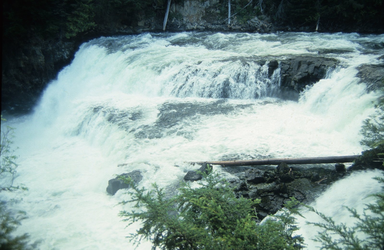
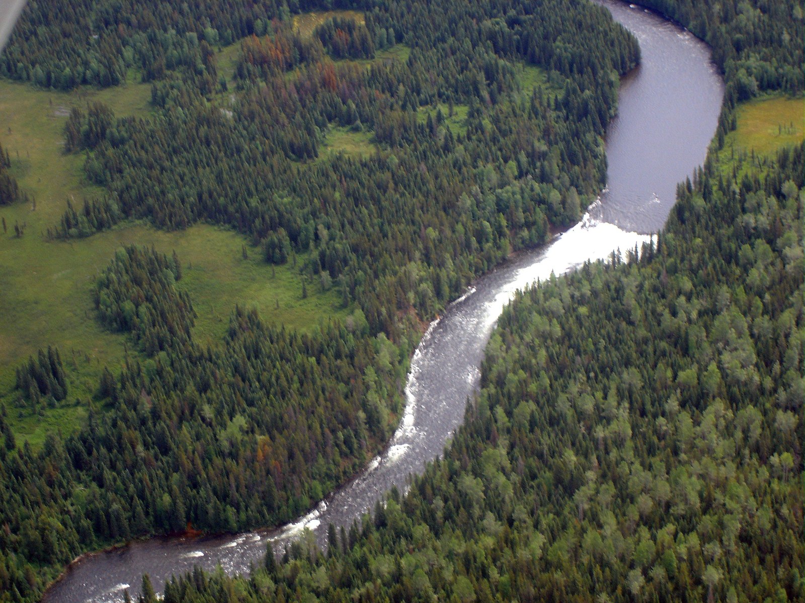
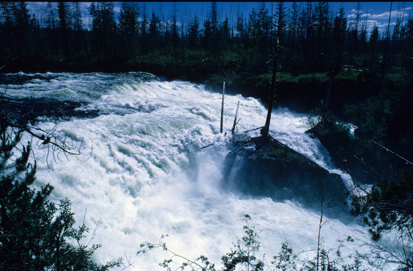
McDougall Falls is a waterfall on the Murtle River in Wells Gray Provincial Park, east-central British Columbia, Canada.
The Setting
McDougall Falls sits at 1,029 metres within Wells Gray Park, in the mountains of British Columbia. The falls drop 14 metres.
Why This Waterfall Exists
McDougall Falls flows over hard volcanic rock, primarily basalt, laid down about 3 million years ago. These resistant rocks form a durable ledge that water cannot easily wear away, creating a 45-foot drop where softer material downstream has already eroded.
Nearby Falls Worth Visiting
Horseshoe Falls (16 m) lies 11.1 kilometres to the west. Also nearby: Majerus Falls (12 m, 14.5 km) and Meadow Falls (8 m, 8.2 km).
Trail & Hike Details
The Approach
The moderate 8.4-km out-and-back trail gains 180 metres of elevation on the way to the falls.
Trail Description
The trail to McDougall Falls is a short forest path through mixed conifer stands with typical root and rock obstacles. The route likely descends moderately toward the stream and offers close-range views of the cascade; there may be brief sections with mud, slippery roots, or loose rock. Expect an informal trail with limited signage and few constructed viewing platforms or railings. Some visitors report short scrambles near the base to obtain different viewpoints.
What to Expect
The falls drop 14 metres over hard volcanic rock.
Accessibility
The trail is not wheelchair accessible. Uneven terrain and elevation changes require steady footing.
Frequently Asked Questions
🐶 Are Dogs Allowed at McDougall Falls?
❌ Dogs are not allowed
Are There Any Fees or Permits Required?
🆖 No fees required
🏊 Is There Swimming at McDougall Falls?
❌ Swimming is not allowed
When to Visit
Late spring to early summer for the fullest water flow and comfortable temperatures. Summer provides warmer weather but lower flows; fall offers good colours and fewer visitors. Winter access may be limited by snow and icy conditions and could require snowshoes or skis and winter travel experience.
Seasonal Access
The best time to visit is Spring, Summer, and Fall. Winter access may be limited. Check with Wells Gray Park for current conditions.
Safety Information
Hazards can include slippery rocks and roots, steep or unstable edges near the falls, fast-flowing or cold water, limited cell service, and changing weather. In spring or after heavy rain the flow and river levels may be higher and more dangerous. Use caution near the water’s edge, supervise children closely, and do not attempt risky cliff-edge or rock scrambles without experience. Always let someone know your plans and expected return.
Current Water Conditions
Based on a Water Survey of Canada gauge 39.1 km away
14.4 m³/s
Current discharge — how much water is flowing
About average for this time of year
Based on 44 years of record
1.12 m
Water depth at gauge
7-Day Discharge Trend
What does this mean for your visit?
Flow is about average for this time of year.
About This Gauge
This gauge is on a regional waterway. Conditions at the falls may differ, especially after local rain.
7-Day Flow Outlook
Based on the WSC gauge BLUE RIVER NEAR BLUE RIVER (39 km away).
Today
Moderate
16 m³/s
6/10Tomorrow
Moderate
16 m³/s
6/10Tue
Moderate
14 m³/s
8/10Wed
Moderate
13 m³/s
6/10Thu
Moderate
12 m³/s
6/10Fri
Moderate
13 m³/s
6/10Sat
Moderate
12 m³/s
6/10Best window: Tue — moderate flow, mainly sunny (trip score 8/10).
Best time of year: this gauge typically runs highest from late April to late July, peaking in June.
How we calculate this
This is a transparent outlook, not a precise forecast. We take the waterfall's current flow strength (how it ranks against its historical normal for today, from the nearest WSC stream gauge), carry that ranking forward along the gauge's seasonal curve, and nudge it for forecast rain. Confidence is highest for the next day or two and falls further out. Always check official conditions and your own judgment before visiting — high flows can be dangerous.
Weather Forecast
Location & Access
Getting There
From Clearwater, BC, travel toward Wells Gray Provincial Park (Clearwater Valley Road). Access to McDougall Falls is via park or forest access roads and a short forest trail; road and trail conditions can be seasonal and may be rough. High-clearance vehicles may be recommended for some forest service roads. Check BC Parks / local visitor information and recent trip reports for the latest access conditions before travel.
Get Directions on Google MapsParking
There is likely a small, informal parking/turnout near the trailhead rather than a large developed lot. Parking spaces may be limited; park well off the road and avoid blocking gates or driveways. Expect minimal facilities (no formal restrooms).
Elevation
1,029 metres above sea level
Coordinates
52.092381° N, -119.873715° W
Land Management
Managed by Government of British Columbia
Visitor Tips & Gear
1) Check current road and trail conditions with BC Parks or local visitor centres before heading out; some forest roads can be rough or gated. 2) Wear sturdy, waterproof footwear, trail surfaces can be wet, muddy and uneven. 3) Bring insect repellent in spring and summer. 4) Pack out all waste and follow Leave No Trace principles. 5) If travelling on unpaved roads, consider a vehicle with higher clearance; avoid driving unimproved roads after heavy rain. 6) Be bear-aware: make noise on the trail, carry bear spray where legal and know how to use it.
As an Amazon Associate, we earn from qualifying purchases.
With 8.4 km and 180 m of elevation gain, sturdy boots and trekking poles will help on this moderate trail. Sun exposure on the trail makes good sun protection a must in summer.

Polarized Sunglasses (Knockaround)
Cuts glare off the water so you actually see the falls — and your photos turn out better too.

Columbia Watertight II Rain Jacket
Packs into its own pocket, seam-sealed, and keeps you dry from spray and surprise rain.

Earth Pak Waterproof Dry Bag
Keeps your phone and gear dry when waterfall mist soaks everything else.

Waterproof Phone Pouch (AiRunTech)
Cheap insurance — take photos right next to the falls without killing your phone.

Timberland Euro Sprint Mid Waterproof
Trusted waterproof boot with premium leather and grippy rubber sole — reliable on rocky, wet trails.

TrailBuddy Trekking Poles
Lightweight aluminum, cork grips, and flip-locks that actually hold — a best-seller for good reason.
Where to Stay
Browse vacation cabins and private rentals nearby
Unique outdoor stays — tents, yurts, and treehouses
Rent a campervan or RV for your waterfall road trip
Some links are affiliate links. We may earn a commission at no extra cost to you.
Nearby Campground
Kostal
5 km away
Additional Information
Nearby Attractions
Wells Gray Provincial Park main attractions (Helmcken Falls, Moul Falls, Spahats Falls), Clearwater Lake, and other smaller cascades and trails in the Clearwater/Wells Gray area.
Wildlife
Black bears, deer, moose, cougars (rare), small mammals, and a variety of birds (including raptors). Be bear-aware and follow local wildlife guidelines.
Nearby Waterfalls
Other waterfalls named McDougall Falls
1 other waterfall shares this name across Canada.
Writing about McDougall Falls? Embed this waterfall on your site for free.