Photo Credits (3)
Difficulty
Moderate
Trail Length
2.4 miles
Trail Type
Out And Back
Elevation Gain
350 ft
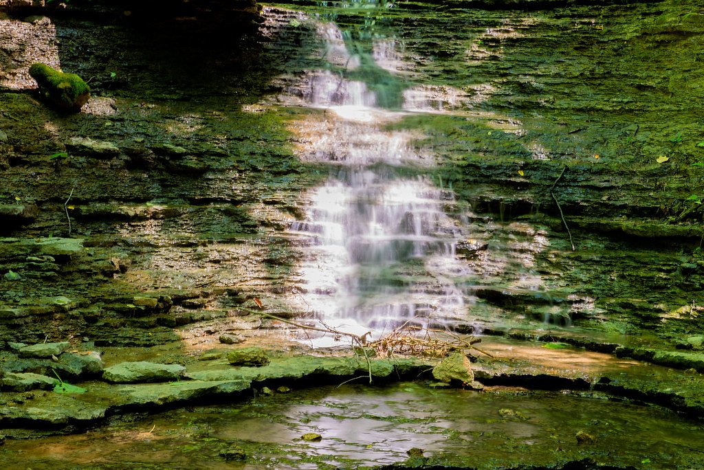
About Horseshoe Falls
Horseshoe Falls is a small but picturesque waterfall located in Shakamak State Park, Indiana. It is known for its serene setting and is a popular spot for nature enthusiasts and photographers.
The Setting
Horseshoe Falls sits at 610 feet along the Muscatatuck River, in the foothills of Indiana.
Trail & Hike Details
The Approach
The moderate 2.4-mile out-and-back trail gains 350 feet of elevation on the way to the falls.
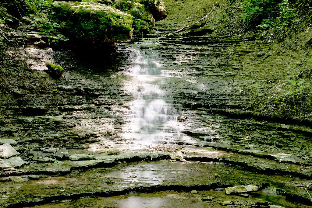
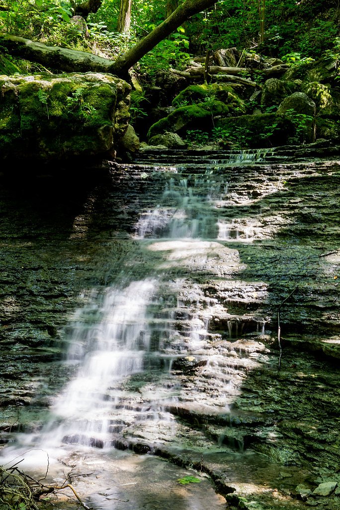
Trail Description
The trail to Horseshoe Falls is a short and easy walk through a wooded area. It is well-maintained and suitable for most visitors, including families with children. The trail offers a peaceful experience with opportunities to spot local wildlife.
What to Expect
Dogs are welcome.
Accessibility
The trail is not wheelchair accessible. Uneven terrain and elevation changes require steady footing.
Frequently Asked Questions
🐶 Are Dogs Allowed at Horseshoe Falls?
✅ Dogs are allowed
Are There Any Fees or Permits Required?
🤑 Fee: $7.00
🏊 Is There Swimming at Horseshoe Falls?
❌ Swimming is not allowed
When to Visit
Spring and early summer are the best times to visit, as the waterfall flow is typically stronger due to seasonal rainfall.
Seasonal Access
The best time to visit is Spring, Summer, and Fall. Winter access may be limited.
Safety Information
Be cautious of slippery rocks near the waterfall, especially after rain. Stay on marked trails to avoid getting lost.
Current Water Conditions
57 ft³/s
Current discharge — how much water is flowing
About average for this time of year
Based on 77 years of record
3.88 ft
Water depth at gauge
7-Day Discharge Trend
What does this mean for your visit?
Flow is about average for this time of year.
About This Gauge
This gauge is on a nearby waterway and may not reflect exact conditions at the falls.
7-Day Flow Outlook
Based on the USGS gauge MUSCATATUCK RIVER NEAR DEPUTY, IN (21 km away).
Today
Low
65 cfs
3/10Tomorrow
Moderate
60 cfs
4/10Sat
Moderate
53 cfs
4/10Sun
Moderate
46 cfs
4/10Mon
Low
37 cfs
6/10Tue
Barely Flowing
32 cfs
5/10Wed
Barely Flowing
32 cfs
5/10Best window: Mon — low flow, sunny (trip score 6/10).
Best time of year: this gauge typically runs highest from early February to late April, peaking in March.
How we calculate this
This is a transparent outlook, not a precise forecast. We take the waterfall's current flow strength (how it ranks against its historical normal for today, from the nearest USGS stream gauge), carry that ranking forward along the gauge's seasonal curve, and nudge it for forecast rain. Confidence is highest for the next day or two and falls further out. Always check official conditions and your own judgment before visiting — high flows can be dangerous.
Know when to go.
Get a free email alert when waterfalls near Hanover hit peak flow. We only send when conditions are worth the trip — no weekly newsletters, no spam.
Weather Forecast
Location & Access
Getting There
Horseshoe Falls is located within Shakamak State Park in Jasonville, Indiana. Visitors can access the park via State Road 48. The waterfall is near one of the park's trails and is relatively easy to find with park signage.
Get Directions on Google MapsParking
Parking is available within Shakamak State Park near the trailheads. Visitors should follow park signs to designated parking areas.
Elevation
610 feet above sea level
Coordinates
38.723115° N, -85.456904° W
Visitor Tips & Gear
Wear comfortable walking shoes and bring insect repellent, especially during the summer months. Arrive early during weekends to avoid crowds.
As an Amazon Associate, we earn from qualifying purchases.
With 2.4 miles and 350 ft of elevation gain, sturdy boots and trekking poles will help on this moderate trail. Sun exposure on the trail makes good sun protection a must in summer.

Polarized Sunglasses (Knockaround)
Cuts glare off the water so you actually see the falls — and your photos turn out better too.

Columbia Watertight II Rain Jacket
Packs into its own pocket, seam-sealed, and keeps you dry from spray and surprise rain.

Earth Pak Waterproof Dry Bag
Keeps your phone and gear dry when waterfall mist soaks everything else.

Waterproof Phone Pouch (AiRunTech)
Cheap insurance — take photos right next to the falls without killing your phone.

Timberland Euro Sprint Mid Waterproof
Trusted waterproof boot with premium leather and grippy rubber sole — reliable on rocky, wet trails.

TrailBuddy Trekking Poles
Lightweight aluminum, cork grips, and flip-locks that actually hold — a best-seller for good reason.
Where to Stay

Comfort Inn Madison near Clifty Falls

Clifty Inn

The Chandler Hotel

Hillside Inn
Browse vacation cabins and private rentals nearby
Unique outdoor stays — tents, yurts, and treehouses
Rent a campervan or RV for your waterfall road trip
Some links are affiliate links. We may earn a commission at no extra cost to you.
Additional Information
Nearby Attractions
Shakamak State Park offers several lakes for fishing and boating, as well as picnic areas and additional hiking trails.
Wildlife
Visitors may spot deer, squirrels, and a variety of bird species in the park.
Cities near Horseshoe Falls
Nearby Waterfalls

Other waterfalls named Horseshoe Falls
14 other waterfalls share this name across the U.S.
Writing about Horseshoe Falls? Embed this waterfall on your site for free.