Horseshoe Falls
By Armen Suny · Last verified Mar 2026
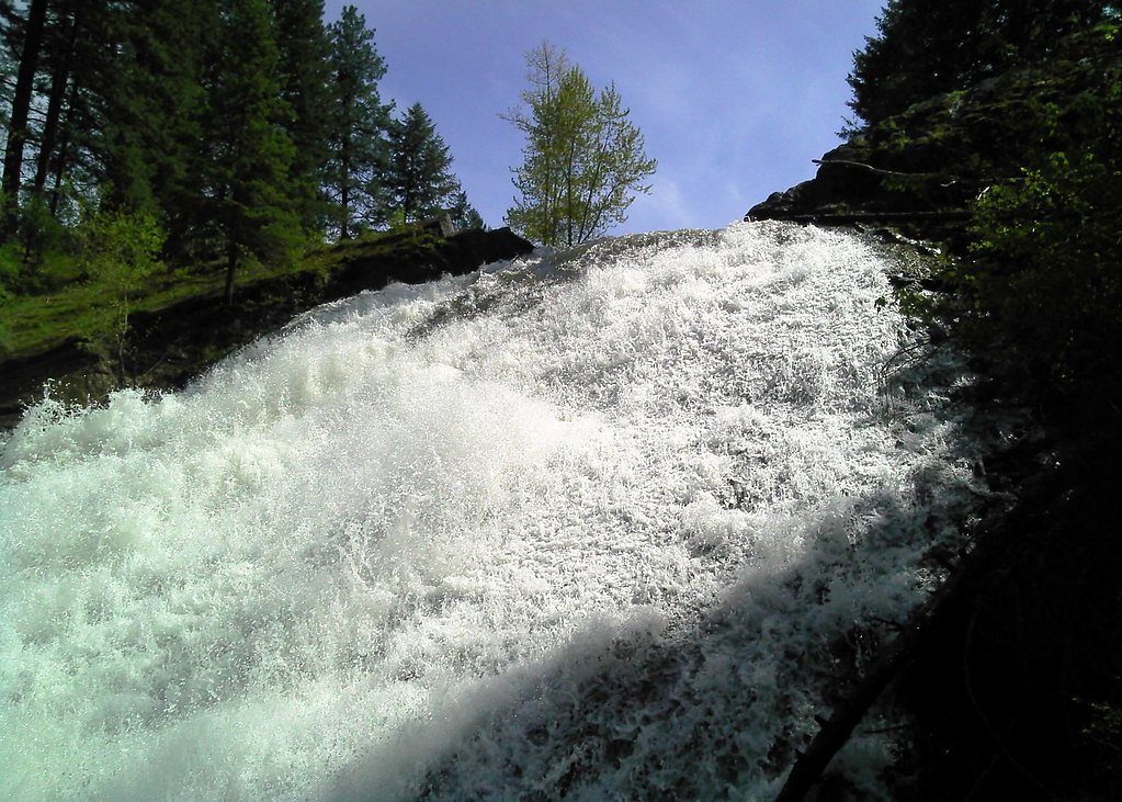
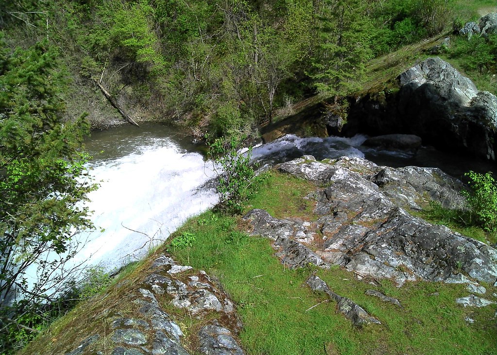
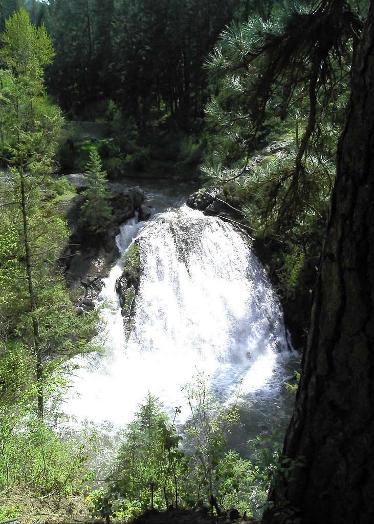
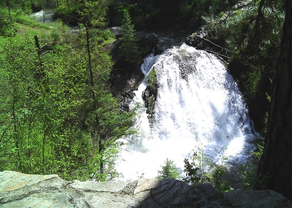

Photo Credits (5)
Difficulty
Easy
Trail Length
0.5 miles
Trail Type
Out And Back
Elevation Gain
50 ft
About Horseshoe Falls
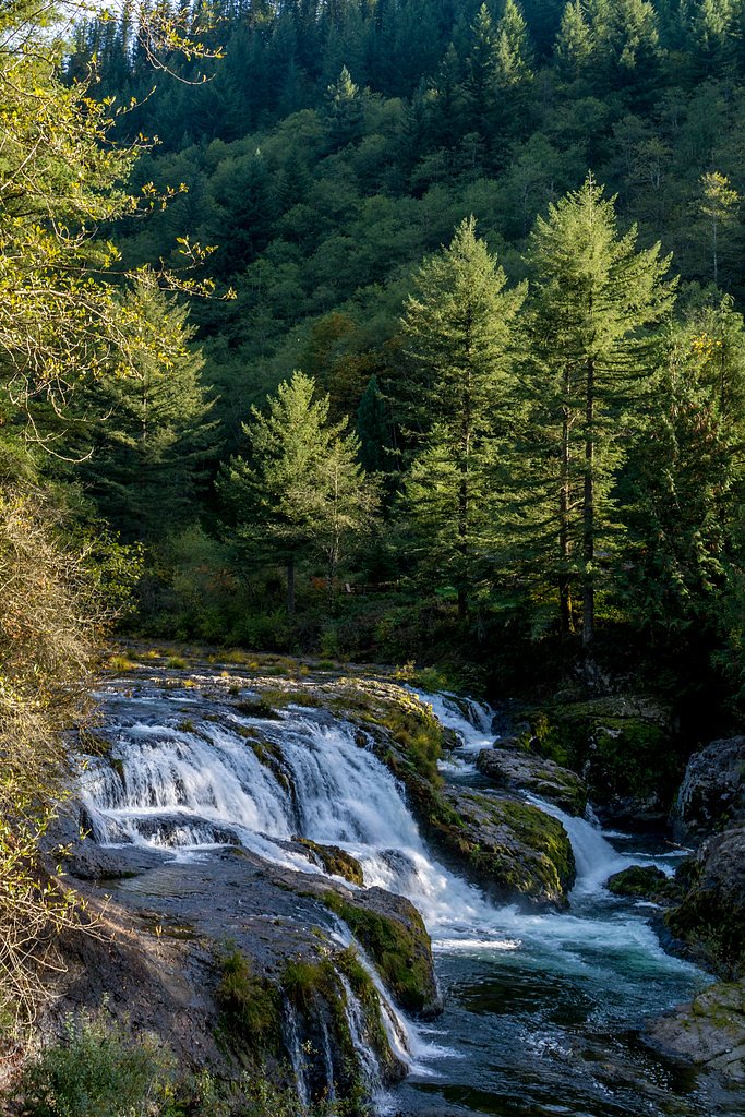
Horseshoe Falls is a scenic, horseshoe-shaped cascade on the South Fork of the Snoqualmie River, tucked into the lush temperate forest of Mount Baker–Snoqualmie National Forest. Nestled within land managed by the U.S. Forest Service, the falls offer a compact yet photogenic stop for hikers and photographers, with the water tumbling into a classic curved plunge pool framed by mossy rocks and old-growth trees. The site is easily reached on a short, family-friendly hike—making it a popular half-day outing from nearby trailheads—and is convenient to overnight camping: Sunset Falls Campground lies about 4.14 km away. Whether you’re combining the visit with other stops along the South Fork or making a quick nature break, Horseshoe Falls is an inviting, accessible taste of Washington’s forested river scenery.
The Setting
Horseshoe Falls sits at 791 feet along the East Fork Lewis River, in the foothills of Washington.
Trail & Hike Details
The Approach
The easy 0.5-mile out-and-back trail gains 50 feet of elevation on the way to the falls.
Trail Description
Out-and-back, 0.5 miles round trip with roughly 50 feet of elevation gain. The route follows a well-maintained footpath through forested terrain to a viewing point near the falls. Rated easy in difficulty, the trail is short and generally level aside from the modest ascent to the overlook, suitable for most hikers and families looking for a quick, scenic walk.
What to Expect
Dogs are welcome.
Accessibility
The trail is short and relatively flat, but the surface may be uneven. Contact the managing agency for accessibility details.
Frequently Asked Questions
🐶 Are Dogs Allowed at Horseshoe Falls?
✅ Dogs are allowed
Are There Any Fees or Permits Required?
🤑 Fee: $5.00
Permit required
A Northwest Forest Pass is required for parking at the trailhead. Day passes can be purchased online or at nearby ranger stations.
🏊 Is There Swimming at Horseshoe Falls?
❌ Swimming is not allowed
When to Visit
Spring and early summer are the best times to visit, as the waterfall is typically at its fullest due to snowmelt.
Seasonal Access
The best time to visit is Spring, Summer, and Fall. Winter access may be limited.
Safety Information
Exercise caution near the falls as rocks can be slippery. Stay on designated trails to avoid accidents. Check weather conditions before visiting, as heavy rain or snow can make the trail hazardous.
Current Water Conditions
114 ft³/s
Current discharge — how much water is flowing
Lower than usual for this time of year
Based on 96 years of record
10.75 ft
Water depth at gauge
7-Day Discharge Trend
What does this mean for your visit?
Flow is lower than usual for this time of year.
About This Gauge
This gauge is on a nearby waterway and may not reflect exact conditions at the falls.
7-Day Flow Outlook
Based on the USGS gauge EAST FORK LEWIS RIVER NEAR HEISSON, WA (13 km away).
Today
Barely Flowing
123 cfs
3/10Tomorrow
Low
134 cfs
3/10Sat
Low
129 cfs
3/10Sun
Low
117 cfs
4/10Mon
Low
113 cfs
4/10Tue
Low
113 cfs
4/10Wed
Barely Flowing
102 cfs
5/10Best window: Wed — barely flowing flow, partly sunny (trip score 5/10).
Best time of year: this gauge typically runs highest from late November to late January, peaking in December.
How we calculate this
This is a transparent outlook, not a precise forecast. We take the waterfall's current flow strength (how it ranks against its historical normal for today, from the nearest USGS stream gauge), carry that ranking forward along the gauge's seasonal curve, and nudge it for forecast rain. Confidence is highest for the next day or two and falls further out. Always check official conditions and your own judgment before visiting — high flows can be dangerous.
Know when to go.
Get a free email alert when waterfalls near Yacolt hit peak flow. We only send when conditions are worth the trip — no weekly newsletters, no spam.
Weather Forecast
Location & Access
Getting There
Horseshoe Falls is located near the Denny Creek area, accessible via Interstate 90. Take Exit 47 and follow signs for Denny Creek Campground. The falls are a short distance from the parking area.
Get Directions on Google MapsParking
Parking is available at the Denny Creek Trailhead, but it can fill up quickly during peak seasons. A Northwest Forest Pass may be required for parking.
Elevation
791 feet above sea level
Coordinates
45.813169° N, -122.302871° W
Visitor Tips & Gear
Arrive early to secure parking, especially during weekends and summer months. Wear sturdy shoes as the trail may be muddy or slippery, particularly after rain.
As an Amazon Associate, we earn from qualifying purchases.
For this easy 0.5 miles trail, lightweight trail shoes and a water bottle are usually sufficient. Sun exposure on the trail makes good sun protection a must in summer.

Polarized Sunglasses (Knockaround)
Cuts glare off the water so you actually see the falls — and your photos turn out better too.

Columbia Watertight II Rain Jacket
Packs into its own pocket, seam-sealed, and keeps you dry from spray and surprise rain.

Earth Pak Waterproof Dry Bag
Keeps your phone and gear dry when waterfall mist soaks everything else.

Waterproof Phone Pouch (AiRunTech)
Cheap insurance — take photos right next to the falls without killing your phone.

JOBY GorillaPod Starter Kit
Wraps around railings and rocks for long-exposure waterfall shots — no flat surface needed.

Osprey Daylite Daypack
Light, organized, and just the right size for a day hike — fits water, snacks, and layers.
Where to Stay

Best Western Plus Battleground Inn & Suites

La Quinta by Wyndham Vancouver

Heathman Lodge

Comfy Family Home, Walkable Neighborhood + Patio!
Browse vacation cabins and private rentals nearby
Unique outdoor stays — tents, yurts, and treehouses
Rent a campervan or RV for your waterfall road trip
Some links are affiliate links. We may earn a commission at no extra cost to you.
Nearby Campground
Sunset Falls Campground
2.6 miles away · 18 sites
Overview Sunset Campground is located in the Gifford Pinchot National Forest. Visitors enjoy scenic views of the river and a waterfall within the campground. The campground is open all year. Recreation There are several hiking trails nearby, including the Silver Star trail which offers excellent views of Portland, Oregon. The area is also popular with kayakers that visit the East Fork Lewis River.Facilities Sunset Campground offers 18 standard sites that accommodate tents and RVs (22 feet), but n
Book on Recreation.govNearby Hot Springs
Hot springs near Yacolt, Washington
Rock Creek Hot Springs
Rock Creek Hot Springs emerges in the Columbia River Gorge in Skamania County, Washington, with water documented as 'hot' witho...
Moffetts (Bonneville) Hot Springs
Moffetts Hot Springs, also called Bonneville Hot Springs, flows at 97 degrees in the Gifford Pinchot National Forest at just 75...

Mt St Helens Fumaroles
Mount St. Helens fumaroles reach 190 degrees at 6,906 feet elevation on the crater rim, emerging 159.1 degrees above ambient in...
St Martins Hot Springs
St. Martins Hot Springs flows at 120 degrees Fahrenheit at just 432 feet elevation in the Columbia River Gorge near Carson in S...
Green River Soda Spring
Green River Soda Spring produces 86-degree carbonated water at 1,644 feet elevation, flowing 37.5 degrees above ambient tempera...

Collins Hot Springs
Collins Hot Springs emerges at 122 degrees just 127 feet above sea level in the Columbia River Gorge, producing water 68.4 degr...
Looking for a soak after your hike? Explore more hot springs near Yacolt, Washington on SoakingSprings.
Explore Washington springsAdditional Information
Nearby Attractions
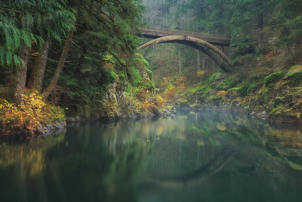
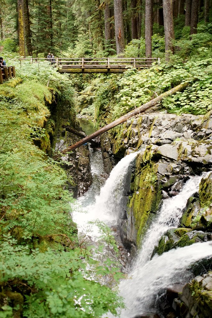
Franklin Falls, Denny Creek Slide, and Snoqualmie Pass are all located nearby and offer additional hiking and sightseeing opportunities.
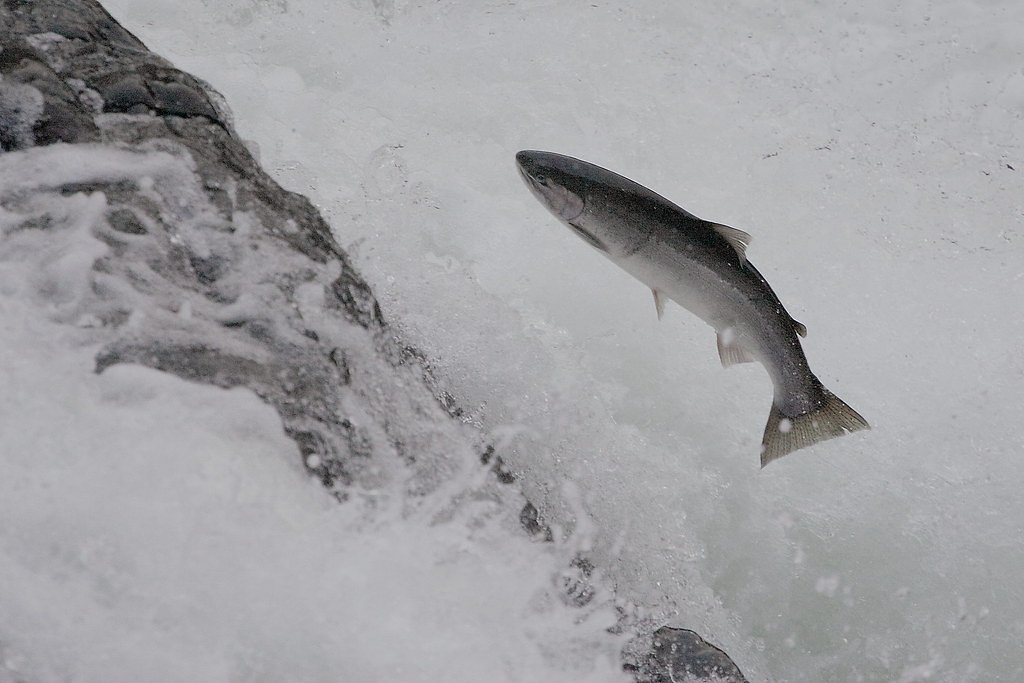
Wildlife
The area is home to a variety of wildlife, including birds, deer, and small mammals. Be cautious of bears and other larger animals, especially during dawn and dusk.
Cities near Horseshoe Falls
Nearby Waterfalls
Other waterfalls named Horseshoe Falls
14 other waterfalls share this name across the U.S.
Writing about Horseshoe Falls? Embed this waterfall on your site for free.