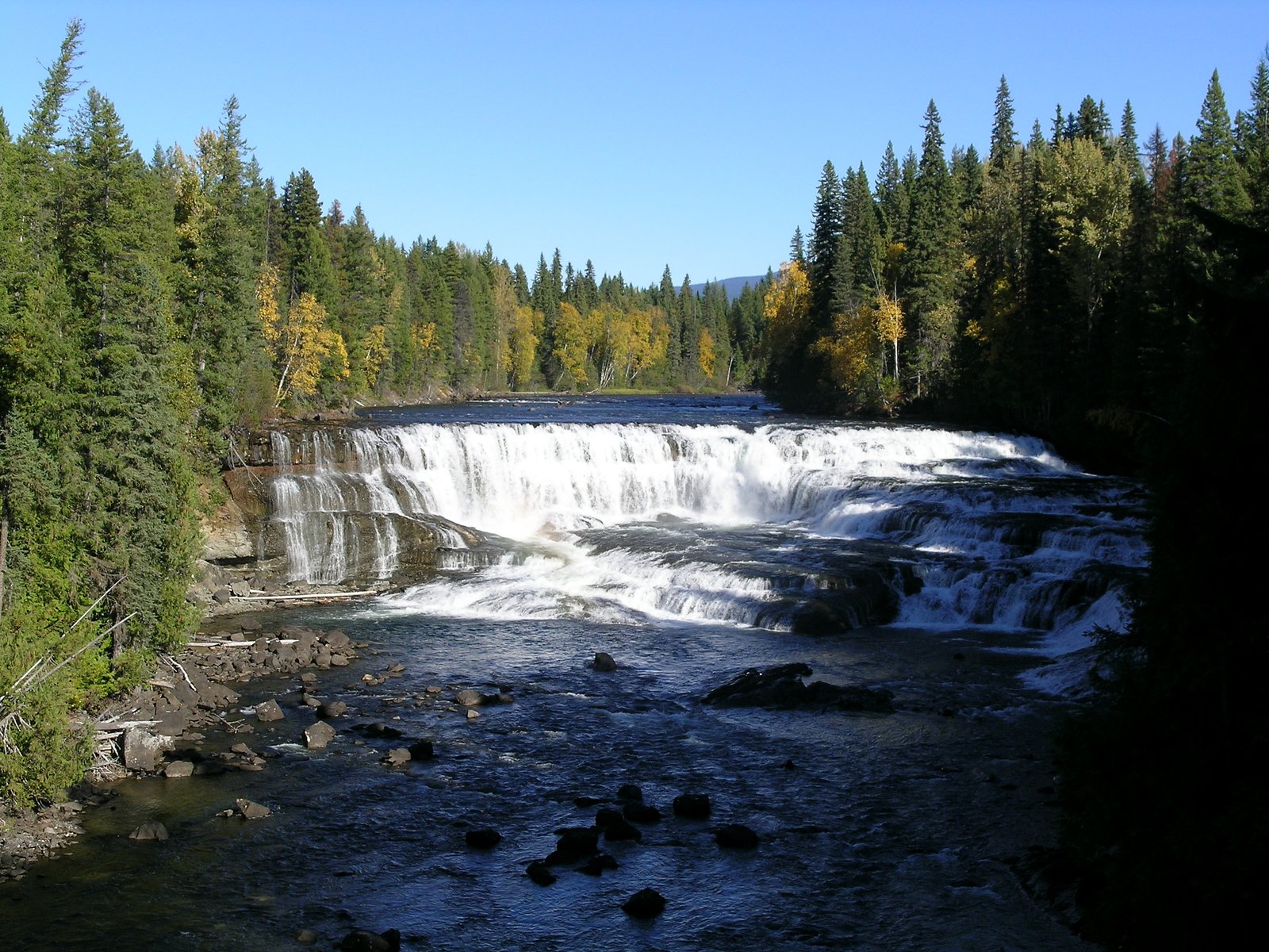
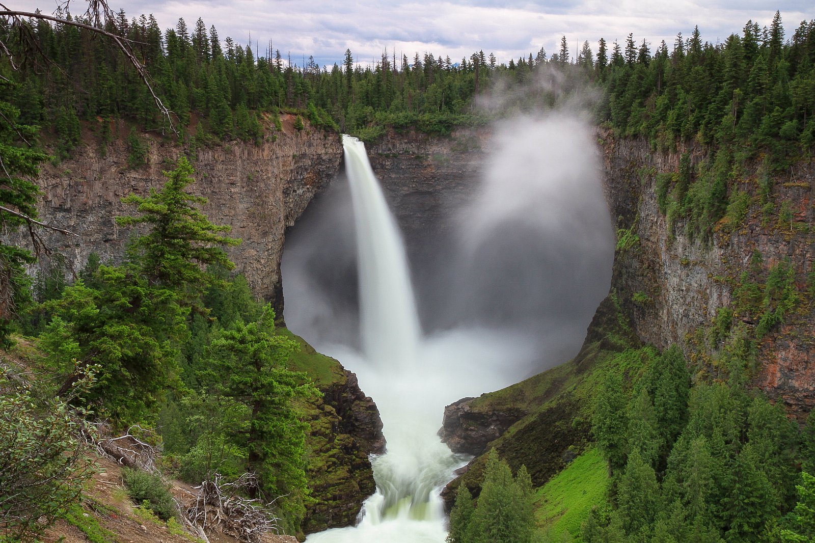
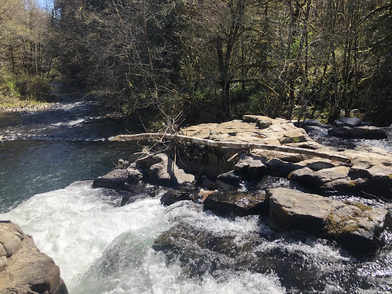
Dawson Falls
British Columbia • Wells Gray Park • 20 m
By Armen Suny · Last verified Jun 2026
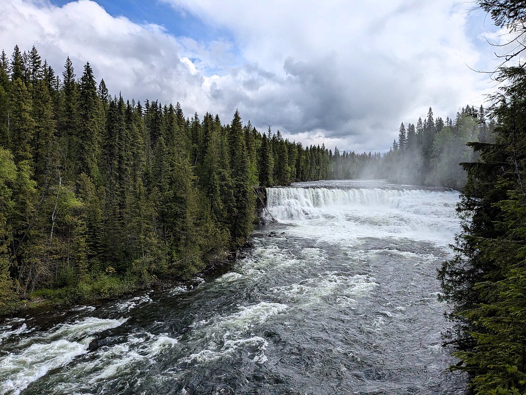
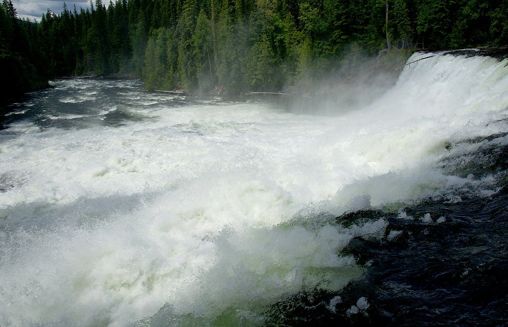
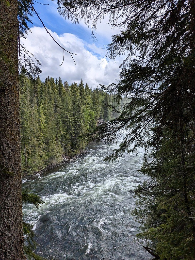

Photo Credits (5)
Difficulty
Easy
Trail Length
1.4 km
Trail Type
Out And Back
Elevation Gain
25 m
About Dawson Falls
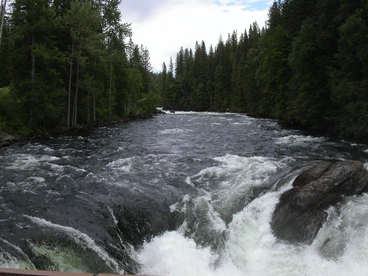
Dawson Falls is one of seven waterfalls on the Murtle River in Wells Gray Provincial Park, British Columbia, Canada.
The Setting
Dawson Falls sits at 817 metres within Wells Gray Park, in the hills of British Columbia. The falls drop 20 metres.
Why This Waterfall Exists
Dawson Falls flows over hard volcanic rock, primarily basalt, laid down about 3 million years ago. These resistant rocks form a durable ledge that water cannot easily wear away, creating a 65-foot drop where softer material downstream has already eroded.
Nearby Falls Worth Visiting
Helmcken Falls (141 m) lies 3.9 kilometres to the west. Also nearby: Cougar Falls (20 m, 3.9 km) and Majerus Falls (12 m, 9.3 km).
Trail & Hike Details
The Approach
The easy 1.4-km out-and-back trail gains 25 metres of elevation on the way to the falls.
Trail Description
A very short, well-used trail/boardwalk from the parking area leads to one or more viewing platforms overlooking the falls and the basalt amphitheatre. The path is typically paved or compacted and is suitable for most visitors. Expect a short round-trip visit (minutes rather than hours).
What to Expect
The falls drop 20 metres over hard volcanic rock.
Accessibility
The trail is short and relatively flat, but the surface may be uneven. Contact the managing agency for accessibility details.
Frequently Asked Questions
🐶 Are Dogs Allowed at Dawson Falls?
❌ Dogs are not allowed
Are There Any Fees or Permits Required?
🆖 No fees required
🏊 Is There Swimming at Dawson Falls?
❌ Swimming is not allowed
When to Visit
Spring for the strongest flows (snowmelt), late spring to early summer for full flow and generally good conditions. Summer and early fall offer more reliable road access and milder weather; avoid icy winter conditions unless experienced with winter travel and checked road status.
Seasonal Access
The best time to visit is Spring, Summer, and Fall. Winter access may be limited. Check with Wells Gray Park for current conditions.
Safety Information
Hazards include slippery surfaces, steep cliff edges, unstable rocks, fast-moving water, and sudden changes in weather. Keep to designated trails and viewing areas, supervise children closely, and do not approach or enter the river near the falls. In winter, icy conditions and closed roads increase risk, travel only with appropriate equipment and current road information.
Current Water Conditions
Based on a Water Survey of Canada gauge 34.6 km away
382.0 m³/s
Current discharge — how much water is flowing
About average for this time of year
Based on 87 years of record
3.70 m
Water depth at gauge
7-Day Discharge Trend
What does this mean for your visit?
Flow is about average for this time of year.
About This Gauge
This gauge is on a regional waterway. Conditions at the falls may differ, especially after local rain.
7-Day Flow Outlook
Based on the WSC gauge CLEARWATER RIVER NEAR CLEARWATER STATION (35 km away).
Today
Moderate
407 m³/s
5/10Tomorrow
Moderate
420 m³/s
5/10Tue
Moderate
388 m³/s
8/10Wed
Moderate
360 m³/s
6/10Thu
Moderate
347 m³/s
6/10Fri
Moderate
366 m³/s
5/10Sat
Moderate
366 m³/s
5/10Best window: Tue — moderate flow, sunny (trip score 8/10).
Best time of year: this gauge typically runs highest from early May to early August, peaking in June.
How we calculate this
This is a transparent outlook, not a precise forecast. We take the waterfall's current flow strength (how it ranks against its historical normal for today, from the nearest WSC stream gauge), carry that ranking forward along the gauge's seasonal curve, and nudge it for forecast rain. Confidence is highest for the next day or two and falls further out. Always check official conditions and your own judgment before visiting — high flows can be dangerous.
Weather Forecast
Location & Access
Getting There
From Highway 5 near Clearwater, BC, follow signed Wells Gray Provincial Park roads toward park attractions. The Dawson Falls parking/viewpoint area is reached via the park road; expect a short walk from the parking area to the main viewing platform. Road and access conditions may be seasonal, check BC Parks or local authorities before travel.
Get Directions on Google MapsParking
Small paved parking area near the viewpoint; space may be limited during peak season. Facilities (toilets, signage) may be available but can be seasonal, visitors should plan accordingly.
Elevation
817 metres above sea level
Coordinates
51.965157° N, -120.123190° W
Land Management
Managed by Government of British Columbia
Visitor Tips & Gear
• Check park/road conditions before traveling, access may be limited in winter or after storms. • Wear sturdy shoes, surfaces near viewpoints can be wet and slippery. • Stay behind railings and on designated trails/boardwalks for safety and to protect fragile geology. • Early morning or late afternoon can offer better light and fewer crowds. • Pack layers; mountain weather can change quickly.
As an Amazon Associate, we earn from qualifying purchases.
For this easy 1.4 km trail, lightweight trail shoes and a water bottle are usually sufficient. Sun exposure on the trail makes good sun protection a must in summer.

Polarized Sunglasses (Knockaround)
Cuts glare off the water so you actually see the falls — and your photos turn out better too.

Columbia Watertight II Rain Jacket
Packs into its own pocket, seam-sealed, and keeps you dry from spray and surprise rain.

Earth Pak Waterproof Dry Bag
Keeps your phone and gear dry when waterfall mist soaks everything else.

Waterproof Phone Pouch (AiRunTech)
Cheap insurance — take photos right next to the falls without killing your phone.

JOBY GorillaPod Starter Kit
Wraps around railings and rocks for long-exposure waterfall shots — no flat surface needed.

Osprey Daylite Daypack
Light, organized, and just the right size for a day hike — fits water, snacks, and layers.
Where to Stay
Browse vacation cabins and private rentals nearby
Unique outdoor stays — tents, yurts, and treehouses
Rent a campervan or RV for your waterfall road trip
Some links are affiliate links. We may earn a commission at no extra cost to you.
Nearby Campground
Pyramid Campground
0.8 km away
Additional Information
Nearby Attractions
Wells Gray Provincial Park offers many other waterfalls and attractions such as Helmcken Falls, Spahats Falls, Moul Falls, Clearwater Lake, and numerous trails and viewpoints.
Wildlife
Typical regional wildlife includes black bears, moose, deer, and a variety of birds. Practice wildlife safety (store food securely, maintain distance).
Nearby Waterfalls
Other waterfalls named Dawson Falls
1 other waterfall shares this name across Canada.
Writing about Dawson Falls? Embed this waterfall on your site for free.