
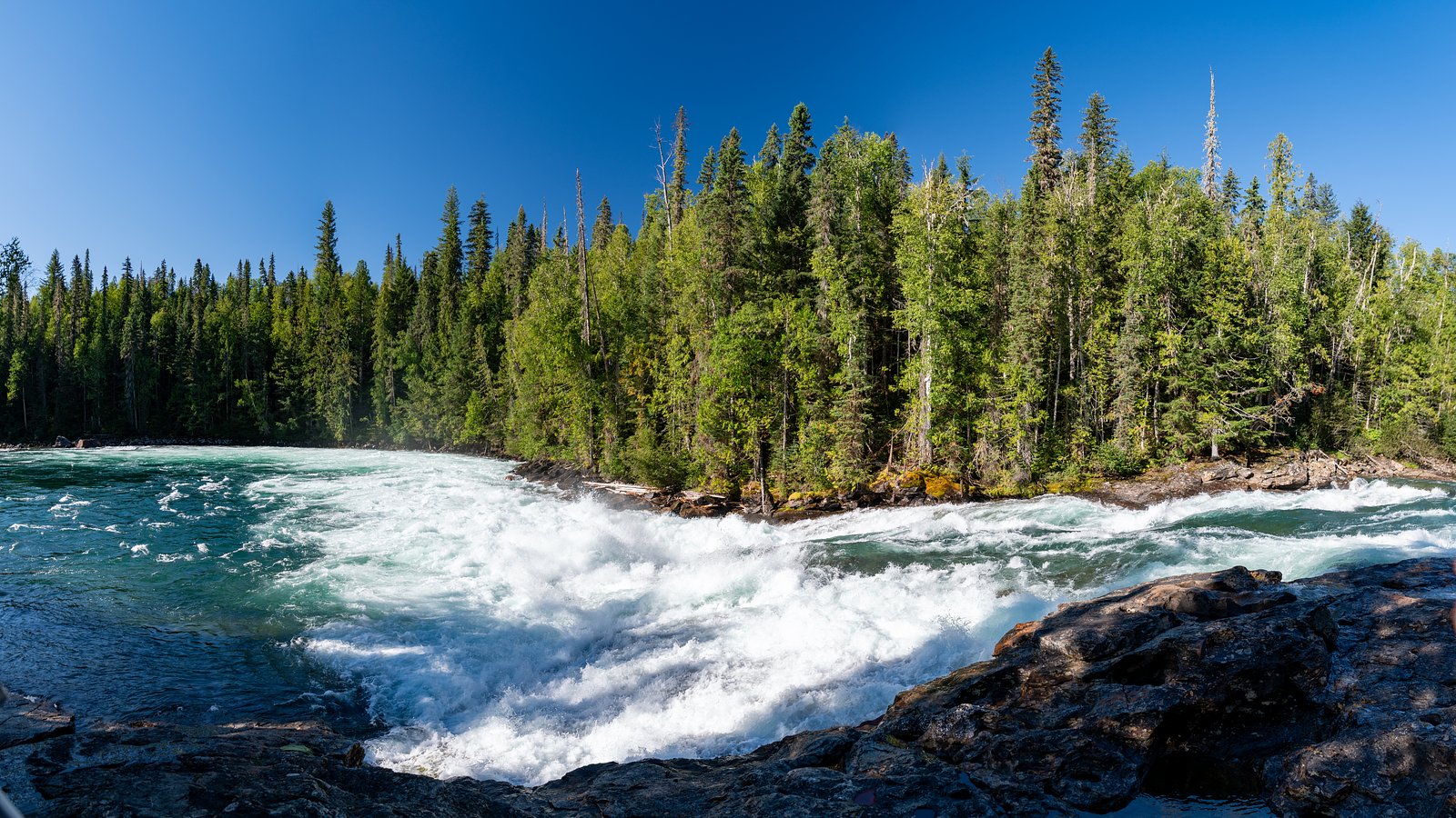
Bailey's Chute
British Columbia • Wells Gray Park • 10 m
By Armen Suny · Last verified Jun 2026
Photo Credits (1)
Difficulty
Easy
Trail Length
1.3 km
Trail Type
Out And Back
Elevation Gain
30 m
About Bailey's Chute
Baileys Chute, often misspelled Bailey's Chute, is one in a series of small waterfalls along the Clearwater River in Wells Gray Provincial Park, British Columbia, Canada. With an average high flow rate of 122 m3/s (4,300 cu ft/s), it is one of the largest waterfalls in British Columbia.
The Setting
Bailey's Chute sits at 638 metres within Wells Gray Park, in the hills of British Columbia. The falls drop 10 metres.
Why This Waterfall Exists
Bailey's Chute flows over layered sedimentary rock laid down about 252 million to 1.0 billion years ago. Over time, the stream has worn through these layers at different rates, creating a 33-foot drop that forms the waterfall.
Nearby Falls Worth Visiting
Marcus Falls (5 m) lies 0.6 kilometres to the west. Also nearby: Osprey Falls (5 m, 7.7 km) and Falls Creek (3 m, 7.4 km).
Trail & Hike Details
The Approach
The easy 1.3-km out-and-back trail gains 30 metres of elevation on the way to the falls.
Trail Description
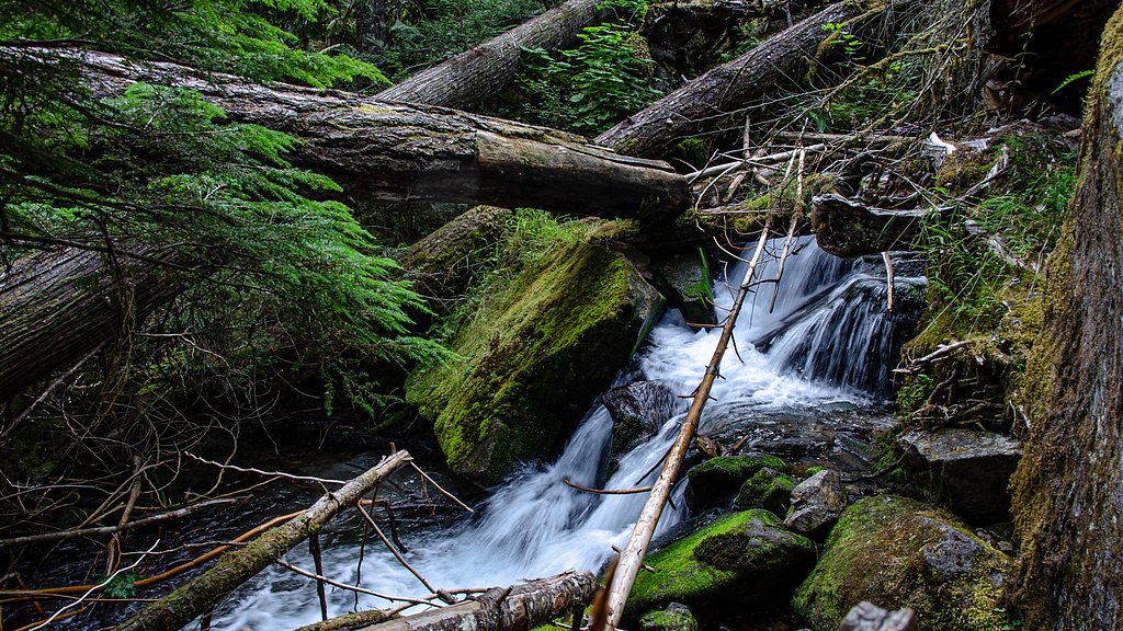
There is limited authoritative trail information for Bailey's Chute at the given coordinates. If a short viewpoint trail exists it is likely informal and possibly short (a walk from a parking pullout to a river viewpoint). Conversely, some chutes are only visible from a road or by walking along an unmarked riverbank. Confirm route details with local resources before travelling.
What to Expect
The falls drop 10 metres over layered sedimentary rock.
Accessibility
The trail is short and relatively flat, but the surface may be uneven. Contact the managing agency for accessibility details.
Frequently Asked Questions
🐶 Are Dogs Allowed at Bailey's Chute?
❌ Dogs are not allowed
Are There Any Fees or Permits Required?
🆖 No fees required
🏊 Is There Swimming at Bailey's Chute?
❌ Swimming is not allowed
When to Visit
Late spring through early fall typically offers the best combination of water flow (spring) and road/access conditions (summer/early fall). Winter access may be limited by snow and is likely to require winter driving skills and equipment.
Seasonal Access
The best time to visit is Spring, Summer, Fall, and Winter. Check with Wells Gray Park for current conditions.
Safety Information
Hazards can include fast, turbulent water and undertows at and below chutes; slippery and unstable rock or riverbanks; sudden changes in water level from upstream operations or storms; exposure to wildlife; and remote conditions with limited cell service. Always tell someone your route and expected return time. Use conservative judgment near water and avoid cliff edges. Check weather, road reports, and local advisories before travel.
Current Water Conditions
Based on a Water Survey of Canada gauge 47 km away
373.0 m³/s
Current discharge — how much water is flowing
About average for this time of year
Based on 87 years of record
3.66 m
Water depth at gauge
7-Day Discharge Trend
What does this mean for your visit?
Flow is about average for this time of year.
About This Gauge
This gauge is on a regional waterway. Conditions at the falls may differ, especially after local rain.
7-Day Flow Outlook
Based on the WSC gauge CLEARWATER RIVER NEAR CLEARWATER STATION (47 km away).
Today
Moderate
425 m³/s
4/10Tomorrow
Moderate
427 m³/s
5/10Tue
Moderate
384 m³/s
8/10Wed
Moderate
356 m³/s
6/10Thu
Moderate
344 m³/s
6/10Fri
Moderate
362 m³/s
5/10Sat
Moderate
381 m³/s
4/10Best window: Tue — moderate flow, mainly sunny (trip score 8/10).
Best time of year: this gauge typically runs highest from early May to early August, peaking in June.
How we calculate this
This is a transparent outlook, not a precise forecast. We take the waterfall's current flow strength (how it ranks against its historical normal for today, from the nearest WSC stream gauge), carry that ranking forward along the gauge's seasonal curve, and nudge it for forecast rain. Confidence is highest for the next day or two and falls further out. Always check official conditions and your own judgment before visiting — high flows can be dangerous.
Weather Forecast
Location & Access
Getting There
The coordinate point places Bailey's Chute in remote north‑central British Columbia. Expect access from local highways and secondary/forest service roads; some final approach may be unpaved. Visitors should consult up‑to‑date maps, local land/park authorities, or trail resources (for example AllTrails or provincial park sites) for the best route. Cell reception may be limited.
Get Directions on Google MapsParking
Parking details are not well documented. There may be informal pullouts on a nearby public road or small (unpaved) parking at a trailhead if a maintained viewpoint exists. Use caution when parking on narrow shoulders and avoid blocking gates or private access roads.
Elevation
638 metres above sea level
Coordinates
52.071321° N, -120.191462° W
Land Management
Managed by Government of British Columbia
Visitor Tips & Gear
• Check recent trip reports or local land/park authorities for current access conditions and road status. • Wear sturdy footwear; approach riverbanks with care, banks can be slippery and unstable. • Give wildlife space and carry bear deterrent appropriate to the area; know how to use it. • Respect private property and active logging operations; obey gates and signage. • If planning to travel on forest service roads, use a suitable vehicle and check for seasonal closures.
As an Amazon Associate, we earn from qualifying purchases.
For this easy 1.3 km trail, lightweight trail shoes and a water bottle are usually sufficient. Icy conditions are common in winter — traction cleats are a smart addition.

Columbia Watertight II Rain Jacket
Packs into its own pocket, seam-sealed, and keeps you dry from spray and surprise rain.

Polarized Sunglasses (Knockaround)
Cuts glare off the water so you actually see the falls — and your photos turn out better too.

Earth Pak Waterproof Dry Bag
Keeps your phone and gear dry when waterfall mist soaks everything else.

Waterproof Phone Pouch (AiRunTech)
Cheap insurance — take photos right next to the falls without killing your phone.

Kahtoola MICROspikes
Cult-favorite traction cleats that grip ice and wet rock — essential for winter waterfall hikes.

JOBY GorillaPod Starter Kit
Wraps around railings and rocks for long-exposure waterfall shots — no flat surface needed.
Where to Stay
Browse vacation cabins and private rentals nearby
Unique outdoor stays — tents, yurts, and treehouses
Rent a campervan or RV for your waterfall road trip
Some links are affiliate links. We may earn a commission at no extra cost to you.
Nearby Campground
Falls Creek Campground
7 km away
Additional Information
Nearby Attractions
Specific nearby attractions are not confirmed for this coordinate. North‑central BC commonly offers provincial parks, hiking, fishing, and scenic drives, check local tourism resources for parks and attractions near the coordinate before planning a visit.
Wildlife
Black bears and possibly grizzly bears (depending on exact location), moose, deer, wolves, cougars, small mammals, and a variety of birds. Practice wildlife safety and store food properly.
Nearby Waterfalls
Writing about Bailey's Chute? Embed this waterfall on your site for free.