Horseshoe Falls
By Armen Suny · Last verified Jun 2026
Difficulty
Easy
Trail Length
0.3 km
Trail Type
Out And Back
Elevation Gain
9 m
About Horseshoe Falls
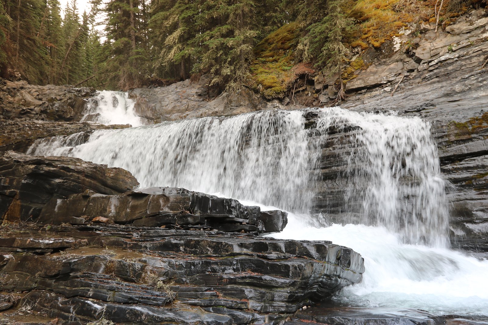
Horseshoe Falls is a small, horseshoe-shaped cascade on the Bow River corridor near Banff in Alberta. The falls are accessed from a short roadside trail off the Bow Valley Parkway (Highway 1A) and are a popular quick stop for visitors traveling between Banff and Lake Louise. Flow and appearance vary seasonally (higher flows in spring); details below are based on commonly reported visitor information and official park guidance where available.
Why This Waterfall Exists
Horseshoe Falls flows over Alberta Group; Smoky Group, a layered sedimentary rock layer deposited about 66-101 million years ago. These soft rocks erode readily, allowing the stream to carve a vertical drop into the landscape.
Nearby Falls Worth Visiting
O'Shaughnessy Falls (7 m) lies 13.5 kilometres to the south.
Trail & Hike Details
The Approach
The easy 0.3-km out-and-back trail gains 9 metres of elevation on the way to the falls.
Trail Description
A short, well-marked path leads from the parking pullout to a viewpoint above the falls. The route is brief (under a quarter mile round-trip) with minimal elevation change. The immediate approach may include a few steps or an uneven dirt/scree surface; the viewpoint provides a safe vantage but watch for slippery rocks and unfenced edges near the river.
What to Expect
A compact, scenic cascade on the Bow River with a classic horseshoe-shaped drop. Expect a short walk from a roadside pullout, good photo opportunities, and variable water flow depending on season. Summer brings wildflowers and more visitors; spring usually has the strongest flows and muddy trails. In winter the falls can be partially frozen and surroundings icy. Limited facilities and variable cell coverage.
Accessibility
The trail is short and relatively flat, but the surface may be uneven. Contact the managing agency for accessibility details.
Frequently Asked Questions
🐶 Are Dogs Allowed at Horseshoe Falls?
❌ Dogs are not allowed
Are There Any Fees or Permits Required?
🆖 No fees required
🏊 Is There Swimming at Horseshoe Falls?
❌ Swimming is not allowed
When to Visit
Late spring for high water flows and dramatic runoff; summer for easier access, warmer weather, and photography; fall for autumn colors along the valley; winter for frozen-ice scenery but expect icy conditions and limited parking.
Seasonal Access
The best time to visit is Spring, Summer, Fall, and Winter. Check with the managing park or local authority for current conditions.
Safety Information
Primary hazards include slippery/unstable rock near the river edge, fast-moving cold water, and icy winter conditions. Wildlife encounters are possible, keep a safe distance and carry bear spray where recommended. Roadside parking can create hazards when entering/exiting traffic on the Bow Valley Parkway. Always check current road and trail conditions with Parks Canada before visiting.
Current Water Conditions
These readings come from the Water Survey of Canada gauge on Jumpingpound Creek, 14.5 km away, not on Horseshoe Falls's own stream. Use them as a sign of whether the area is running wet or dry.
0.1 m³/s
Current discharge — how much water is flowing
Lower than usual for this time of year
Based on 49 years of record
0.29 m
Water depth at gauge
7-Day Discharge Trend
What does this mean for your visit?
Flow is lower than usual for this time of year.
About This Gauge
This gauge is on a nearby waterway and may not reflect exact conditions at the falls.
7-Day Flow Outlook
Based on the WSC gauge JUMPINGPOUND CREEK NEAR COX HILL (15 km away).
Today
Low
0.1 m³/s
5/10Tomorrow
Moderate
0.1 m³/s
5/10Sat
Moderate
0.1 m³/s
5/10Sun
Moderate
0.1 m³/s
5/10Mon
Low
0.1 m³/s
5/10Tue
Low
0.1 m³/s
5/10Wed
Low
0.1 m³/s
5/10Best window: Today — low flow, cloudy (trip score 5/10).
Best time of year: this gauge typically runs highest from mid May to late June, peaking in May.
How we calculate this
This is a transparent outlook, not a precise forecast. We take the waterfall's current flow strength (how it ranks against its historical normal for today, from the nearest WSC stream gauge), carry that ranking forward along the gauge's seasonal curve, and nudge it for forecast rain. Confidence is highest for the next day or two and falls further out. Always check official conditions and your own judgment before visiting — high flows can be dangerous.
Know when to go.
Get a free email alert when waterfalls near Banff hit peak flow. We only send when conditions are worth the trip — no weekly newsletters, no spam.
Weather Forecast
Location & Access
Getting There
Located along the Bow Valley Parkway (Highway 1A) near Banff. From Banff townsite drive west on the Bow Valley Parkway/1A toward Lake Louise; watch for a small pullout/turnout and trail signage near the coordinates (51.1178, -115.0356). The site is about 25 miles from Banff, ~42 miles from Calgary, and ~64 miles from Lake Louise by road.
Get Directions on Google MapsParking
Small roadside pullout/parking area off the Bow Valley Parkway. Parking can be limited during peak season; use caution entering/exiting the highway. No formal services at the lot, no restrooms or potable water are usually provided.
Elevation
1,249 metres above sea level
Coordinates
51.117762° N, -115.035589° W
Visitor Tips & Gear
Arrive early in peak season to secure parking; be prepared for limited services. Wear sturdy footwear; use microspikes or traction devices in icy/winter conditions. Stay behind barriers and off slippery rocks, river currents are swift and water is cold. Carry bear awareness gear (bear spray recommended in Banff area) and make noise on approach. Pack out all trash and follow Parks Canada regulations. Check Parks Canada or local road reports for Bow Valley Parkway closures or maintenance before travel.
As an Amazon Associate, we earn from qualifying purchases.
For this easy 0.3 km trail, lightweight trail shoes and a water bottle are usually sufficient. Icy conditions are common in winter — traction cleats are a smart addition.

Columbia Watertight II Rain Jacket
Packs into its own pocket, seam-sealed, and keeps you dry from spray and surprise rain.

Earth Pak Waterproof Dry Bag
Keeps your phone and gear dry when waterfall mist soaks everything else.

Waterproof Phone Pouch (AiRunTech)
Cheap insurance — take photos right next to the falls without killing your phone.

Kahtoola MICROspikes
Cult-favorite traction cleats that grip ice and wet rock — essential for winter waterfall hikes.

Polarized Sunglasses (Knockaround)
Cuts glare off the water so you actually see the falls — and your photos turn out better too.

Osprey Daylite Daypack
Light, organized, and just the right size for a day hike — fits water, snacks, and layers.
Where to Stay
Browse vacation cabins and private rentals nearby
Unique outdoor stays — tents, yurts, and treehouses
Rent a campervan or RV for your waterfall road trip
Some links are affiliate links. We may earn a commission at no extra cost to you.
Nearby Campground
Willow Rock Campground
4.1 km away
Additional Information
Nearby Attractions
Banff townsite (Bow Falls, Banff Avenue), Johnston Canyon, Lake Minnewanka, Castle Mountain viewpoint, Lake Louise (further east), numerous scenic pullouts along the Bow Valley Parkway.
Wildlife
Expect typical Bow Valley wildlife: elk, deer, bighorn sheep, black and grizzly bears, coyotes, and various birds. Keep distance, secure food, and follow Parks Canada wildlife safety guidance.
Cities near Horseshoe Falls
Nearby Waterfalls
Other waterfalls named Horseshoe Falls
14 other waterfalls share this name across Canada.
Writing about Horseshoe Falls? Embed this waterfall on your site for free.